You must be logged in to view this content. Click Here to become a member of IndyWX.com for full access. Already a member of IndyWx.com All-Access? Log-in here.
Category: Windy
Permanent link to this article: https://indywx.com/2020/02/25/video-winter-storm-impacts-central-indiana-wednesday-into-thursday-morning/
Feb 02
VIDEO: Pleasant Open To The Week Takes On A More Wintry 2nd Half…
You must be logged in to view this content. Click Here to become a member of IndyWX.com for full access. Already a member of IndyWx.com All-Access? Log-in here.
Permanent link to this article: https://indywx.com/2020/02/02/video-pleasant-open-to-the-week-takes-on-a-more-wintry-2nd-half/
Jan 11
VIDEO: Short-Term Update And More On Winter’s Return…
You must be logged in to view this content. Click Here to become a member of IndyWX.com for full access. Already a member of IndyWx.com All-Access? Log-in here.
Permanent link to this article: https://indywx.com/2020/01/11/video-short-term-update-and-more-on-winters-return/
Jan 10
Client Brief: Heavy Rain Increases Flood Potential Into The Weekend; Strong Wind Also A Concern…
Type: Heavy Rain & Strong Winds

What: Localized flood potential
When: Friday and Saturday
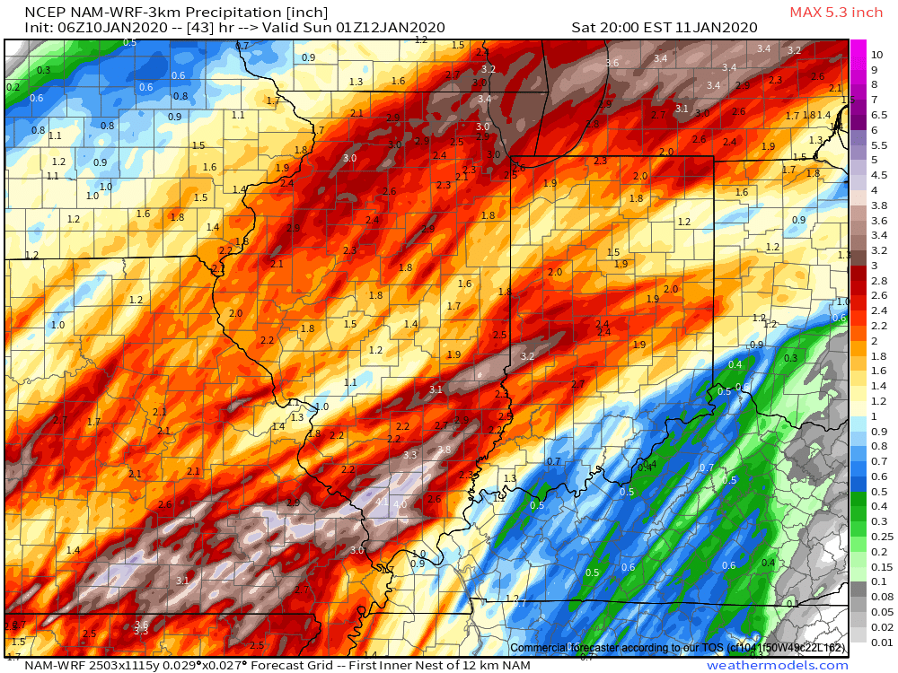
Rain Amounts: 2.5″ to 3.5″ (localized heavier totals)
Wind: Variable 20-30 MPH with gusts to 50 MPH+ Saturday

Periods of moderate to heavy rain developed during the overnight and continue as we type this client brief this morning. Rain will continue for a good portion of today into tonight (locally heavy at times) before we likely go through a break in the rain early Saturday morning. That lull in the action won’t last long as rain is quickly expected to return by late morning and continue through the afternoon, into the early evening hours. What will already be a windy day today (30-40 MPH gusts) will only grow worse Saturday with some 50 MPH gusts a good bet.
As the surface low moves to our northeast, a cold front will sweep through the state Saturday evening and shut off the rain. Cooler air will move in to close the weekend.
Confidence: High
Next Update: Friday evening
Permanent link to this article: https://indywx.com/2020/01/10/client-brief-heavy-rain-increases-flood-concerns-into-the-weekend-strong-wind-also-a-concern/
Jan 09
VIDEO: Walking Through The Specific Details Of Our Incoming Strong Storm…
A strong winter storm system will impact a good chunk of the country between today and Sunday morning. More specific to Indiana, rain will begin to overspread the region (initially…
You must be logged in to view this content. Click Here to become a member of IndyWX.com for full access. Already a member of IndyWx.com All-Access? Log-in here.
Permanent link to this article: https://indywx.com/2020/01/09/video-walking-through-the-specific-details-of-our-incoming-strong-storm/
Dec 31
VIDEO: Opening Up 2020 On An Active Note…
You must be logged in to view this content. Click Here to become a member of IndyWX.com for full access. Already a member of IndyWx.com All-Access? Log-in here.
Permanent link to this article: https://indywx.com/2019/12/31/video-opening-up-2020-on-an-active-note/
Dec 27
VIDEO: Heavy Rain Storm Blows Into Town This Weekend…
Our quiet weather pattern will come to a rather abrupt halt over the weekend as a heavy rain event unfolds late Saturday night through Monday morning. This evening’s video update walks through the various periods where more intense rainfall is expected:

Permanent link to this article: https://indywx.com/2019/12/27/video-heavy-rain-storm-blows-into-town-this-weekend/
Dec 27
Cooler Today; Heavy Rain Arrives Over The Weekend…
A cold front will slip south through central Indiana over the next couple of hours. This will result in a much cooler feel when compared to the past couple of days, but still milder than normal for late-December. We’ll note temperatures generally holding steady in the mid 40s before falling into the 30s this evening.
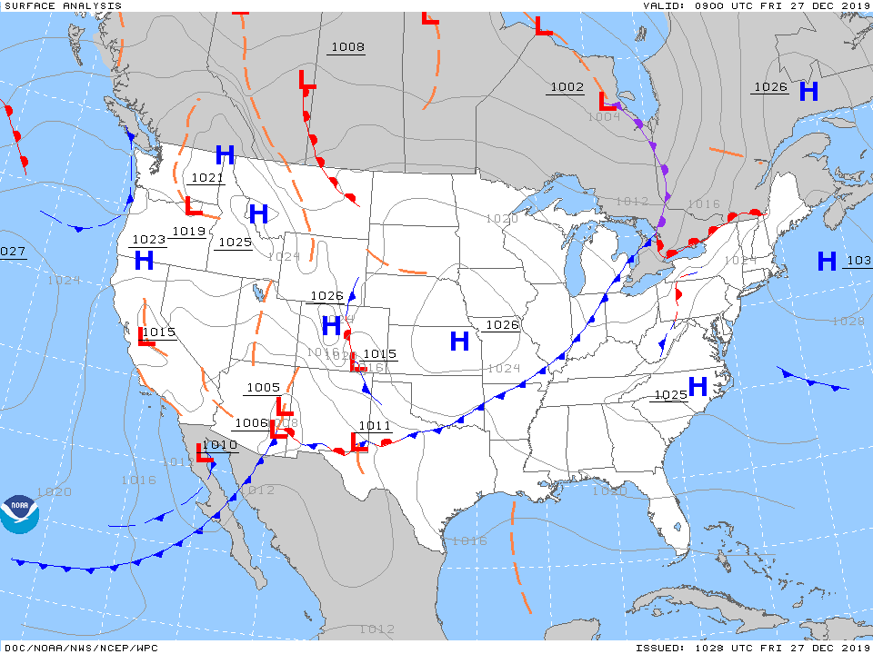
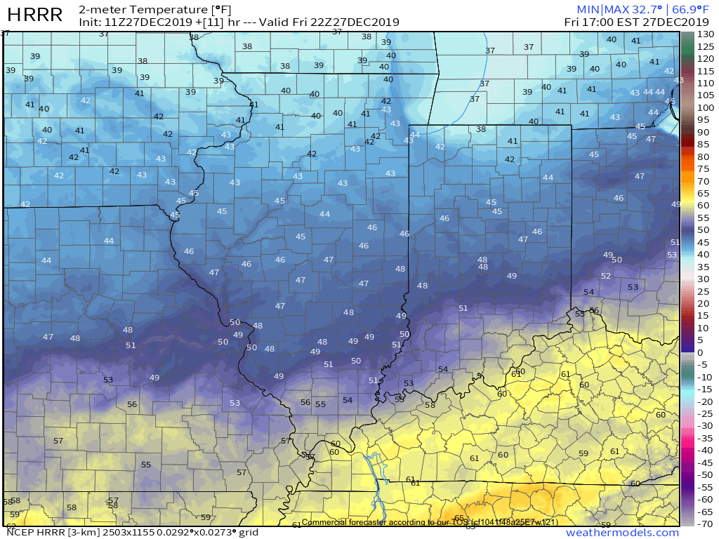
As we flip the page to Saturday, changeable weather can be expected by evening. For the majority of the daytime, expect considerable cloudiness and cool conditions. Our wind direction will back around to the south Saturday night and this will result in rising temperatures (into the lower 60s by Sunday morning) along with periods of showers and thunderstorms developing during the overnight hours into Sunday.
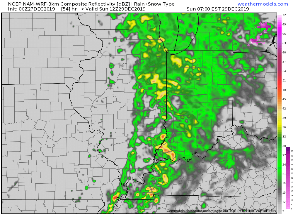
We’ll keep close eyes on a secondary wave of moisture that will develop Sunday afternoon. While it still appears as if the bulk of the heavy rain associated with this secondary wave will remain to our east, portions of east-central Indiana can expect heavier storm totals. The large majority of central Indiana can expect total rainfall amounts of 0.75” to 1.25”, with 1.25” to 2” across east and southeast areas.

We’ll turn windy and colder for New Year’s Eve (northwest gusts of 30-40 MPH), but dry things out. Our next system of note won’t arrive until late next week.
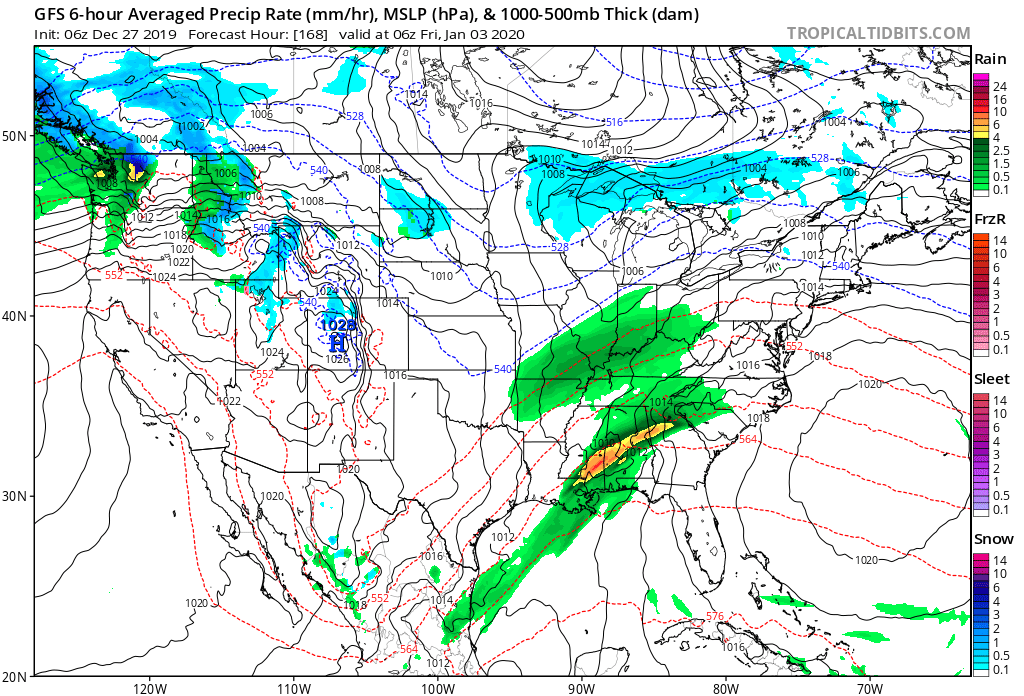
More later this evening in our latest video update. Make it a great Friday!
Permanent link to this article: https://indywx.com/2019/12/27/cooler-today-heavy-rain-arrives-over-the-weekend/
Dec 26
Evening Video Update: “Different” Feel Friday Is Replaced By Sunday Morning Thunder; Colder Next Week…
You must be logged in to view this content. Click Here to become a member of IndyWX.com for full access. Already a member of IndyWx.com All-Access? Log-in here.
Permanent link to this article: https://indywx.com/2019/12/26/evening-video-update-different-feel-friday-is-replaced-by-sunday-morning-thunder-colder-next-week/
Dec 25
Merry Christmas! The Weather Pattern Takes On A More Active Look To Close The Year…
You must be logged in to view this content. Click Here to become a member of IndyWX.com for full access. Already a member of IndyWx.com All-Access? Log-in here.
Permanent link to this article: https://indywx.com/2019/12/25/merry-christmas-the-weather-pattern-takes-on-a-more-active-look-to-close-the-year/
