Updated 09.22.22 @ 7:38a
You must be logged in to view this content. Click Here to become a member of IndyWX.com for full access. Already a member of IndyWx.com All-Access? Log-in here.

Sep 22
Updated 09.22.22 @ 7:38a
You must be logged in to view this content. Click Here to become a member of IndyWX.com for full access. Already a member of IndyWx.com All-Access? Log-in here.
Permanent link to this article: https://indywx.com/2022/09/22/video-coolest-since-last-spring-friday-morning-all-eyes-on-the-gulf-next-week-as-a-potential-significant-hurricane-threat-looms/
Sep 20
Updated 09.20.22 @ 7:37a
You must be logged in to view this content. Click Here to become a member of IndyWX.com for full access. Already a member of IndyWx.com All-Access? Log-in here.
Permanent link to this article: https://indywx.com/2022/09/20/video-gusty-storm-potential-heat-followed-by-significant-late-week-cool-down/
Sep 18
Updated 09.18.22 @ 8:10a
You must be logged in to view this content. Click Here to become a member of IndyWX.com for full access. Already a member of IndyWx.com All-Access? Log-in here.
Permanent link to this article: https://indywx.com/2022/09/18/video-discussing-tonights-severe-weather-threat-near-record-heat-followed-by-a-frost-threat-across-ne-in-friday-morning/
Aug 29
Updated 08.29.22 @ 7:00a
You must be logged in to view this content. Click Here to become a member of IndyWX.com for full access. Already a member of IndyWx.com All-Access? Log-in here.
Permanent link to this article: https://indywx.com/2022/08/29/video-gusty-storm-complex-takes-aim-on-the-region-later-this-evening/
Aug 07
Updated 08.07.22 @ 8:44a
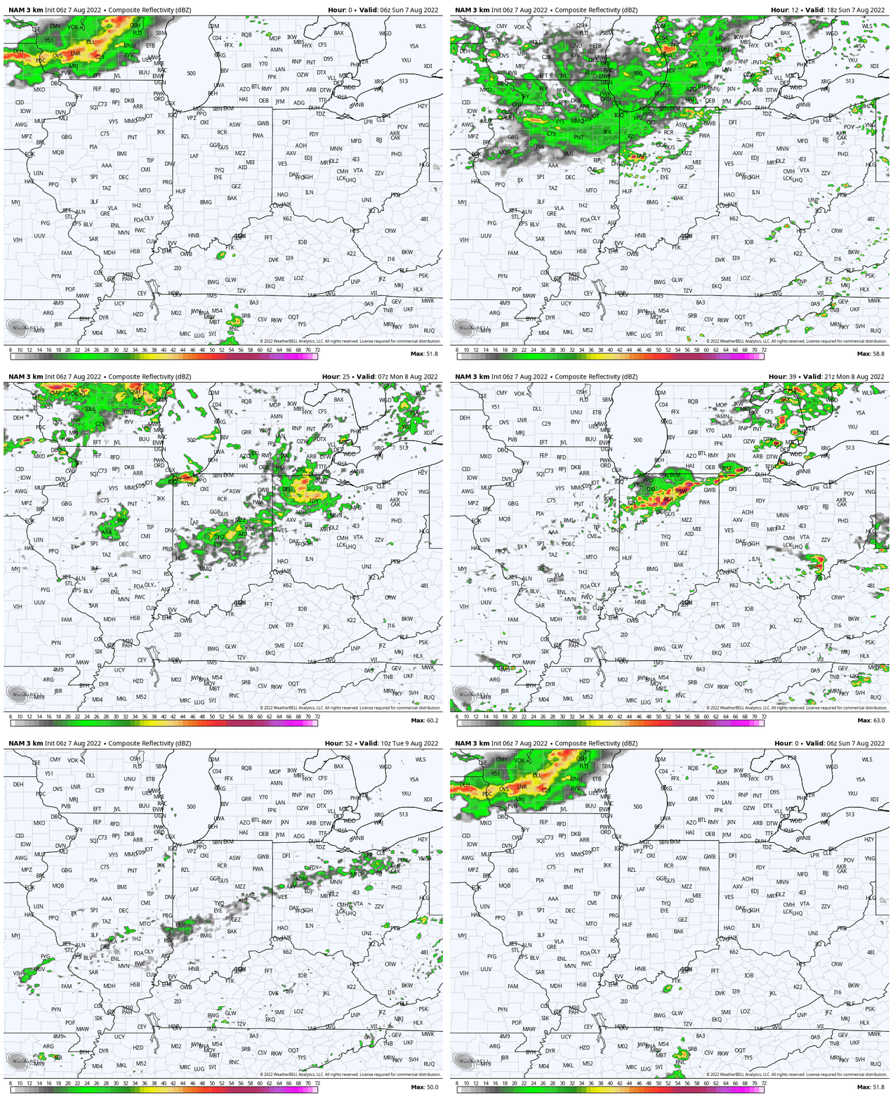
1.) In the short-term, a much cooler and less humid airmass awaits on deck this week. 2 frontal systems will pass through the state between Tuesday night and Thursday. We’ll notice an uptick in coverage of showers and thunderstorms starting this afternoon/ evening and repeating itself once again Monday afternoon/ and evening as the 1st front slowly sags south. Some gusty winds are possible with these lines of storms, as well as heavy rain. In fact, most areas in/ around Indianapolis and points north should cash in on 1″ to 2″ of rain (locally heavier totals) by Tuesday morning.
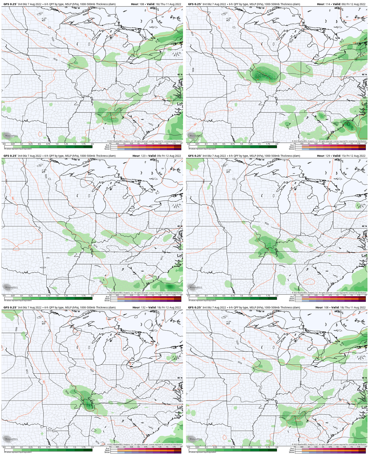
2.) The secondary cold front won’t have as much moisture to work with so coverage of showers and storms isn’t expected to be as widespread Thursday (“widely scattered” at best from this distance).
Thereafter, an even drier and cooler air mass is scheduled to arrive just in time for the weekend. Look for lower humidity levels, sunshine, and refreshing temperatures (even should dip into the 50s for overnight lows).
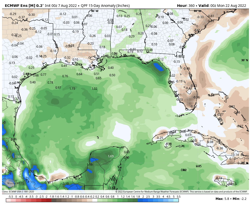
3.) After a quiet time in the tropics, there are signs we’re on the cusp of heading into busier days (should the MJO swing into Phase 2, then things could get very busy and in rather quick fashion). We note the National Hurricane Center (NHC) is monitoring a tropical wave that’s just now emerging off the African coast. There’s the potential the environment will become more conducive for gradual development of this feature over the next few days.

Also of interest is the precipitation pattern in the Gulf of Mexico over the next couple weeks. Additional trouble lurking here? It’s getting to be that time of year…
4.) Finally, new seasonal modeling is in for the upcoming fall and winter. The European seasonal model suggests that potentially our idea of a fast start to the upcoming winter (after a warmer than average fall overall) is on the right track.
Meteorological fall (Sept through Nov):
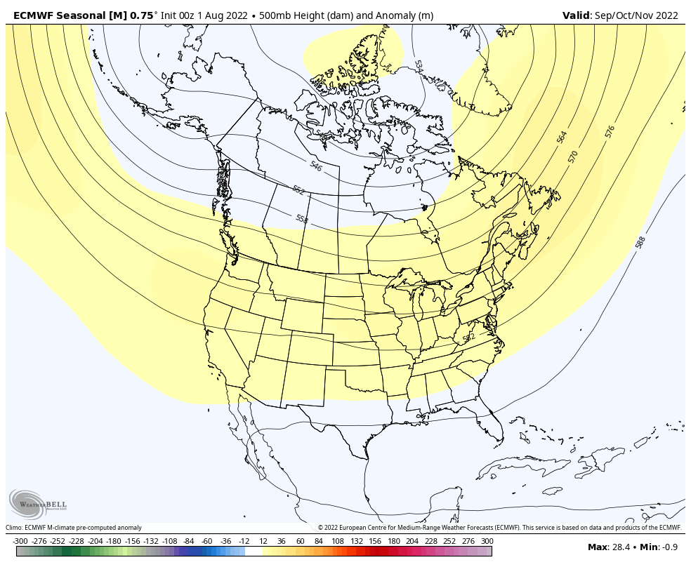
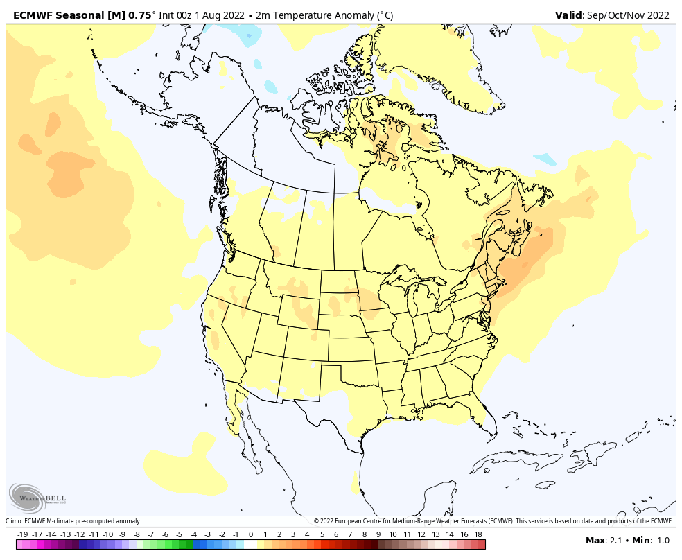
Note how the ridge builds in western Canada come December (reflection of a trough over the East). Candidly, for a model that struggles to ever really see cold, this is a bullish look. We’ll have to keep an eye on things as we get closer as I suspect cold to begin to show with more authority given the 500mb setup. Cold, wintry Christmas season in the works this year?
December:
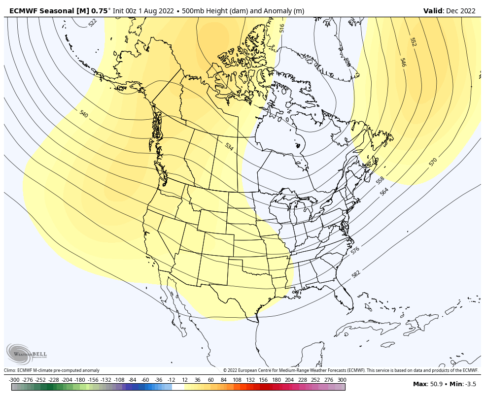
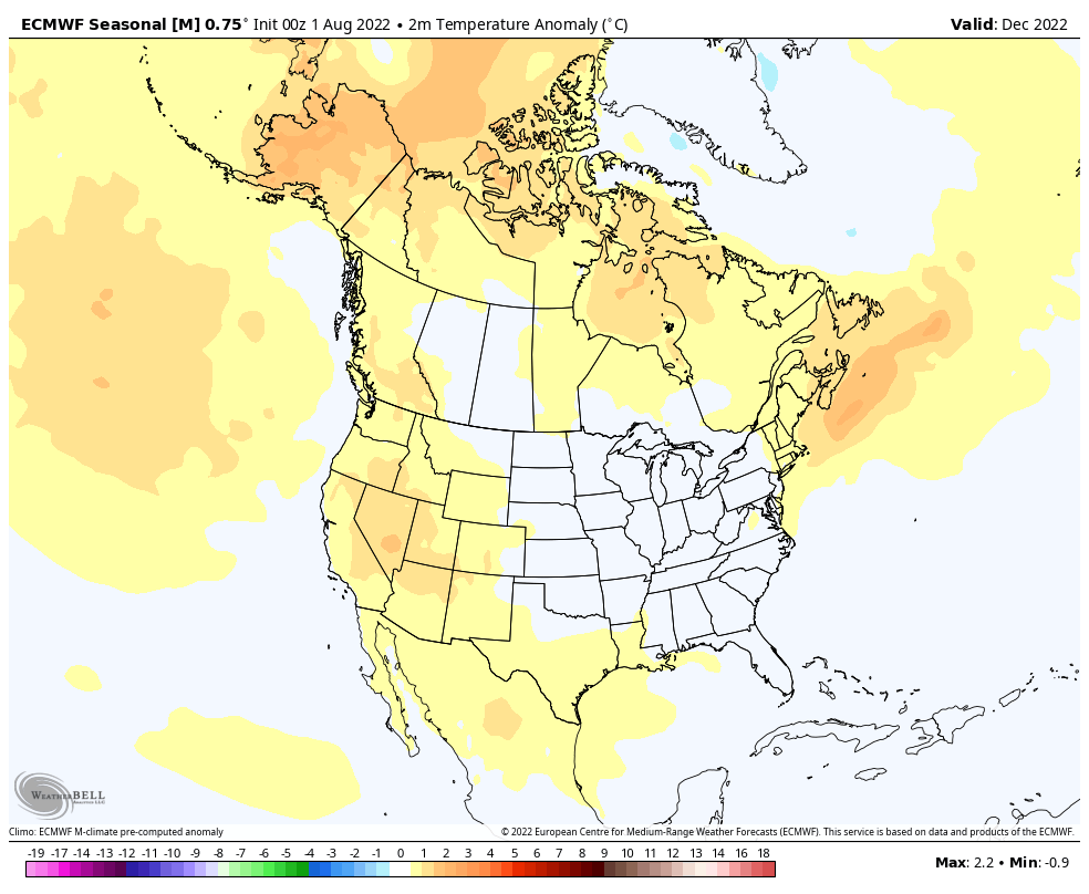
The pattern is shown to remain favorable for additional colder than normal weather, locally, into the new year:
January:
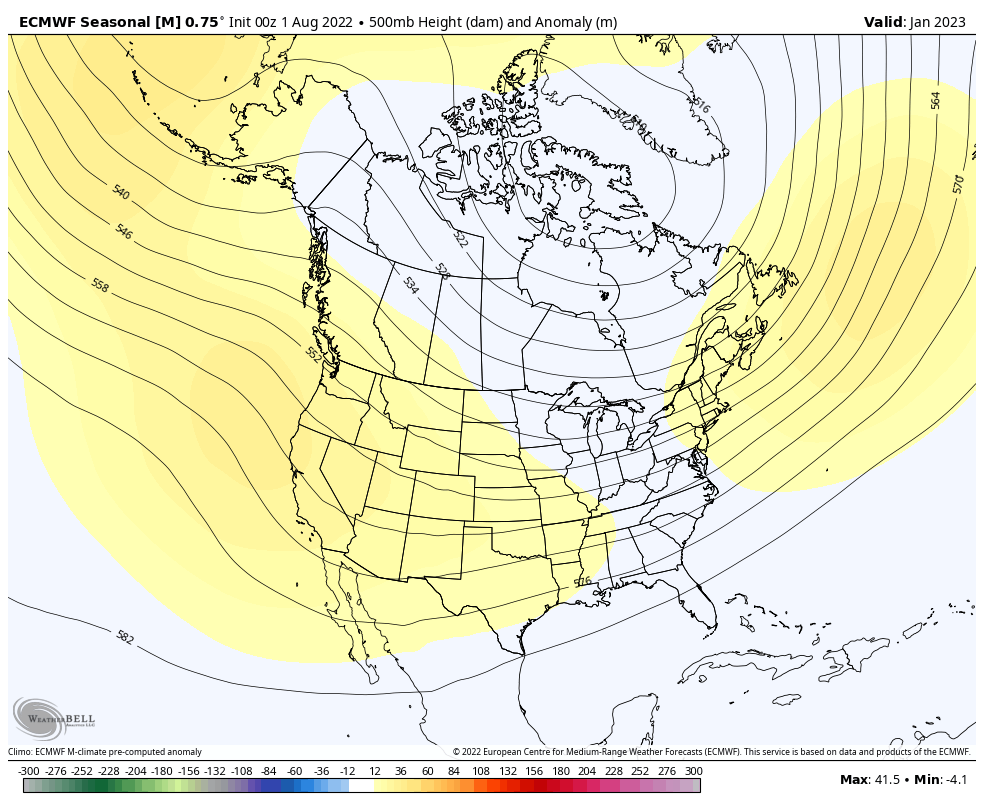
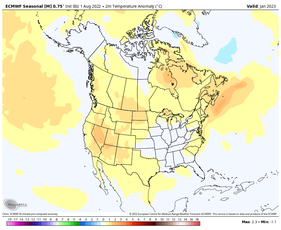
Very interesting as this fits our early research (triple dip Nina). Also of interest is how things break down and are modeled to end on a warmer than normal note (would agree with this idea as well) as we finish off meteorological winter.
February:
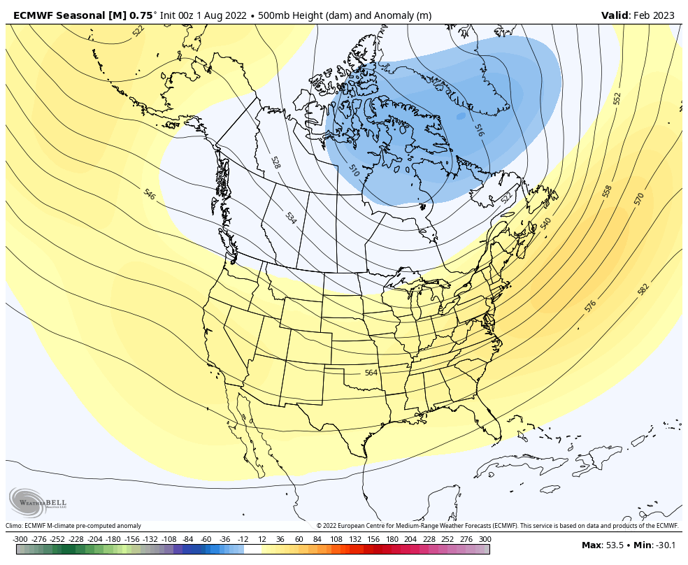
Permanent link to this article: https://indywx.com/2022/08/07/sunday-morning-rambles-tropics-about-to-wake-up-new-model-data-in-for-fall-winter/
Aug 03
Updated 08.03.22 @ 7:35a
You must be logged in to view this content. Click Here to become a member of IndyWX.com for full access. Already a member of IndyWx.com All-Access? Log-in here.
Permanent link to this article: https://indywx.com/2022/08/03/video-unsettled-stretch-of-weather-into-the-early-part-of-next-week/
Jul 23
Updated 07.23.22 @ 7:55a
You must be logged in to view this content. Click Here to become a member of IndyWX.com for full access. Already a member of IndyWx.com All-Access? Log-in here.
Permanent link to this article: https://indywx.com/2022/07/23/video-wet-stormy-pattern-heat-backs-off-in-the-coming-days/
Jul 03
Updated 07.03.22 @ 6:40a
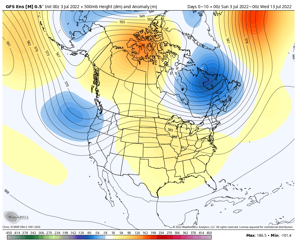
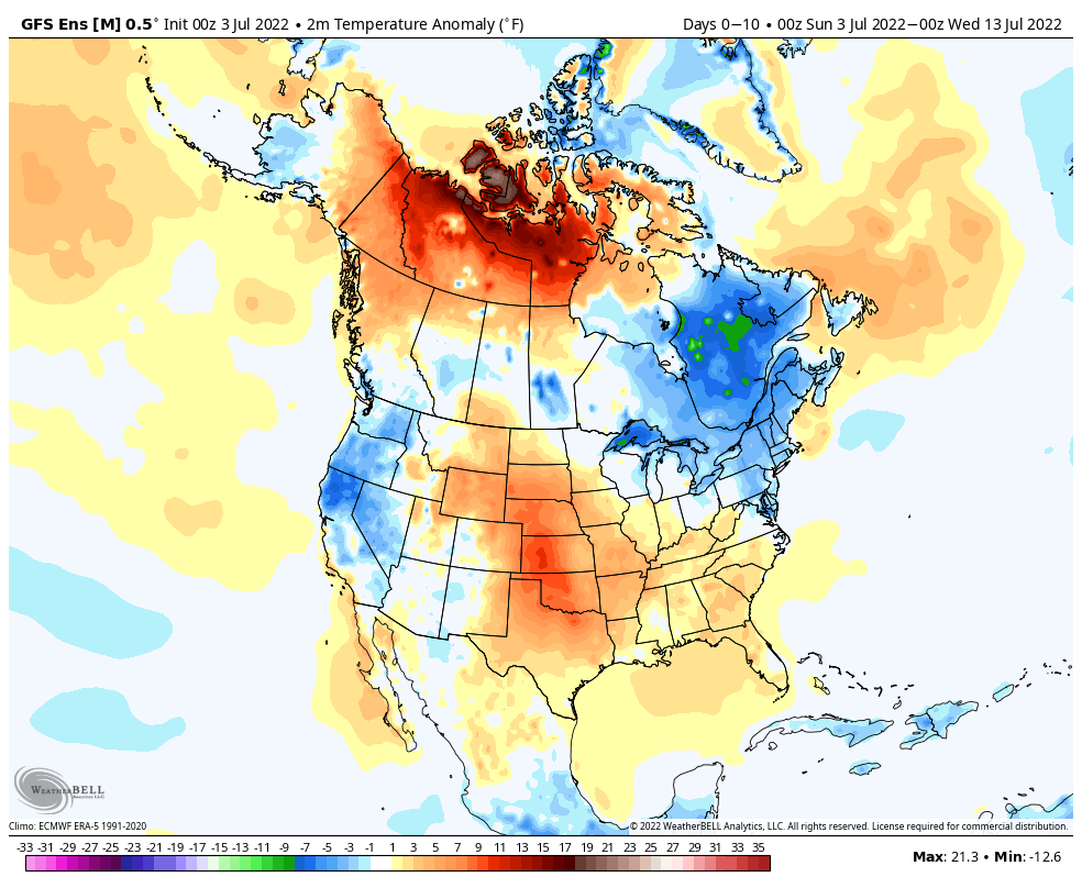

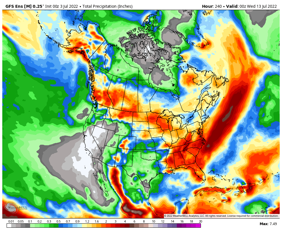
Forecast Period: 07.03.22 through 07.13.22
After a quiet holiday weekend, a much more active pattern will take hold as we navigate the 1st half of July. It won’t rain everyday, but chances of benefitting from soaking rain in more widespread fashion will be on the rise as we move into the middle and latter part of this week into the following week.
Serious heat will bake the Plains while a cooler pattern dominates the Northeast region. In between, here on the home front, we’ll note heat trying to expand northeast into the Ohio Valley (and there will be several 90°+ days thrown in the 10-day period), but each time it may look like the heat is here to stay for more than a few days, we’ll likely get cooling relief from cold fronts moving southeast around the periphery of the ridge.
We’ll have to pay close attention to some of the more “mature” storm complexes including a heightened threat of damaging straight line winds give the overall pattern. It’s impossible to pin down which complexes may include a better threat of severe weather from this distance, but this threat may include a closer look as we move into the middle and latter part of the week.
10-Day Rainfall Forecast: 1”-2”
Permanent link to this article: https://indywx.com/2022/07/03/weekly-agwx-and-severe-weather-outlook-44/
Jun 13
Updated 06.13.22 @ 6:40a
You must be logged in to view this content. Click Here to become a member of IndyWX.com for full access. Already a member of IndyWx.com All-Access? Log-in here.
Permanent link to this article: https://indywx.com/2022/06/13/video-chance-of-severe-storms-this-afternoon-evening-before-the-heat-builds-much-cooler-less-humid-weekend-on-tap/
Jun 08
Updated 06.08.22 @ 7:27a
You must be logged in to view this content. Click Here to become a member of IndyWX.com for full access. Already a member of IndyWx.com All-Access? Log-in here.
Permanent link to this article: https://indywx.com/2022/06/08/video-detailing-todays-severe-threat-few-days-of-intense-heat-humidity-arrives-next-week/