Weekend Snow Storm…

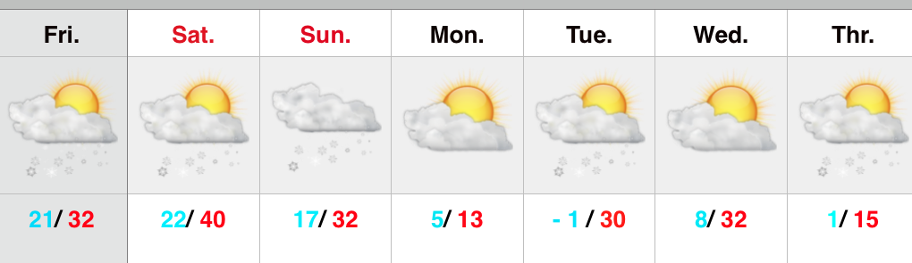
Screen Shot 2015-01-30 at 7.10.35 AMWeekend Snow Storm On Deck…Scattered snow flurries and snow showers will come to an end this morning with increasing sunshine following.  Despite seeing a little vitamin D this afternoon, it won’t do anything to help us in the temperature department.  In fact, we already experienced our high around midnight.  Temperatures this afternoon will remain in the middle to upper 20s with a gusty wind.

Most of Saturday will be quiet (calm before the storm) with dry conditions and afternoon highs around 40.  Clouds will lower and thicken as we go through the afternoon and evening and snow will develop (rain or a wintry mix down state initially) across central Indiana during the overnight.  Snow will increase in intensity Sunday morning and grow heavy at times during the day as low pressure tracks along the Ohio River (a classic track for central Indiana snow storms).  See our initial accumulation map below, which is still subject to change.  We’ll introduce a gusty east and northeast wind into the mix Sunday evening and night and this will lead to blowing and drifting snow Sunday night.  Stay tuned.

The big story next week will be the cold, but we’re also watching two potential snow makers, as well.  More on that after we deal with Sunday’s snow storm.

Upcoming 7-Day Precipitation Forecast:

  • 7-Day Snowfall Forecast: 5″ – 10″
  • 7-Day Rainfall Forecast: Trace

2115SnowfallMap

Late Night Update: Snow Storm Brewing…

Early forecast model data into the office tonight suggests we remain on track for a disruptive widespread snow storm this weekend. We note the timing is speeding up just a…

You must be logged in to view this content. Click Here to become a member of IndyWX.com for full access.  Already a member of IndyWx.com All-Access?  Log-in here.

So Long Boring Weather…

Screen Shot 2015-01-24 at 8.49.04 AMBusy Times In The Forecast Office…Let’s get to the easy part of this forecast package and that’s today.  Look for lots of sunshine along with seasonably mild temperatures after a cold and frosty start.

Things get fun tomorrow as a clipper low dives southeast and tracks in a favorable position for accumulating snow- especially from the city and points north (snowfall forecast below).  A mixture of rain and snow will overspread central Indiana Sunday morning and transition to all snow through the late morning into the early afternoon.  This will be a heavy, wet snow (perfect for snowball fights or making a snowman).  The other aspect to this storm system will be an increasing east and northeast wind Sunday evening into Monday morning.  Snow will diminish Sunday night, but the “damage” will likely be done by that point, leaving a mark on your Monday morning commute.

Another (weaker) weather maker may deliver scattered snow showers Tuesday.

Briefly milder air will move in here Thursday with a mixture of rain, snow, and sleet (depending on where you’re viewing us through the state), but the bigger story will be MUCH colder air set to pour into the region to close January and open February.  Some forecast models suggest a winter storm will precede the bitterly cold air around Super Bowl Sunday…. Stay tuned.

Upcoming 7-Day Precipitation Forecast:

  • 7-Day Snowfall Forecast: 2″ – 5″
  • 7-Day Rainfall Forecast: 0.10″ – 0.25″

12515SnowfallMap

Friday Morning Thoughts…

I’m blessed to have family in town this weekend so posts will be a bit off schedule the next few days, but keep it tuned here as they will come!

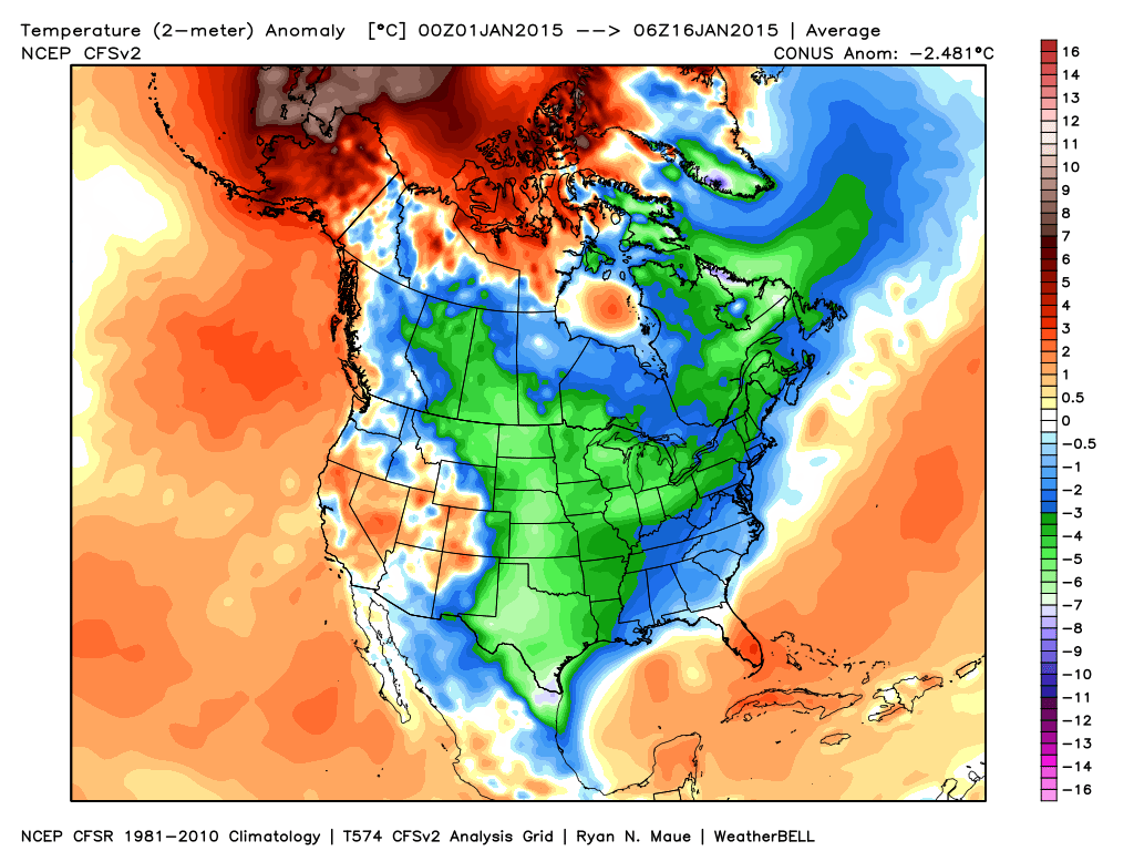
What a remarkable January this is as temperatures are averaging more than 9 degrees (fahrenheit) below average AND COLDER than last January.  While I know snow lovers are wanting more snow (yours truly included), one has to sit back and really appreciate the pattern for what it is from a cold standpoint.  I would go as far as to argue this pattern is actually more impressive than last January as the cold has come in the face of what’s been a much less impressive snow pack (for the most part).

ncep_cfsr_noram_t2m_anom

Despite a brief “relaxation” now, models suggest the cold comes on like gangbusters yet again to wrap up the month.  Given where we’ve been and what appears to lie ahead, it would seem as if this January will be even colder than last January- not only through the first half, but at month’s end.  It’ll be fascinating to watch unfold.

Speaking of snow, I still believe this is the type pattern that can “flip on a dime” in the snow department.  The sea surface temperature profile and analogs at least suggest we’re on the playing field for a stormy ride through the month of February and even into March this year.  Does it mean it has to be a snowy pattern?  No, but at this distance it’s at least nice knowing we’re on the field with a chance to win the game.

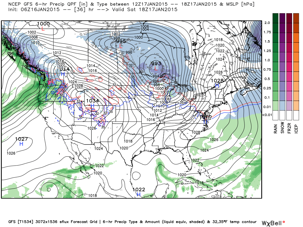
In the shorter term, a windy “mild up” will occur Saturday as highs reach the middle to upper 40s with a gusty southwest wind in play.  Winds will top 30-40 MPH so you’ll definitely want to “batten down the hatches” Saturday.

gfs_ptype_slp_conus2_7

Quiet Weather For Now….

Screen Shot 2015-01-15 at 8.07.55 AM

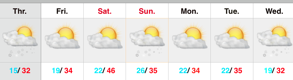
Moderation Continues; Windy Saturday…A weak frontal boundary will slip through the state this afternoon/ evening and could offer up a snow flurry.  Otherwise it’s a rather uneventful forecast until Saturday when we introduce a gusty southwesterly wind (up to 30 MPH).  The bright side of that southwesterly breeze will be that temperatures will reach the middle 40s.

The milder air will be very brief as a cold front moves through Saturday night and provides snow shower potential as early as Sunday morning.  We should remain dry for the better part of the first half of next week, but we’ll be keeping a close watch for a potential winter storm brewing the middle to latter portions of next week…

Upcoming 7-Day Precipitation Forecast:

  • 7-Day Rainfall Forecast: Trace
  • 7-Day Snowfall Forecast: Dusting – 1″