Unseasonably Chilly, Active Pattern…

Screen Shot 2016-04-02 at 9.39.00 AMHighlights:

  • Busy, active pattern
  • Unseasonably cool
  • Multiple hard freezes ahead

Fast-Moving Weather Pattern…The upcoming forecast period will feature multiple fast-moving weather systems in an almost every other day format.  It’s an unseasonably chilly pattern, as whole, as well.

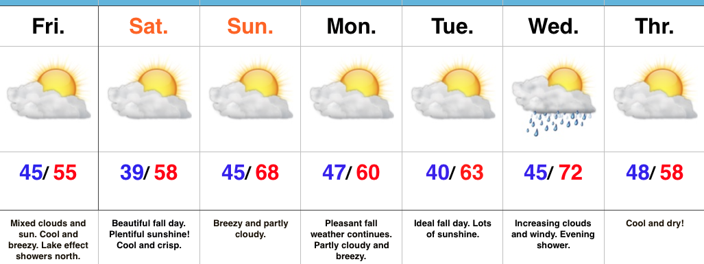
Saturday has opened with plentiful sunshine, but clouds will quickly increase and winds will turn strong (50+ MPH gusts) as we progress into the afternoon.  Batten down the hatches.  A few showers will accompany those clouds and some small hail is also possible with a few “stronger” showers.  As colder air pours in this evening, widely scattered snow showers will impact north-central IN.

A hard freeze will take place tonight into Sunday morning.  High pressure will briefly supply a mostly sunny day Sunday, but our next system will approach late Sunday night.  Consequently, SW winds will turn strong and gusty late Sunday and a broken band of showers will be associated with reinforcing chilly air late Sunday night into the pre dawn hours Monday.

A more significant storm system will arrive on the scenes mid week and feature more widespread rains Wednesday (perhaps an embedded thunderstorm, as well).  As a cold front slides through here Thursday, MUCH colder air will push into central IN and transition lingering left over moisture into scattered snow showers/ flurries late Thursday night into early Friday morning.  Friday certainly won’t feel much like April around these parts…

Monitoring Severe Potential Tuesday Night…

We have scattered showers and embedded thunderstorms to deal with today and Monday (along with plenty of dry time, too), but our attention is beginning to shift to the potential of strong to severe thunderstorms Tuesday- particularly Tuesday night.

The SPC has outlined most of the state for a *Slight Risk* of severe thunderstorms Tuesday.

We note surface dew points surge into the upper 50s and lower 60s Tuesday.

SfcDPThis should be sufficient enough to help fuel a developing thunderstorm cluster in IL Tuesday afternoon/ evening that will likely race eastward with time Tuesday night.  We note a strong area of low pressure over the upper Mid West that will “bull-whip” a cold front through the region Tuesday night.  This will tap into the available moisture and relative warmth (lower to middle 70s a good bet for highs Tuesday) to continue the storm threat through IN and into western OH during the late evening/ overnight.

3All modes of severe weather appear to be in play right now, but we’re particularly concerned about the potential of damaging straight line winds within any thunderstorm complex that develops Tuesday afternoon/ evening.  We’ll also have to monitor the potential of discrete cells that develop away from the primary storm complex.

We turn cooler and windy Wednesday.

Turning Stormy Later Tonight…

Screen Shot 2016-03-12 at 7.59.37 AMHighlights:

  • Turning stormy this weekend
  • Warm open to the week
  • Active times give way to a colder finish to the week

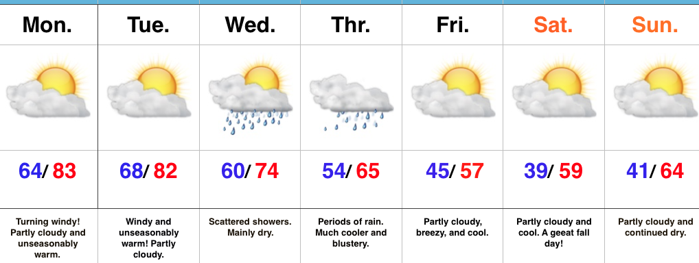
Thunderstorms Develop Tonight…A warm front is lifting through the state this morning and this could spark a few showers as it passes through central IN through the late morning hours.  Most of today will be dry before heavier rains and embedded thunderstorms push into the region tonight into Sunday morning.  By the way, don’t forget to set those clocks ahead an hour tonight ;-).

Rather unsettled weather will continue through the early and middle portions of the work week, but we caution timing is still up in the air.  It’s an active regime that will require fine tuning.  As things stand now, we forecast scattered showers and storms Monday and a mostly dry Tuesday.  Gusty SW winds will pull anomalous warmth into the region Tuesday before storms blow into the state late Tuesday night/ Wednesday.  This is in association with a cold front that will have things feeling much cooler around these parts to close the work week.

7-Day Precipitation Forecast:

  • Snowfall: 0.00″
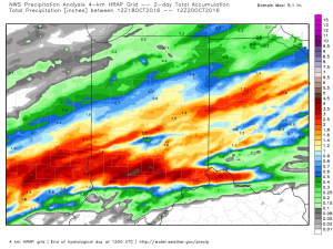
  • Rainfall: 1.25″ – 1.75″ (locally heavier totals)
Interested in more in-depth long range forecast discussions, video updates, ag. forecasts, and seasonal outlooks? E-mail bill@indywx.com for more information.

Milder Weekend Ahead…

Screen Shot 2016-02-26 at 6.42.32 AM

Highlights:

  • Dry, chilly close to the week
  • Milder weekend
  • Eyeing a mid week storm

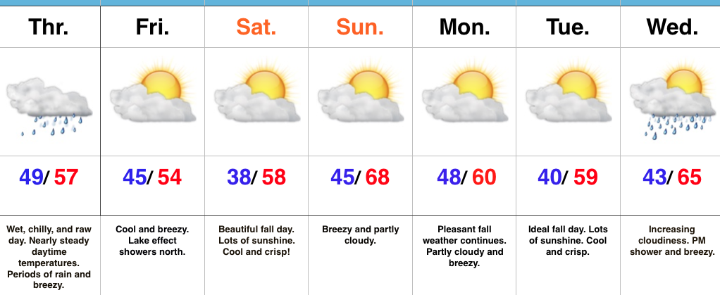
Milder Weekend Ahead…Scattered flurries are flying across northeastern and eastern parts of the state this morning, but drier air is invading from the west and this should lead to increasing sunshine through the afternoon.

Though Saturday won’t be as warm as Sunday, it’s our pick of the weekend with lots of sunshine and mild temperatures.  We’ll add wind and evening showers into the mix Sunday.

The next storm of significance is slated to arrive Tuesday.  Though we’ll have to fine tune details as we move forward, for now we’ll go with developing rain Tuesday followed by a transition to snow showers Wednesday. Stay tuned.

Indications late next week are that we may have to deal with an active NW flow and snow-producing clippers.