 Highlights:
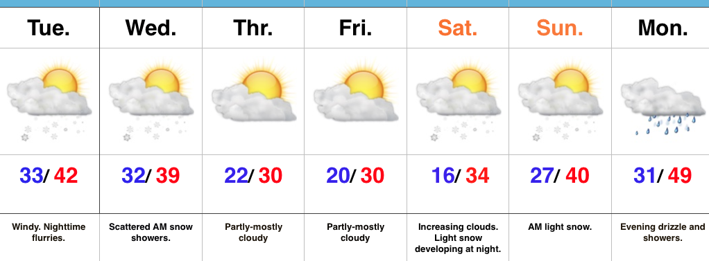
- Windy Tuesday
- Scattered flurries; snow showers tonight-Wednesday AM
- Accumulating weekend snow?
Bumpy Ride…Wind will be the big weather item today as a clipper low passes to our north. Gusty west breezes will reach 30 MPH at times. Otherwise, it’ll be a mild day as highs reach the lower 40s. Cooler air will arrive tonight and will promote the chance of a passing flurry or scattered snow shower into Wednesday morning.
We’ll close the week with cold and dry conditions, including highs below freezing both Thursday and Friday.
As we move into the upcoming weekend, a storm system will attack the lingering cold air and this will allow for a period of snow to develop Saturday night into Sunday morning. We still have time to monitor this event, but as of now this appears to be a relatively weak, flatter wave and “light” is the key word to describe the snow intensity Saturday night into Sunday morning.
Models want to drive a more significant storm system to our northwest early next week. What’s new this winter? A windy warm-up would result, including heavier rains late Monday into Tuesday.
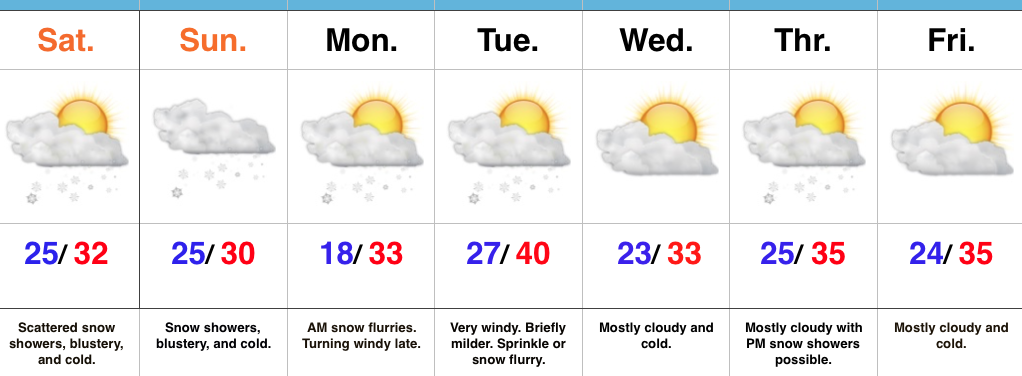
Upcoming 7-Day Precipitation Forecast:
- Snowfall: 1″ – 2″
- Rainfall: 0.25″ – 0.50″
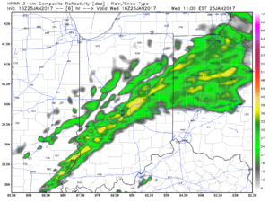
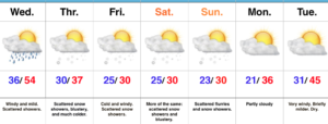 Showers will expand in overall coverage as we progress through the late morning hours, but shouldn’t amount to much (0.10″ for a few neighborhoods). We return to a drier theme this afternoon.
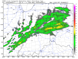
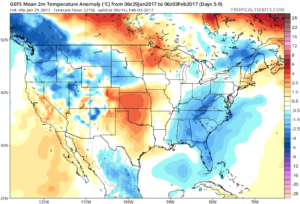
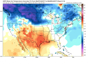
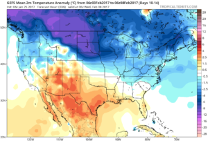
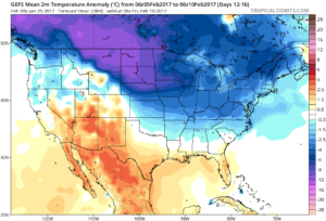
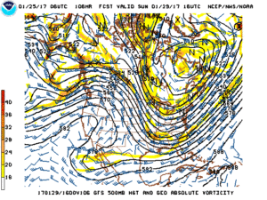 Longer term, the GFS ensemble continues to show the cold growing deeper and stronger for the region as we progress into early February. Winter is far from over.