
You must be logged in to view this content. Click Here to become a member of IndyWX.com for full access. Already a member of IndyWx.com All-Access? Log-in here.
Category: Windy
Permanent link to this article: https://indywx.com/video-late-week-storms-and-much-cooler-next-week/
May 05
More Heavy Rain Today, But Improving Conditions As We Move Into The Weekend…
After a relative “lull” in the rainfall coverage and intensity overnight, rain is expanding in coverage and intensity yet again this morning. While there will be a rather sharp cut-off to the west, additional heavy rains are ahead from northwestern Indianapolis ‘burbs (including places such as Brownsburg, Whitestown, and Sheridan), Indianapolis, and points south and east.
HRRR simulated radar shows this rain shield nicely as we progress through mid and late morning.
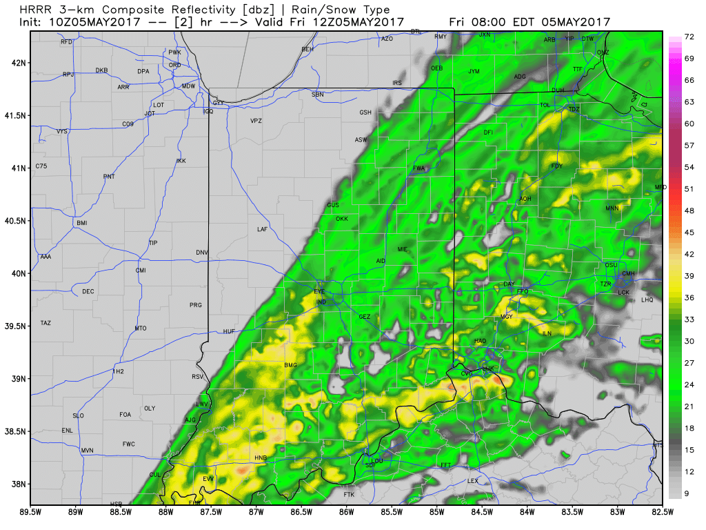
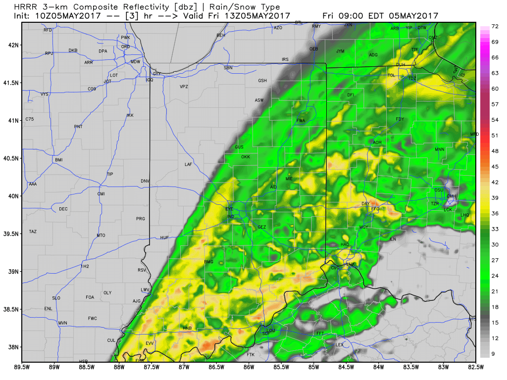
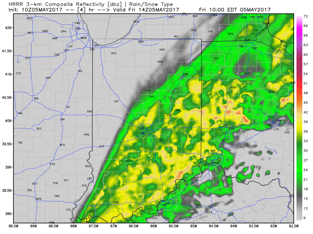 Additional rainfall of 1″-1.5″ is likely from Indianapolis and points south and east with this band of rain before drier weather finally works in here this afternoon and evening. Otherwise, expect continued windy, cold, and raw conditions today as temperatures remain in the 40s this afternoon, including wind chills in the 30s.
Looking ahead, one last batch of rain will arrive on the scene Saturday morning.
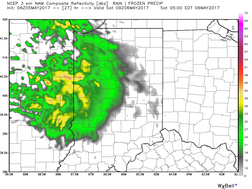
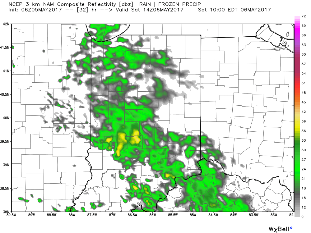 We’ll finally get rid of the rain and introduce a drier regime Saturday afternoon into Sunday, including a sunny close to the weekend. With the drier air, overnight lows will fall to frosty levels Sunday and Monday mornings (lower to middle 30s).
More on the longer range this weekend!
Permanent link to this article: https://indywx.com/more-heavy-rain-today-but-improving-conditions-as-we-move-into-the-weekend/
May 04
VIDEO: Heavy Rain & Flooding Update…
You must be logged in to view this content. Click Here to become a member of IndyWX.com for full access. Already a member of IndyWx.com All-Access? Log-in here.
Permanent link to this article: https://indywx.com/video-heavy-rain-flooding-update/
May 03
Flooding Concerns Return…
 Highlights:
- Heavy rain returns
- Unseasonably cool
- Drier weather returns late in the weekend
Live Near A Body Of Water? Keep An Eye On The Level…Central Indiana will deal with an extended period of rain, occasionally heavy, tonight through Friday afternoon. With saturated soils in place, an additional widespread 2.5″-3.5″ (with locally heavier amounts) between now and Saturday morning, flooding concerns are very high. As the lead off states, please remain aware of water levels if you live near a creek, stream, or river. The other aspect of this storm will be unseasonably chilly air and gusty easterly winds that will shift to the north Friday night into Saturday.
The weekend will provide a drier trend, but the improvements will be slow to occur. Showers remain in our Saturday forecast before drier air finally wins out Sunday with sunshine. The worry once to Sunday and Monday mornings will be the potential of frost and freeze conditions- especially in communities away from downtown. Remember, no planting around these parts until after Mother’s Day! 😉
Shower chances return by the middle of next week!
Upcoming 7-Day Precipitation Forecast:
- Snowfall: 0.00″
- Rainfall: 3″ – 4″
Permanent link to this article: https://indywx.com/flooding-concerns-return/
May 02
Unseasonably Chilly; Another Heavy Rain Maker Blows Into Town…
Clouds will lower and thicken Wednesday morning and give way to an expanding rain shield late morning into the early afternoon hours. Initially this rain won’t be heavy, but will begin to increase in overall coverage and intensity as we progress into the nighttime hours.

Forecast radar around lunchtime shows rain increasing across central IN.
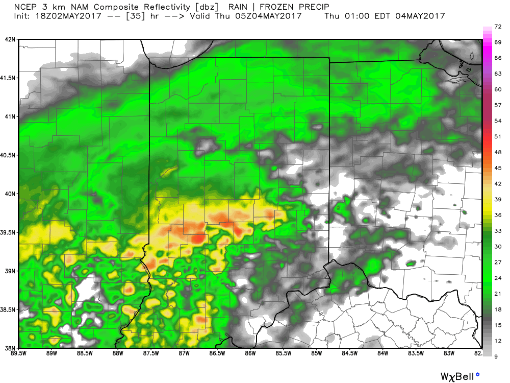
Rain becomes heavy Wednesday night.
The culprit behind this new heavy rain maker is a deepening surface low pressure system that will slowly track from Arkansas (Wednesday night) northeast along the Ohio River (Thursday) and into Ohio (Friday). Not only will this spread heavy rain across central Indiana, but will also result in strong and gusty easterly winds Thursday into Friday, and unseasonably cold air. In fact, temperatures Friday will likely remain in the 40s across central IN with wind chills in the 30s. Add in that wind-driven rain and we have the makings for an UGLY day.
Periods of heavy rain will fall on the region Wednesday night into Friday and by the time all is said and done (Saturday night) widespread rainfall of 3″ is likely across most of central Indiana. Locally heavier totals will be possible where the most persistent heavy rain bands set-up shop.
 We’ll begin to dry things out Saturday night into Sunday, but unseasonably chilly air will remain. Lows over the weekend into early next week will grow cold enough to allow patchy frost to develop in outlying communities. We think low to mid 30s will be common across the region Sunday and Monday mornings.

Permanent link to this article: https://indywx.com/unseasonably-chilly-another-heavy-rain-maker-blows-into-town/