
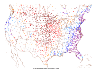
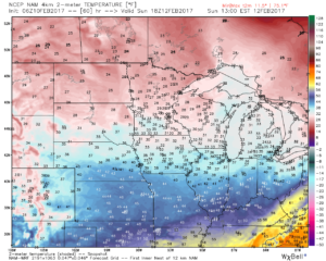
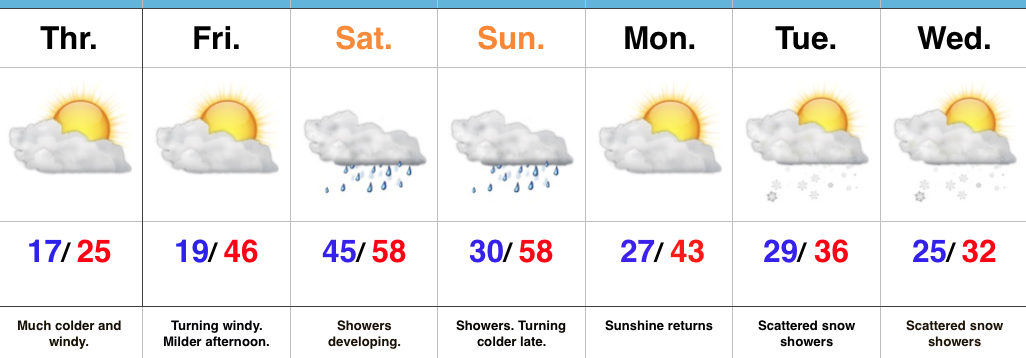
Happy Friday, friends. We’re still cold this morning, but a look at the change in temperatures compared to 24 hours ago shows the milder trend that will be with us through the upcoming weekend. Highs today will reach the upper 40s and 55-60 Saturday.
 Winds will turn strong and gusty out of the southwest this afternoon, noted by the tightly packed isobars (lines of equal pressure) along with considerable mid and high level clouds.
 Clouds will lower and thicken Saturday and we may also have to deal with periods of fog, as well. Showers and drizzle will lift into town as the day progresses, especially by afternoon and evening.
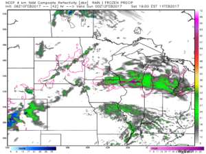
 We don’t expect heavy rain this weekend. In fact, model data continues to really back off on expected totals. The general consensus is between 0.15″ and 0.25″ across central Indiana.
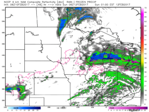
 After a mild Saturday, cooler (but not cold) air will ooze into the Ohio Valley Sunday.
 Resurgent cold air will blow into town during the middle and latter portions of the upcoming work week. Highs will return to the 30s with overnight lows in the lower 20s. We’ll likely add scattered snow showers into the mix as well.
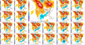

 However the cold air won’t last and milder times will return by the second half of the weekend. This back and forth “tug of war” type regime will remain as cold and warmth (relative to average) continue to battle over the upcoming couple weeks. The latest European ensemble shows this nicely.
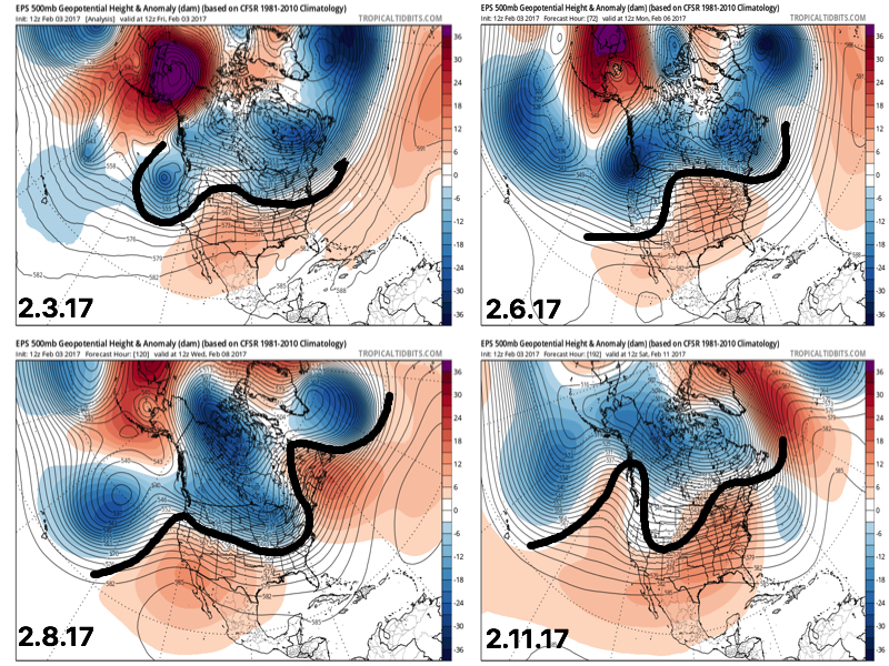 This also favors a rather active pattern and confidence is high on a wetter than average period upcoming over the next couple weeks. See the GFS ensembles support this idea. A couple strong storms are also possible Tuesday.
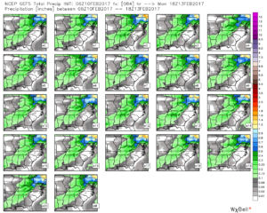
 Unfortunately for snow lovers, the majority of significant moisture should fall as rain. Best snow chances appear to come with “backlash” wrap around snow showers and squalls Tuesday night into Wednesday morning. Accumulating snow is possible, but most amounts should be light. We’ll keep an eye on it.
 Longer-term, the fight continues deeper into the month. As