
 Highlights:
- Wet, raw St. Patrick’s Day
- Brighter weekend ahead
- Shower chances return next week
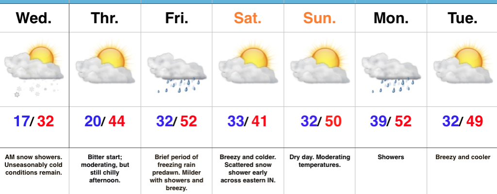
Weekend Improvements Ahead…Today won’t be the classic “chamber of commerce” weather day across central Indiana. A brief wintry mix impacted central and eastern portions of the state earlier this morning and will give way to “showery” weather with blustery conditions and an overall raw feel. It won’t rain the entire day, but plan on packing the wet weather gear as you venture out to your March Madness and St. Patrick’s Day parties. Stay safe out there!
Drier times will return for the weekend as high pressure slowly builds overhead. Saturday will feature a couple of showers- especially across eastern portions of the state through the early afternoon. However, brighter conditions will develop late in the day and by Sunday, mostly sunny skies will return. Along with the increasing Sunday sunshine, temperatures will top 50° for the first time since March 8th.
Unfortunately the sunshine won’t last into the early stages of the work week as moisture returns and showers follow Monday into Tuesday. We’ll turn briefly colder Wednesday before a moist southerly flow returns Thursday with another round of showers.
Upcoming 7-Day Precipitation Forecast:
- Snowfall: 0.00″
- Rainfall: 0.50″ – 1.00″
 Highlights:
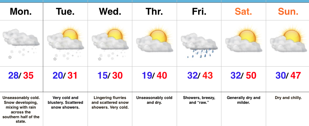 Highlights:
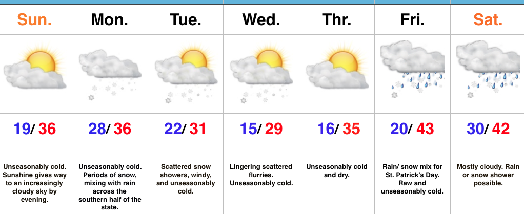 Highlights:
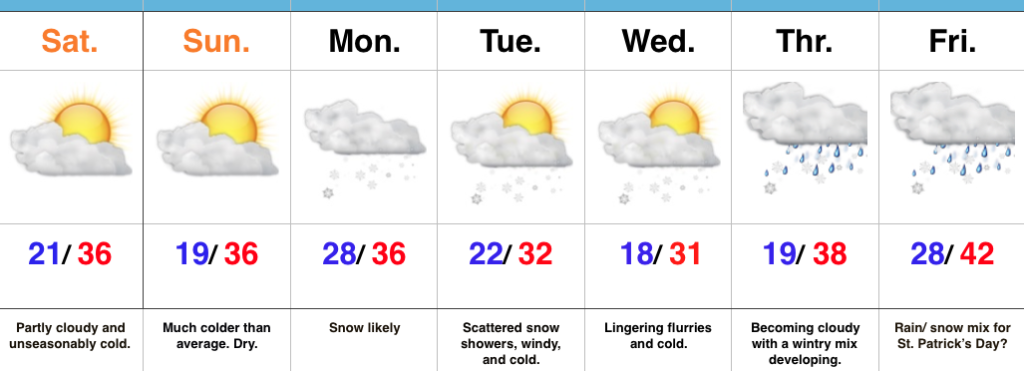 Highlights: