Updated 05.03.21 @ 7:29a
Light rain is currently falling across most of central Indiana. That will end by late morning to early afternoon (west to east) and we’ll then likely get several dry hours into the evening. By this time, all eyes will be focused to our west as a line of storms is expected to erupt across MO and IL by late afternoon. It’s this line of storms that will potentially impact Indiana towards late evening.
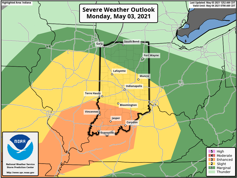
The Storm Prediction Center (SPC) has nudged southwestern Indiana into an “Enhanced Risk” of severe weather today. A good chunk of the remainder of the state is under a “Slight Risk.” Damaging winds are the greatest concern within the aforementioned potential line of storms later this evening.
Unsettled weather will remain in place Tuesday, including the opportunity for additional rain Tuesday evening/ night.
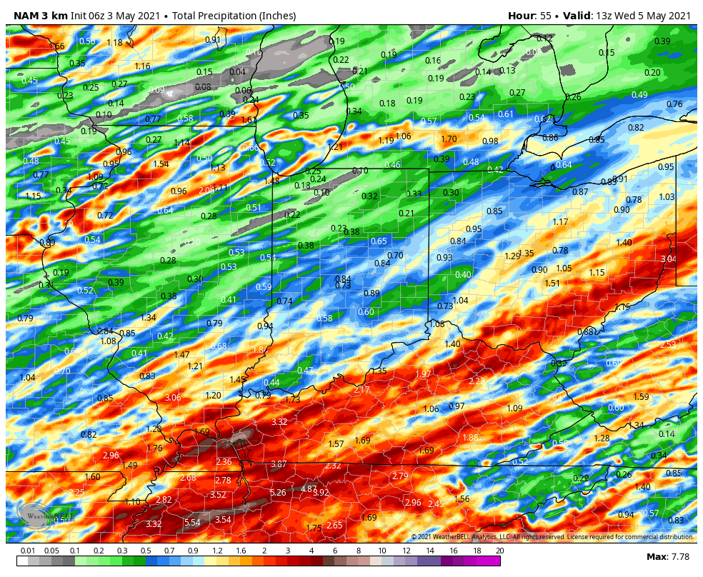
Most area rain gauges should pick up between 0.75″ and 1″ of rain by Wednesday morning, but there will be locally heavier totals for communities that find themselves under stronger storms.
Dry weather will be hard to come by in the week ahead. We’ll get a brief break in the action Wednesday, but upper level energy will spark additional shower chances by Thursday. Unfortunately, Mother’s Day weekend looks quite unsettled, including additional opportunities for rain into early next week.
If that’s not enough, temperatures will also shift to a much cooler than normal feel for the 2nd half of the week (highs in the 50s and 60s and lows in the 30s and 40s). Don’t put those jackets away just yet…
We’ll be back later this afternoon with a fresh look at tonight’s storm threat.