You must be logged in to view this content. Click Here to become a member of IndyWX.com for full access. Already a member of IndyWx.com All-Access? Log-in here.
Category: Weather Rambles
Permanent link to this article: https://indywx.com/video-looking-at-the-longer-range/
Jun 24
Checking In: No Changes To Expected Significant 4th Of July Heat Wave…
As attention turns to the 4th of July holiday, there aren’t any changes to the ongoing idea of a significant heat wave gripping the region.
A strong ridge of high pressure will anchor itself over the Ohio Valley during this time frame and help power a big time period of hot and mostly dry weather. It’s the type of pattern that has legs to promote multiple days of highs in the middle to upper 90s across central Indiana. With tropical dew points in place, overnight lows won’t be allowed to fall much below the middle 70s during the height of the heat wave. Heat indices will rise into the lower 100s to near 110° at times.
Take this period of heat seriously. With many area festivals, firework shows, and events going on during the holiday week, it’ll be important to have a means of keeping cool. Simply put, this kind of heat wave doesn’t come around every year (and thank heavens for that).
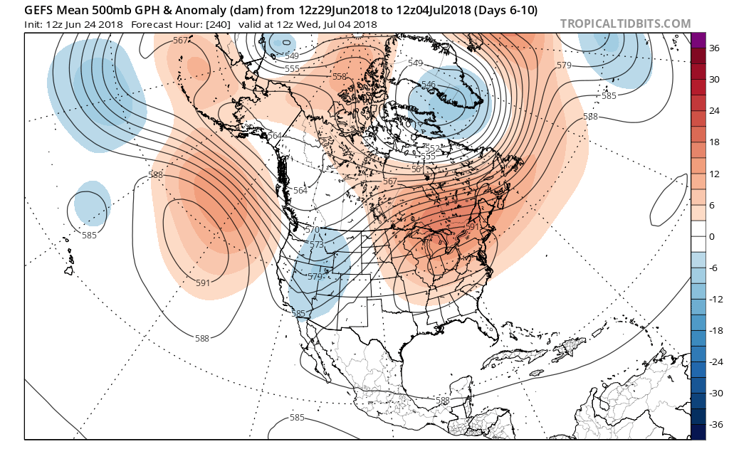 With the hot dome centered over the Ohio Valley, it’ll really help to limit shower and thunderstorm chances. That’s not to say isolated coverage of cooling thunderstorms won’t occur on occasion during the afternoon and evening, but widespread rain of significance won’t be around during the period. Thankfully, the recent wet pattern and additional storm complexes coming in Tuesday into Wednesday have and will help surface moisture levels. Had we not seen the recent wet shift over the past couple weeks, you could easily tack on an additional 3° to 5°…
For those longing for the cool, crisp days of fall, hang in there. Heck, it’s only 69 days until my beloved Auburn Tigers tee it up and kick it off against the University of Washington… I am one that says “bring it on!”
Permanent link to this article: https://indywx.com/checking-in-no-changes-to-expected-significant-4th-of-july-heat-wave/
Jun 18
Stormy Pattern Returns; Localized Flash Flood Threat Emerges…
A cold front will sink south into the Ohio Valley Tuesday afternoon before stalling out through the remainder of the work week and into the weekend.
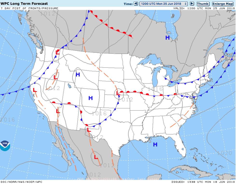
Unsettled weather returns as a frontal boundary stalls out across the region into the upcoming weekend.
Rain and storm chances will increase in overall coverage and intensity as we move into Tuesday- particularly during the afternoon hours. With precipitable water values exceeding 2″ at times, locally heavy downpours can be expected.
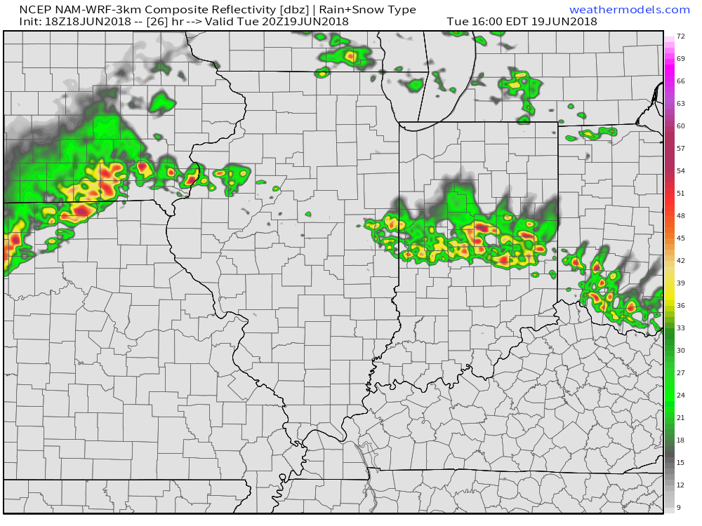 Despite cooler (still mighty humid) temperatures arriving, the overall pattern won’t change significantly into late week and this weekend. With the frontal boundary draped across the Ohio Valley, periods of showers and thunderstorms will remain in the forecast. At times, disturbances will track along the boundary and lead to increased coverage of storms. Perhaps Thursday and Friday will serve up the greatest coverage of thunderstorms as a surface wave moves out of the central Plains into the Great Lakes.
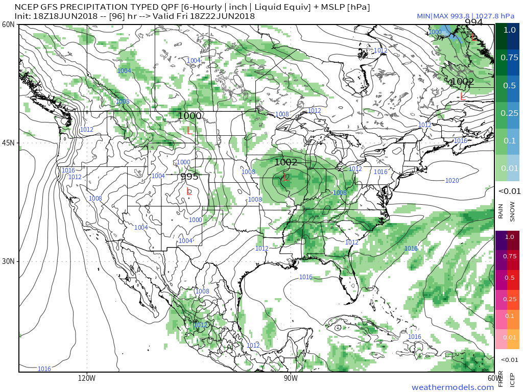 The combination of a juicy air mass and a stationary boundary draped overhead spells a flash flood risk. The lack of any sort of overall steering current suggests the potential of thunderstorms that may train over the same communities at times. As mentioned earlier, precipitable water values (PWATS) will approach and exceed 2″ and this will support torrential downpours at times.
 Officially, we think the upcoming 7-day period will deal out widespread 2″ to 3″ rainfall totals across central Indiana, but there will be locally heavier amounts where thunderstorms train.
After a dry few days with exceptional heat, the unsettled and cooler pattern, overall, will be welcomed with open arms!
Permanent link to this article: https://indywx.com/stormy-pattern-returns-localized-flash-flood-threat-emerges/
Jun 13
Hottest Air (So Far) This Season Arrives Over The Weekend…
A cold front is sinking south as we write this (6:45p) Wednesday evening. A couple of strong to severe storms have developed ahead of the boundary and if you’re reading this from the southern 1/3 of the state, remain weather aware this evening. Otherwise, a drier regime will arrive behind the boundary and at least temporarily lead to a more refreshing air mass for our Thursday. Those 50s sure will feel nice out the door Thursday morning!
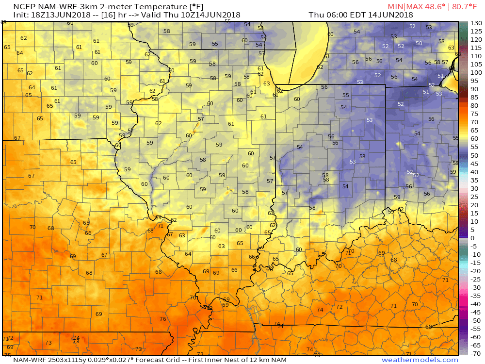
Lows will fall into the middle 50s for many communities outside of the city Thursday morning.
Unfortunately, the nice and refreshing air won’t last long. A building hot dome (ridge of high pressure) will center itself over the Ohio Valley this weekend and help promote excessive heat. It’s not just the high temperatures that will reach dangerous levels (lower to middle 90s), but overnight lows will remain oppressive, as well (low to mid 70s). Heat indices will surge north of 100° at times. The ridge will also serve to limit storm chances this weekend- “isolated” coverage at best.
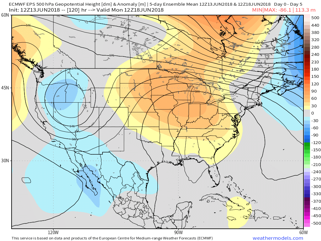
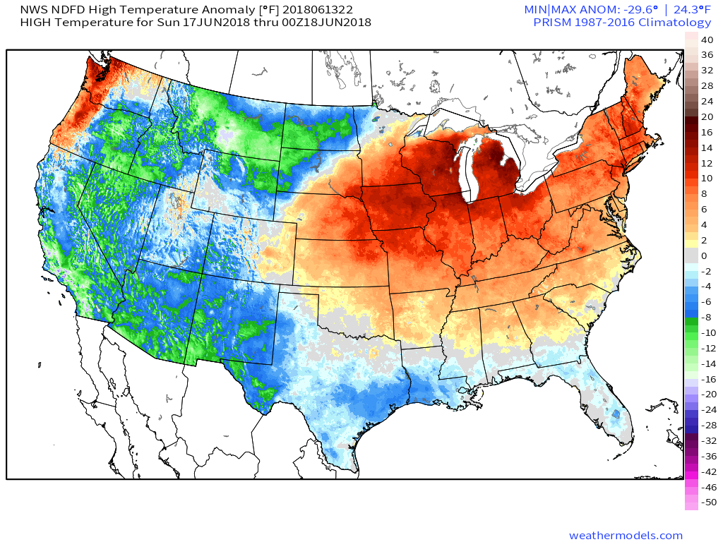 A cold front will drop south early next week and help increase overall coverage of showers and thunderstorms late Monday into Tuesday along with provide relief (at least temporary) from the hot, humid conditions. Temperatures will settle back closer to average by the middle of next week.

Permanent link to this article: https://indywx.com/hottest-air-so-far-this-season-arrives-over-the-weekend/
Jun 09
New Week Kicks Off With More Storm Chances…
An active, and at times stormy, pattern will remain into the new week. The setup remains the same and doesn’t need rehashing :-). While we’ll have to keep a close eye on the potential of morning convection around the area Sunday, thinking here is beginning to shift to Sunday night and predawn Monday as the next best chance of gusty storms and more widespread coverage of beneficial rain. A warm and muggy air mass will be in place and as vigorous upper level energy interacts with the tropical air, thunderstorms that initiate to our northwest should hold together, if not grow stronger moving into central Indiana.
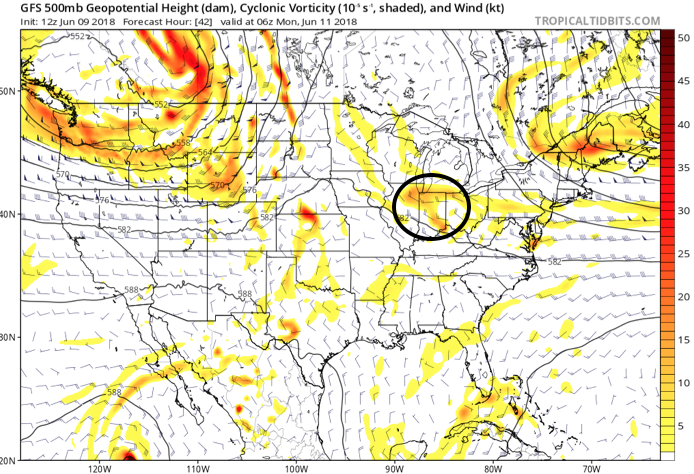
Upper level energy will track across the state Sunday night and Monday morning.

Dew points are forecast to surge into the lower 70s Sunday night.
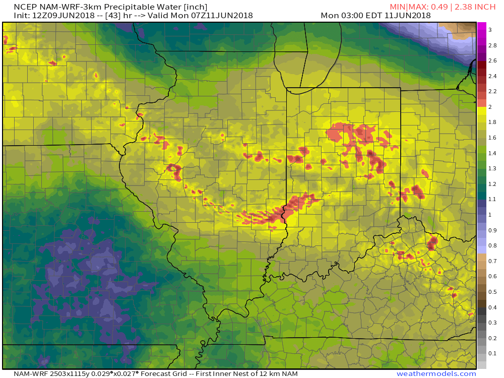
Precipitable water values will approach 2″ Sunday night and early Monday morning.

Forecast radar is beginning to pick up on potentially a noisy time of things Sunday night.
A warm and sticky air mass will remain in place through the first half of the work week before a frontal passage offers up a brief bout of slightly drier air for the middle of the week. Dew points will ease back into comfy range (50s) Wednesday and should also lead to a mostly dry day.

We’ll get to at least briefly enjoy a drier air mass Wednesday.
Humidity will build once again as we move into the latter portions of the work week and with the return of the summer mugginess will come a return of thunderstorm chances (scattered coverage Thursday and Friday).
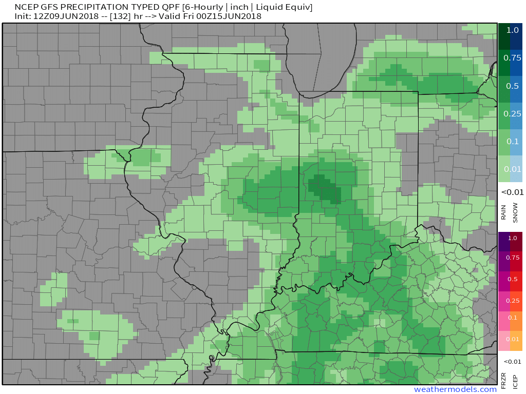 An early look at next weekend shows general agreement with the GFS and European forecast models: drier air returning along with slightly cooler air. We’ll keep you updated!
Permanent link to this article: https://indywx.com/new-week-kicks-off-with-more-storm-chances/
