You must be logged in to view this content. Click Here to become a member of IndyWX.com for full access. Already a member of IndyWx.com All-Access? Log-in here.
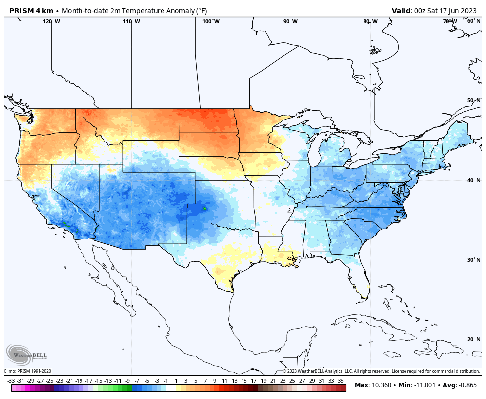
I. It’s been a cool June so far compared to normal. Officially, Indianapolis is running close to 3° below normal month to date.
Locally, there’s still no sign of any sort of significant heat on the horizon in this kind of pattern.
Needless to say, the lack of heat this time of year given how dry it’s been is a true blessing (otherwise the feedback would absolutely be kicking into high gear by now). Thankfully, it continues to look like we’ll avoid any sort of sustained hot wx compared to normal while also seeing the pattern transition towards a more active state.
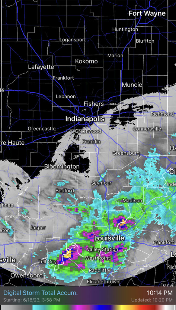
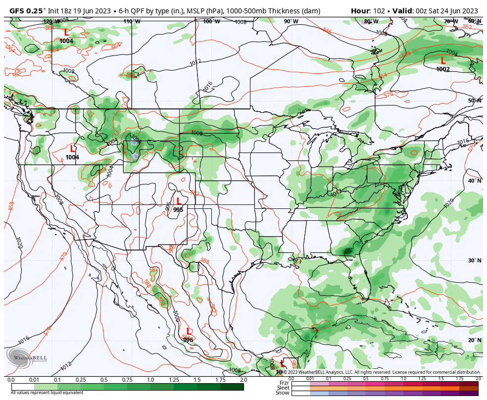
II. Heaviest rains Monday fell across southern and southeastern Indiana, including amounts in excess of 1”.
Additional showers will pinwheel into central Indiana this afternoon and evening. Indianapolis and more of immediate central Indiana stand a better shot of getting some beneficial rain today when compared to Monday. Fingers crossed.
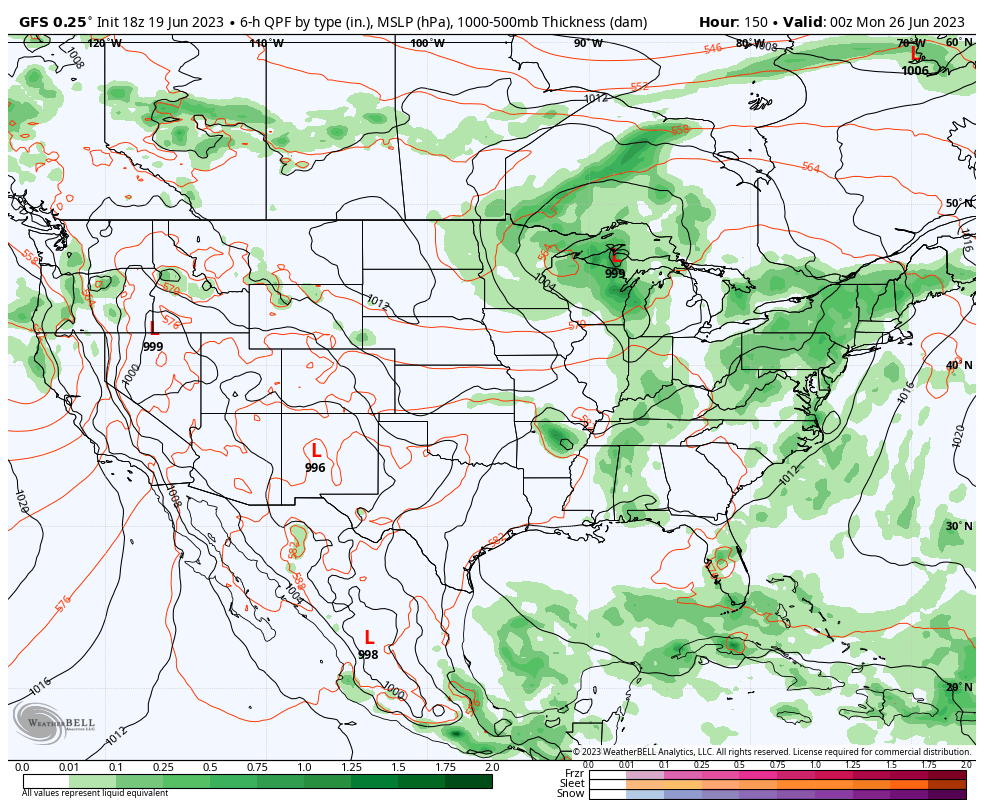
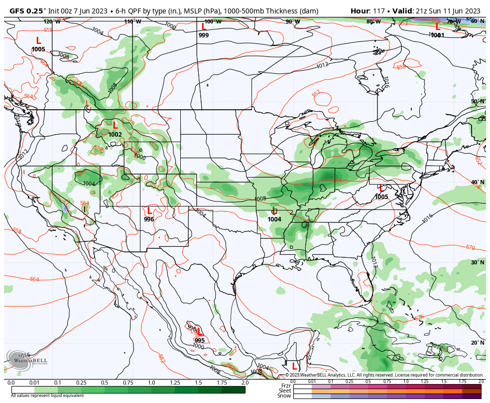
III. Additional opportunities of scattered to numerous showers and storms will occur Friday and Sunday.
Fresh Client video will be posted later this evening!
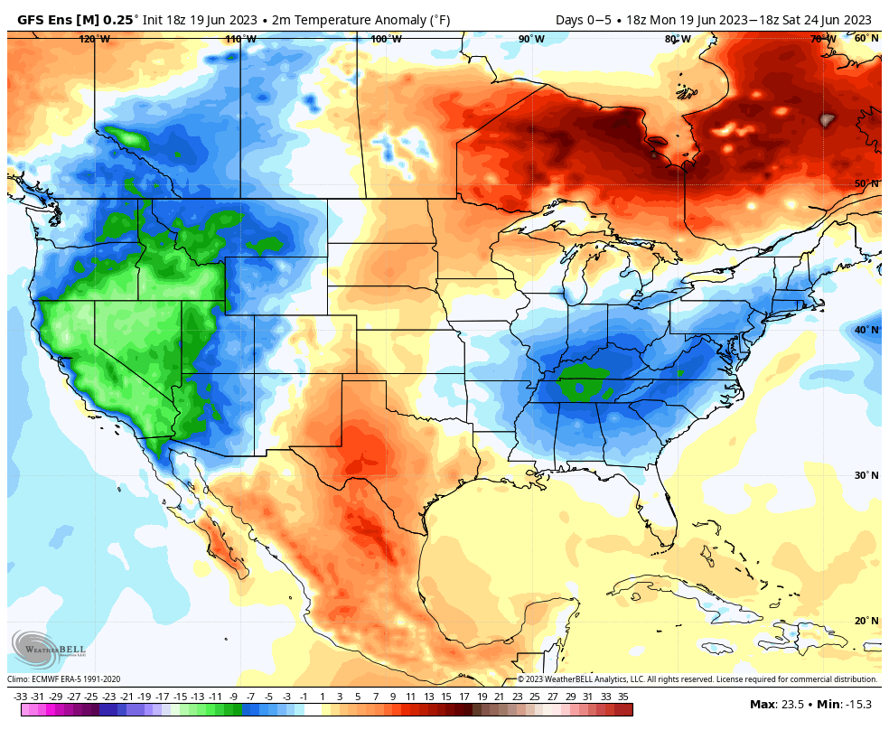
While some backyards have been lucky enough to cash in on downpours over the past several weeks, the large majority of our region has suffered through a dry, to much drier than average, period. Thankfully, the evolving pattern over the next couple weeks will begin to provide much better opportunities of more widespread, organized rain. While still not yet considered a truly “wet” pattern (remember, we believe that kicks in mid to late summer), it certainly will be much more active than what we’ve seen over the past 4-6 weeks, overall.
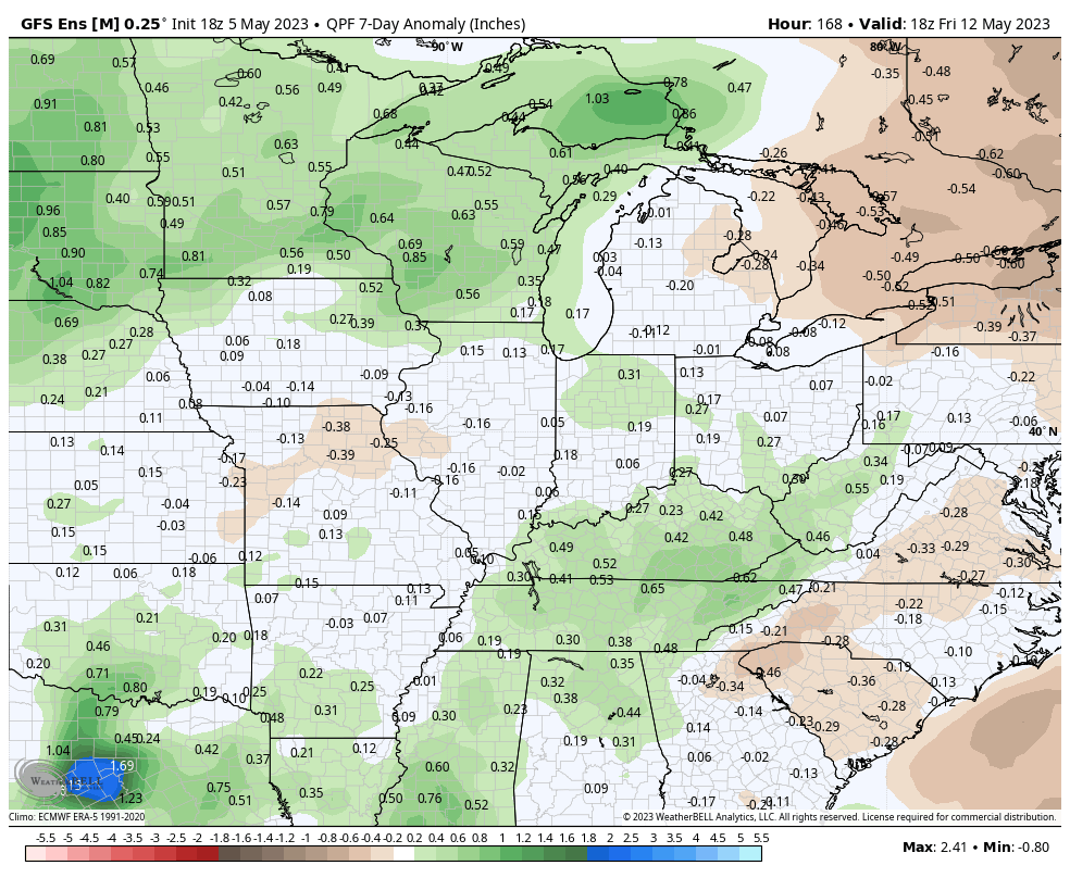
More specifically, we’re targeting this upcoming Sunday to get the wetter party started. While still too early for specific rain amounts, a good chunk of central Indiana and the Ohio Valley as a whole should enjoy a widespread rain.
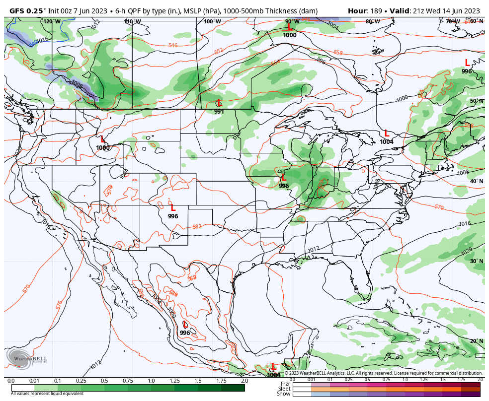
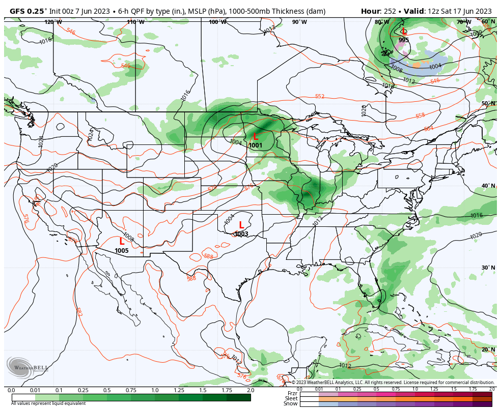
Additional organized rain events are then slated for the middle of next week and the following weekend.
A cold front settled south across Indiana Friday evening. Most area rain gauges picked up anywhere between a tenth and 1/3 of an inch but a few lucky neighborhoods cashed in on up to half an inch. Whatever amount of rain you received last night, cherish it.
As we look forward, an extended dry period and quiet weather can be expected. This overall dry, calm pattern will prevail through the entire week ahead. As moisture levels slowly begin to increase over the holiday and all-important Indy 500 weekend, small rain chances may sneak back into the forecast, but even this is very unlikely from this distance.
High pressure will result in dry skies and plenty of sunshine in the week ahead (despite some haze from time to time, courtesy of those Canadian wild fires).
The focus is really just on temperatures over the next few days. The cool and dry airmass that reinforced itself behind our frontal passage will remain in control through Monday and then we’ll see moderating temperatures through the upcoming work week. Despite the temperature “uptick,” dry air will remain in place through the week. Great times for outdoor activities, no doubt, in the week ahead.
A new pattern is emerging (at least for the time being) and will offer up a much more typical feel by May standards, along with periods of storms as we navigate the early portion of the new week.
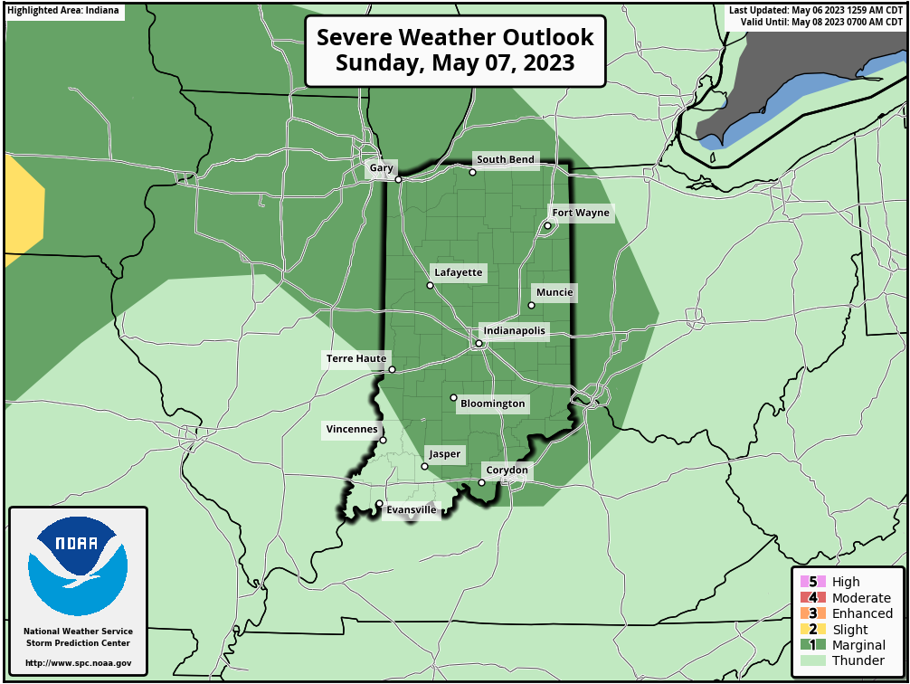
The good news is that our Saturday continues to look dry.
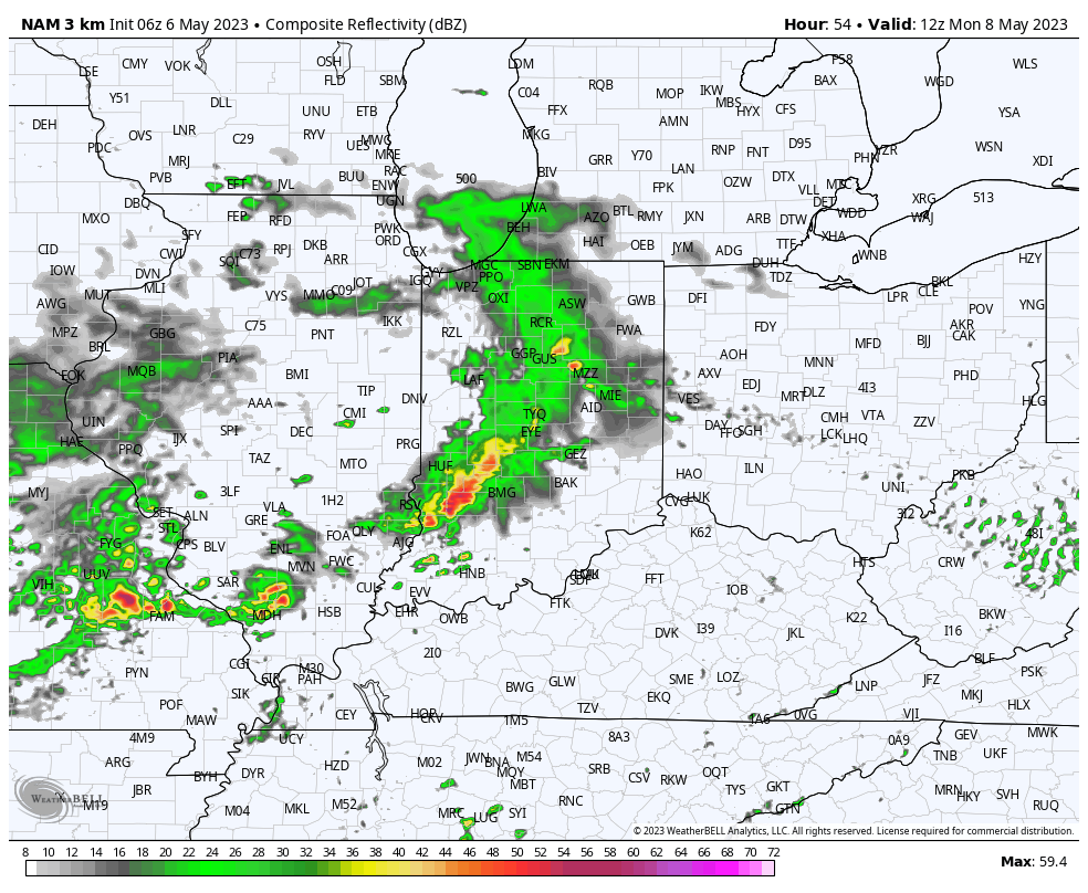
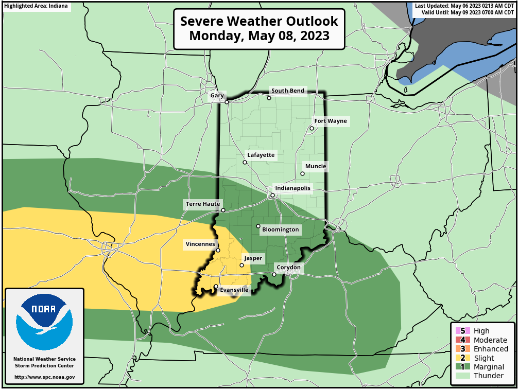
Attention will shift off to our west and northwest later this evening for the potential of local overnight rumbles on into Sunday morning. This will be the onset of more of an unsettled pattern, including multiple storm complexes to track at times through Tuesday.
Severe weather parameters certainly aren’t “off the charts” but there will be enough energy and moisture to signal a localized damaging wind threat Sunday and Monday with any storm cluster(s) that flare up.
Rainfall amounts won’t be uniform but localized 1”+ amounts can be expected with more of a general 0.50” to 1” area-wide rain in the Sunday through Tuesday timeframe.
Drier air and a brief ridge of high pressure will eliminate rain and storm chances Wednesday through Friday.
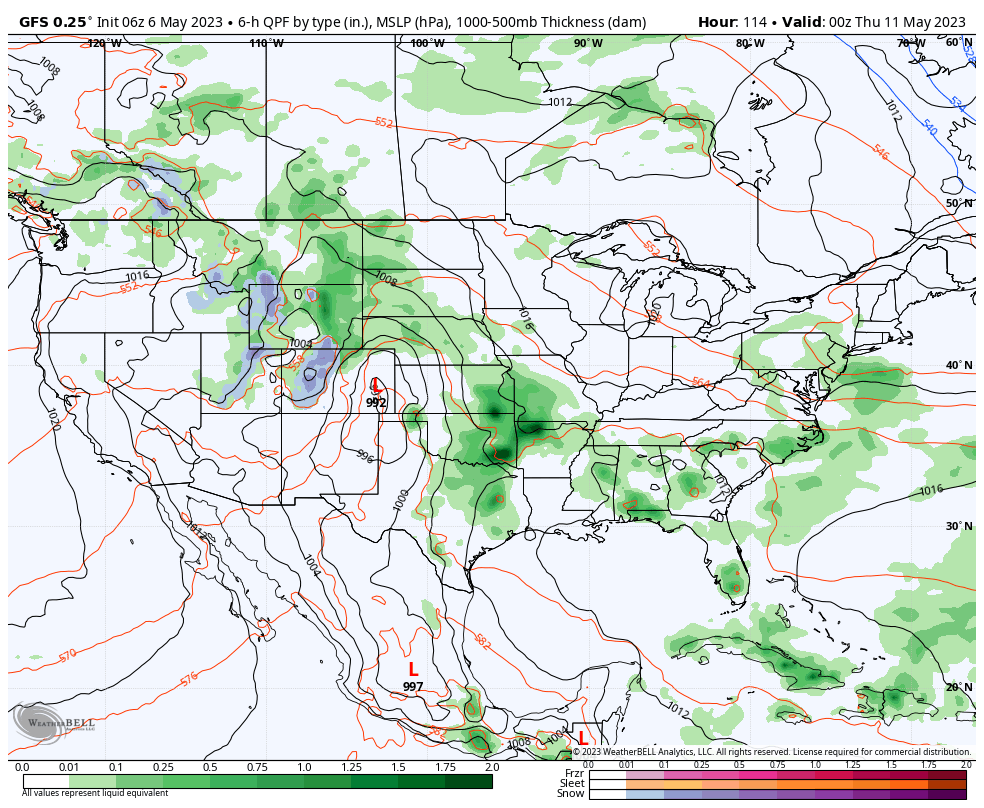
Unfortunately, as it looks now, moisture levels will rise significantly heading into Mother’s Day weekend and a return of unsettled weather will follow during this time period.