Updated 06.05.22 @ 4p 1.) Our pleasant weekend will give way to an unsettled open to the work week as the first in a series of storm systems blows into…
You must be logged in to view this content. Click Here to become a member of IndyWX.com for full access. Already a member of IndyWx.com All-Access? Log-in here.
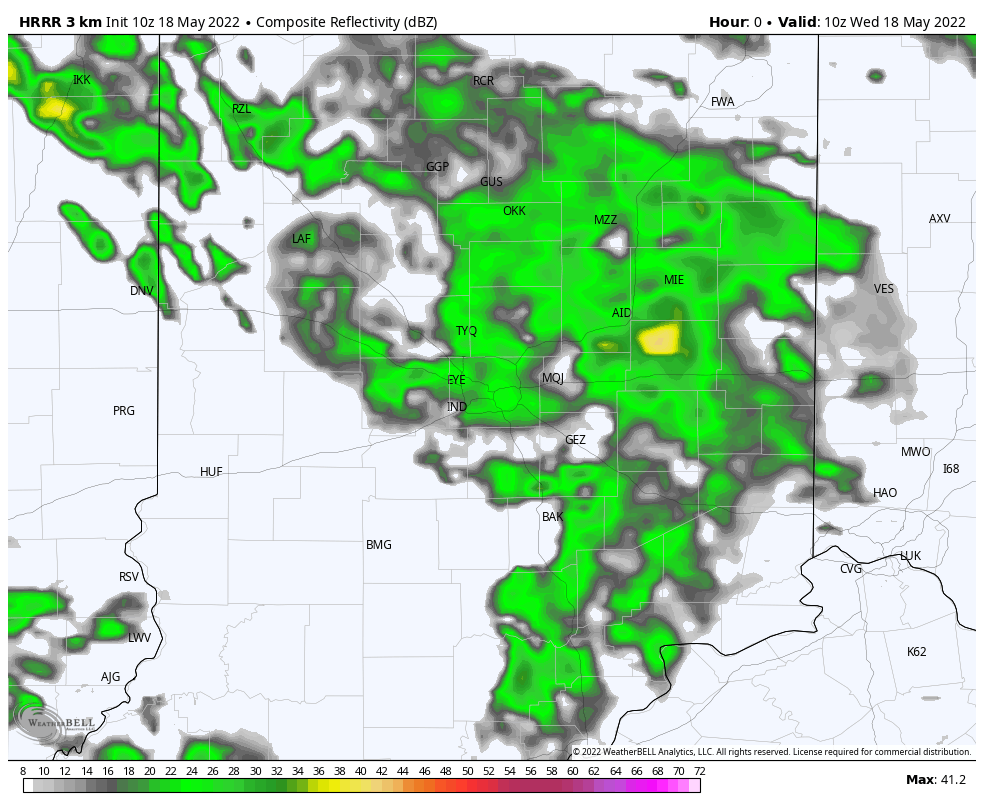
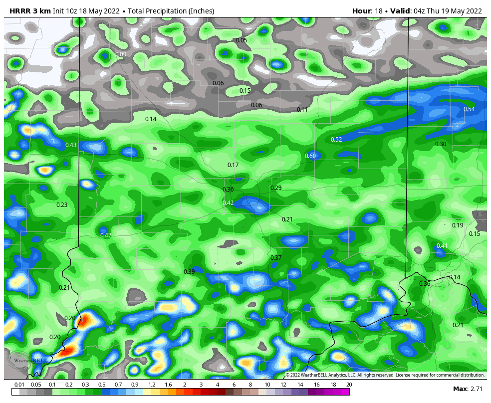
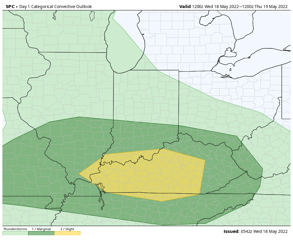
I. Unsettled weather will continue much of the day before exiting off to the east around the evening rush hour. Some embedded stronger storms are possible across southern Indiana (where the SPC also includes in a Slight Risk of severe weather). Otherwise, we’re generally looking at rainfall amounts less than half an inch north of the city and between 0.5” and 1” south of the city.
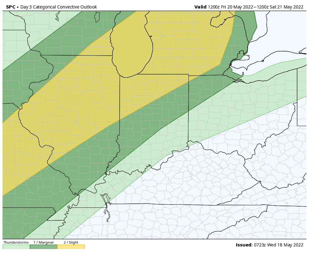
II. Thursday and Friday (for most of the region) will be dry. Heat and humidity will be the big story as southwesterly winds tap into the Gulf of Mexico ahead of the approaching weekend front. The exception to this may be across northwestern portions of the area where a few severe storms are possible late in the day on Friday. The Storm Prediction Center continues to include this area in a Slight Risk (damaging winds are the biggest concern).
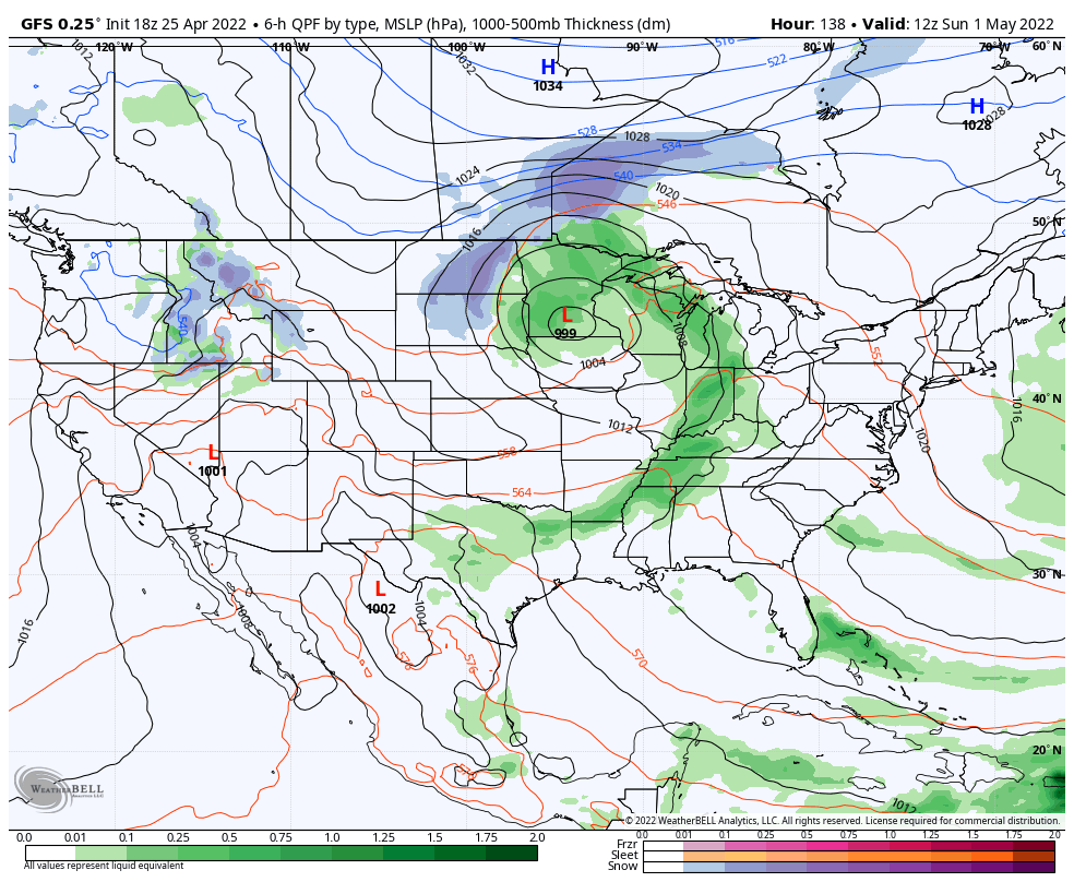
III. Greatest coverage of showers and storms should arrive here Saturday evening into Sunday morning. While a few strong storms are possible, due to the timing in the day, most of these should remain below severe levels.
IV. Cool, refreshing air will settle overhead to close the weekend and by Monday morning we’ll be talking about widespread low-mid 40s. That sure will feel mighty nice after feels like temperatures climb into the 90s Friday.
V. While next week will open on a nice note, wet and active times will return by midweek and signal what very well looks like a wet close to the month of May.
While we’ll have to deal with showers and storms Wednesday (could have a couple strong cells across southern Indiana), the big deal of the short-term forecast package centers on a strong cold front that will blow through the area this weekend. Ahead of the front, a brief surge of significant heat and humidity will push into town as we wrap up the work week. Friday looks particularly oppressive as heat and humidity combine to push “feels like” temperatures into the lower 90s for many.
While we’ll have to fine tune timing and deal with the all-important specifics (are we having to deal with cloud cover that could limit instability?) as we get closer, the Storm Prediction Center continues to highlight western and northwestern Indiana in a risk of severe weather Friday. (Most of the storms should impact our state Friday night- still think the majority of the day time will be free of any storms).
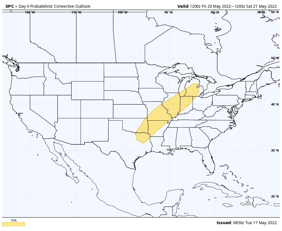
As low pressure heads for the Great Lakes and drags a cold front through our region, it wouldn’t surprise me if the SPC hoists an additional risk of severe weather Saturday. Saturday afternoon into predawn Sunday is expected to offer up the most widespread coverage of rain and storms, locally.
Once the front is off to our east, a MUCH different airmass will blow into town, courtesy of a gusty northwest breeze. We’re talking about highs only in the 60s early next week with lows into the 40s. Talk about a breath of fresh air after the heat and humidity to close the week!
Dry weather should prevail Monday before a new system offers up a soaking Tuesday PM into Wednesday.
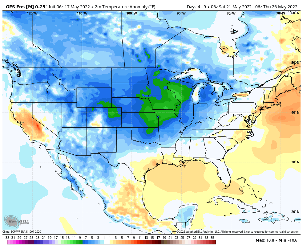
There’s a reason we labeled the midweek pattern as a “taste” of summer. Thankfully, (speaking for most, I believe) we’re not ready to “lock and load” the summer like heat and humidity. In fact, we’ll get some relief from humidity by the latter stages of the work week. By early next week, highs will drop back into the lower 70s and overnight lows will fall into the 40s.
Pattern next week at this time will be feeling mighty different around these parts as a trough carves itself out across the Great Lakes/ Northeast.
Despite the roller coaster ride the next couple of weeks will likely deliver from a temperature perspective (remember, we have the MJO to deal with again now, too), the pattern, as a whole, looks drier than normal over the upcoming 10-14 days.
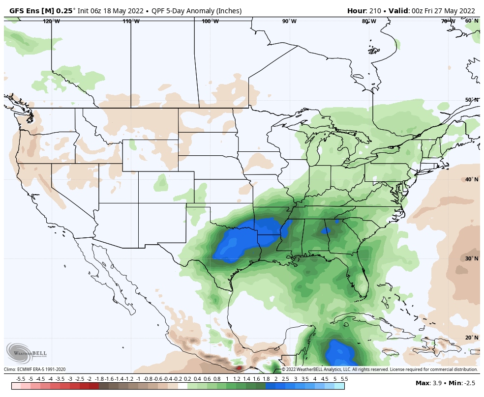
While the pattern is likely one to continue featuring wild swings in temperatures to wrap up the month, most of the frontal systems seem like they won’t deliver excessive rainfall amounts from this distance. It should be noted the European data above has plenty of support from its American and Canadian counterparts.
Permanent link to this article: https://indywx.com/transitional-is-the-theme-for-our-temperature-pattern-upcoming-10-14-days-precipitation-pattern-not-so-much/
Now that our cold front is to our east, it’s time to look ahead to the next weather maker. Headlines over the next 48 hours will come from patchy frost potential (or “widespread” if north of the city, itself).
Weak systems will try and push into the Ohio Valley over the next 72 hours but most, if not all, of these systems should run into a drier, more stable airmass, locally and a rather significant weakening of any sort of organized areas of rain.
There will be times of mostly cloudy conditions and light shower chances midweek but most, if not all, of any sort of “organized” rain chances will hold off until the weekend. What at times will look like appreciable rain heading in our direction will diminish in significant fashion as it pushes east into the region. The blocking pattern will breakdown and allow more organized rain and storm chances to enter the picture from the west this weekend.
Rain and storm chances should increase in earnest Saturday night into Sunday morning, including the potential of locally heavy downpours.
Another storm system awaits on deck for a Sunday evening and Monday morning arrival…
More on this and more in this evening’s client video update.