Clouds will increase this evening and an isolated shower is possible though most will remain dry. More on this and a look ahead to the weekend and beyond in the…
You must be logged in to view this content. Click Here to become a member of IndyWX.com for full access. Already a member of IndyWx.com All-Access? Log-in here.
Fall-Like Breeze…The second of two cold fronts moved through central Indiana overnight. A weak trough of low pressure is yet to pass, but will do so this afternoon and may be accompanied by a couple of showers. Otherwise, we’ll enjoy a stiff northwesterly breeze today and it’ll feel very much like early fall out! The humidity of yesterday is long gone and we’ll really begin to notice the drier feel to the air this evening.
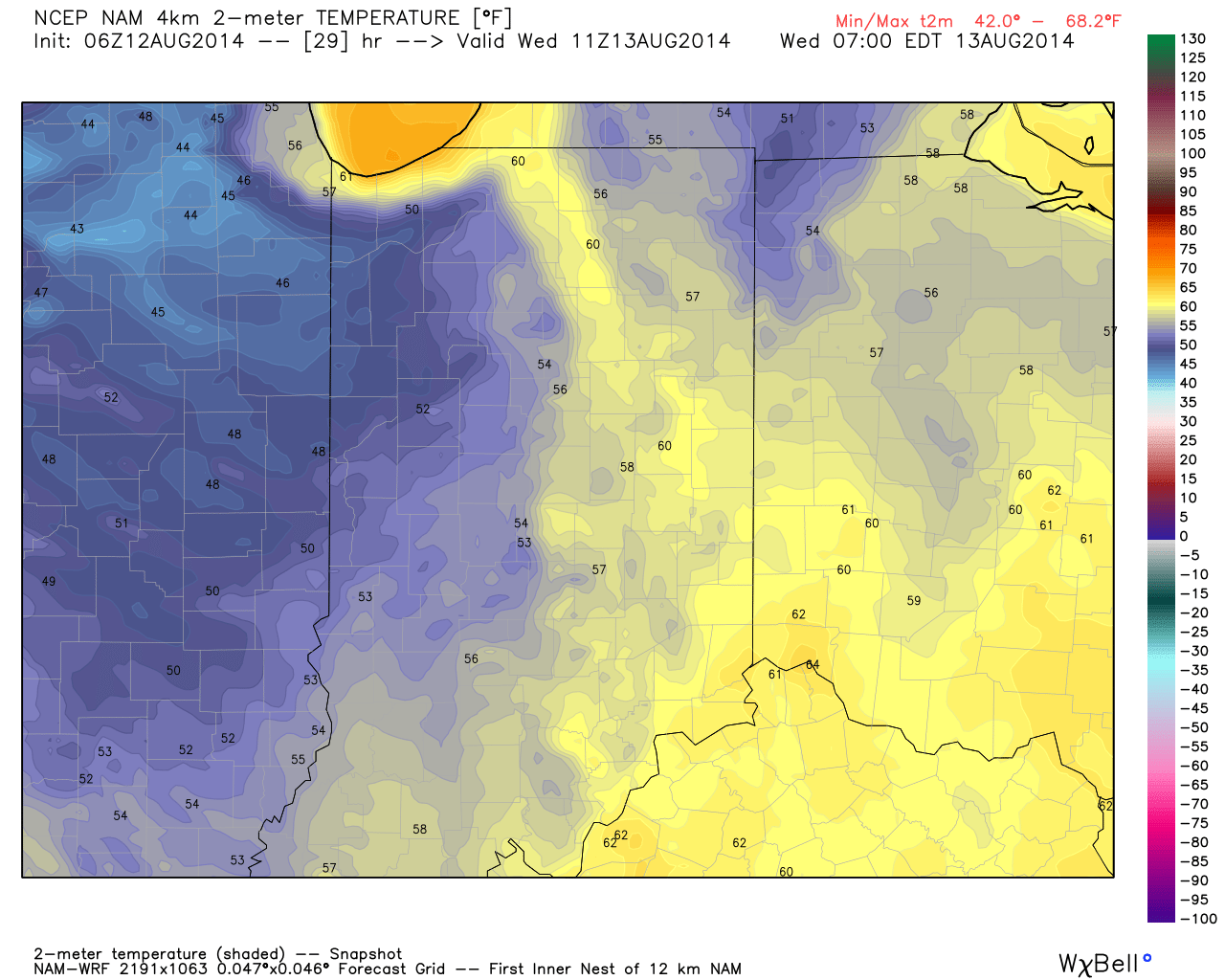
Dry skies and early fall-like temperatures will continue Wednesday. Some may even start the day in the upper 40s away from the city, especially across western suburbs.
Weak Cold Front…A weak cold front will blow through Thursday, but moisture will be limited. While an isolated shower is possible, we chose not to even bring out the shower icon for Thursday, as these will be just that- “isolated.” Most will remain dry and unseasonably cool.
Warming Up…Temperatures will begin to moderate going into the weekend and push to above normal levels early next week. We’ll keep a close eye on the weekend as past forecast model runs suggested some rain may enter the picture Sunday. Most recent runs keep us dry through the weekend, but key on a storm system late Monday into Tuesday with possible beneficial rainfall.
7-Day Precipitation Outlook:
7-Day Rainfall Forecast: 0.25″-0.50″
7-Day Snowfall Forecast: 0.00″
Fall-like temperatures are ahead over the next couple days. We forecast an official low in the city tonight in the middle 50s, but some upper 40s can be anticipated across western and northwestern suburbs.
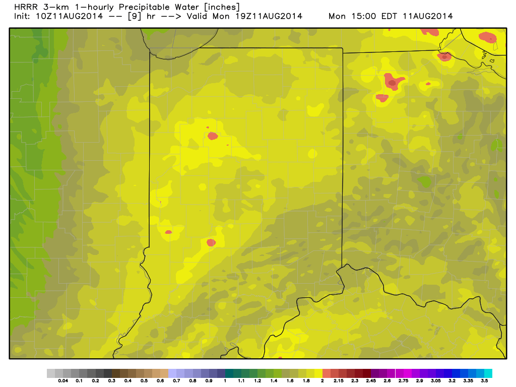
Air You Can Wear…We’re awaking to lots of fog and very muggy conditions. Dew points remain in the upper 60s and lower 70s (very oppressive)! A shower or thunderstorm will be possible really at any time today, but most likely this afternoon as the first of two cold fronts drops into the region. Similar to yesterday, locally heavy downpours will certainly be possible with all of the moisture in the air.
A secondary cold front will blow through Tuesday with a continued chance of scattered showers and thunderstorms. We’ll get in on a much cooler and drier air flow Tuesday evening and this will set the stage for a very pleasant rest of the work week, including below normal temperatures into the weekend.
Warming Up; Chance Of Storms…Temperatures will moderate and we’ll introduce showers and thunderstorms into your forecast Sunday. Early thinking on next week suggests a potentially unsettled (stormy) one, but warmer than average.
7-Day Precipitation Outlook:
7-Day Rainfall Forecast: 0.50″-1.00″
7-Day Snowfall Forecast: 0.00″
Precipitable water values will once again approach 2″ today and assist in locally torrential downpours around the region.
Cooler than normal air masses have been lined up this summer as frequently as airliners waiting to land at Atlanta-Hartsfield airport. With that said, it’s only fitting that we’re targeting…
You must be logged in to view this content. Click Here to become a member of IndyWX.com for full access. Already a member of IndyWx.com All-Access? Log-in here.
Good evening and happy Friday! Tonight’s video looks at the weekend weather, another push of cool air next week, and touches on the long range looking at late August and…
You must be logged in to view this content. Click Here to become a member of IndyWX.com for full access. Already a member of IndyWx.com All-Access? Log-in here.