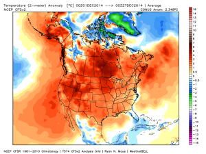
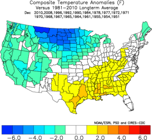
After a cold November, December has been a mild month across the country:
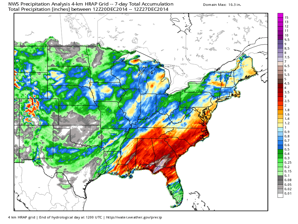
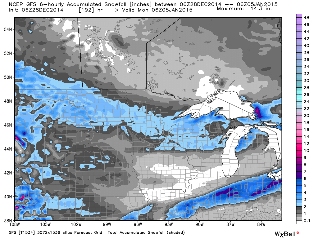
Our headache of a Christmas Eve storm delivered wet weather and this was followed by another wet weather maker (that ended as a wintry mix across central Indiana) yesterday:

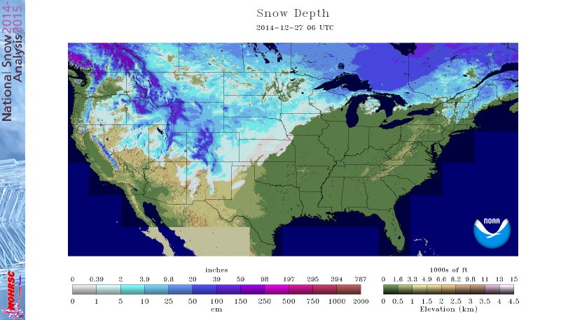
Lower 48 Snowpack isn’t impressive considering the time of year:

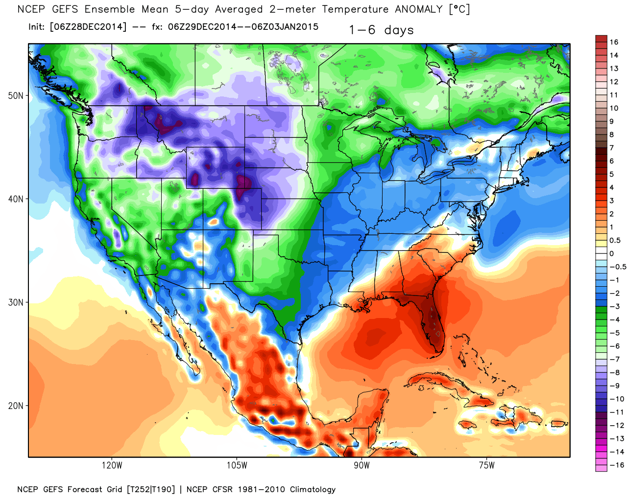
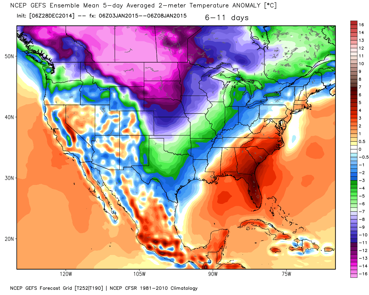
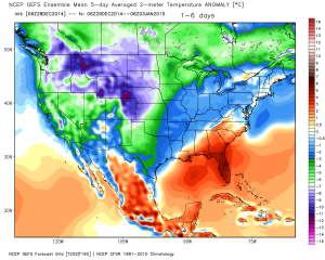
As we move forward, colder times are ahead to wrap up 2014. Note the latest GFS ensembles showing a one-two punch of cold in the coming couple of weeks. Also note the initially warmer Southeast region- courtesy of that negative PNA. 1st image is Day 1-6, 2nd image is Day 6-11, and the 3rd image is Day 11-16.

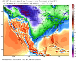
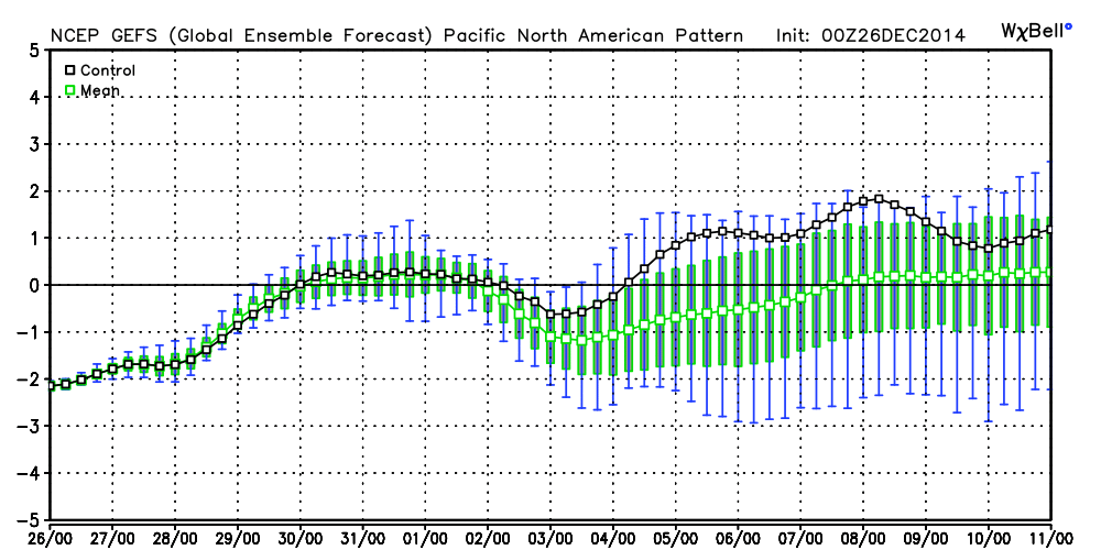
The GFS ensembles suggests the cold eventually overwhelms the pattern in the face of a mostly negative PNA that slowly begins to trend positive:

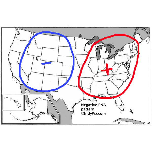
Remember a negative PNA typically would provide a milder southeast this time of year:

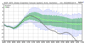
The AO, or Arctic Oscillation, has shown a tendency to want to go negative- a cold signal (note the control run off the charts negative):
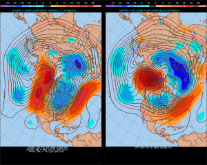
The European model is suggesting we have a true direct discharge of arctic air in the mid range pattern (left) while the GFS isn’t as bullish on the cold. We’ll likely have to put down a snowpack to achieve the cold the European is suggesting Days 8-10 (below zero). Needless to say, we’ll keep a close eye on things.
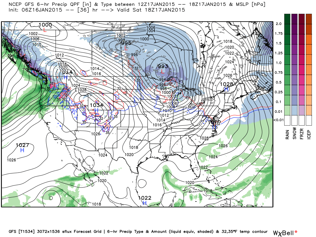
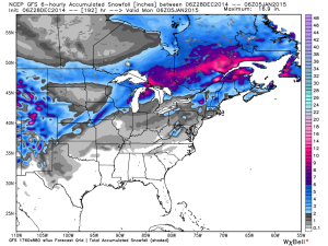
The last few days of 2014 will be relatively quiet, and colder than normal. The next storm system of significance awaits for Friday and Saturday. Modeling ranges anywhere from mostly a rain event to more of a significant winter storm. Case in point, let’s just compare the GFS (TOP- milder and less snow) and GFS Upgrade (BOTTOM- colder and more snow). While we can’t show it here, the European model is more of a blend and also delivers accumulating snow. Again, another big fight coming (and you thought you wanted to have this job ;-))?!

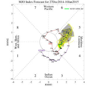
In the longer term, the MJO suggests we’re heading back into a milder pattern for mid January as it takes us into Phase 5. Caution though as the MJO forecasts have been erratic as of late, as well. (Click on the images to enlarge if needed).
Bottom line: Our short term confidence is very high on a dry and colder than normal stretch of weather through Day 5. By Day 6 confidence begins to decrease as a wide range of solutions can be argued for and against concerning the storm system next week. We appear set to go into a highly volatile weather pattern through the mid and longer range. Many of our long range teleconnections contradict one another leading to a lower than normal confidence in the longer range.
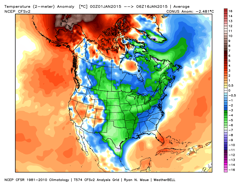
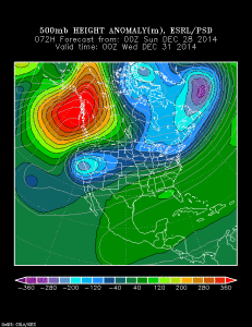
All of that said, one key ingredient that’s been missing over the past few weeks is arctic air getting involved with the pattern. As stated above, that’s not the case any longer (thanks to this blocking ridge over AK):
Modeling can struggle in handling true arctic air and, as such, wild swings can take place with mid and long range guidance. We caution against this in advance. With so many different signals out there, anticipate a very stormy (not necessarily saying this has to mean snowy) pattern over the next 2-3 weeks.
Thank you, as always, for your support. If you, or your business, can benefit from more detailed weather discussions and updates, send us an e-mail to learn of additional weather consulting services we offer. Additionally, if you don’t already, be sure to follow us on Twitter- @indywx.