“Block Ready To Rock?” Cold Pattern Developing Around Thanksgiving…
Model data continues to suggest a Greenland block will develop as we progress into late-November. This kind of pattern creates a “log jam” of sorts in the weather pattern and is the type pattern notorious for unseasonably cold regimes across our region. The overall agreement between various models raises our confidence in this pattern unfolding as Thanksgiving nears.

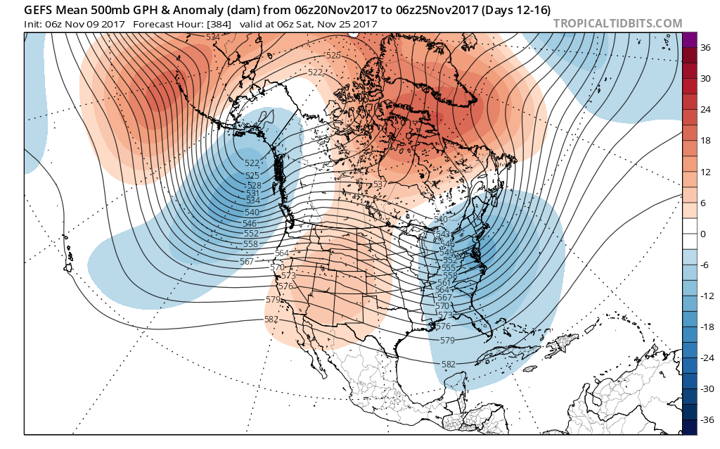 Such a pattern illustrated above, per the European ensemble (image 1) and the GFS ensemble (image 2), would help drill a tongue of unseasonably cold air through the northern Plains, into the Mid West, and across the East.
A look at the 00z teleconnections this morning shows 3/4 “big boy” drivers going to that cold look for late-November, as well:
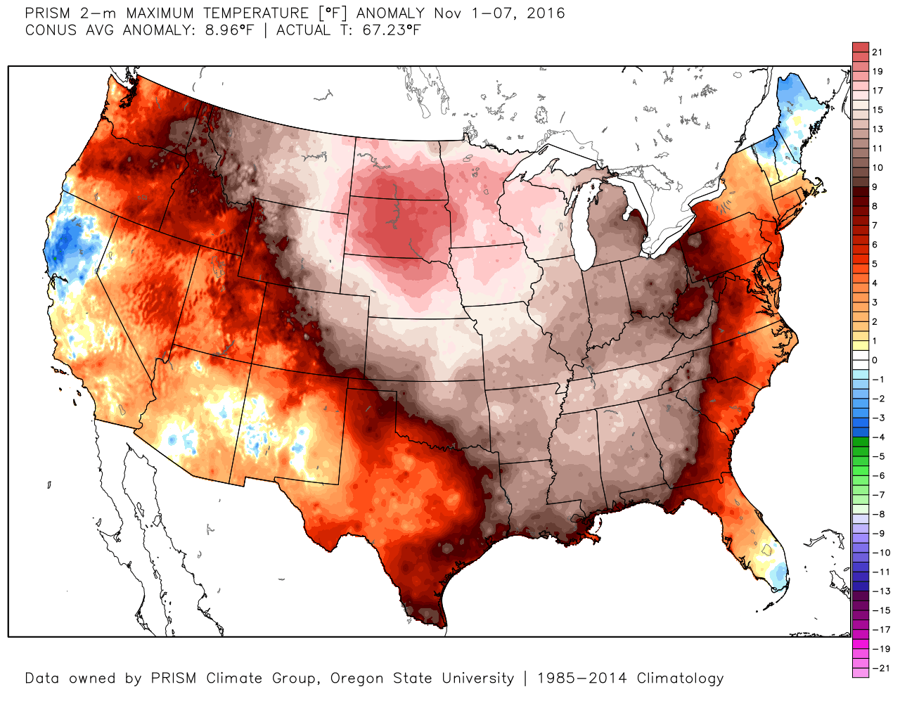
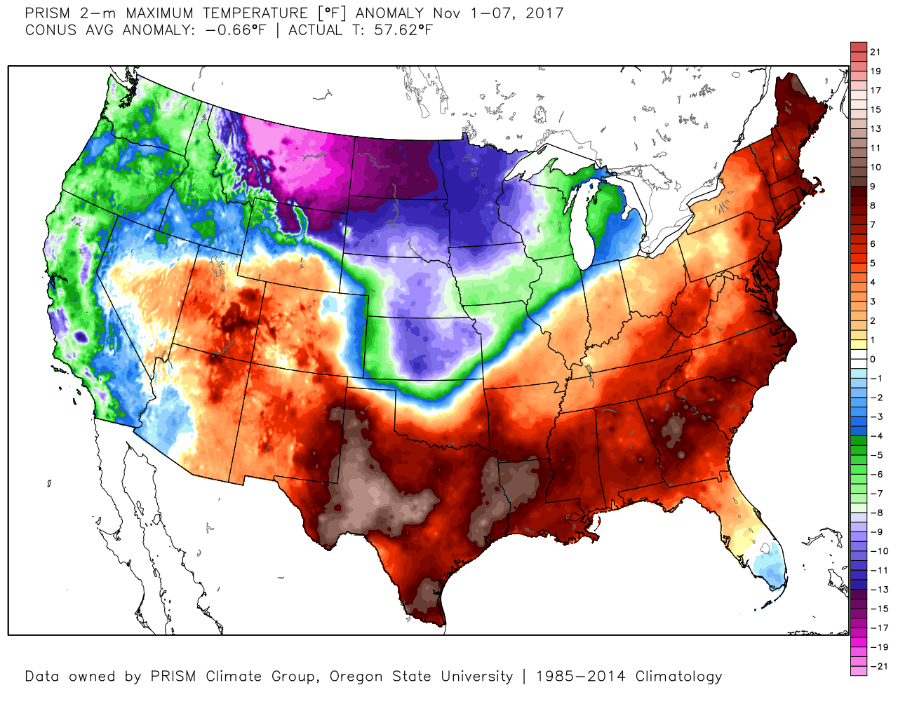
 We’ve been discussing early snow cover across Canada and the northern tier for weeks and how models would have to “correct” colder as they realize the air masses traveling over the snowpack won’t be able to modify as they normally would without that snowpack. The differences between this November and last are startling and show how the early snowpack is beginning to “feedback” on itself leading to early-season cold air.
2016 snowpack and temperatures anomalies through the first week of November:

 2017 snowpack and temperatures anomalies through the first week of November:

 Given the overall look to the pattern downstream, I anticipate the cold will continue to “press” and eventually overwhelm the pattern east as we progress through the second half of the month.
To close, we expect a developing Greenland Block to help drive an unseasonably cold late-November, including the Thanksgiving holiday. This is the type pattern that can also help generate early season wintry “fun and games,” however it’s far too early to be specific with any sorts of potential wintry events that may eventually come in this pattern. Stay tuned.
 Highlights:
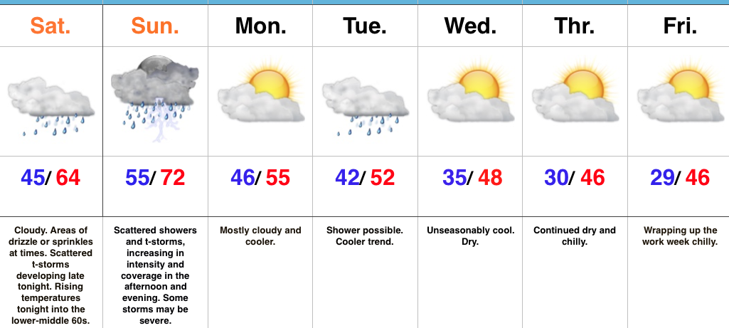
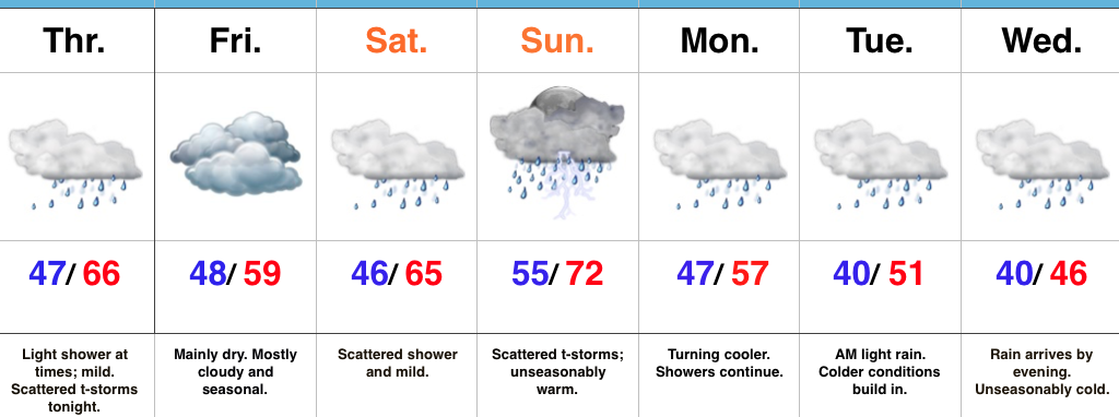
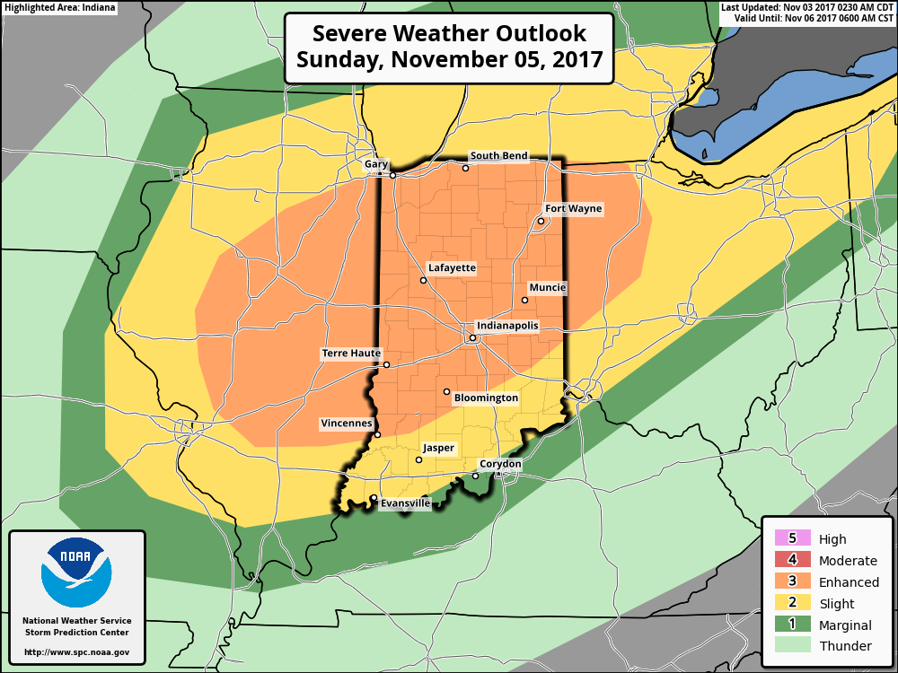 A trough and associated cold front will slice into an unseasonably warm and increasingly moist air mass Sunday. Ahead of the approaching front, temperatures should climb into the lower 70s Sunday afternoon (average high is in the upper 50s) and dew points will reach the lower to middle 60s. While the developing surface low isn’t expected to be terribly strong, as this feature moves northeast, it’ll help drag a cold front into this warm and increasingly unstable air mass late Sunday. From this distance, conditions seem favorable for a couple of super cells to develop Sunday afternoon and evening. We’ll have to keep a close eye on the northward extent of the warm front as this would be the areas of greatest concern for potential tornadic activity Sunday afternoon. Large hail and damaging winds are also included in Sunday’s severe threat. We’re in the second severe weather season, after all, and this kind of event isn’t unusual. Late November 2013 comes to mind.
 Highlights: