Monday Morning Rambles: Pleasant Open To The Week…
I. High pressure will dominate the early part of the work week, helping to supply plentiful sunshine and seasonably mild temperatures. We’ll continue to enjoy the much-needed dry theme the weekend ended on!
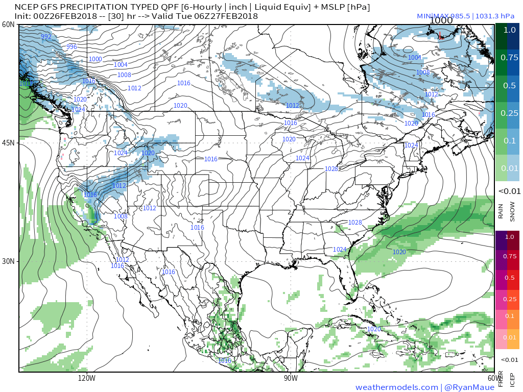 II. Our next weather maker will arrive midweek and provide a few showers Wednesday (not a huge deal from a precipitation perspective). However, as a deepening surface low tracks into the Great Lakes Thursday morning, a period of heavier rain and even thunder is possible. In general, this looks like a 0.50″ to 1.00″ type event.
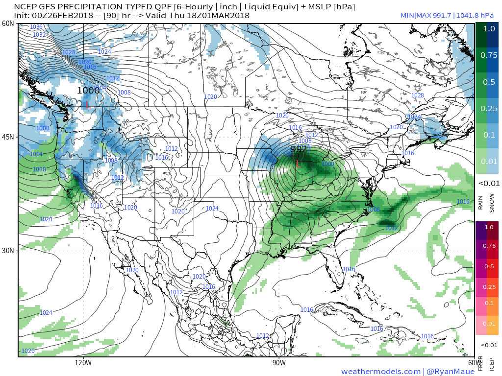
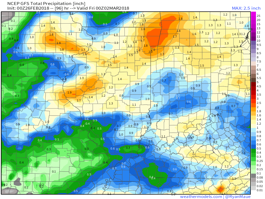 III. Somewhat cooler air will whip in behind the low, allowing leftover precipitation to end as a couple wet snowflakes across the northern half of the state Friday morning. The bigger story will be the “bumpy” start to Friday with strong and gusty north winds.
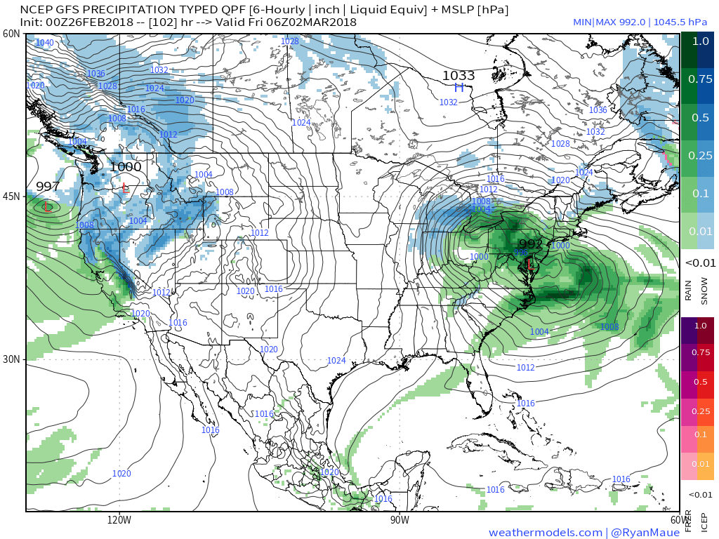 IV. High pressure returns for the weekend and with it will come a return of sunny skies. Though the mornings will be frosty, afternoon temperatures will “warm” to pleasant levels, especially with the increasingly strong early-March sun angle.
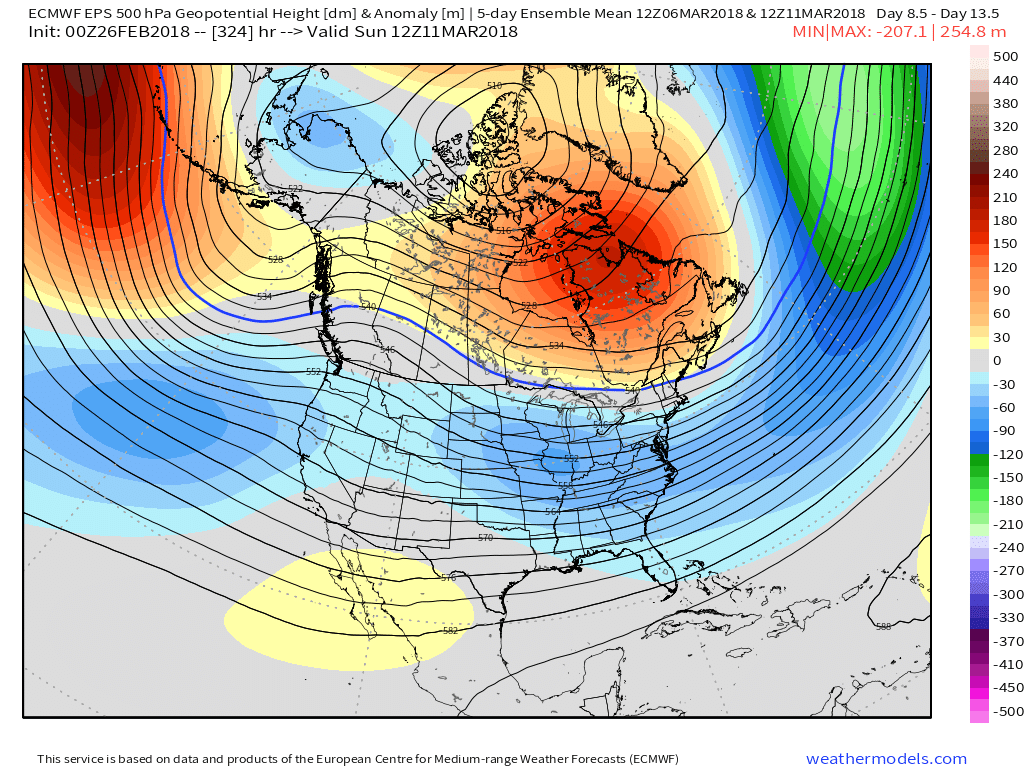
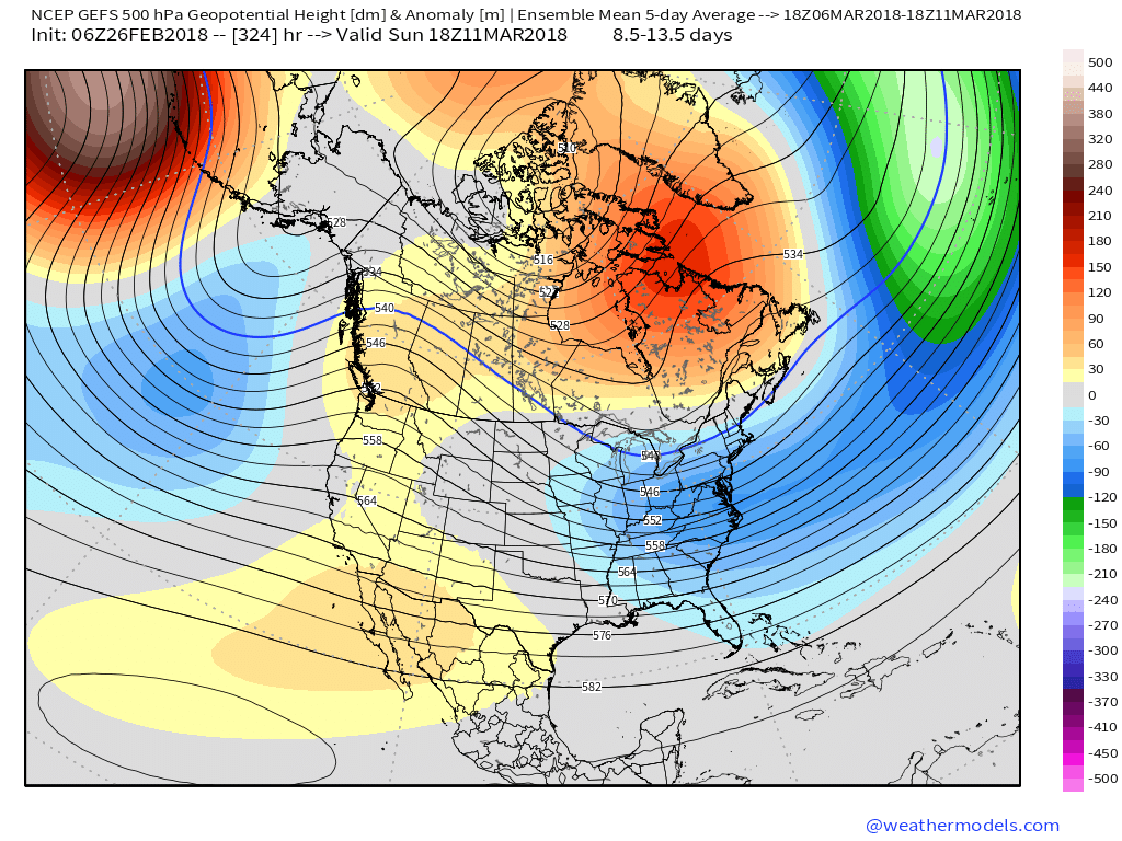
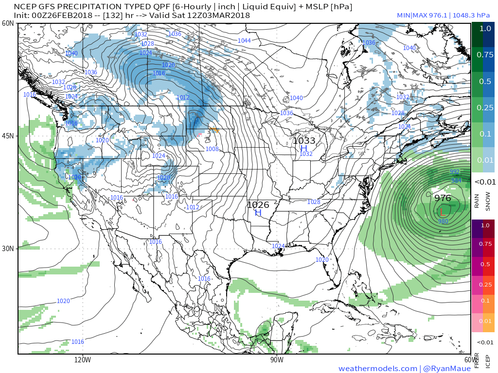 V. Looking ahead, let’s keep a close eye on the second week of March. Potential is present for a stormy period to emerge under the block. We note the GEFS and EPS (respective ensembles of the GFS and European models) are in relative agreement on a stormy, cold look during this time frame. While far too early for specifics, the potential is there for a rather widespread wintry event from the Plains into the Northeast.
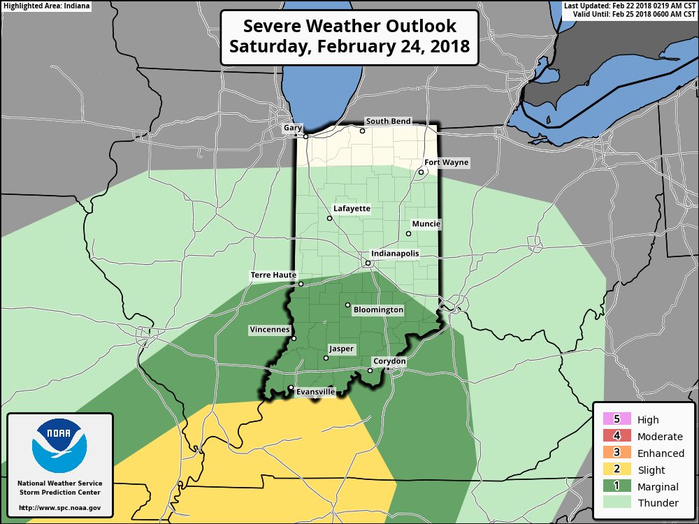
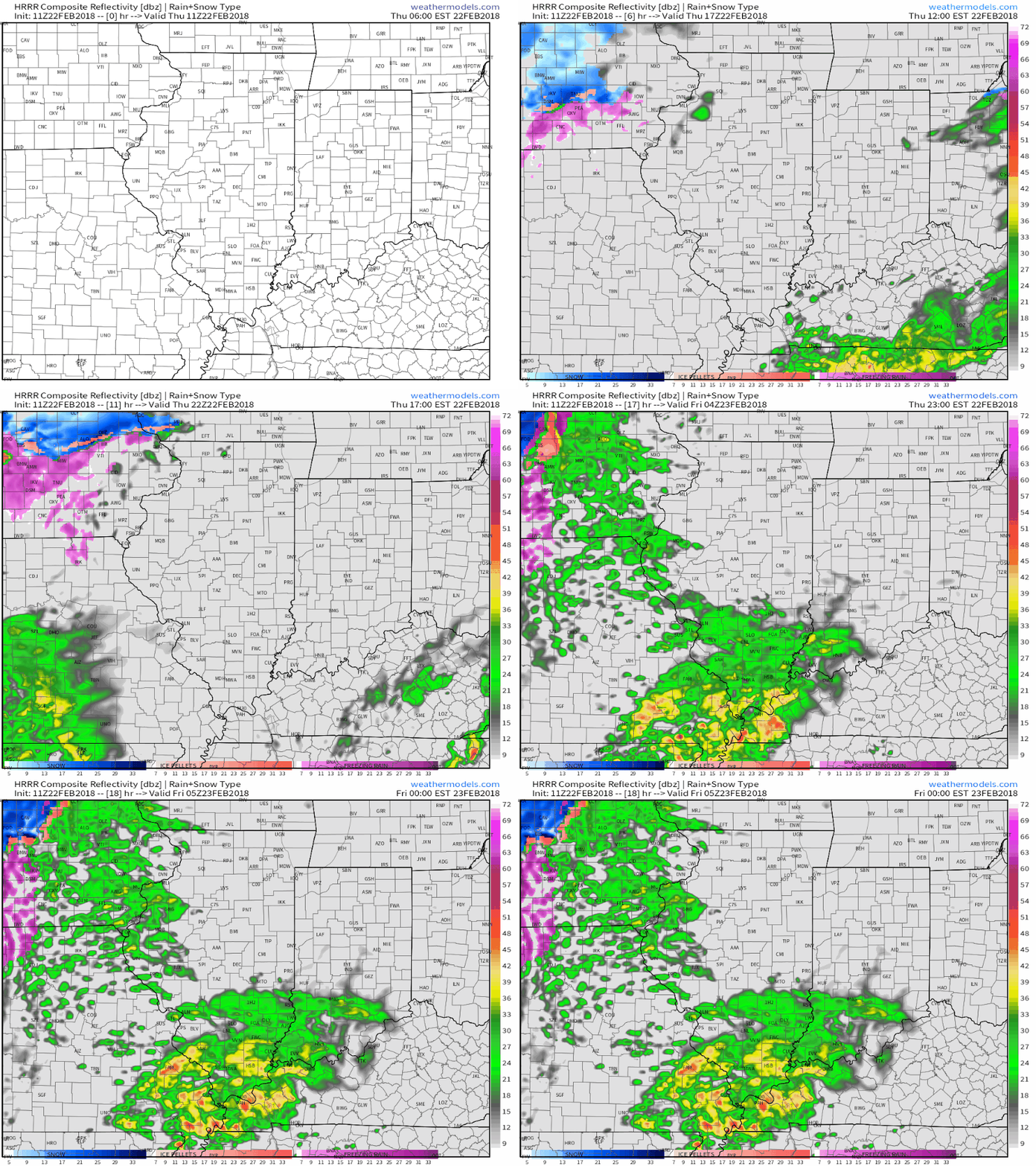 Embedded thunderstorms may target southern Indiana late tonight and Friday morning before more widespread thunderstorms (a couple could become strong) Saturday. The Storm Prediction Center (SPC) has included the southern half of the state in a “marginal risk” of severe thunderstorms Saturday.
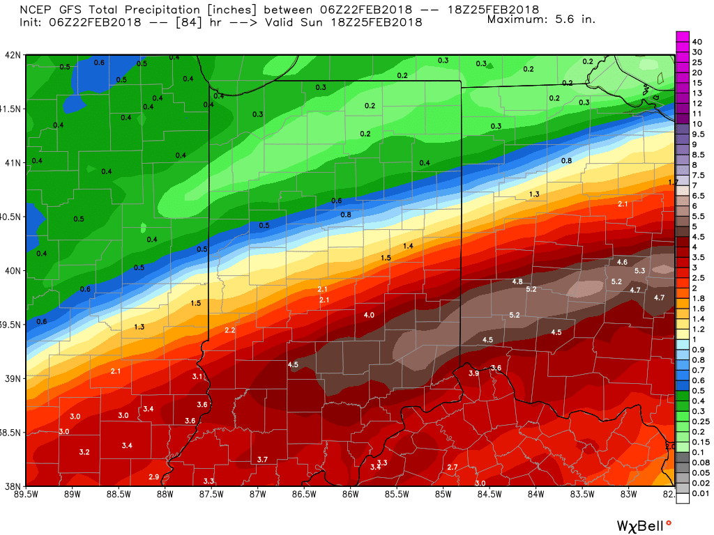
 All total, additional rainfall between now and Sunday morning should reach 2″ to 3″ across a widespread portion of the southern half of Indiana with locally heavier amounts.
 We’ll finally dry things out as we close the weekend and head into early next week as high pressure settles overhead.
 Next week will begin a pattern transition from the unseasonably warm weather we’ve enjoyed as of late to a colder regime for the first half of March. We note models continue to tank the NAO and AO.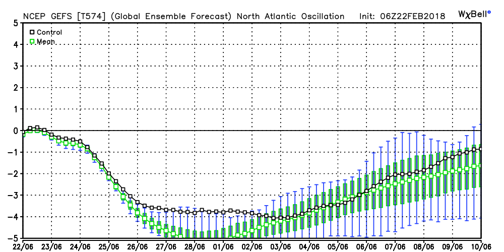
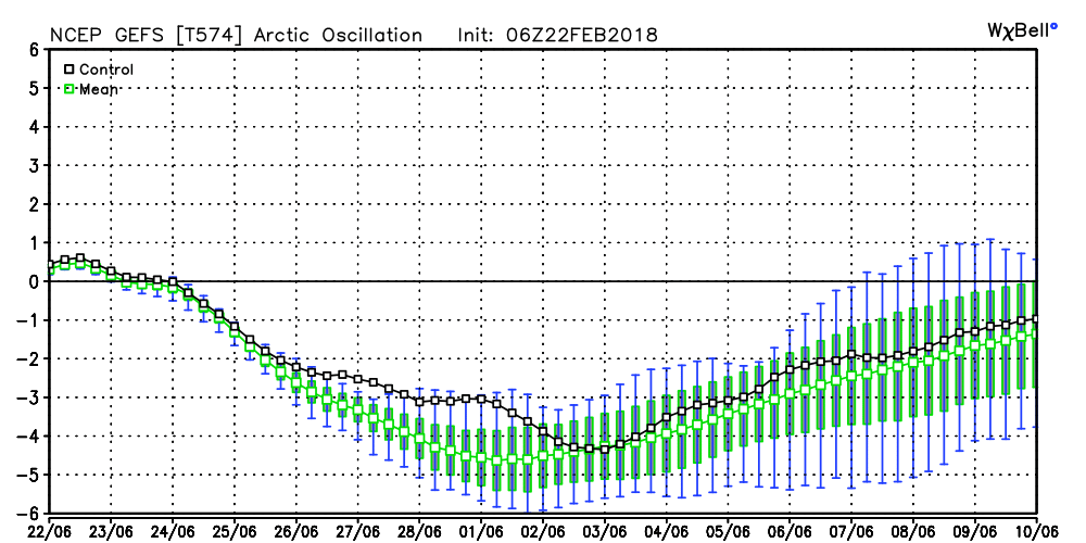 Accordingly, the models are seeing the trough and associated colder than average pattern returning to the eastern half of the country as we rumble through the first half of March. With such a strong block in place, this can turn into an active pattern for a couple weeks to go along with the cold. Both the GEFS and EPS agree on the overall look.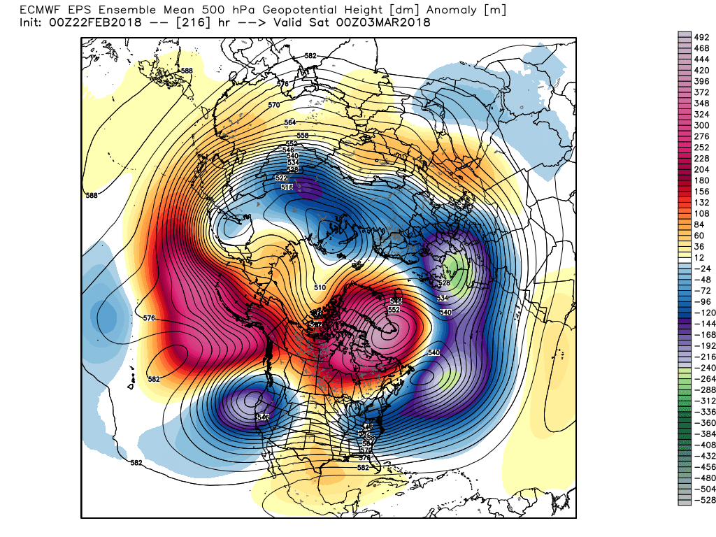
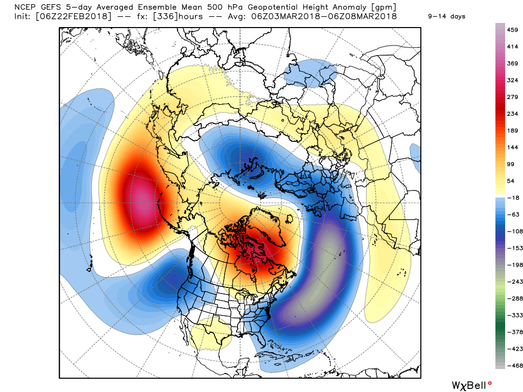 While there’s no way to get specific on the individual storm threats that will eventually come with this pattern, the potential is present for a few storms to “bowl” underneath the block through the first 10-15 days of the month. Each storm will have the capability of delivering wintry precipitation, but this can also be a tricky time of year where most, if not all, ingredients need to come together to create significant wintry events. In a winter that’s been frustrating to central Indiana snow lovers (frigid, but dry first half and milder, wetter second half), perhaps it would be fitting to get a couple good snow dumps in March (when most are wanting and ready for spring)…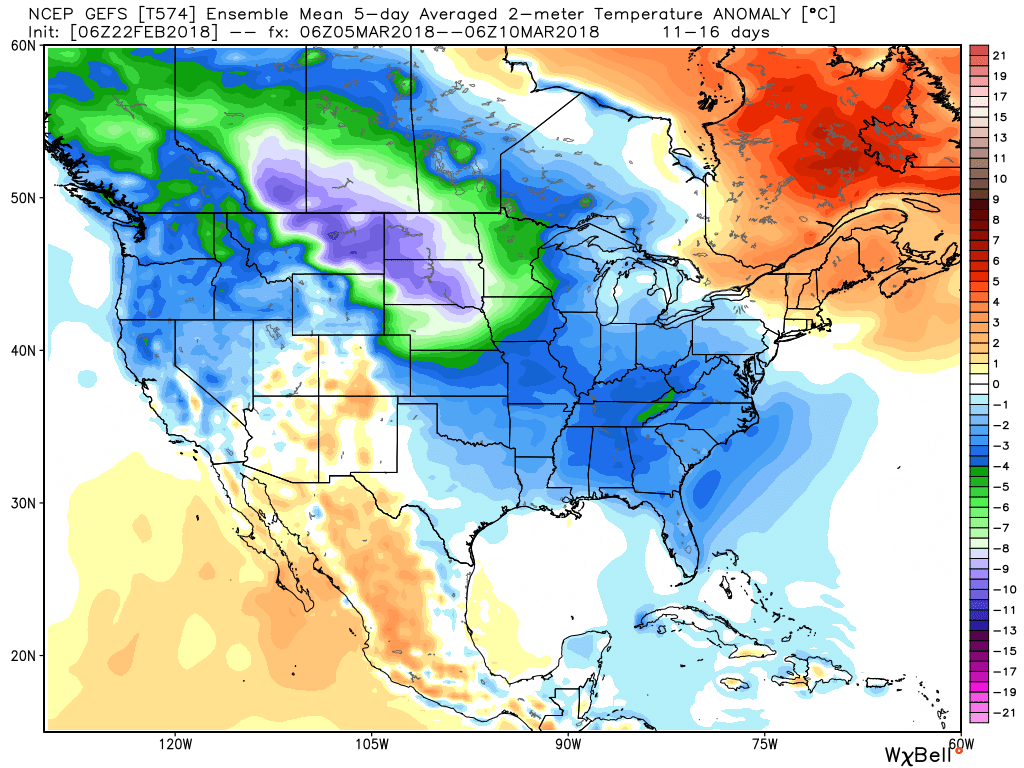
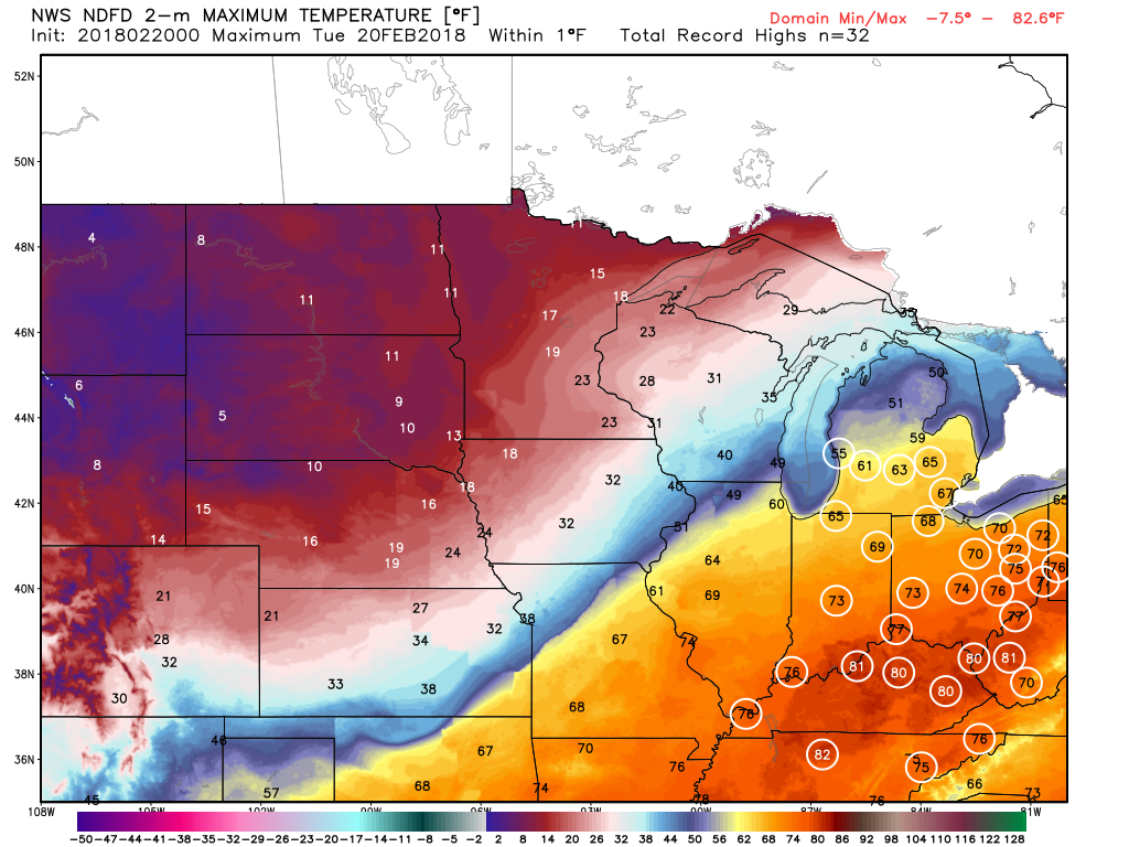 Steadiest rains will fall across the northern third of the state Tuesday with scattered downpours through the morning and afternoon hours across central Indiana.
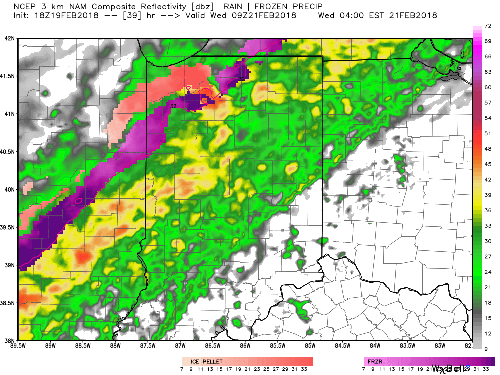
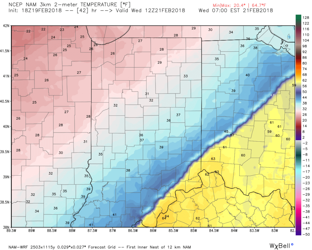 After a quieter time of things most of Thursday, we’re tracking three additional waves of moisture Friday and through the weekend. At times, rain will be heavy, and we’ll certainly have to be on guard for water rise and increasing flooding issues as the weekend arrives.
 By the time all is set and done Monday morning, we forecast additional widespread 3.5″ to 5″ rainfall totals with locally heavier amounts.