Looking Over The New JMA Weeklies…
The JMA Weeklies update every Thursday morning and this gives us another tool to look at when developing the forecast over the upcoming 3-4 weeks. Here are some highlights from the most recent update:
Week 1
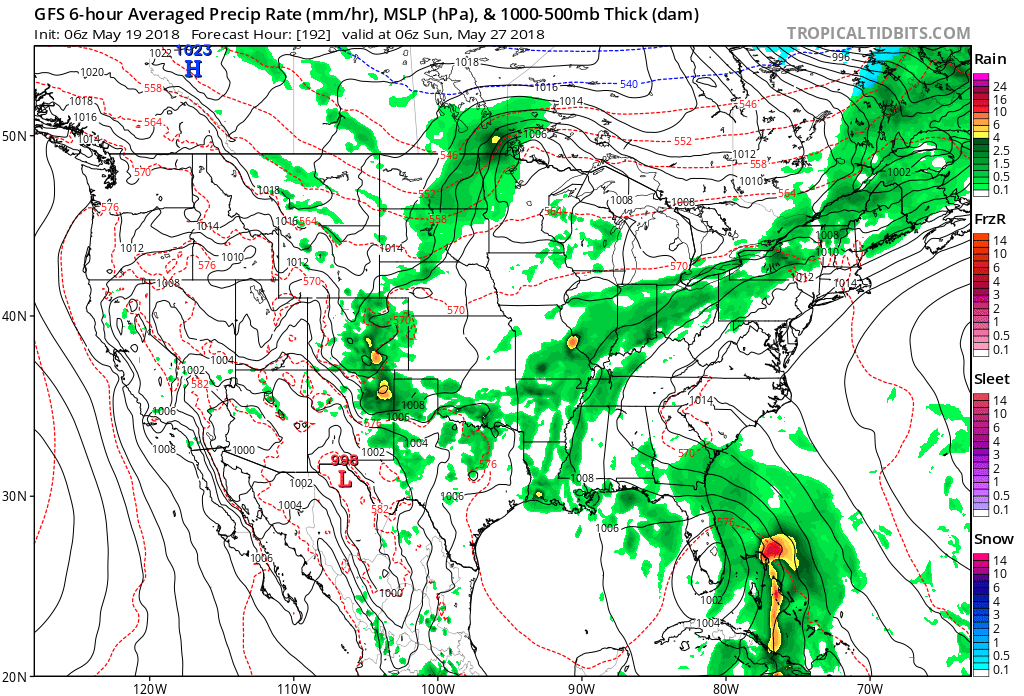
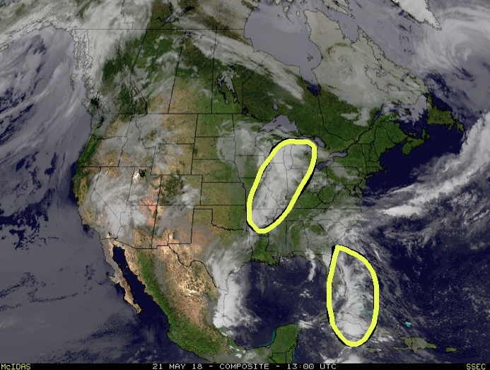
The big story in Week 1 is the surge of tropical moisture with the area of disturbed weather in the GOM (Gulf of Mexico). Unfortunately, it’s not until possibly Week 2 that remnant tropical moisture may interact with an approaching cold front to provide better rain chances here. The big story for the balance of the upcoming Week 1 period, locally, will be the heat. An unseasonably warm stretch will continue through the Memorial Day weekend and on into the middle of next week.
 Week 2
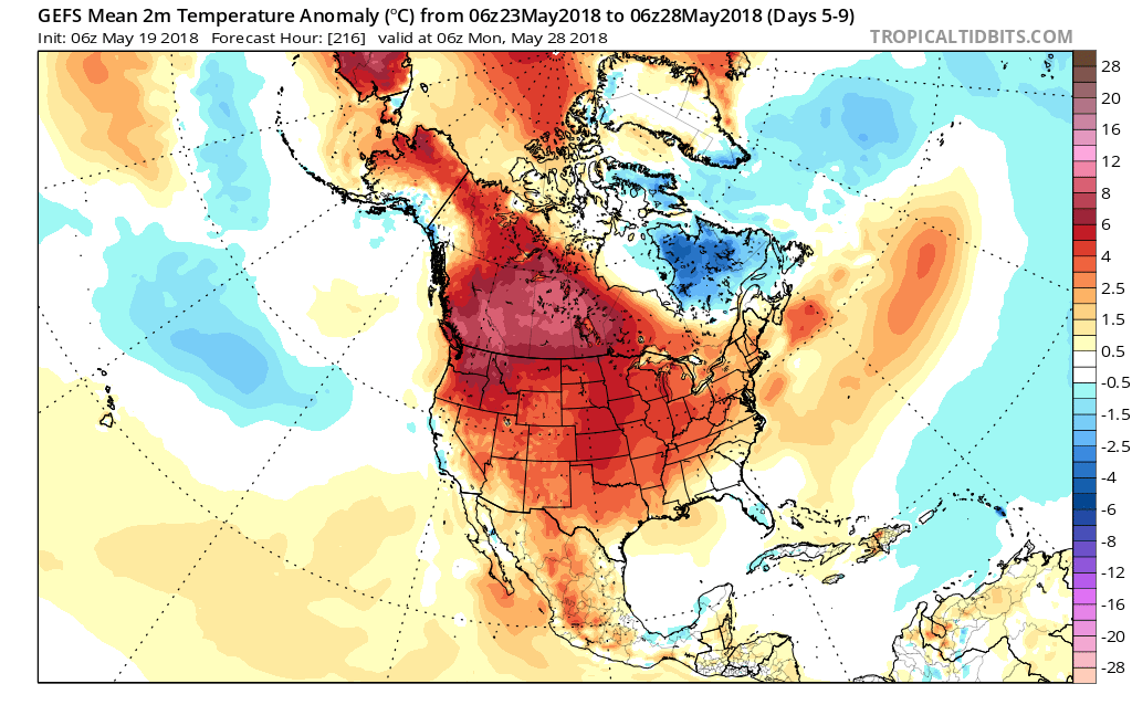
The model shows a bit of a transition in the pattern with the core of the heat shifting west during the Week 2 period. With this, there are some hints that the pattern will turn increasingly wet and stormy, locally, including a backing off of the extreme 90° heat.
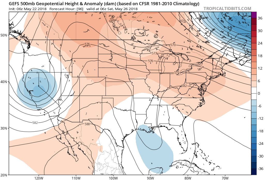
 Weeks 3-4
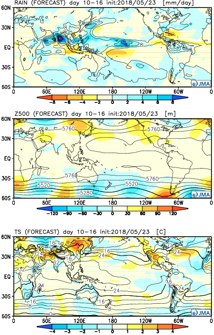
An intriguing “ring of fire” pattern develops in the Weeks 3-4 time frame. If correct, this would result in a more active pattern across the Mid West with a busy northwest flow pattern emerging. Storm complexes are notorious for tracking in a northwest to southeast fashion around the hot dome. Sure enough, the model is going with a wetter than normal pattern here. It’s hard to disagree with that given the look at 500mb.
 The other big story, especially for those planning to attend the race, will be increasing humidity over the weekend. Forecast dew points will approach and exceed the 70° mark Sunday afternoon, providing a very tropical feel to the air.
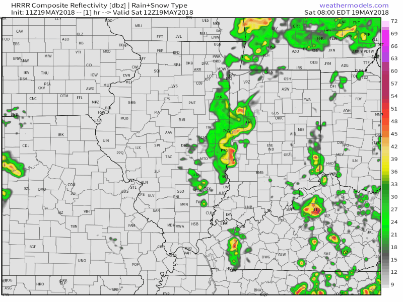
 Back here on the home front, a quiet start to our Monday will turn stormy at times this evening as the front nears. We think best coverage of showers and thunderstorms will come between 5p and 10p. There will be some winners and losers when it comes to rainfall amounts by midnight. Some can expect over an inch in the stronger storms while others may only see a tenth of an inch, or so. Something that must be taken into forecasts moving forward is the tendency of most model data (high resolution and global data alike) to “over forecast” rainfall amounts as of late. Also of note is for the potential of a couple of strong to severe storms to develop this evening. We always have to be wary of fronts draped across central Indiana as they’ve been known to help tornadic activity spin up. We’ve lost count of how many slight risk days with warm fronts nearby that turn busy… If you’re planning to be outdoors this evening, please have a means of receiving the latest watches and potential warnings that may be issued.
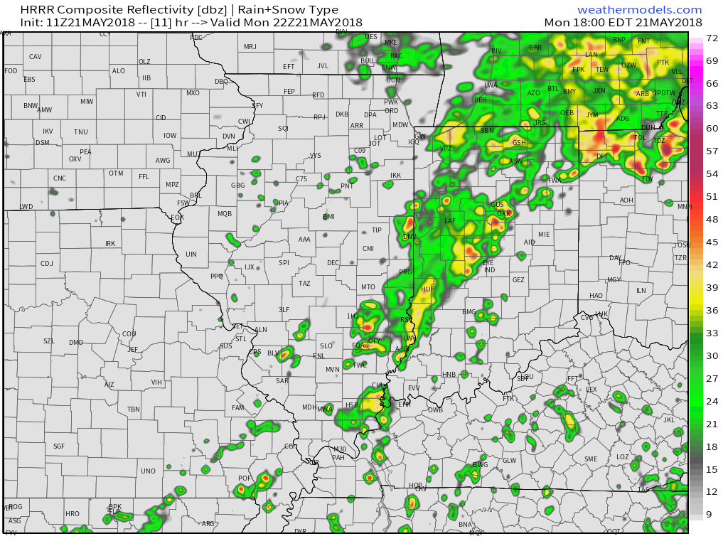 High pressure will build in for the midweek period and supply plentiful sunshine along with continued warmer than average conditions. Overnight lows will fall into the upper 50s (couple of degrees above average) with the drier air mass in place, but afternoon highs will continue to climb into the lower and middle 80s (around 10 degrees above average).
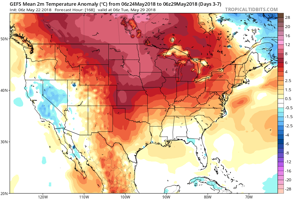
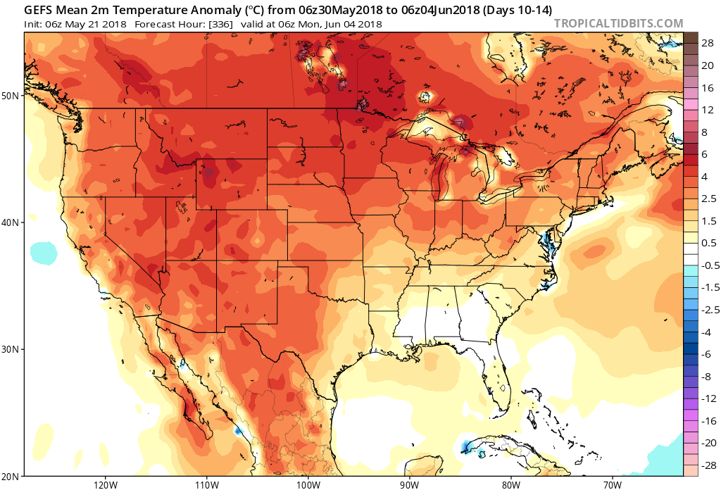
 Longer term, thoughts are shifting towards the open to meteorological summer (where is this year going?!). The GFS ensemble suggests the overall warm pattern remains intact as we open a new season with widespread warmth expected through the first few days of the June.
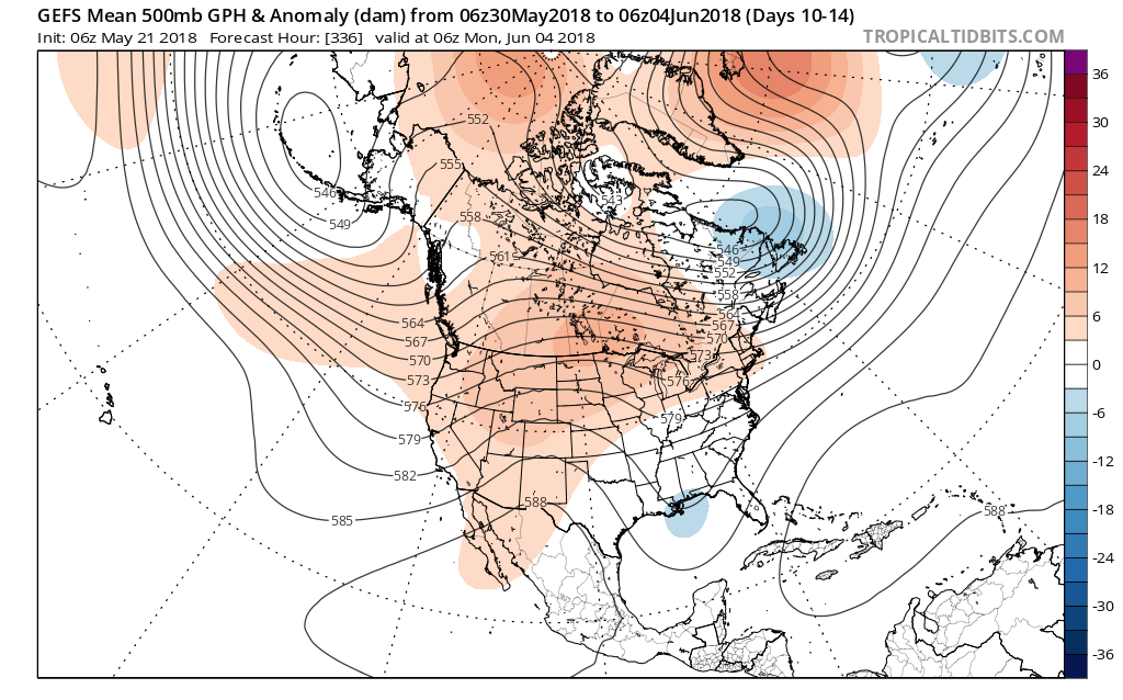
 By the time all is said and done late Monday night and early Tuesday, expect widespread rainfall totals between 0.50″ and 1″ with locally heavier amounts where the stronger storms track.
 High pressure will build into the region through the midweek stretch and result in increasingly sunny and pleasant conditions. With a drier air mass in place, overnight lows will fall into the 50s through the midweek period.
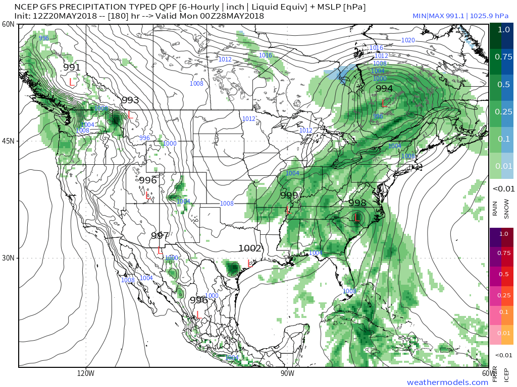
 Our attention will then shift to the potential of strong thunderstorms late Sunday. Higher resolution guidance suggests storms will begin to rumble into western Indiana late Sunday evening (around 9p to 10p) before tracking east into the overnight hours.
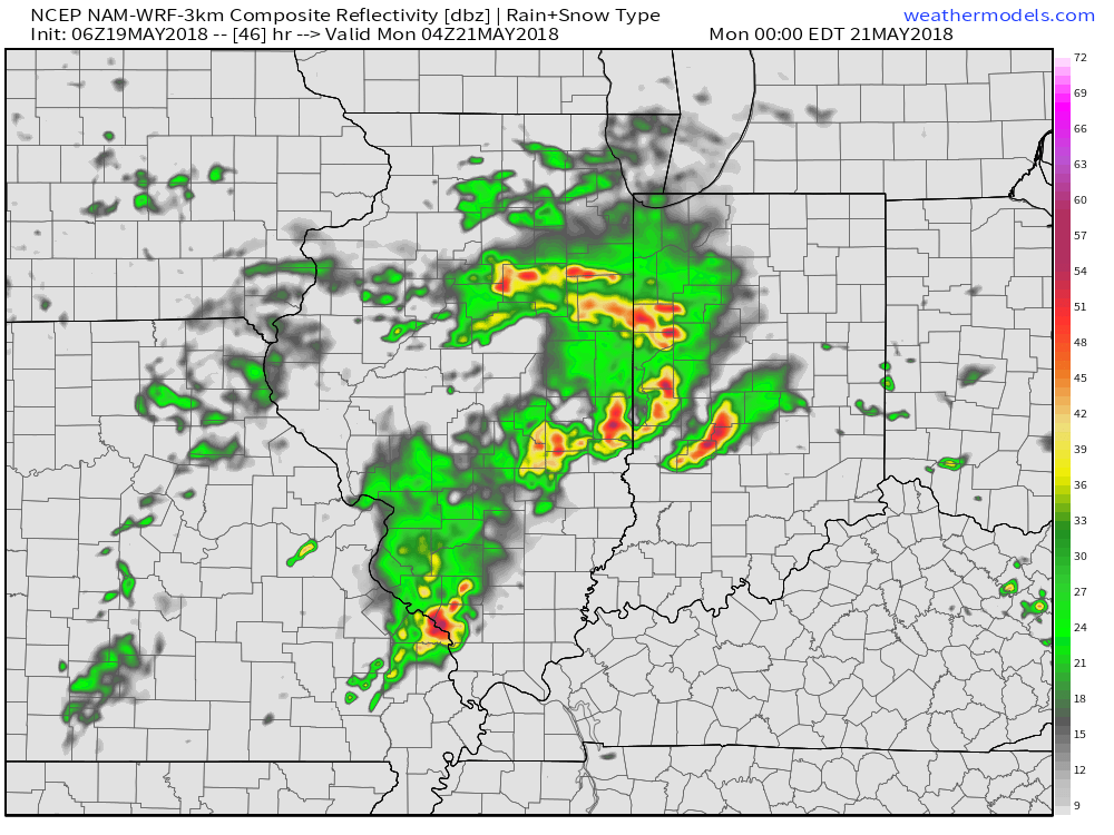 With a stalled front nearby, shower and thunderstorm chances will remain in our forecast into the middle of the week. While it won’t rain the entire time, unsettled conditions will remain into Wednesday before high pressure provides drier conditions Thursday and most of Friday.