 Highlights:
- Stretch of unseasonably warm, summer-like weather
- Turning much cooler late in the period
- Unsettled to close the work week
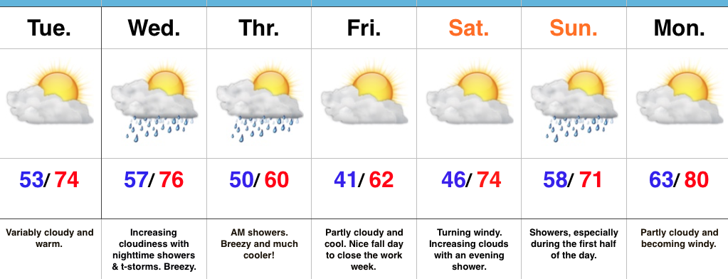
Near Record Warmth Gives Way To A Cooler Feel…We have to deal with low clouds and areas of fog this morning, but expect enough wind to mix things out and return us to a variably cloudy sky this afternoon. Significantly warmer conditions are on tap today than what we’ve dealt with over the past couple days. Winds will become gusty this afternoon (20-30 MPH).
Scattered showers will drop south Sunday. These will impact mostly northern locations (north of I-70) and won’t be a big deal.
Monday and Tuesday will feature strong and gusty southwest winds (30-40 MPH), dry conditions, and near record warmth. Highs in the lower 80s for mid October is downright impressive, but the warm overnight lows in the mid to upper 60s is almost unheard of for this time of year. Enjoy the stretch of extended summer.
Our weather pattern will offer up an increasingly chilly regime late week and the overall evolution of a storm system is still up in the air in regards to rain timing and amounts. For now we’re leaning towards a wet, chilly, and blustery forecast Thursday and Friday.
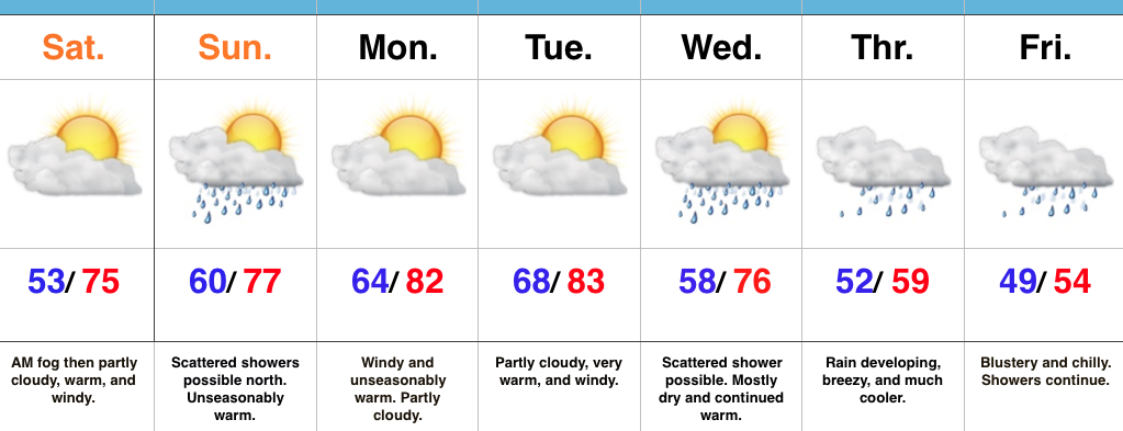
Upcoming 7-Day Precipitation Forecast:
- Snowfall: 0.00″
- Rainfall: 1.50″ – 2.00″