
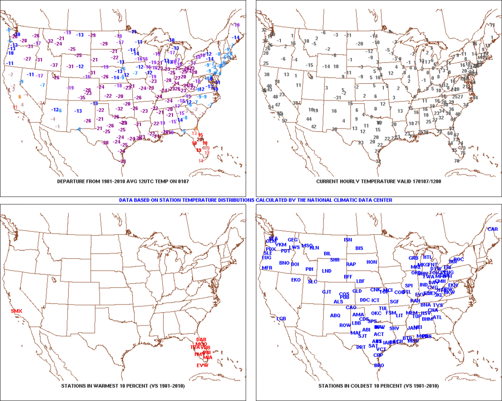
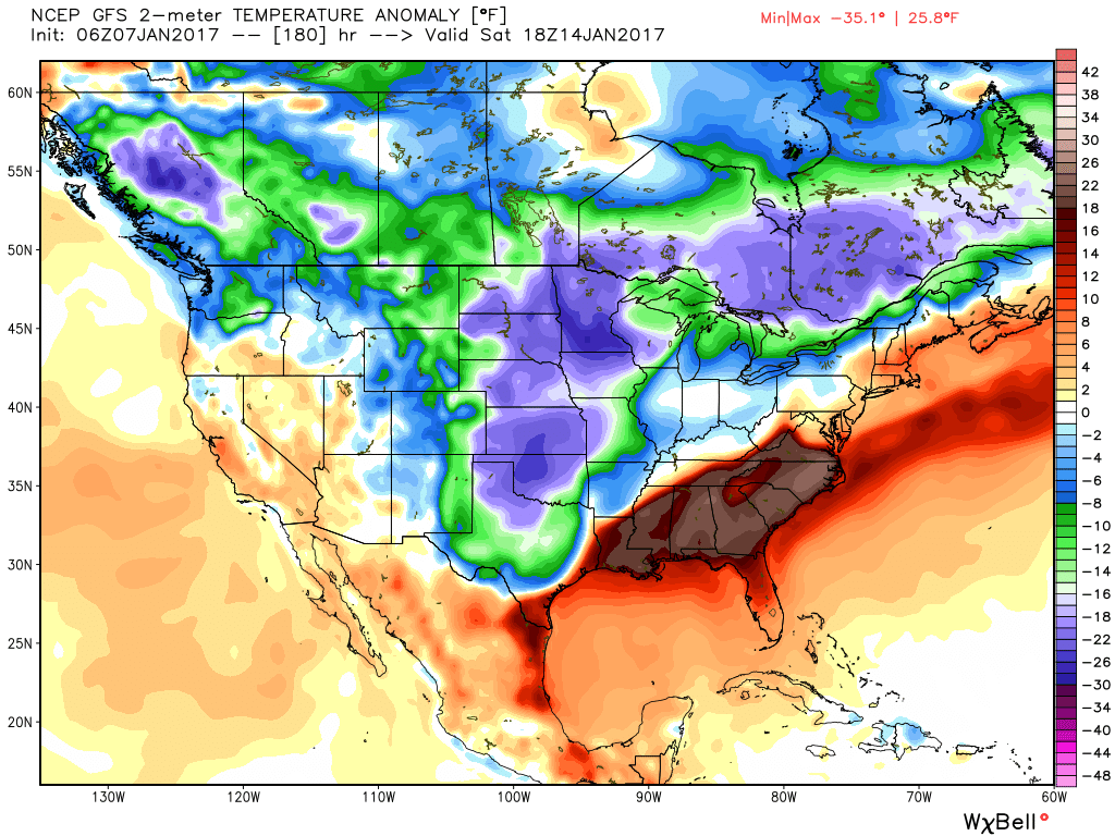
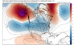
1.) Coast-to-coast cold: The Lower 48 is waking up in an ice box this morning as widespread arctic air and below normal temperatures engulf the country (minus the FL peninsula this morning). The arctic express will remain with us through the weekend, including temperatures once again tonight that threaten to dip into the sub-zero range across central Indiana. Highs today will only reach the middle 10s and upper 10s to lower 20s Sunday. Bundle up and stay warm.
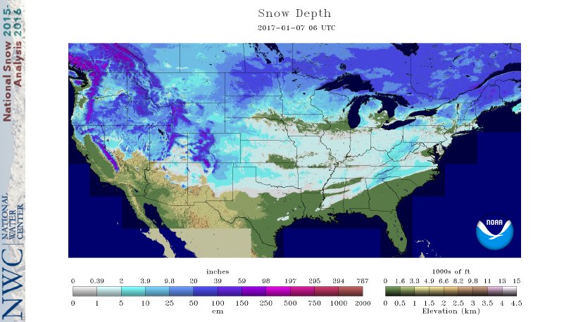
 2.) Expanding Snowpack: 65.4% of the country is covered in snow this morning. The cold, arctic high suppressed the winter storm threat south as we alluded to in previous posts. Places across the Deep South that aren’t used to wintry precipitation are waking up to snowy and icy conditions this morning, including MS, AL, GA, SC, and into the Mid Atlantic. Heavier snowfall accumulated across east TN, including 5″-8″ in the high country. Heavy snow also fell through western and central NC and Blizzard Warnings are up in rare areas including VA Beach this morning.
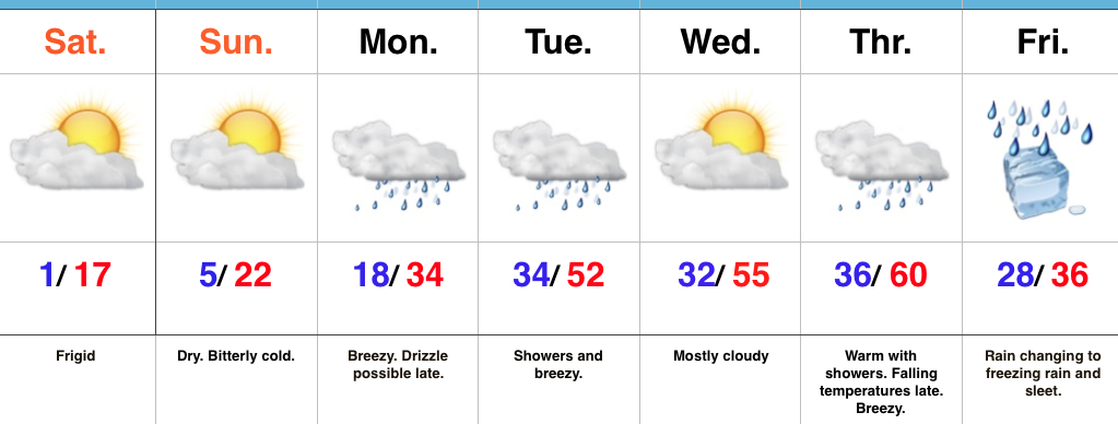
 3.) Moderating Temperatures: Our air flow will back around to the southwest and this will help temperatures begin to moderate early next week (around freezing Monday and all the way to around 50 Tuesday). As the moderating trend gets underway, we may have to deal with a brief period of freezing drizzle/ freezing rain Monday evening.
 4.) Rainy Midweek: A more significant surge of moisture will arrive midweek and result in periods of moderate to heavy rain Wednesday PM into Thursday. Potential is present for 1″+ during this timeframe.
 5.) Weekend Wintry “Fun And Games?” A tremendous battle will take place next weekend between a strong and sprawling arctic high pressure system and the southeast ridge. In between it’ll be fascinating to watch things unfold, and as you’d imagine, that includes Indiana. Despite the southeast ridge flexing it’s muscle, the concern here is that the shallow dense arctic air will “ooze” south and present an icy set-up for portions of the Ohio Valley and Mid West for the weekend. We still have some time to watch this, but the potential of significant icing is very much present for some and this will require a close eye through the week.
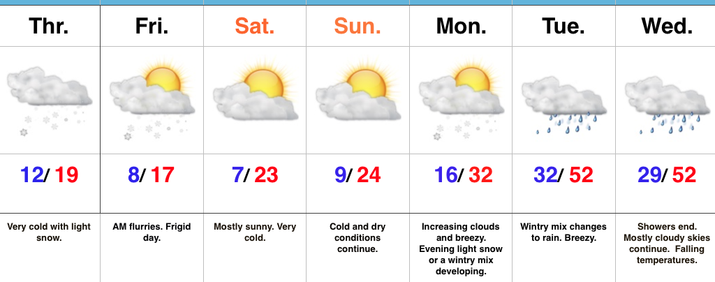
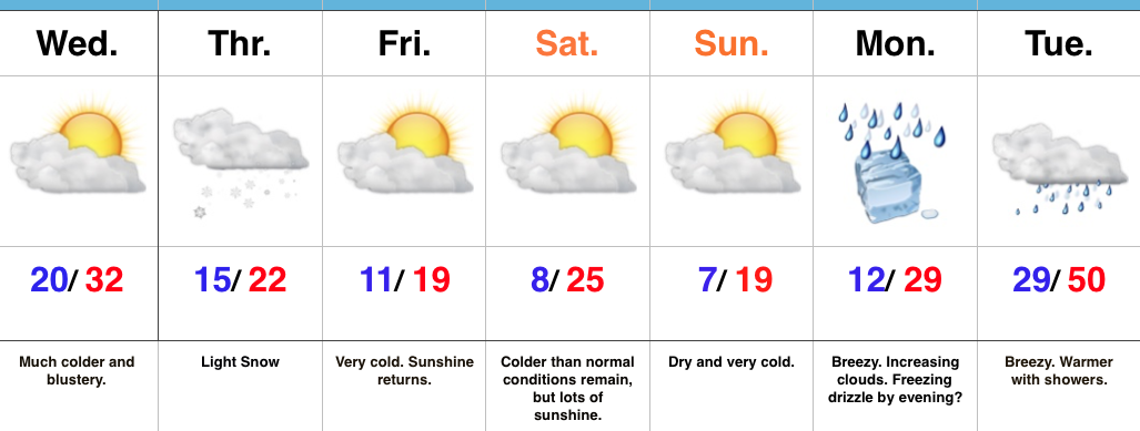
 This will take us through mid week and into the weekend with lows in the single digits and lower teens and highs generally in the lower and middle 20s. We still need to watch Thursday evening-night for a wave of low pressure that may attempt to deliver light snow, but this doesn’t look like a significant event from this distance.
 To further complicate matters, the European and Canadian solutions are much less robust and result in a more suppressed scenario. Forecasters (including yours truly) can only wish for the days to return of worrying about respected snow/ mix/ rain lines amongst the various data, versus the present time of models showing a storm only to take it away from run-to-run and other modeling not even showing the storm.
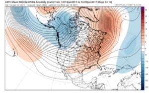 That brings us to our next point and that’s the modeling performance, itself. For really the better part of a year now, modeling has been poor, at best- even in the short-term solutions. More recently speaking to the last few months, I can’t recall model data ever performing worse (13 years of forecasting experience).