Category: Unseasonably Warm

Bumpy Start To The Work Week…

Highlights:

  • Stormy open to the work week
  • Colder midweek
  • Storms return this weekend

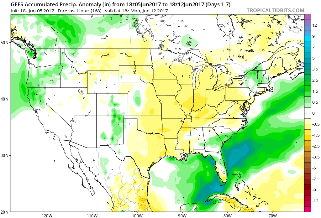
Couple Rounds Of Storms Possible Today…Radar this morning is showing widespread showers and thunderstorms sinking south out of northern Indiana.  Expect to get wet in, and around, the city as the rush hour gets into full swing.  We’ll monitor this evening for the potential of another round of thunderstorms that’ll, once again, originate across northern IN before tracking southeast.  We don’t anticipate widespread severe weather with these rounds of storms, but small hail is certainly possible in some of the storms.

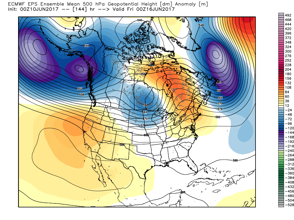
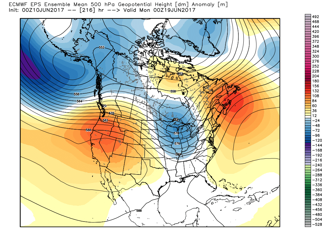
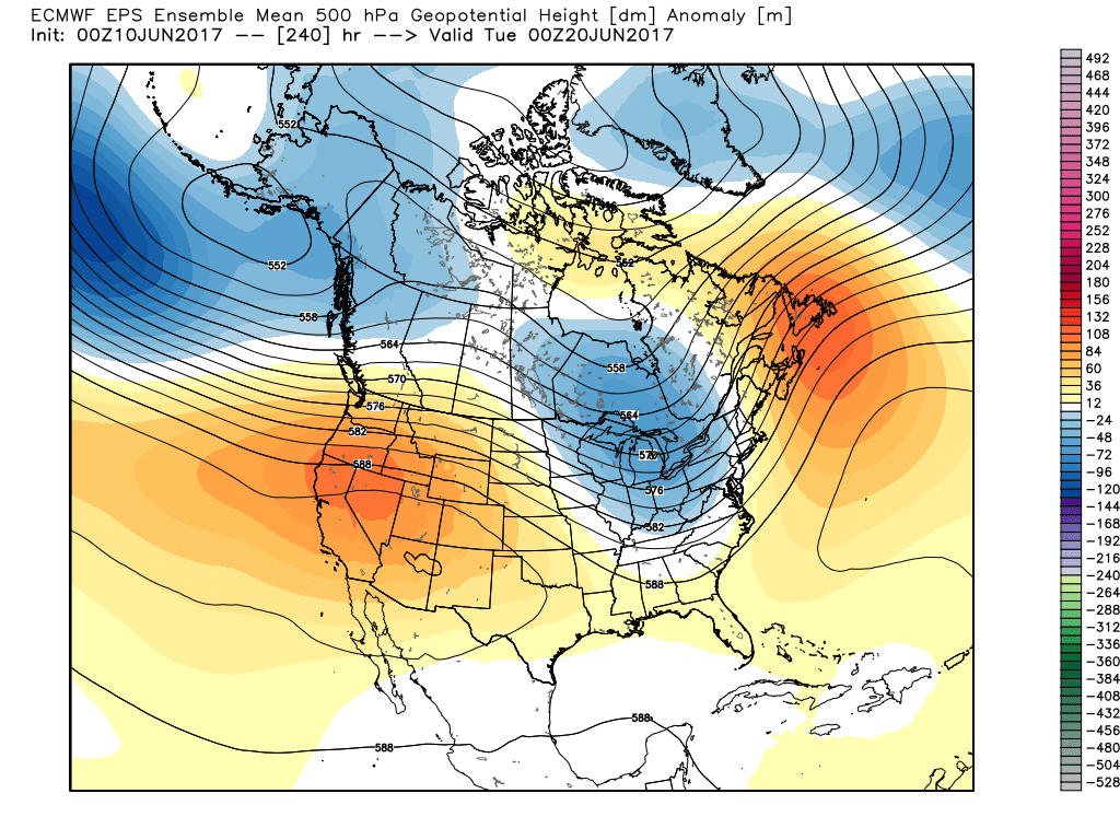
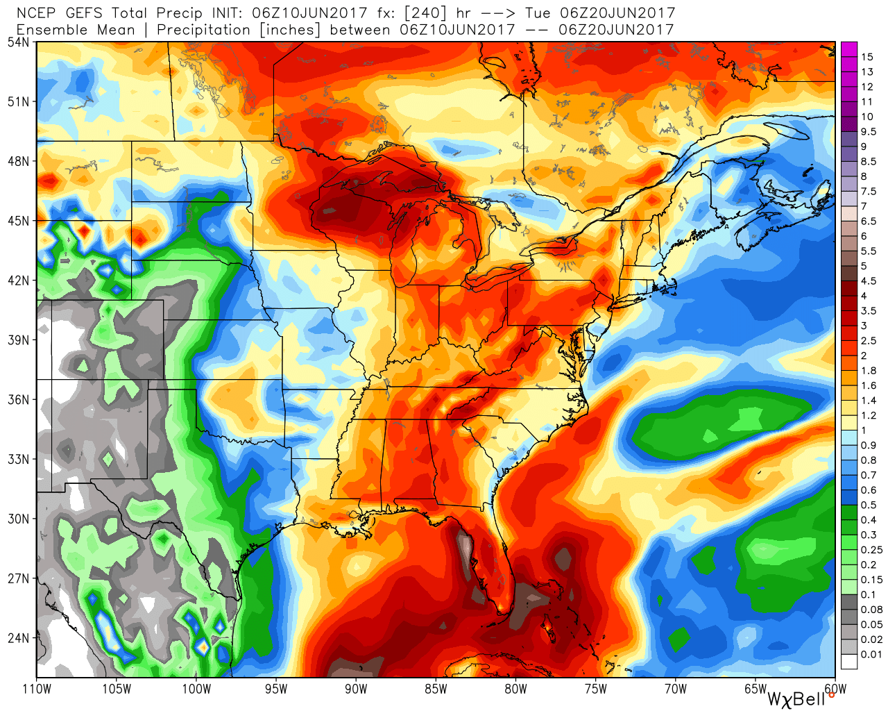
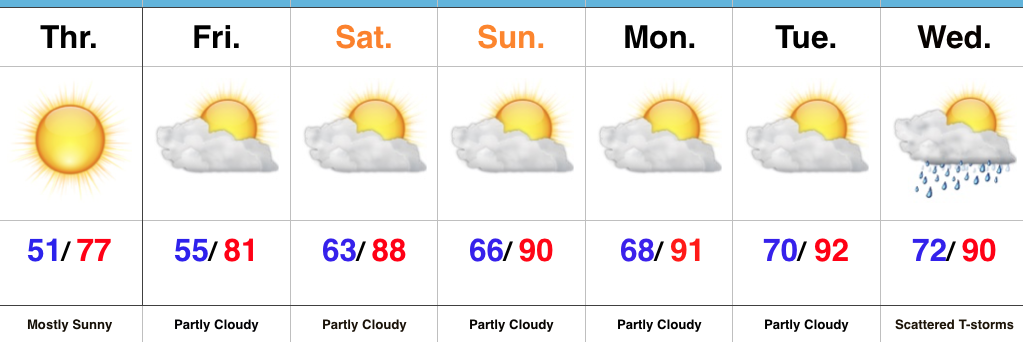
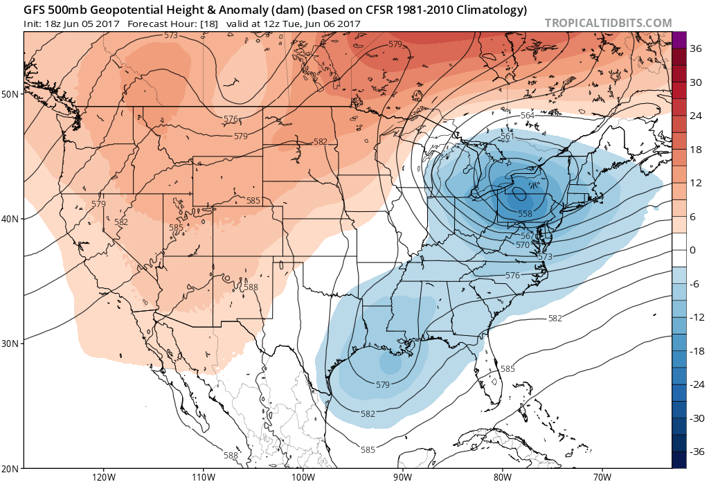
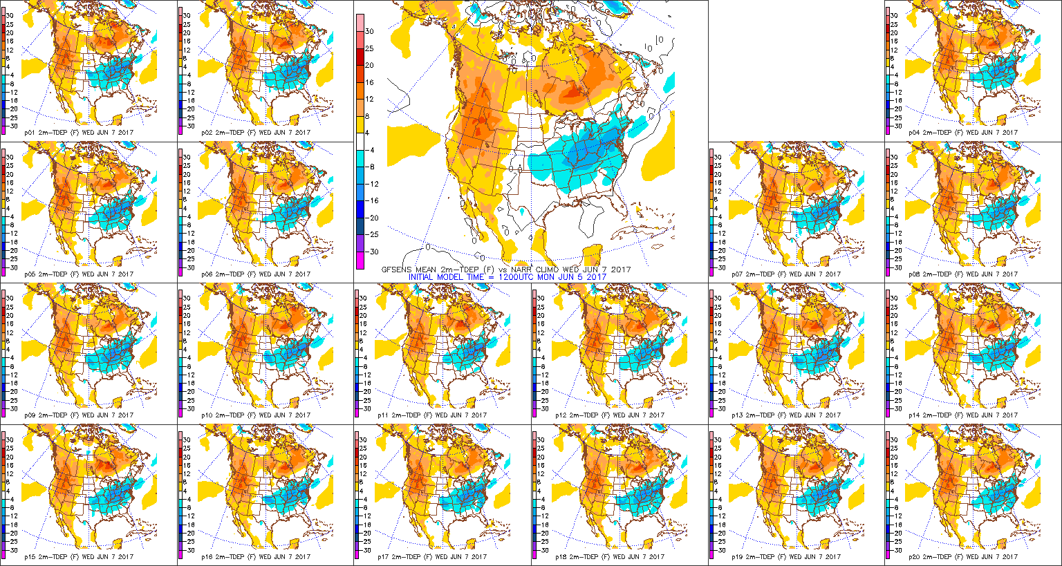
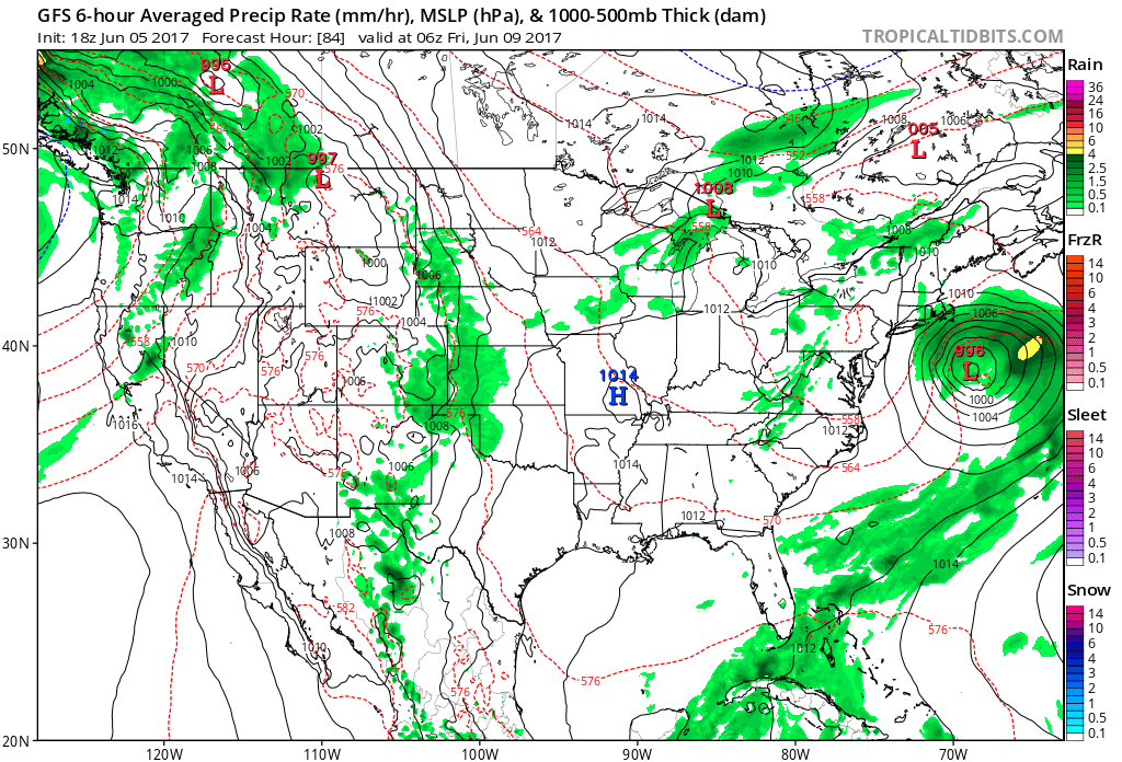
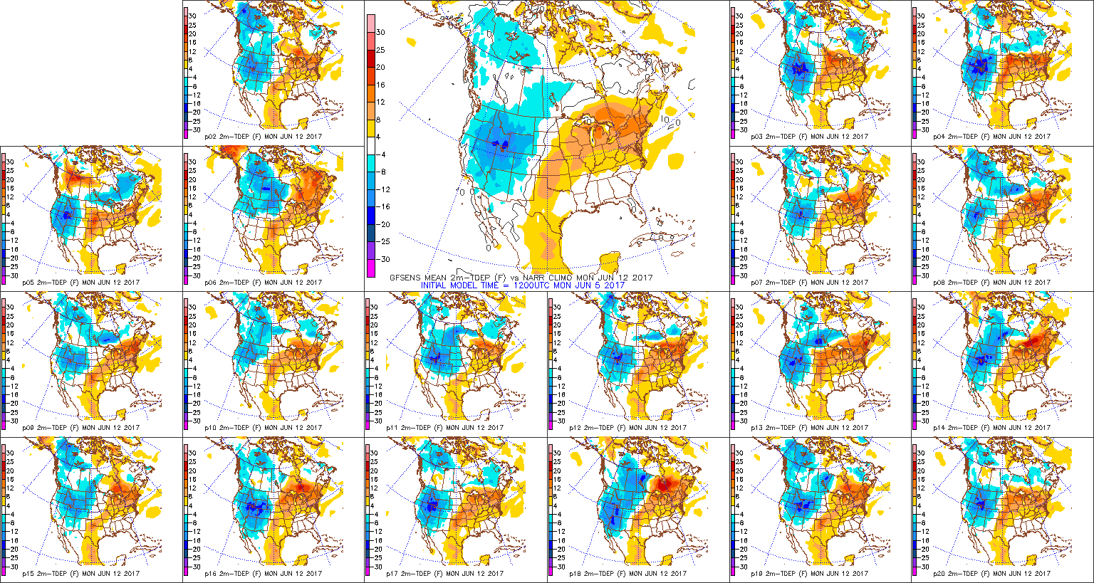
Tuesday will be an overall quieter day, but a cold front will pass with a shower chance Tuesday evening.  We’ll then note a northerly wind shift and a much colder air mass Tuesday night through Thursday morning.  Highs Wednesday will run 10°-15º below average.  If you’re not a fan of the cold, no need to fret as a warmer southerly flow will develop Thursday afternoon and put us in position to return to seasonable levels for highs Thursday after the chilly start.  We’ll then run much warmer than average this weekend, but it comes with a wet and stormy trade off.  Periods of heavy rain are possible Saturday into Sunday.

Upcoming 7-Day Precipitation Forecast:

  • Snowfall: 0.00″
  • Rainfall: 1.25″ – 1.75″

Permanent link to this article: https://indywx.com/bumpy-start-to-the-work-week/

Weekend Improvements…

Highlights:

  • Chilly Saturday
  • Brighter Sunday
  • Unsettled week ahead

Improving Weekend Weather…The second half of the weekend will most certainly be more pleasant than the way we’re opening up.  Expect mostly cloudy skies with a potential quick-hitting shower, especially from Indianapolis and points northeast through the afternoon hours.  Drier air will then push in this evening and help set-up a very pleasant Sunday.  After a chilly Saturday, lower 50s sure will feel nice with that sunshine Sunday.

Unfortunately, we won’t be able to hang onto the sunny conditions for long.  Clouds increase Monday and evening showers develop.  Tuesday is a transition day and we’ll include mention of showers Tuesday morning before drier, colder air builds south Tuesday night and Wednesday.

A fast transition to a moist southerly flow will greet us for the latter portions of the week and we’ll ramp up shower and thunderstorm chances Thursday PM into Friday as a cold front approaches.  It’ll also be very windy (non-thunderstorm gusts of 40 MPH+).

Upcoming 7-Day Precipitation Forecast:

  • Snowfall: 0.00″
  • Rainfall: 0.50″ – 1.00″

Our friend, Moe, sent these images from earlier in the week just north of Frankfort.  Despite the unseasonably cold weather we’ve been dealing with, these shots, separated only by a few hours, illustrate the power of that increasingly high March sun angle.

Permanent link to this article: https://indywx.com/weekend-improvements/

Thursday Morning Weather Rambles…

1.)  All of a sudden what was a warm March has revered big time.  Officially, Indianapolis is running close to 1° below normal on the month and will continue to fall further once today’s data is factored in.  Always fun to see Mother Nature “balance” things out.

2.)  It’s another cold start to the day with many central Indiana neighborhoods in the teens and hard freezes extending south into Florida this morning.

3.)  Sunshine can be expected today and after the frigid beginning, a moderating trend will begin this afternoon that will send temperatures into the lower to middle 40s.  That’s still close to 10° below average for daytime highs, but will feel much better than what we’ve been dealing with over the past several days.  Add in that high March sun angle and it’ll actually be a very pleasant afternoon.

4.)  Unfortunately, we won’t hang on to the sunshine for St. Patrick’s Day.  A warm front will lift northeast through the region during the overnight and lead to an increase in clouds by evening.  A wintry mix of sleet and freezing rain will impact central IN predawn Friday morning before transitioning to showers mid-to-late morning.  “Light” is the key word here with models suggesting less than 0.20″ total.  By Friday afternoon we’re back to dry times.

5.)  We’ll turn a touch cooler Saturday and it’ll be a blustery day, as well.  A couple of early snow showers are possible across east and northeast portions of the state before afternoon sunshine returns.  High pressure settles in overhead Saturday evening and will set up a nice second half of the weekend- lots of sunshine and milder temperatures by Sunday (lower 50s).

6.)  Looking ahead, the quiet times will be hard to come by as we progress through the latter portions of the month.  Both the new JMA Weeklies (shown below) and other ensemble guidance is bullish on a wetter than average close to the month, and also one that features wild temperature swings.  Thoughts shift back to severe prospects, especially for our friends to our south and the potential of backlash wet snow showers in the colder air.  From a temperature perspective, it’s a pattern that will be very “transient” with no true long-lasting periods of significant warmth, or cold- relative to average.

Permanent link to this article: https://indywx.com/thursday-morning-weather-rambles-4/

Enjoy Today; Winter Returns…

Highlights:

  • Spring-like feel today
  • Much colder pattern developing
  • Accumulating snow early next week?

Colder Pattern Taking Hold…The day is dawning bright and sunshine will be with us through the majority of the day, along with pleasant, spring-like temperatures.  Find a way to get out and enjoy it!  Unfortunately, the pleasant weather will end tonight.

Clouds will increase late in the day and give way to showers during the nighttime period.  A cold front will press south and pull much colder air into the region as we wrap up the work week and head into the weekend.  The suppressed route is still the one most likely for the weekend system and instead we’re left with an unseasonably cold, mostly dry forecast, locally.  We’ll still be on the watch for the potential of some light snow early Saturday, but the more significant, accumulating snow will be shoved south to the TN Valley.  Those beautiful northeast TN and western NC mountains look to be in the “sweet spot” for this storm (plowable accumulations).

Another storm system will track through the Mid West as we close the weekend and open next week.  Consequently, clouds increase late in the day Sunday and snow should overspread the region Monday.  Reinforcing cold air will arrive Tuesday with snow showers and gusty winds.

Upcoming 7-Day Precipitation Forecast:

  • Snowfall: 1″ – 3″
  • Rainfall: 0.10″ – 0.20″

Permanent link to this article: https://indywx.com/enjoy-today-winter-returns/

Strong Wind Event; Winter Makes A Comeback…

Highlights:

  • Windy day ahead
  • Colder pattern develops
  • Two snow chances in the days ahead

Hold On To Your Hats…The big story today will be developing strong and gusty winds, especially from the city and points north.  Westerly gusts will approach 50 MPH+ this afternoon and evening.  Hold onto your hats (and steering wheels)!

As we move into the latter portions of the week and into next week, a fast and active weather pattern will develop.  Three disturbances will have at least some impact on our weather between Thursday evening and Tuesday morning.

The first disturbance will result in an increase in cloudiness late Thursday along with an evening shower- especially across far eastern portions of the state.  We’ll turn much colder to close the week and that’s when our second disturbance will approach.  Clouds will increase Saturday and light snow is possible.  Models have trended further south with this disturbance, but we need to keep an eye on this as a last-minute shift north could take place.  As of this update, the most impactful disturbance looks to be the one that arrives Monday into Tuesday.  Accordingly, we’ll forecast developing snow Monday, continuing Tuesday with strong and gusty winds and even colder air.

After a prolonged stretch of spring-like warmth, the upcoming forecast period will serve as harsh reality that Old Man Winter still has some fight left in him.

Upcoming 7-Day Precipitation Forecast:

  • Snowfall: 1″ – 3″
  • Rainfall: 0.10″

Permanent link to this article: https://indywx.com/strong-wind-event-winter-makes-a-comeback/