
 Highlights:
- Dry open to the work week
- Warming trend develops
- Turning more unsettled
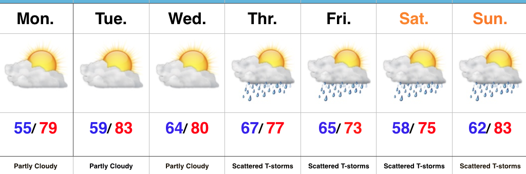
Week Opens Dry; Ends Unsettled…High pressure will remain in control of our weather as we open up the new work week. This will supply continued dry conditions along with a warming trend as our refreshing easterly flow transitions to the south.
This southerly air flow will help transport moisture northward as we progress into midweek and a “sluggish” front will begin to impact the area Wednesday evening into Thursday. Scattered showers and thunderstorms will develop and as the front meanders around the region, shower and thunderstorm chances will continue into the weekend. Forecast models differ on the evolution of things over the weekend and result in the sensible weather conditions ranging from more widespread showers and embedded thunder to more of a “splash and dash” variety of rain coverage. We’ll fine tune things as we progress through the week.
Much cooler air is forecast to return just past the current 7-day forecast period.
Upcoming 7-Day Precipitation Forecast:
- Snowfall: 0.00″
- Rainfall: 0.75″- 1.00″
 This will be enough to send temperatures into the 85° to 90° range by the early to middle of next week. To shed some perspective on that, our averages for early October include low temperatures in the upper 40s and highs in the upper 60s. For at least a couple of days next week, overnight lows will be much closer to where our afternoon highs should be this time of year.
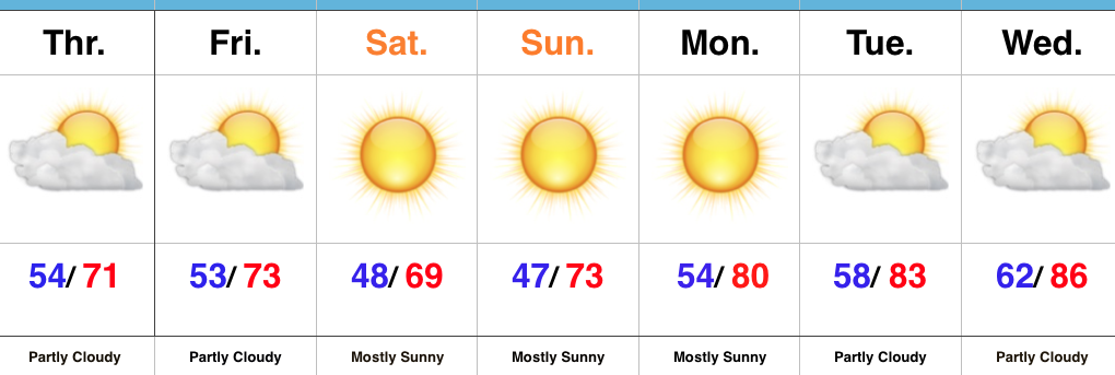 Highlights:
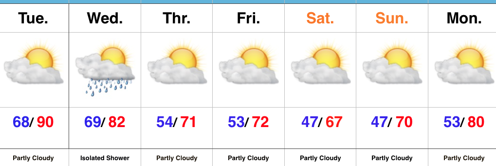 Highlights: