Category: Unseasonably Warm

From Summer To Fall…

screen-shot-2016-10-15-at-9-03-37-amHighlights:

  • Stretch of unseasonably warm, summer-like weather
  • Turning much cooler late in the period
  • Unsettled to close the work week

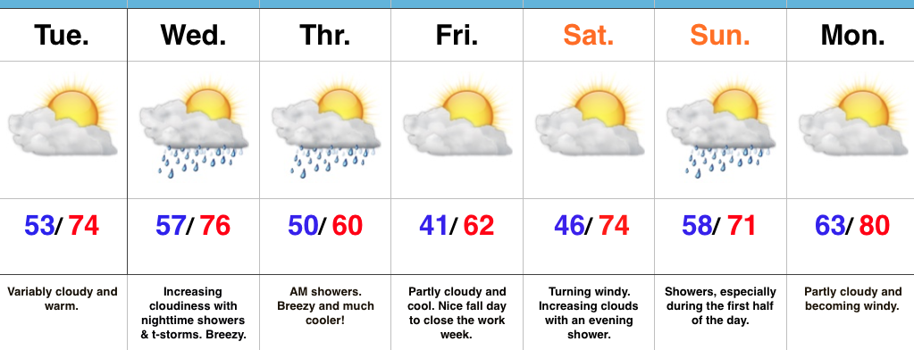
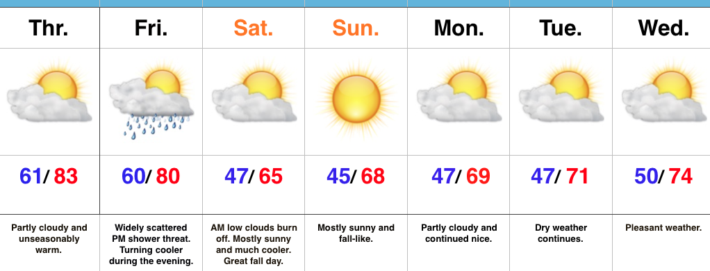
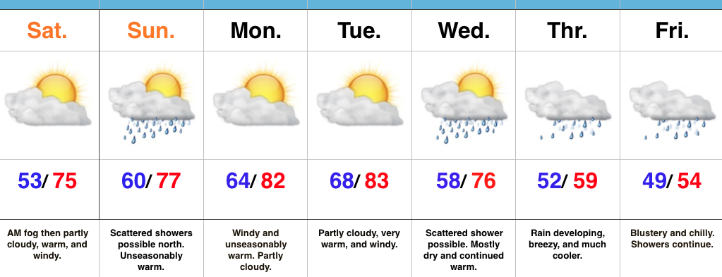
Near Record Warmth Gives Way To A Cooler Feel…We have to deal with low clouds and areas of fog this morning, but expect enough wind to mix things out and return us to a variably cloudy sky this afternoon.  Significantly warmer conditions are on tap today than what we’ve dealt with over the past couple days.  Winds will become gusty this afternoon (20-30 MPH).

Scattered showers will drop south Sunday.  These will impact mostly northern locations (north of I-70) and won’t be a big deal.

Monday and Tuesday will feature strong and gusty southwest winds (30-40 MPH), dry conditions, and near record warmth.  Highs in the lower 80s for mid October is downright impressive, but the warm overnight lows in the mid to upper 60s is almost unheard of for this time of year.  Enjoy the stretch of extended summer.

Our weather pattern will offer up an increasingly chilly regime late week and the overall evolution of a storm system is still up in the air in regards to rain timing and amounts.  For now we’re leaning towards a wet, chilly, and blustery forecast Thursday and Friday.

Upcoming 7-Day Precipitation Forecast:

  • Snowfall: 0.00″
  • Rainfall: 1.50″ – 2.00″

Permanent link to this article: https://indywx.com/2016/10/15/from-summer-to-fall/

Warm & Windy This Weekend; Changeable Weather Next Week…

Central Indiana will enjoy a nice open to the weekend. High pressure will scoot off to the east and allow a warmer, but blustery return southwesterly flow. Though we’ll be warmer tomorrow, winds will increase and gust to 30-40 MPH late in the day. Highs will top out in the middle to upper 70s.

Sunday will feature an increase in cloudiness, but most shower activity should remain across northern and north-central parts of the state. Even in areas that receive rain Sunday, amounts will be light and insignificant. Here’s a look at what the radar may look like Sunday afternoon. It’ll be another unseasonably warm day as highs top out between 75°-80°, despite the increase in cloud cover.


Speaking of warmth, that will be the major story for early and middle parts of the work week. Highs around 80° and warm overnight lows in the 60s (where our average high should be) can be expected with dry, but windy, conditions in play. Extended summer, anyone?!


Changes are brewing for the latter portion of the week and that will require most of our attention over the weekend as far as sifting through the various details. While confidence is high in a transition to drastically cooler conditions, the evolution of specifics concerning rain chances results in a much lower level of confidence. As it stands now, we’ll increase rain chances for the late week period (late Wednesday into Thursday), but the duration of wet weather is up in the air. The GEFS (below) shows the wetter pattern returning.


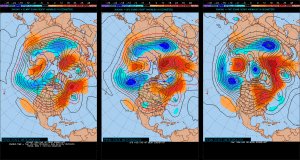
Note the various ensemble solutions (above) of how the upper air pattern may look in the 8-10 day period. Solutions range from a drier and downright chilly look (European) to one that’s cooler, but still unsettled (GFS, GEM). Time is required to continue to fine tune things.

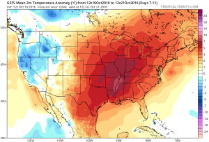
All of that said, as previously mentioned, we’re much more confident in the cooler look to close October. The GEFS sees that, as well.

Permanent link to this article: https://indywx.com/2016/10/14/warm-changeable-weather-next-week/

VIDEO: Windy Warm-Up Arrives This Weekend; Complex Pattern Next Week…

You must be logged in to view this content. Click Here to become a member of IndyWX.com for full access.  Already a member of IndyWx.com All-Access?  Log-in here.

Permanent link to this article: https://indywx.com/2016/10/14/video-windy-warm-up-arrives-this-weekend-complex-pattern-next-week/

VIDEO: An Active Autumn Pattern Is Here…

You must be logged in to view this content. Click Here to become a member of IndyWX.com for full access.  Already a member of IndyWx.com All-Access?  Log-in here.

Permanent link to this article: https://indywx.com/2016/10/13/video-an-active-autumn-pattern-is-here/

Wednesday Night Storms Before A Much Cooler Push Of Air…

screen-shot-2016-10-11-at-7-29-43-amHighlights:

  • Shower and storm chances increase Wednesday night
  • Coolest air so far this season to close the work week
  • Warm push of air early next week

Nice Today Before Wednesday Night Storms…Mid and high level cloudiness will continue to scoot through the Ohio Valley today. While we noted a few sprinkles during the predawn hours, the air remains dry and we should be rain-free today with increasing PM sunshine.

Wednesday will turn increasingly breezy as the day progresses and a cold front will help kick up scattered showers and thunderstorms Wednesday night into the early morning hours Thursday.  Behind the front, the coolest air so far this season will press southeast and set us up for a chilly close to the week.

The cool air won’t stay around long as we flip our air flow back to the south over the weekend.  Showers are a good bet Sunday followed by a gusty south wind and a summer-like high in the lower 80s Monday.

A couple of notes:  It’s beginning to be that time of year again when we have to get used to the wind.  As the jet continues to mature, storm systems will become more frequent as we go deeper into fall.  Strong winds are a given and the increasingly busy nature of the pattern is a signal of changes brewing.  While we’re still a couple weeks away from a wholesale pattern change, don’t be surprised if we undergo a rather dramatic flip in the pattern as October gives way to November.  This sure doesn’t look like last year in any way, and, in fact, it’s easy to argue it’s the exact opposite when it comes to early season cold and potentially wintry weather…

Upcoming 7-Day Precipitation Forecast:

  • Snowfall: 0.00″
  • Rainfall: 0.50″ – 0.75″

Permanent link to this article: https://indywx.com/2016/10/11/wednesday-night-storms-before-a-much-cooler-push-of-air/

Mid Week Showers Followed By A Pop Of Cool Air…

Mid and high level clouds are streaming overhead this evening and will help set up a brilliant sunset across central IN.

screen-shot-2016-10-10-at-6-57-58-pmTuesday will remain rain-free across the region, along with pleasant temperatures and humidity levels (mid 70s after a low in the lower 50s).
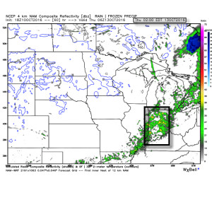
Moisture will continue to be transported northward Wednesday, courtesy of a gusty SW breeze at times.  As the approaching cold front interacts with the moisture return, scattered showers will “blossom” across the area Wednesday night into the wee morning hours Thursday.

wednightshowersRainfall amounts don’t look particularly impressive; generally 0.10″-0.25″ during the Wednesday night-Thursday morning time frame.
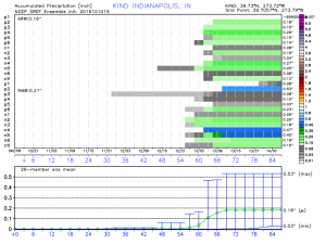
17The cool air flowing in behind the front is impressive though.  In fact, highs both Thursday and Friday will likely only reach the lower 60s (if that).
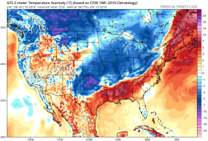
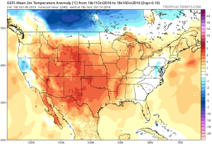
12Despite the chilly air that will be with us to wrap up the work week, ensemble data is in excellent agreement on a significant warmer than average regime developing under a big eastern ridge in the 6-10 day.  This will likely promote highs into the lower 80s next week for a few days.  Impressive, no doubt, considering we’ll be rumbling through the second half of October by that point.
test8

13

Permanent link to this article: https://indywx.com/2016/10/10/mid-week-showers-followed-by-a-pop-of-cool-air/

Mid Week Cold Front…

screen-shot-2016-10-09-at-9-22-00-amHighlights:

  • Dry and cool fall weather remains
  • Mid week front delivers showers and cooler air
  • Warm pattern develops next weekend

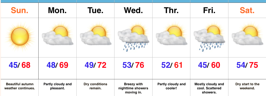
Classic Autumn Weather…Today will be just about as nice of a mid-October day that we could ask for around these parts.  High pressure will supply mostly sunny skies and pleasantly cool air.

Dry weather will remain through early in the work week, along with slowly moderating temperatures as our air flow shifts to a SW direction.  This will allow enough moisture return for a cold front to help spark showers Wednesday evening.

As that front sweeps through the region, reinforcing cool air will ooze back into the state.  A weak disturbance will scoot south of our region Friday, but will likely be close enough to create a mostly cloudy close to the work week, along with scattered showers.  Moderating temperatures return next weekend.

Upcoming 7-Day Precipitation Forecast:

  • Snowfall: 0.00″
  • Rainfall: 0.25″ – 0.50″

Permanent link to this article: https://indywx.com/2016/10/09/mid-week-cold-front/

Stretch Of Fall Weather…

screen-shot-2016-10-08-at-8-03-12-amHighlights:

  • Much cooler weekend
  • Dry conditions continue
  • Next cold front arrives mid week

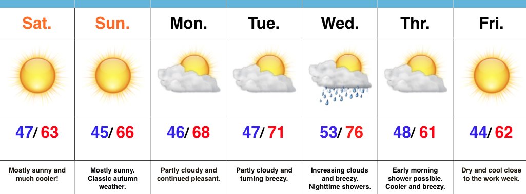
Classic Fall Weather…High pressure is building in to supply a dry and pleasantly cool weekend. Average temperatures this time of year include highs in the upper 60s with lows in the upper 40s.  We’ll run a few degrees below those norms. this weekend with mostly sunny skies in place.  Bon fire, pumpkin patch, or corn maze, anyone?  Perhaps all of the above?!

Dry conditions will remain early next week with slowly moderating temperatures.

Our next item on the agenda is a cold front approaching by the middle of the week.  This front will slide through with showers Wednesday evening into early Thursday followed by resurgent cool air as we wrap up the work week.  Rainfall amounts don’t look impressive, but moisture return will be better than yesterday’s cold front.  We’ll label the rain coverage as “scattered” for now.

Upcoming 7-Day Precipitation Forecast:

  • Snowfall: 0.00″
  • Rainfall: 0.10″ – 0.20″

Permanent link to this article: https://indywx.com/2016/10/08/stretch-of-fall-weather/

Thursday Evening Rambles…

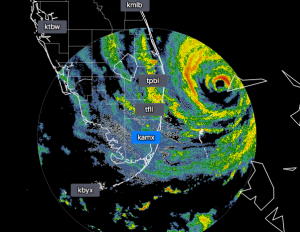
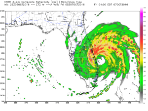
1.) Matthew is rumbling towards the east coast of FL this evening and data continues to suggest a landfall near West Palm Beach late tonight or during the predawn hours Friday.  Regardless, an extended period of hurricane conditions, beach erosion, surge, and heavy rain await the FL peninsula.

For the Space Coast region, this very well could be the most significant hurricane the area has seen.  Our thoughts and prayers continue for our family and friends in Matthew’s path.

Radar around 8p Thursday.

Radar around 8p Thursday.

Forecast radar 1a Friday.

Forecast radar 1a Friday.

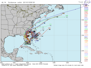
Most model data likes the “loop de loop” idea and potentially brings Matthew back in for a second FL landfall early next week (in a much weaker state, thankfully, due to upwelling and shear).

al14_current2.) A cold front will pass through our neck of the woods as we put a wrap on the work week.  While moisture is limited with the front, a much cooler air mass will greet us out the door Saturday morning.  A light shower is possible Friday afternoon or evening, but this won’t be a big deal and most high school football games will remain dry.  Temperatures Saturday morning will be in the 40s with lingering low clouds and areas of fog possible.  We should shake the morning low cloudiness and allow for sunshine most of the day.  Temperatures will remain crisp; generally in the lower to middle 60s for highs.
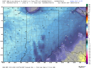
A chilly start is anticipated Saturday morning.

A chilly start is anticipated Saturday morning.

The weekend into early next week will remain pleasant, with chilly, clear nights and lots of sunshine during the day, along with cool afternoon highs.

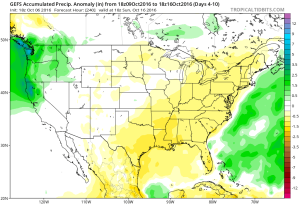
3.)  The longer term pattern through at least the middle of October is one that features anomalous warmth and dry conditions.  In fact, it’s not entirely out of the realm of possibility for afternoon highs to reach close to 80 once again towards Day 10…. We shall see.

We warm back up above average in the 6-10 Day period

We warm back up above average in the 6-10 Day period

A mainly dry pattern continues

A mainly dry pattern continues

Permanent link to this article: https://indywx.com/2016/10/06/thursday-evening-rambles-3/

Not Impressed With Rain Coverage; Much Cooler Weekend…

screen-shot-2016-10-05-at-5-57-22-pmHighlights:

  • Unseasonably warm weather continues for now
  • Much cooler weekend ahead
  • Unimpressed with rain coverage

Feeling More Like It Should By The Weekend…A SW air flow will continue to pump unseasonably warm air into the Mid West as we go through the back half of the work week.  Dry conditions will remain before a cold front serves up a widely scattered shower chance Friday afternoon.  That cold front will sweep through the state Friday evening and much cooler air will spill into the region.  Despite some low clouds and areas of fog Saturday morning, the weekend should feature lots of sunshine along with cool, crisp air.  It’ll be a classic fall weekend in central IN.  Make plans for a bonfire or to visit one of the many popular corn mazes throughout the region.

As we rumble into early next week, high pressure and pleasant weather conditions will remain.

In the tropics, Hurricane Matthew continues to be the headline.  Our thoughts and prayers are with the Bahamas tonight as Matthew roars through.  Tomorrow night and Friday will then feature Matthew coming dangerously close to the east coast of FL.  Landfall or not, those living along the east coast of FL should brace for a long duration and damaging erosion event, along with hurricane conditions.

Upcoming 7-Day Precipitation Forecast:

  • Snowfall: 0.00″
  • Rainfall: 0.10″

Permanent link to this article: https://indywx.com/2016/10/05/not-impressed-with-rain-coverage-much-cooler-weekend/

IndyWx.com