Category: Unseasonably Warm

Scattered Storms; Summer-like Feel…

Highlights:

  • Scattered t-storms
  • Dry weather returns
  • True summer-like feel

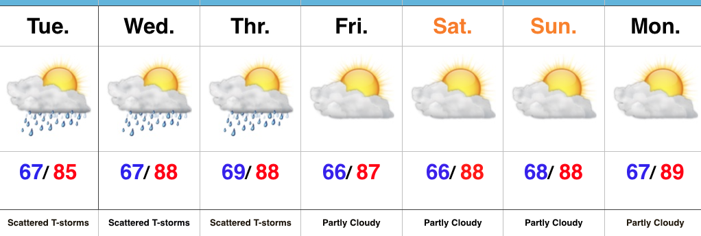
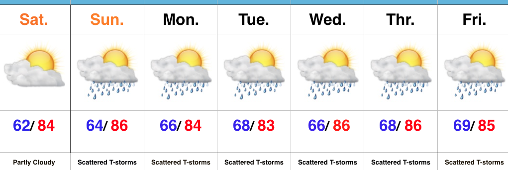
Unseasonably Warm Weather Continues…Similar to the past 24 hours, scattered showers and thunderstorms will dot the central Indiana landscape through midweek.  As has been the case, there will continue to be “haves and have nots” over the next couple of days.  Some neighborhoods will get lucky with localized slow moving downpours while others miss out entirely.  All in all, it’s a very summer-like regime- both from a temperature/ humidity standpoint, as well as a precipitation perspective.

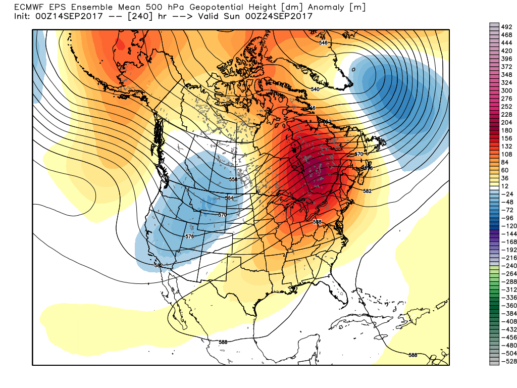
As we flip the page and head into the upcoming weekend, dry times will return.  A big ole upper level ridge will balloon over the mid west and eastern portion of the country and this will serve to lead to a continuation of summer-like warmth- certainly well above average.  It sure won’t feel like fall as we officially welcome in the new season Friday.

Upcoming 7-Day Precipitation Forecast:

  • Snowfall: 0.00″
  • Rainfall: 0.25″ – 0.50″ (locally heavier totals)

Permanent link to this article: https://indywx.com/2017/09/18/scattered-storms-summer-like-feel/

Highly Amplified Pattern; Making Up For Lost Time In The Summer Department…

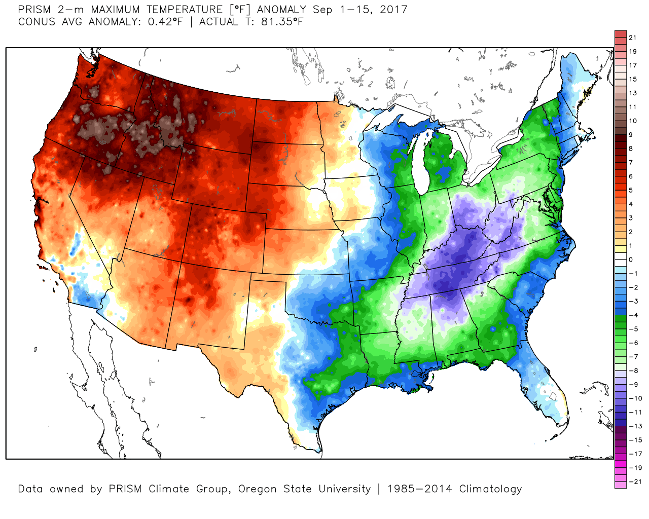
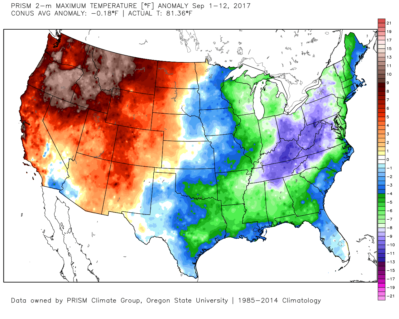
So far this month, unseasonably cool conditions have set up shop across the eastern portion of the country (IND is running more than 4° below normal through the 16th) while the west has experienced a much warmer than average pattern.

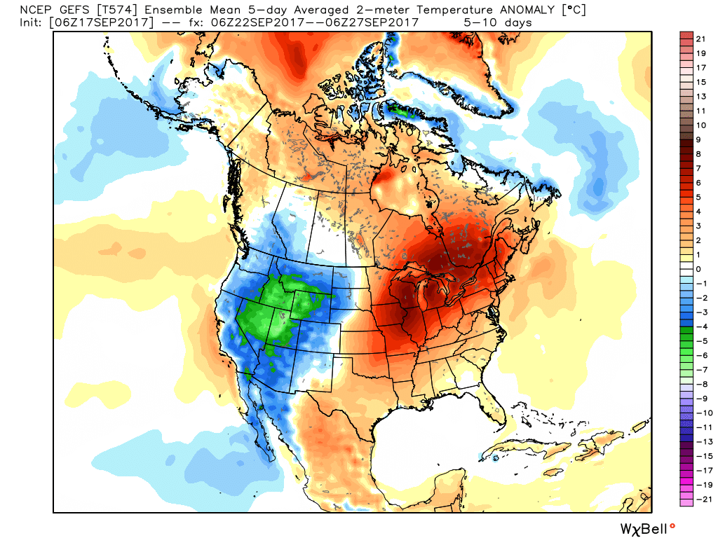
That will flip around in big time fashion this week as a highly amplified pattern takes hold.  The mean trough position will shift into the west and lead to an early taste of winter, including mountain snow.  Meanwhile, our region will make up for lost time in the summer department, including highs generally in the mid to upper 80s (around 10° above average).
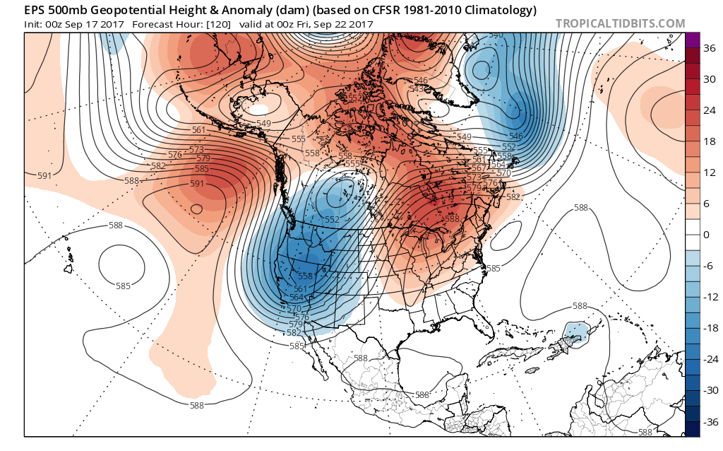
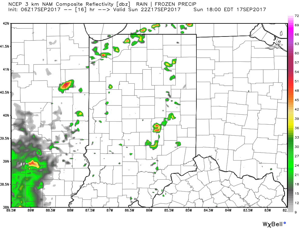
Daily chances of widely scattered afternoon and evening thunderstorms will be with us beginning today through the majority of the upcoming week.  Everyone won’t get wet, but there will be a couple of localized heavy downpours on area radars at times.  As dry as we’ve been, we’ll take what we can get.
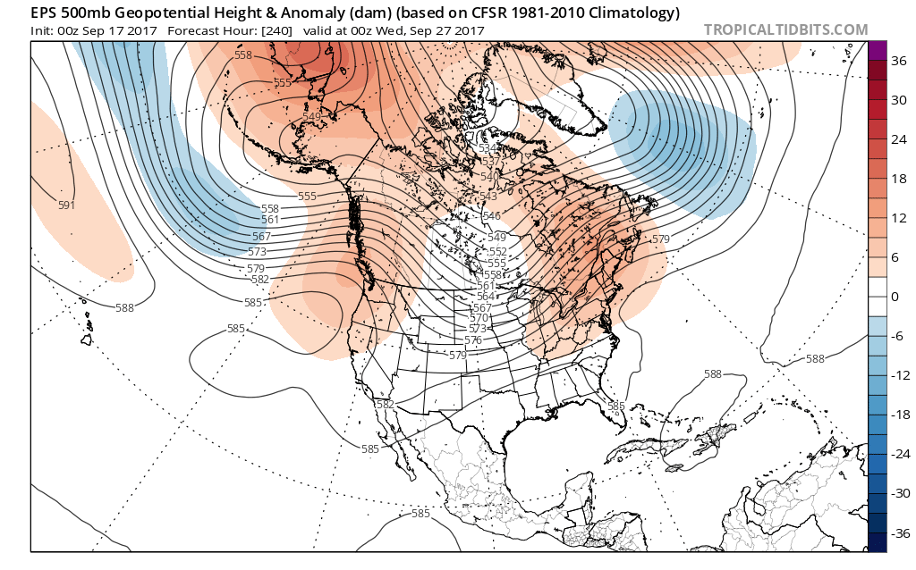
Eventually, the pattern will “relax” (at least briefly) out towards Day 10.  This will feature a more seasonable regime returning to the region, along with better chances of more widespread rains as a cold front approaches.  We’ll also have to keep a close eye on additional tropical threats to the southeast region…
Permanent link to this article: https://indywx.com/2017/09/17/highly-amplified-pattern-making-up-for-lost-time-in-the-summer-department/

Still Some Summer Left In The Tank…

Highlights:

  • Warmth builds
  • Storms chances (finally) return
  • Rinse and repeat

Summer Isn’t Finished Yet…We may be inching ever so much closer to the official start of autumn (next Friday), but don’t tell Mother Nature that.  After an unusually cool close to August and open to September, we’re set to make up for lost time over the next couple of weeks.  Heat will build and expand across the Mid West this weekend and that will set the tone for the upcoming forecast period.

Weather conditions should remain dry to kick off the weekend (great day for the Whitestown Brewfest, by the way), but moisture will return for the second half of the weekend.  Combine the increasing moisture with enough lift and widely scattered thunderstorms will fire Sunday.  Overall coverage won’t be particularly impressive, but will be a harbinger of things to come as the new week unfolds.  A couple of surface fronts will push up against the strong ridge in place as we progress through the work week.  While these will “wash out” over the Ohio Valley, they’ll be sufficient enough to provide scattered-to-numerous showers and thunderstorms next week.  Our parched soils will take anything they can get!

Upcoming 7-Day Precipitation Forecast:

  • Snowfall: 0.00″
  • Rainfall: 0.50″ – 1.00″

Permanent link to this article: https://indywx.com/2017/09/15/still-some-summer-left-in-the-tank/

Weekly Update: JMA, CFSv2, Euro…

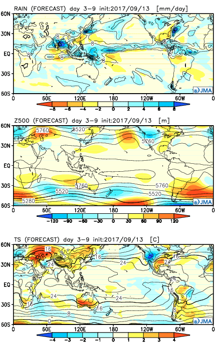
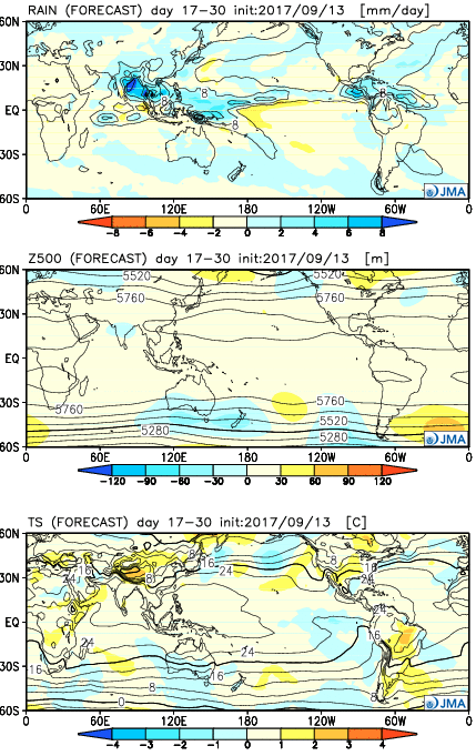
The general consensus between the JMA and CFSv2 is that warmth is the story through Week 2, especially this weekend into next week.  JMA first:

Week 1

Week 2

Weeks 3-4

Before we show the CFSv2, a couple take-aways from the JMA:

  • Warmth is most impressive early on (through next week), relative to average
  • As cold tries to push, active times will return (finally) to the region from Week 2 on

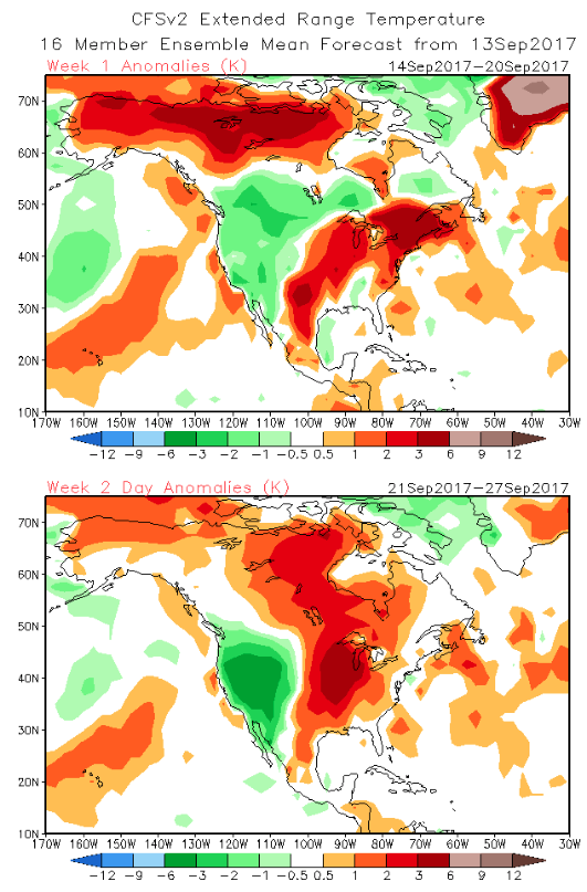
Now…the CFSv2:

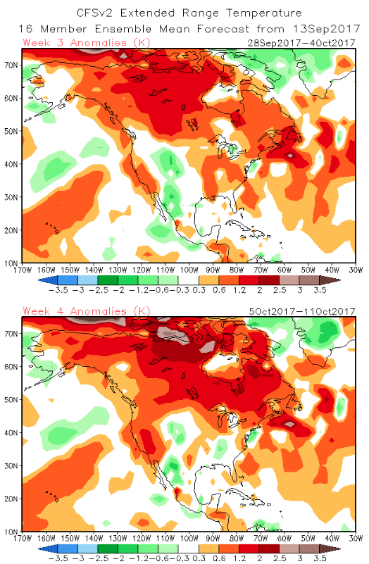
Weeks 1-2

Weeks 3-4

Key take-aways:

  • Similar to the JMA, warmth is most impressive early on before a “fight” develops thereafter.

While we can’t show the European Weeklies due to licensing issues, they paint a similar theme, overall.  They sing a similar song in the short-term for warmth to close the month, but are much more bullish on the transition to a colder than average first half of October compared to the CFSv2 and JMA.

To sum things up, confidence is high on a summer-like regime to engulf the region through the balance of the second half of September as a ‘Nina-ish pattern takes hold.  Late-season summer warmth will rule through next week, including highs in the 85°-90° range at times- developing as early as this weekend.  This, of course, comes on the heels of an unusually early cool start to meteorological fall (IND is running a whopping 6° below average, MTD).  After the warmth dominates, a transitional pattern should ensue, including more active times (wetter than average as we close September and open October), along with “pops” of colder air.  That said, a consistently positive southern oscillation index has us “raising an eye brow” to the aggressively cold start to October such as the Euro implies… Stay tuned.

Permanent link to this article: https://indywx.com/2017/09/14/weekly-update-jma-cfsv2-euro/

BIG Reversal Coming…

Through August and the first half of September, the mean trough position has been located across our part of the country.  This has helped lead to an extended period of below normal temperatures and an early start to fall.

Well below normal temperatures have dominated the first half of September.

You knew summer wouldn’t go away without fighting back at least once more, didn’t you?!  Sure enough, over the next couple of weeks, ridging will expand across the east and this will provide late-season summer heat in the exact area where it’s been coolest month-to-date.

This will deliver temperature anomalies 5° to 10° above average as we traverse the back half of the month, including highs in the mid-to-upper 80s.
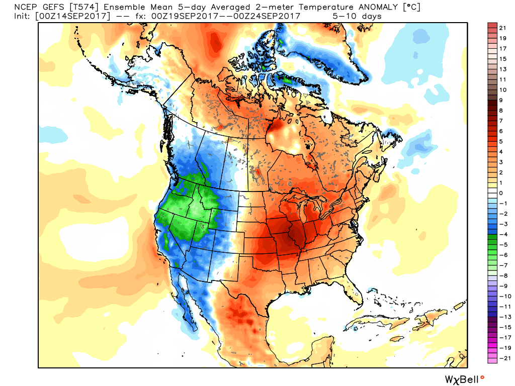
Meanwhile, our friends out west (where it’s been warm, month-to-date) will begin to experience early winter-like conditions, including high elevation snowfall across the central and northern Rockies.

Looking ahead, after our period of summer-like conditions comes to an end late month, a more transient (active) pattern should develop.  This will serve to do a couple of things:

  • Lead to a rather wet regime
  • Pops of cold air become increasingly likely behind FROPAs

It’ll be interesting to see what the NEW Weeklies look like today, including the European and JMA.  We’ll post on our thoughts with both later.

Permanent link to this article: https://indywx.com/2017/09/14/big-reversal-coming/

Irma’s Remnants Limp Into The Region; Warming Up This Weekend…

Highlights:

  • Showers and breezy conditions thanks to what’s left of Irma
  • Sunshine returns
  • Warmth builds

Irma’s Remnants…What’s left of Irma will begin to impact the state today.  As promised, this won’t be a big deal, locally.  We’ll notice scattered to numerous showers lifting north through the day, continuing Wednesday.  Greatest overall rainfall coverage across central parts of the state should occur tonight into Wednesday.  We’ll also note east and northeast winds gusting over 20 MPH at times.  All in all, not a big weather event in the least for our region and our thoughts and prayers remain with our neighbors to our south beginning clean up/ rebuilding efforts.

High pressure will return as we wrap up the work week and move into the weekend.  Additionally, a southerly air flow will help pump unseasonably warm conditions northward to encompass the Ohio Valley and Mid West.  Our next weather maker will be a cold front that will make a run at the region Monday.  Early indications are this front will “wash out” as it nears the region with only a few showers/ embedded thunder expected.

Looking ahead, much more active times loom as we progress through late September and open October…

Upcoming 7-Day Precipitation Forecast:

  • Snowfall: 0.00″
  • Rainfall: 0.25″ – 0.50″

Permanent link to this article: https://indywx.com/2017/09/12/irmas-remnants-limp-into-the-region-warming-up-this-weekend/

Monday Evening Rambles: Looking Towards October….

Irma: Irma’s remnants will begin to impact the state Tuesday. We noticed an increasing mid and high level cloud deck today and moisture will spread north to encompass southern Indiana…

You must be logged in to view this content. Click Here to become a member of IndyWX.com for full access.  Already a member of IndyWx.com All-Access?  Log-in here.

Permanent link to this article: https://indywx.com/2017/09/11/monday-evening-rambles-looking-towards-october/

VIDEO: Hurricane Irma And Warmer Times Loom…

You must be logged in to view this content. Click Here to become a member of IndyWX.com for full access.  Already a member of IndyWx.com All-Access?  Log-in here.

Permanent link to this article: https://indywx.com/2017/09/11/video-hurricane-irma-and-warmer-times-loom/

Chances Of Needed Rain Increasing For Central Indiana…

August, month-to-date, is running bone-dry.  Officially, IND has only accumulated 0.18″ of rain, but that may be changing as early as this afternoon and evening.

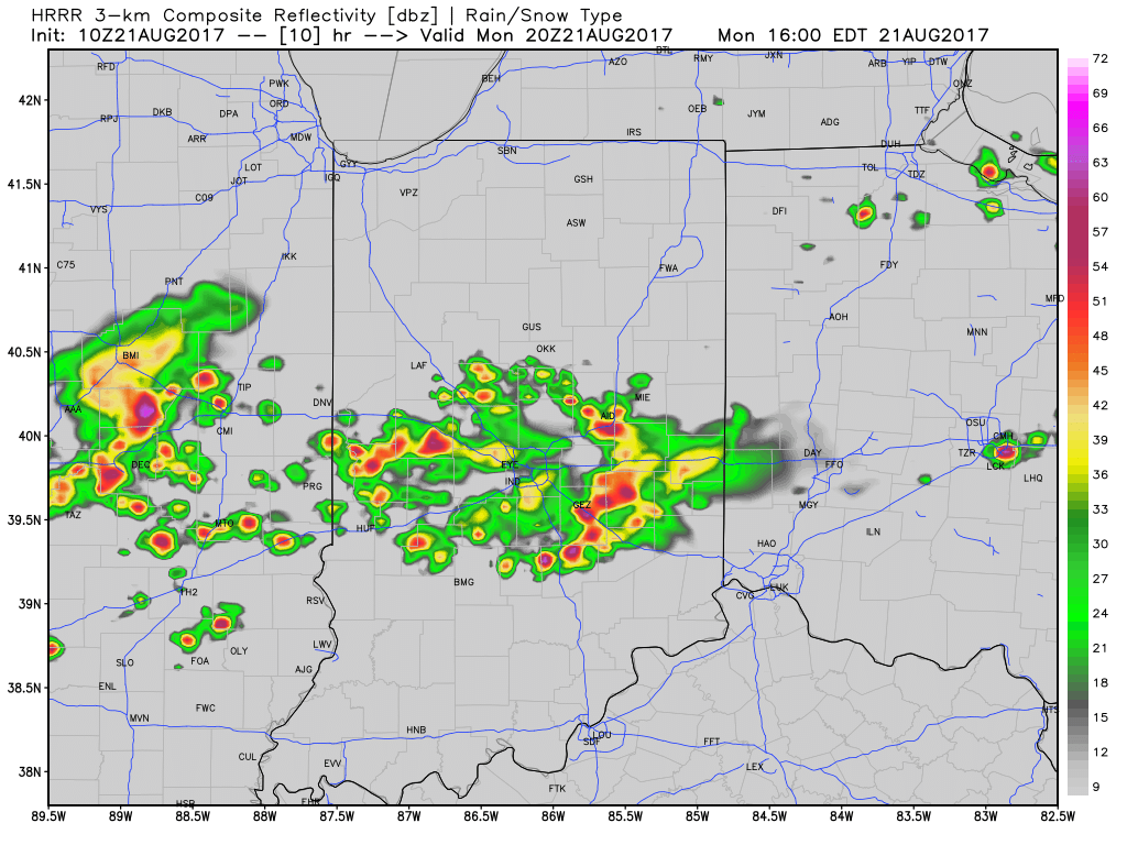
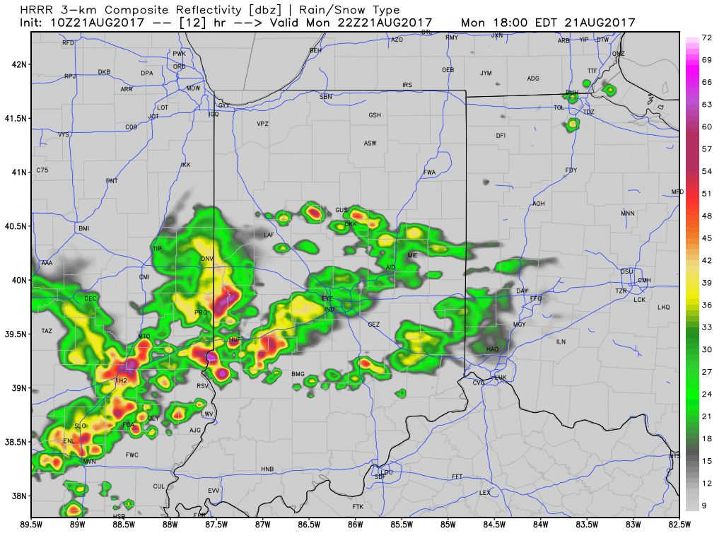
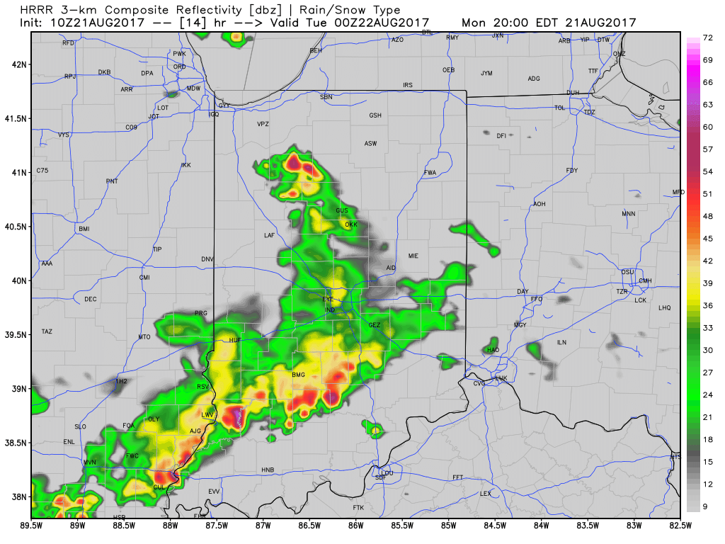
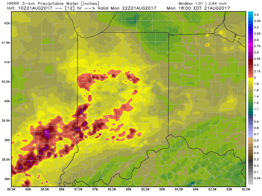
We note high resolution, short-term data is becoming more aggressive with the development of showers and thunderstorms this afternoon and evening.  Initially, storms will impact w-central parts of the state before encompassing more of central Indiana.  The following are images of what the local radar may look like at 4p, 6p, and 8p.

With leftover boundaries from early morning storms across northern parts of the state (likely will serve as a “trigger” for PM storm development), combined with a hot and muggy airmass, confidence is increasing on numerous showers and thunderstorms across central Indiana this afternoon and evening.  Widespread heavy rain isn’t expected this afternoon, but localized hefty downpours are a good bet with precipitable water values (PWATs) approaching 2″ this afternoon.
Unsettled times remain Tuesday before a much cooler regime looms for the second half of the week…

Permanent link to this article: https://indywx.com/2017/08/21/chances-of-needed-rain-increasing-for-central-indiana/

Hot, Humid Weather Gives Way To Much Cooler Times…

Highlights:

  • Hot and humid open to the week
  • Scattered early week storms
  • Much cooler and less humid times loom

Time To Sweat…A hot and increasingly humid airmass will be with us as we open a new week.  While most of the upcoming 24-48 hours will remain rain-free, we will mention chances of an isolated to widely scattered thunderstorm Monday.  Most will remain free of rain and storms, but those lucky folks who do find themselves under a storm Monday can expect to pick up a quick 1″ of rain.  Better overall coverage of showers and thunderstorms will develop late Monday night into Tuesday.

Typically, a pattern change such as what we’ll undergo this week (summer-like to early fall-like) would yield widespread showers and thunderstorms.  However, a look at short-term, higher resolution data isn’t particularly “excited” about widespread significant rainfall across central Indiana.  We expect a weakening complex of thunderstorms off to our northwest to drift southeast Monday night.  Depending on how quickly this complex weakens will determine rainfall amounts, locally.  Additionally, it’s very possible this weakening storm complex will serve to limit new thunderstorm development Tuesday as the cold front moves closer.  We do note high resolution data places emphasis on northern and southern parts of the state for heaviest rains and it’s tough to disagree with that idea given what we’re looking at right now.  Stay tuned.

Regardless of the rain and storm situation, locally, we’ll all turn significantly cooler by midweek.  In fact, temperatures will grow cool enough to feel like mid-September.  Dry conditions will carry us into next weekend.

Upcoming 7-Day Precipitation Forecast:

  • Snowfall: 0.00″
  • Rainfall:  0.25″ – 0.75″

Permanent link to this article: https://indywx.com/2017/08/20/hot-humid-weather-gives-way-to-much-cooler-times/

IndyWx.com