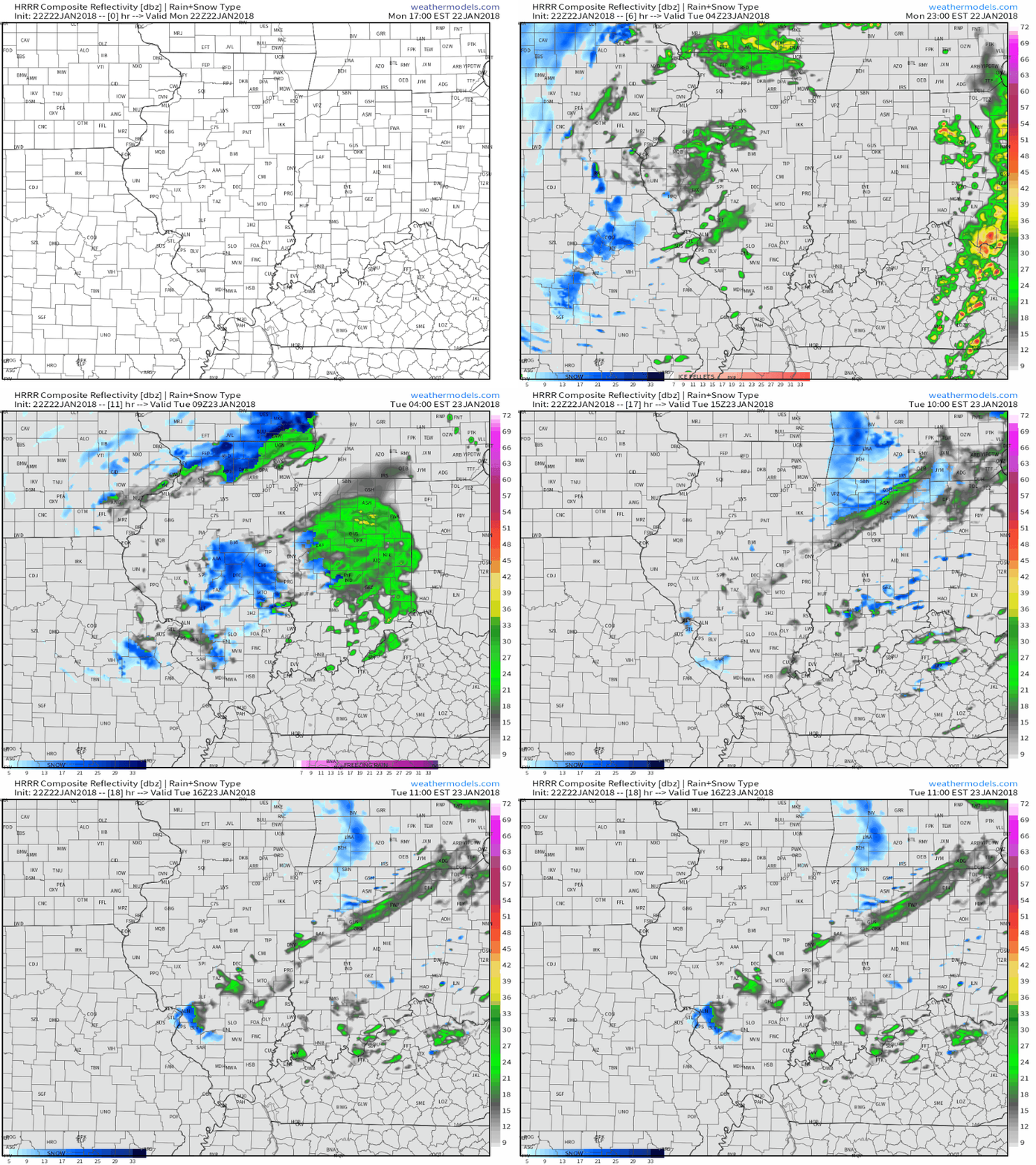
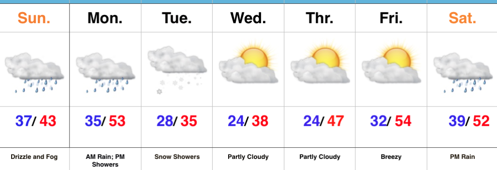
 I. Another round of showers will pivot through central Indiana later this evening ahead of a cold front. Once the cold front sweeps through the state, temperatures will fall during the overnight and grow cold enough to allow precipitation to transition to wet snow showers Tuesday as upper level energy rotates through the Ohio Valley.
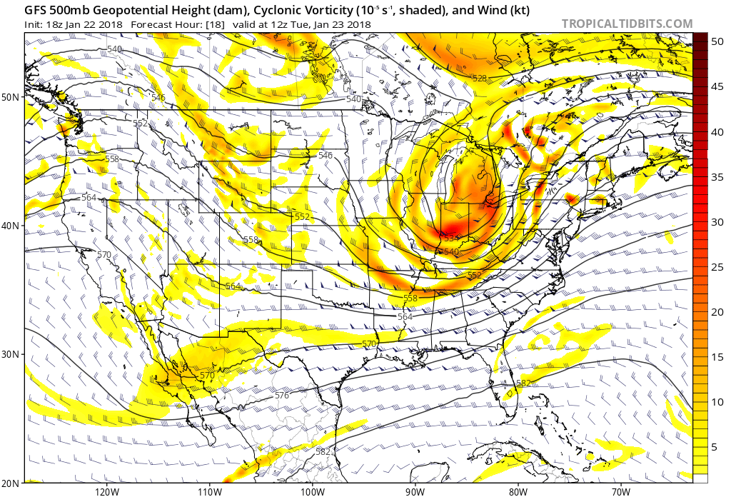 II. High pressure will settle overhead through midweek and while we’ll “chill” to near seasonal levels Wednesday, the rebound will begin Thursday and we’ll climb into the 50s for highs Friday, complete with an increasingly gusty southwest breeze.
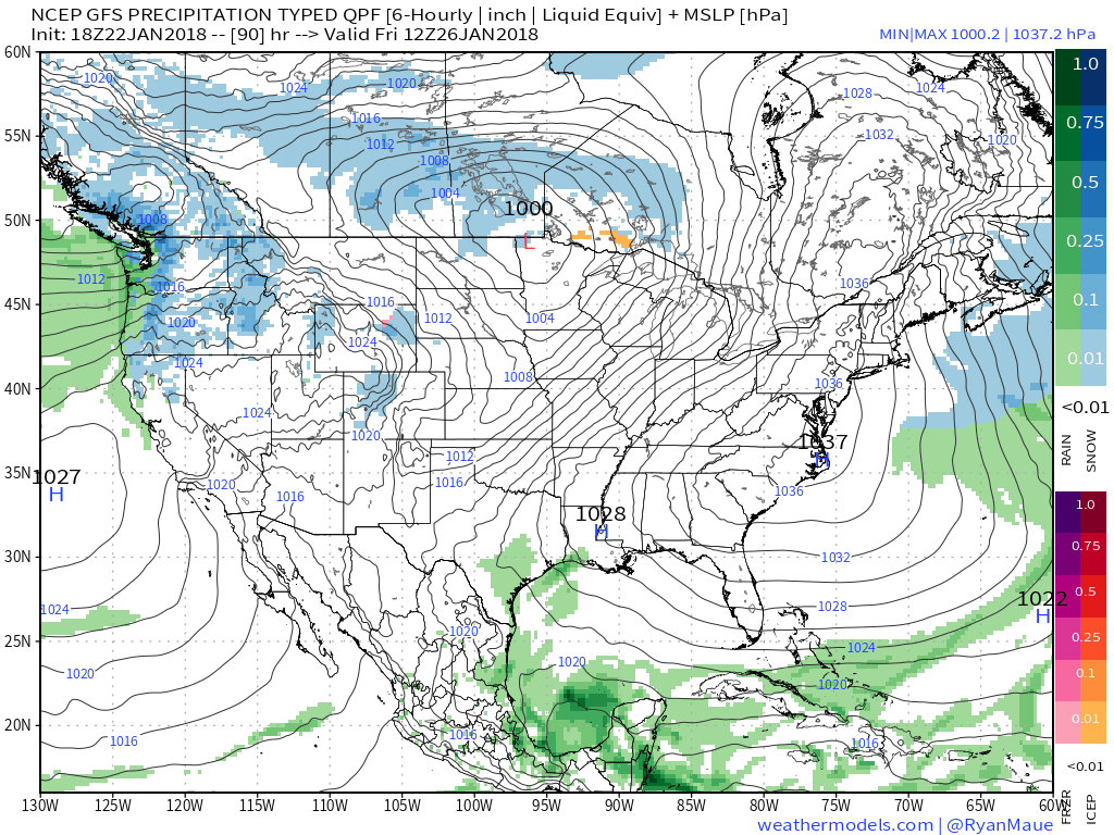 III. Our next storm system will approach late Friday night into Saturday with rain and gusty winds. Models differ on rainfall amounts and we’ll split the difference for now (in general we forecast between 0.25″ to 0.50″, but we’ll keep a close eye on data over the next few days).
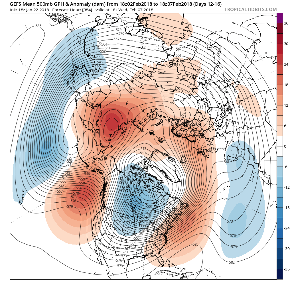
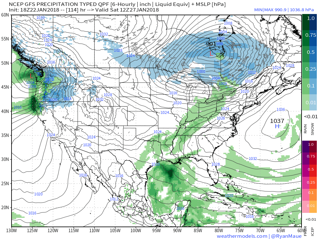 IV. We’ll turn cooler for the second half of the weekend, but the overall pattern is a transient one into next week and overall milder than average. That said, things will begin to change in big time fashion as we rumble into February. Winter is a long ways from being over…

 Areas of fog and drizzle will continue this evening before a stronger southwesterly air flow pushes the low clouds and fog north during the overnight. As a cold front draws closer, steadier rains and perhaps even a clap of thunder (especially down state) will arrive Monday morning. Temperatures will remain nearly steady or even rise overnight into the lower 50s.
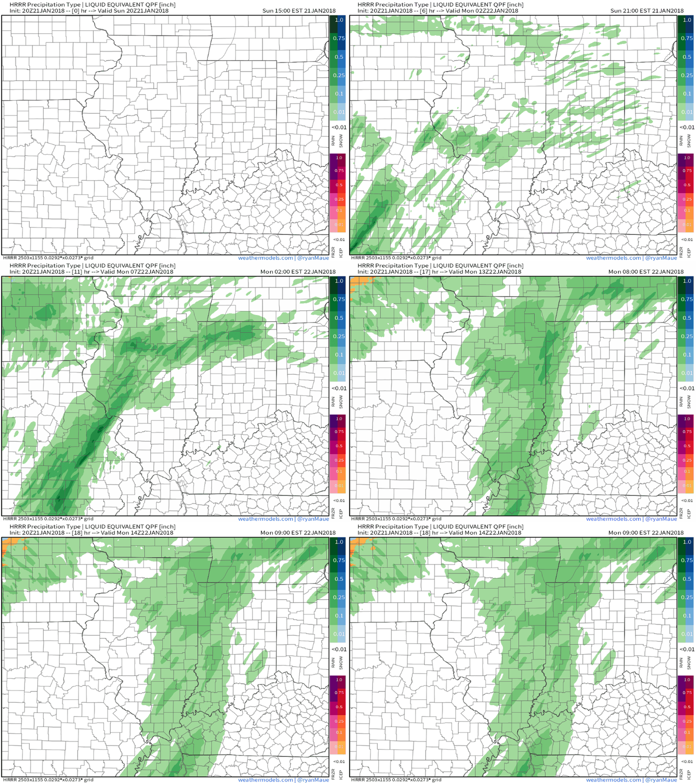 The frontal passage, itself, will take place Monday evening and may feature a couple of gusty showers, especially across western and central portions of the state.
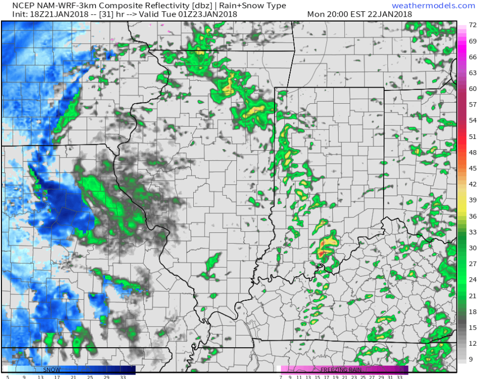 Temperatures will grow colder Monday night into Tuesday morning and precipitation will end as snow showers Tuesday.
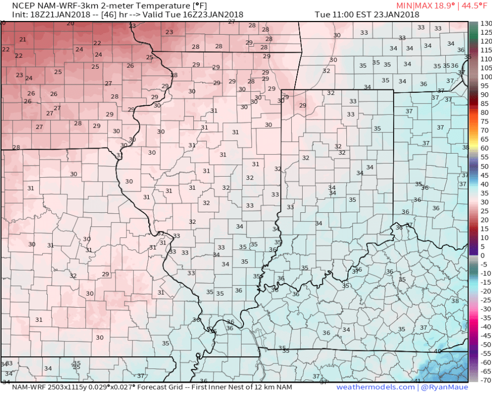
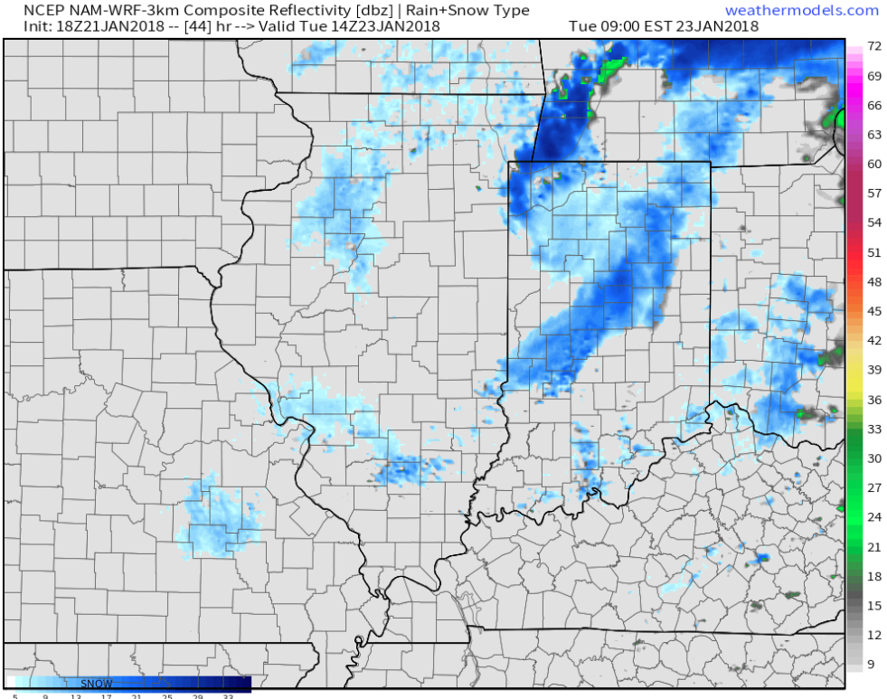 High pressure will build in through midweek and provide dry conditions with increasing sunshine. The midweek stretch will begin seasonable before warming ahead of our next storm system.
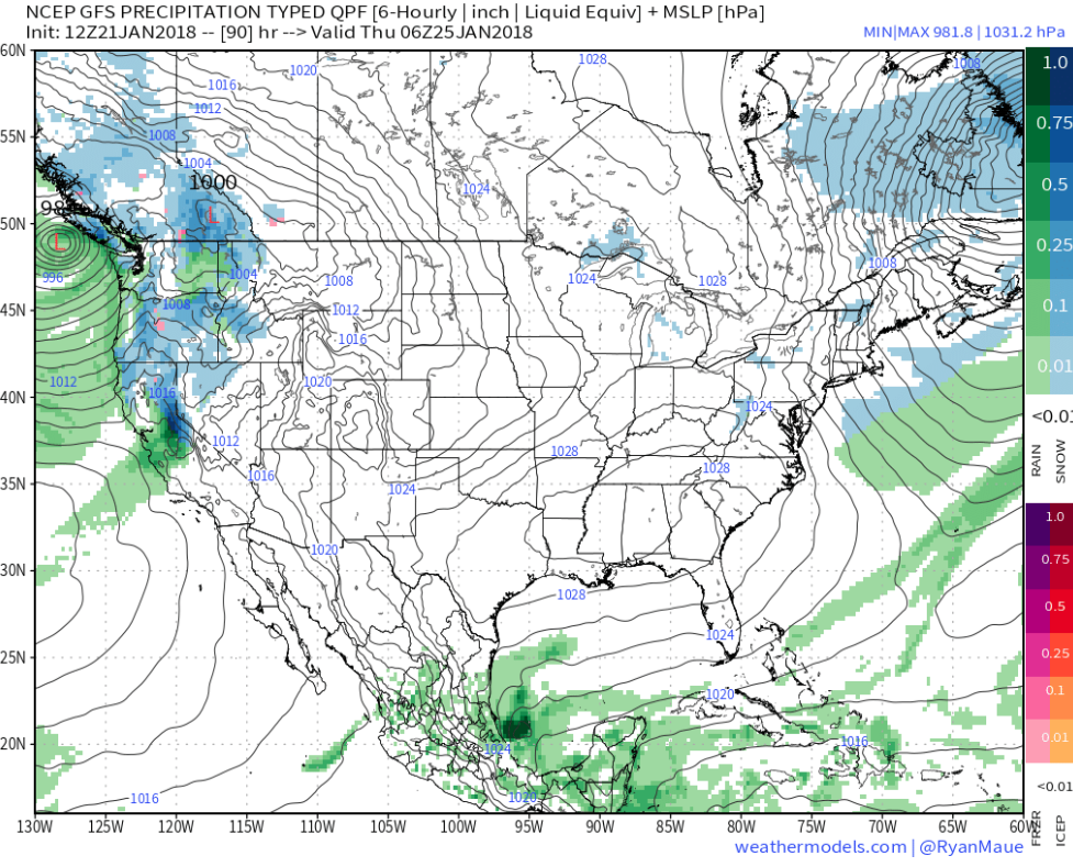 That next storm system will deliver rain as early as Friday evening into Saturday. We’ll note an increasingly gusty southwesterly breeze as we wrap up the work week, along with increasing cloudiness.
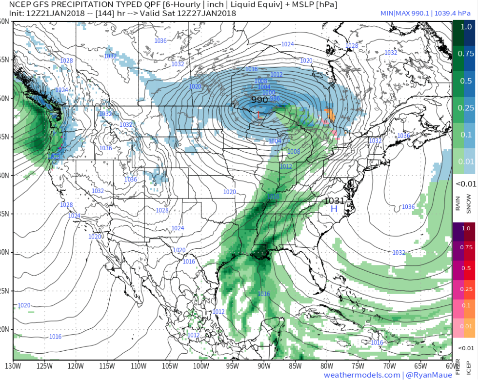
 Highlights:
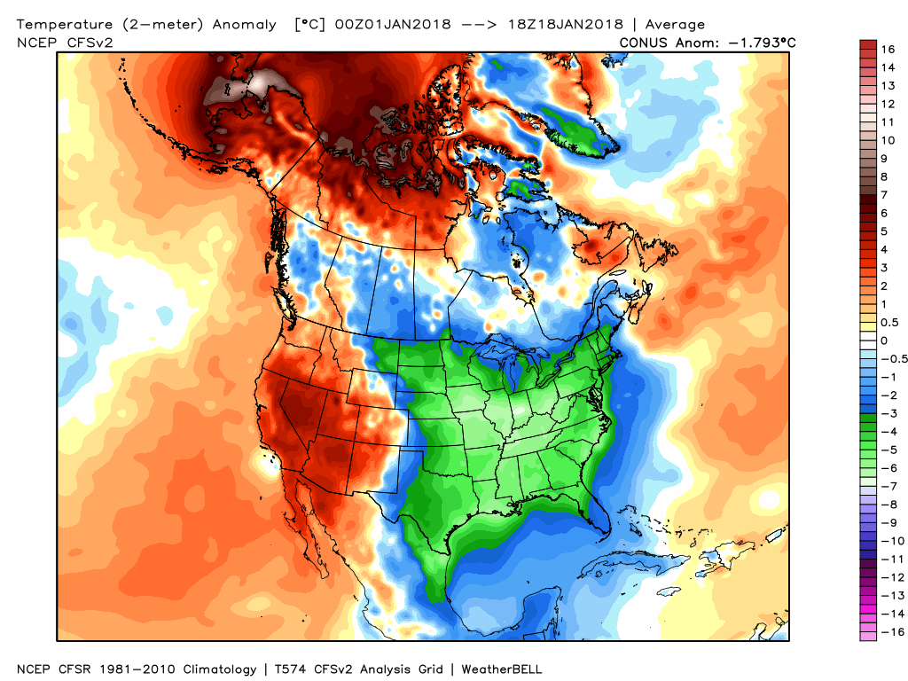
 However, big changes begin to take place this weekend and will remain intact for the majority of the next couple weeks. The mean trough position will back into the west while ridging takes hold across the east. This will feature temperatures that will push to above average values and lead to an active and moist southwesterly flow.
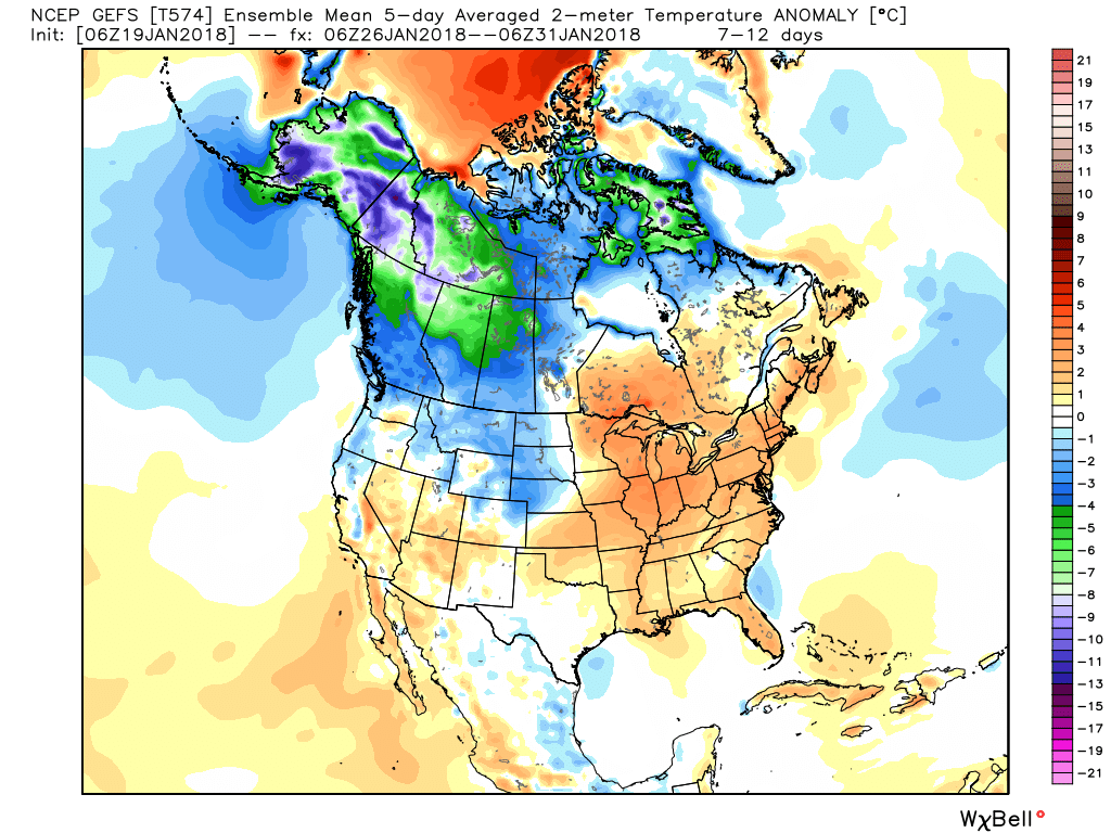
 Over the upcoming (10) days, temperatures may reach 50°, or greater, on 3 to 4 of those days. Compared to how frigid we’ve been (already had 7 mornings this month with sub-zero lows), this will feel like a heat wave.
 Highlights:
 Eight mornings so far this winter have plunged below zero. We’ll see if we can add another to that list this morning (IND is officially at 0° as we write this).
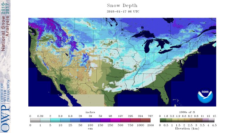 If you’re sick and tired of the cold, wintry conditions relief is on the way. We’ll turn “less cold” through late-week and above normal over the weekend (around 40° Saturday and into the upper 40s Sunday).
 A storm system will cut into the ridge Sunday with showers (image 1) followed by “backlash” snow showers and gusty winds Monday (image 2).
 Thereafter, models see another storm that will approach the region late next week. Since cold air won’t be readily available, it’ll take the perfect track to get impactful wintry conditions from this next event. We’ll monitor things closely next week. With this near Day 10, models will continue to struggle with timing, track, and intensity over the next few days.
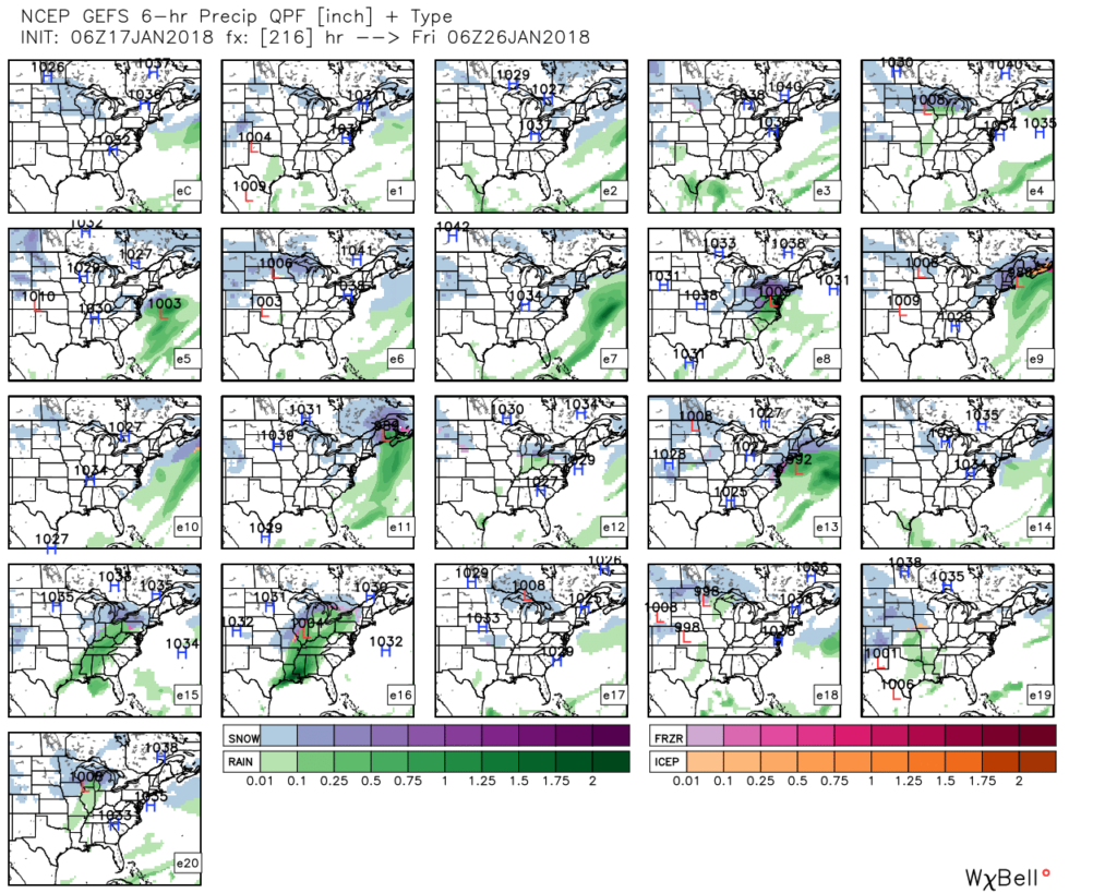 As a whole, the second half of January should run milder than average. However, as we all know, that doesn’t mean we won’t have wintry challenges to deal with. The upcoming (10) days illustrates that nicely. Looking ahead, we note the MJO is forecast to rumble through the warmer phases (especially if you’re reading this from the eastern regions of the country- where we expect warmth to be most anomalous into early February).
 Other teleconnections also support a relaxation of the cold, and warmer times, overall, with the exception of the Arctic Oscillation which remains negative through the period.
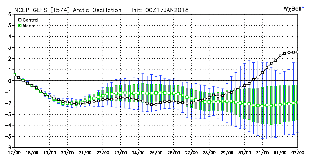 It should be noted that the longer range data and overall trends, supported by our analogs, suggest winter roars back with authority as we get into February. In fact, winter might not be so quick to leave this year either. Data paints a cold, wintry open to meteorological spring this year, but we’re getting way ahead of ourselves. It is only mid-January, after all. 🙂