A cold front will sink south into the Ohio Valley Tuesday afternoon before stalling out through the remainder of the work week and into the weekend.
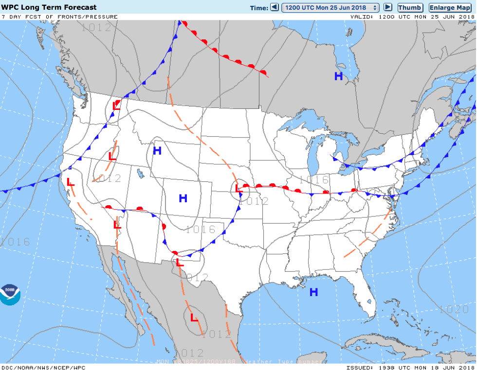
Unsettled weather returns as a frontal boundary stalls out across the region into the upcoming weekend.
Rain and storm chances will increase in overall coverage and intensity as we move into Tuesday- particularly during the afternoon hours. With precipitable water values exceeding 2″ at times, locally heavy downpours can be expected.
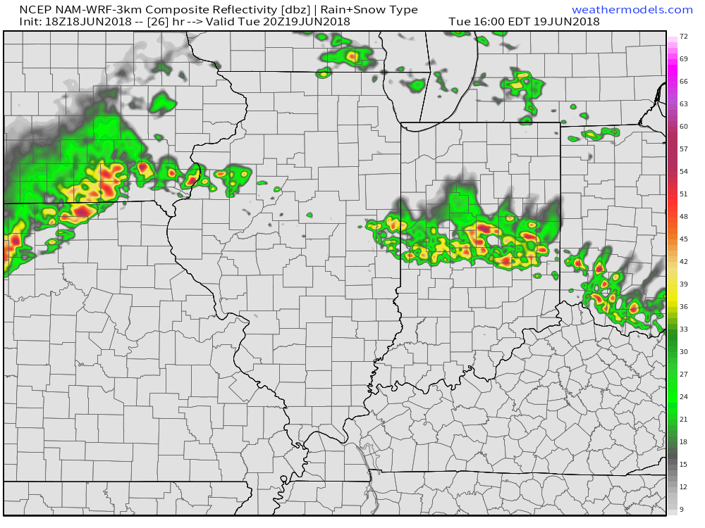 Despite cooler (still mighty humid) temperatures arriving, the overall pattern won’t change significantly into late week and this weekend. With the frontal boundary draped across the Ohio Valley, periods of showers and thunderstorms will remain in the forecast. At times, disturbances will track along the boundary and lead to increased coverage of storms. Perhaps Thursday and Friday will serve up the greatest coverage of thunderstorms as a surface wave moves out of the central Plains into the Great Lakes.
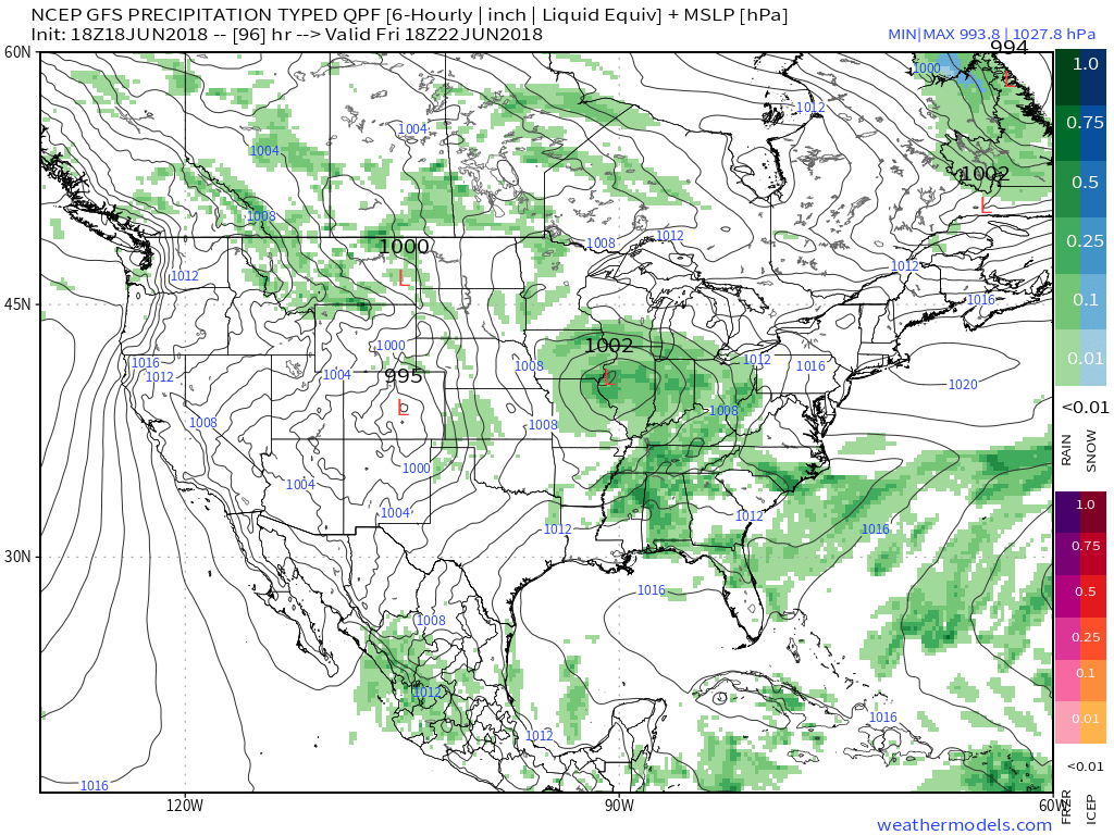 The combination of a juicy air mass and a stationary boundary draped overhead spells a flash flood risk. The lack of any sort of overall steering current suggests the potential of thunderstorms that may train over the same communities at times. As mentioned earlier, precipitable water values (PWATS) will approach and exceed 2″ and this will support torrential downpours at times.
 Officially, we think the upcoming 7-day period will deal out widespread 2″ to 3″ rainfall totals across central Indiana, but there will be locally heavier amounts where thunderstorms train.
After a dry few days with exceptional heat, the unsettled and cooler pattern, overall, will be welcomed with open arms!

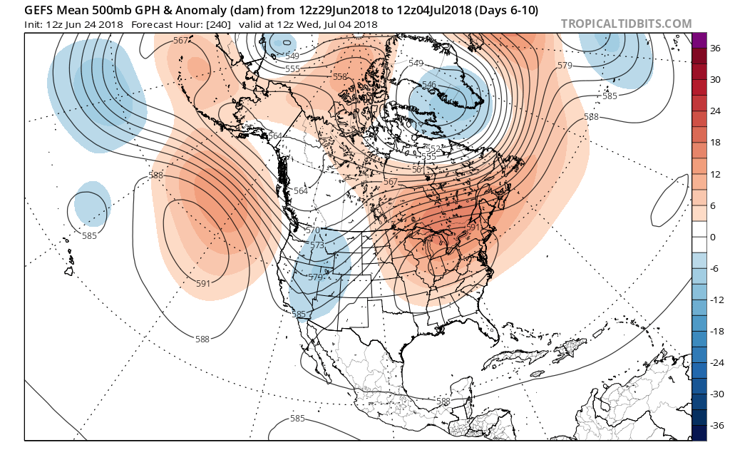 With the hot dome centered over the Ohio Valley, it’ll really help to limit shower and thunderstorm chances. That’s not to say isolated coverage of cooling thunderstorms won’t occur on occasion during the afternoon and evening, but widespread rain of significance won’t be around during the period. Thankfully, the recent wet pattern and additional storm complexes coming in Tuesday into Wednesday have and will help surface moisture levels. Had we not seen the recent wet shift over the past couple weeks, you could easily tack on an additional 3° to 5°…
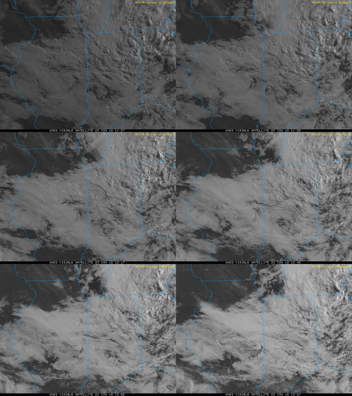 Sunshine will increase for the second half of the weekend and highs will respond- mid 80s after a refreshing start Sunday morning.
 While it’ll certainly turn more humid through midweek, the rain and storms will keep temperatures at seasonable levels. All of that changes once to Thursday and Friday as a building ridge of high pressure expands across the Ohio Valley.
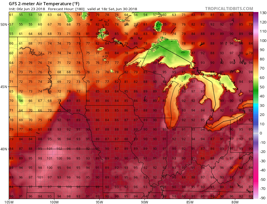
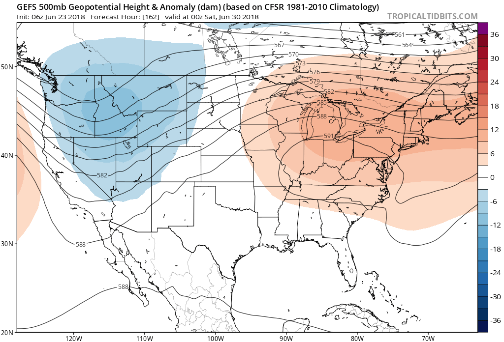 This will limit rain chances and potentially offer up the hottest air of the summer. We expect 5-6 days of low-mid 90s for highs and oppressive overnight lows in the lower to middle 70s.
 Thankfully, the hot dome will retrograde west and lead to “less hot” and increasingly stormy conditions after the first week of July. An active northwest flow pattern will take hold and provide an active time of things during this period.
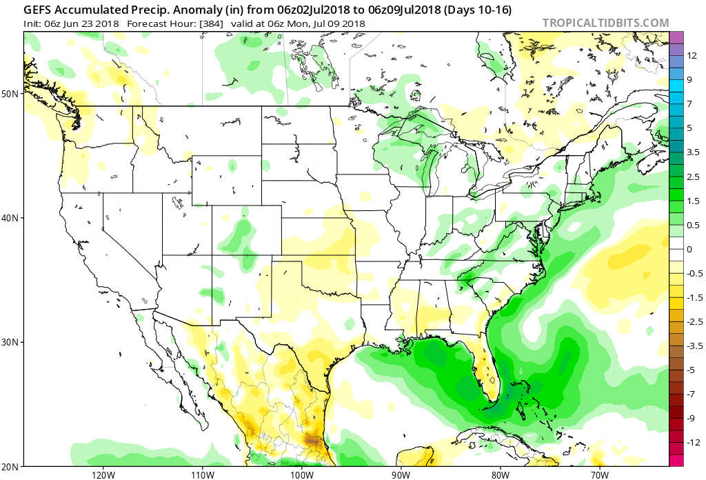
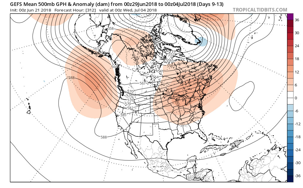
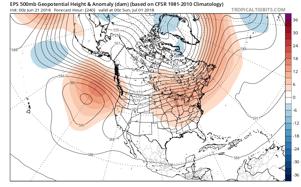 The end result would be anomalous heat and a drier pattern, as a whole, as we transition through the early stages of July. Heat to the magnitude of what we experienced last weekend isn’t off the table with such a similar pattern.
 Looking ahead, thankfully, one of our more trusted longer range computer models (JMA Weeklies), shows the pattern relaxing as we move into mid-July. The model shows the heat backing west and a more active northwest flow (wetter pattern) returning here…

 Despite cooler (still mighty humid) temperatures arriving, the overall pattern won’t change significantly into late week and this weekend. With the frontal boundary draped across the Ohio Valley, periods of showers and thunderstorms will remain in the forecast. At times, disturbances will track along the boundary and lead to increased coverage of storms. Perhaps Thursday and Friday will serve up the greatest coverage of thunderstorms as a surface wave moves out of the central Plains into the Great Lakes.
 The combination of a juicy air mass and a stationary boundary draped overhead spells a flash flood risk. The lack of any sort of overall steering current suggests the potential of thunderstorms that may train over the same communities at times. As mentioned earlier, precipitable water values (PWATS) will approach and exceed 2″ and this will support torrential downpours at times.
 Officially, we think the upcoming 7-day period will deal out widespread 2″ to 3″ rainfall totals across central Indiana, but there will be locally heavier amounts where thunderstorms train.