Tuesday Morning Rambles: Opportunity For Cross Polar Flow Late Month And Looking Ahead To A Renewed Active Pattern…

Updated 02.06.24 @ 5:27a

We’re pushing 6 days now since our last measurable precipitation and that unusually calm, boring stretch of weather will continue for a couple more days. Despite some low clouds at times, expect our quiet and unseasonably mild weather pattern to continue. A late week frontal passage (FROPA) will pull a true taste of spring north into the Ohio Valley and lower Great Lakes Thursday into Friday. We still don’t anticipate this being a significant precipitation maker for central Indiana.
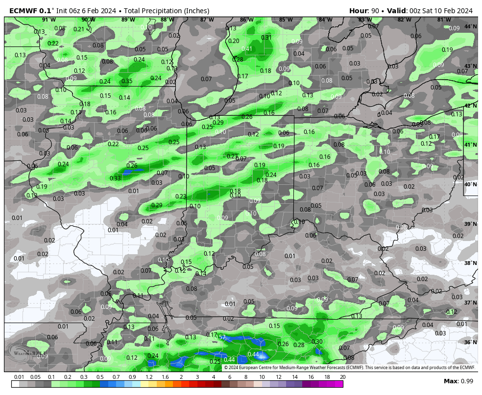
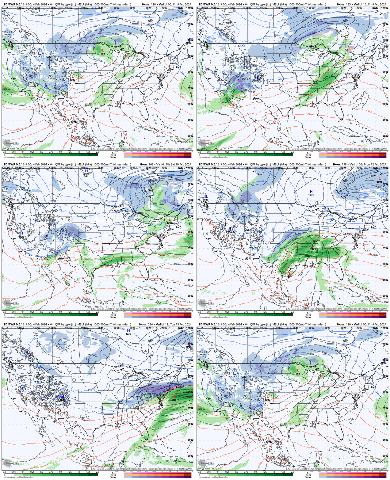
A secondary (much stronger) low pressure system will ride along this pressing boundary and impact areas to our east (and south) with heavier precipitation over the weekend into early next week. The southern Appalachians once again may “cash in” on a hefty snow event.

This more active period comes as a wholesale pattern change gets underway with a significantly colder air mass aimed to overwhelm much of the Lower 48 as we push into next week.
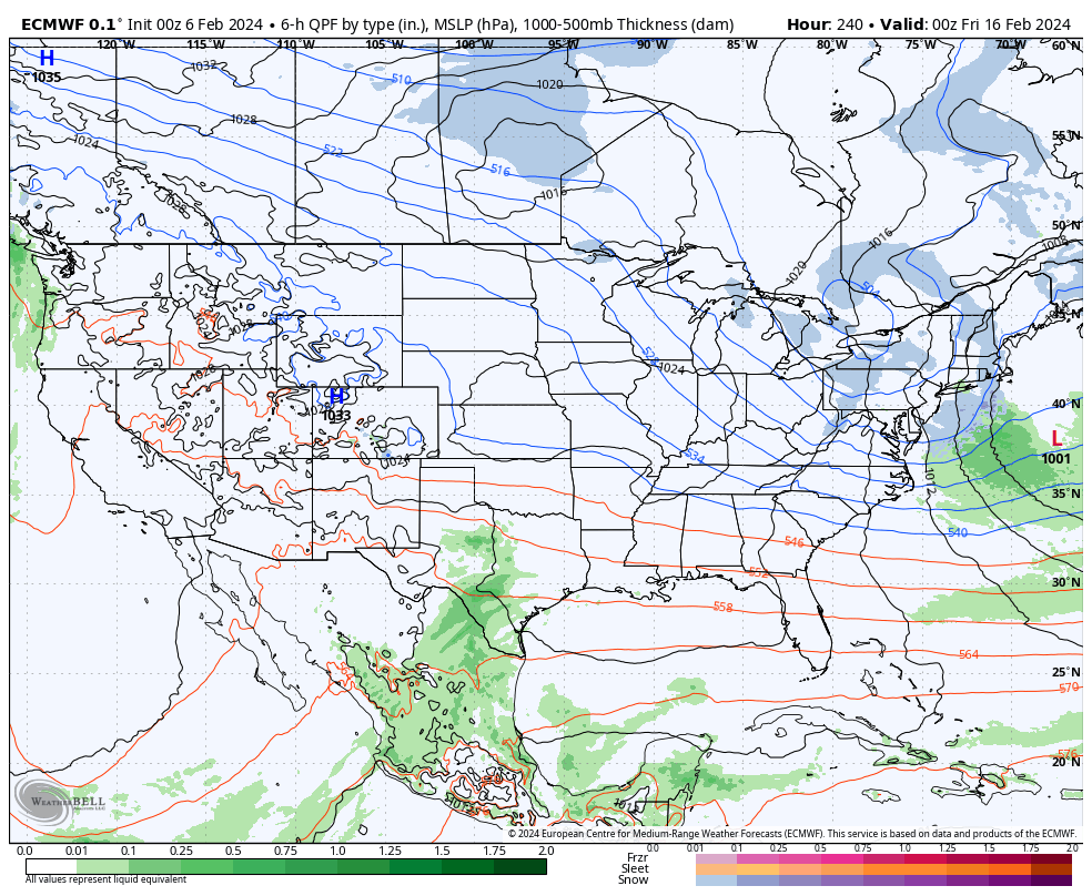

We note longer range models showing cross polar flow setting up late February. To no surprise, the ante is upped for the threat of a period of significant cold prior to month’s end.
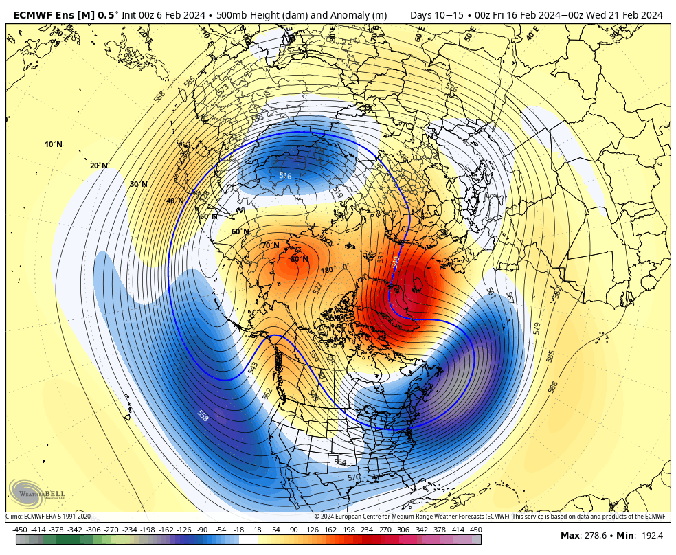
We’ll watch for the threat of new winter weather opportunities to emerge during this colder pattern down the road.
VIDEO: Potential Of Significant Period Of Cold; #Plant24 Pattern Thoughts…

Updated 02.05.24 @ 6p Potential is on the increase for a period of notable cold during late-February. We look into this along with the staying power, and early thoughts on…

You must be logged in to view this content. Click Here to become a member of IndyWX.com for full access.  Already a member of IndyWx.com All-Access?  Log-in here.

VIDEO: Enjoy A Quiet And Mild Week Ahead Of A Significant Pattern Change…

Updated 02.05.24 @ 7:30a This week will be about as quiet and mild as it gets around these parts for early-February. Enjoy, friends. A weak frontal boundary will slip through…

You must be logged in to view this content. Click Here to become a member of IndyWX.com for full access.  Already a member of IndyWx.com All-Access?  Log-in here.

Mild Week Ahead; More Prolonged Cold Pattern On The Table?

Updated 02.04.24 @ 8:55a

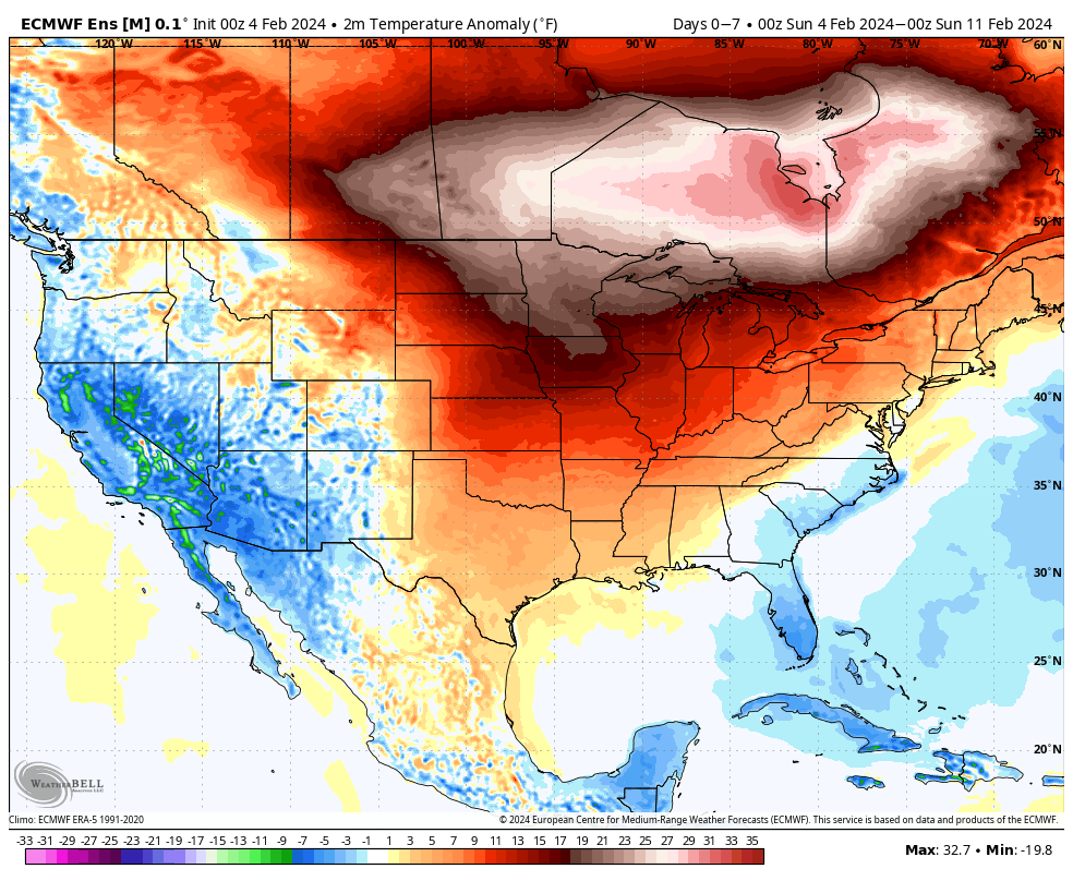
An unseasonably mild and quiet week is on tap. We aren’t forecasting rain to return into the picture until late week and the upcoming Super Bowl weekend. Highs will likely flirt with, if not exceed, the 60° mark Friday ahead of a frontal passage.

An unseasonably mild week is on tap.
Highs will flirt with, if not surpass, the 60° mark Friday.

After Friday’s FROPA, we’ll watch the trailing, more significant piece of energy impact the Ohio Valley next weekend. Obviously, it’s far too early to determine if we’re talking about more rain and/ or snow, but the initial hunch here is that this should be primarily a liquid event, despite the snowy solution on the overnight European model. We’ll watch carefully in the coming days.

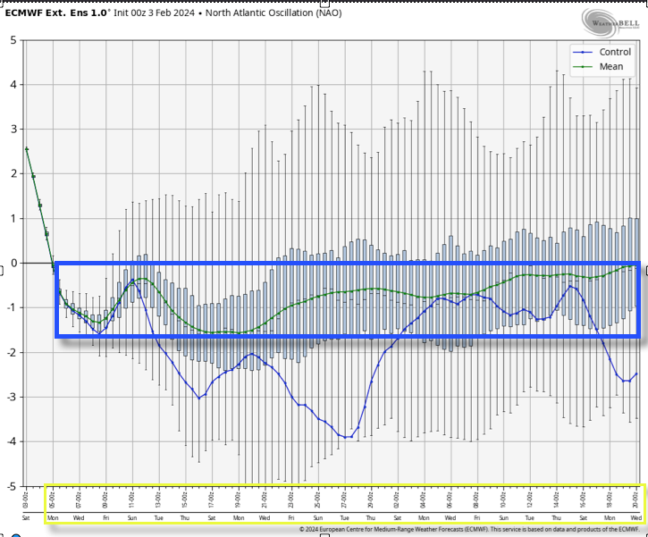
The more active pattern late week and over the weekend is a signal that the pattern is changing. Once again, we believe that we’re heading into more of a prolonged version of what we dealt with in January, thought the jury is still out on the extreme solutions on the table with respect to just how cold (should we get into Phase 8 of the MJO then look out). As it is, the teleconnection suite aligning in a manner that they are is reason enough to be fired up on an all-out return of winter for mid-February. The forecasted strongly negative NAO (North Atlantic Oscillation) provides us with a greater than normal confidence level that this cold pattern will have staying power not only through the remainder of the month, but into the 1st half of March (at least).

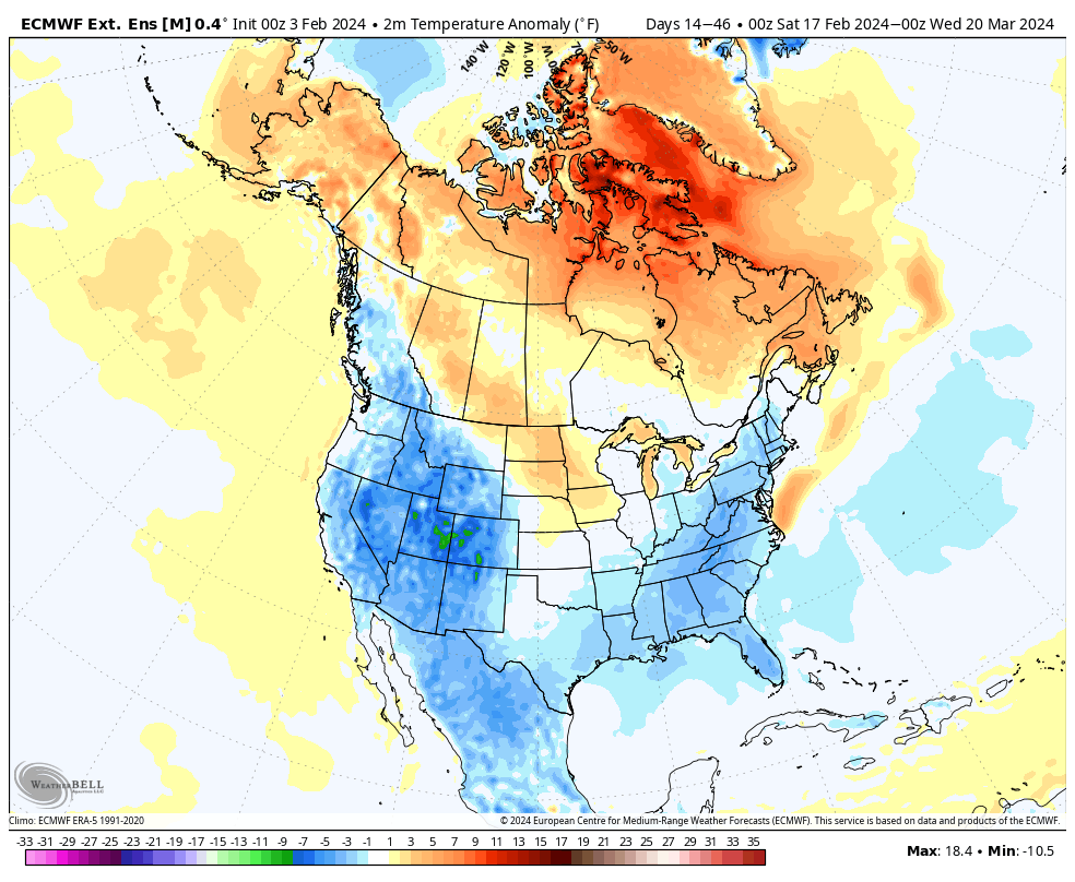
Latest long range modeling highlights the prolonged nature of the cold pattern:

Temperature anomalies Feb. 17 – Mar. 20

Make it a great Sunday, friends!

VIDEO: All Is Quiet (For Now); Initial Spring And Summer Ideas As We Head To La Nina…

Updated 02.03.24 @ 10:12a The calm weather pattern that we’ll enjoy this weekend is giving us time to look ahead to a significant pattern transition to La Nina and the…

You must be logged in to view this content. Click Here to become a member of IndyWX.com for full access.  Already a member of IndyWx.com All-Access?  Log-in here.