You must be logged in to view this content. Click Here to become a member of IndyWX.com for full access. Already a member of IndyWx.com All-Access? Log-in here.
Category: Unseasonably Warm
Permanent link to this article: https://indywx.com/2019/10/12/video-timing-out-storm-systems-in-the-upcoming-week-colder-late-month-trends/
Oct 11
First Strong Cold Front Of The Season…
Our Friday is starting off with heavy rain and embedded thunder across western portions of the state.
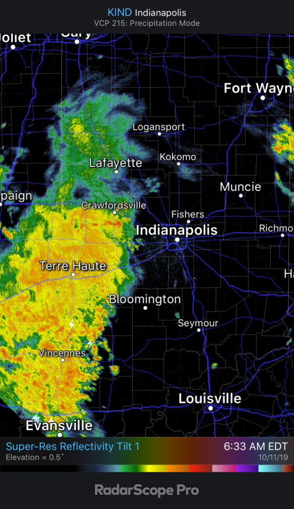
It’ll still be a while before central Indiana gets in on the more concentrated, widespread rain. We think this arrives later this afternoon into the early evening hours. Most can expect to pick up between 0.20” and 0.40” across central parts of the state, but there will be a few locally heavier totals.

Before the rain arrives, a strong southerly wind ahead of the front will send temperatures to around 70°. Meanwhile, note temperatures at the same time already into the 40s across eastern IL.
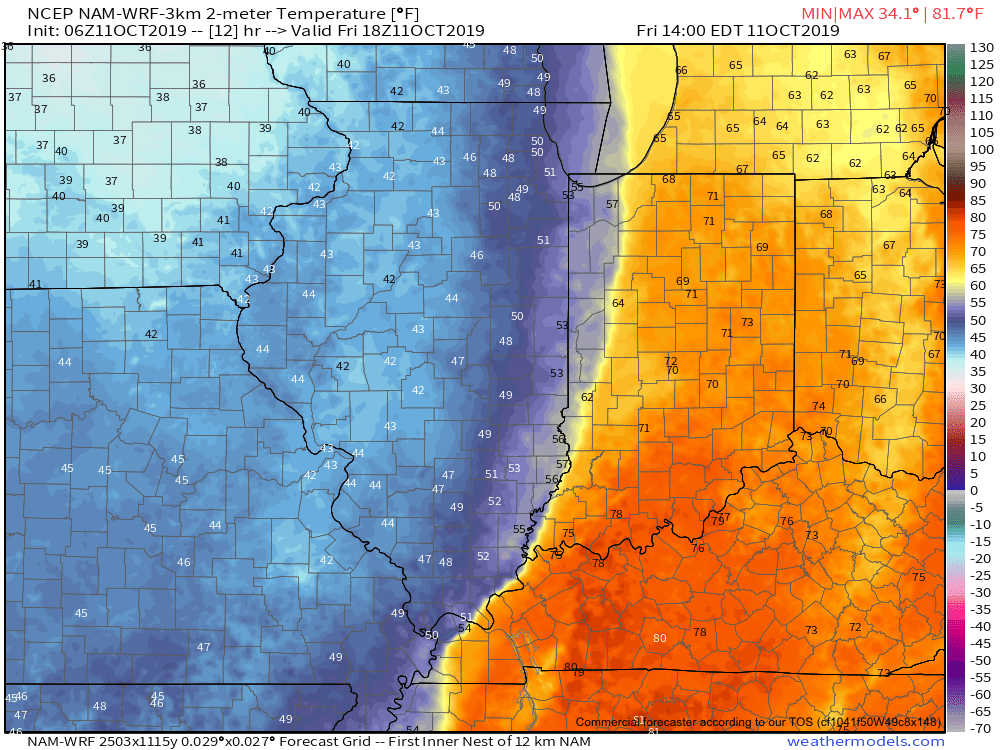
The temperature crash will continue through the evening hours advancing east. By 7p, temperatures in and around Indianapolis and points west will be in the 40s. A gusty wind will result in “feels like” temperatures into the 30s.

The first freeze of the season is expected Saturday morning for many across central Indiana into western and northern portions of the state. We anticipate wind chill values to fall into the middle 20s.
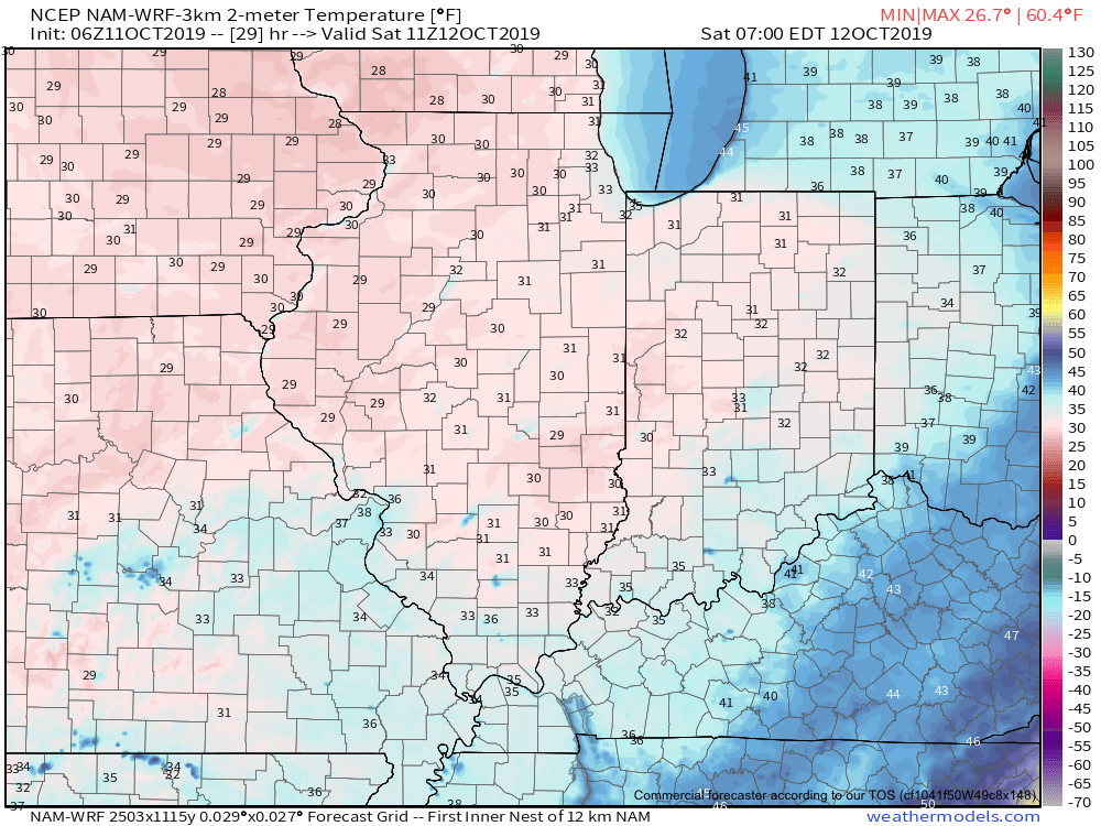
Another reinforcing shot of chilly air is dialed up next week. More on this and other items a bit later…
Permanent link to this article: https://indywx.com/2019/10/11/first-strong-cold-front-of-the-season/
Oct 10
VIDEO: Friday Will Feature Major Weather Changes Across The Region…
You must be logged in to view this content. Click Here to become a member of IndyWX.com for full access. Already a member of IndyWx.com All-Access? Log-in here.
Permanent link to this article: https://indywx.com/2019/10/10/video-friday-will-feature-major-weather-changes-across-the-region/
Oct 10
Cool 6-10 Day Period Ahead, But Then What?
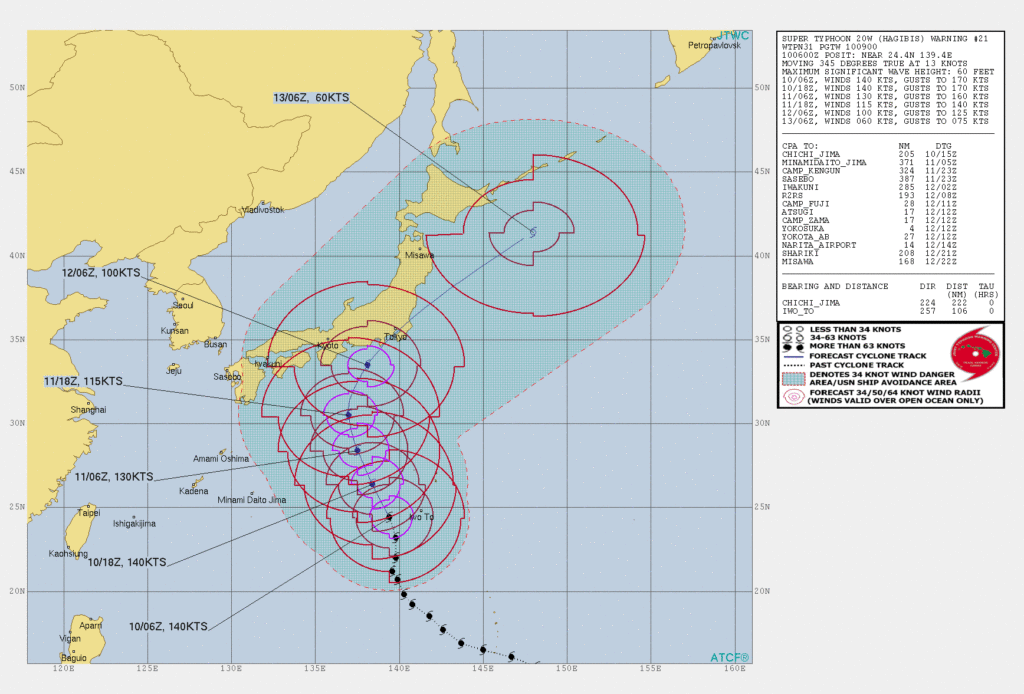
A strong cold front will sweep through the area tomorrow and help usher in the coolest air so far this autumn. This will set the tone, combined with the recurving WPAC typhoon, for a chilly upcoming 6-10 day period, but what lies beyond this period later in the month?
We turn to a couple of our more trusted teleconnections for advice.
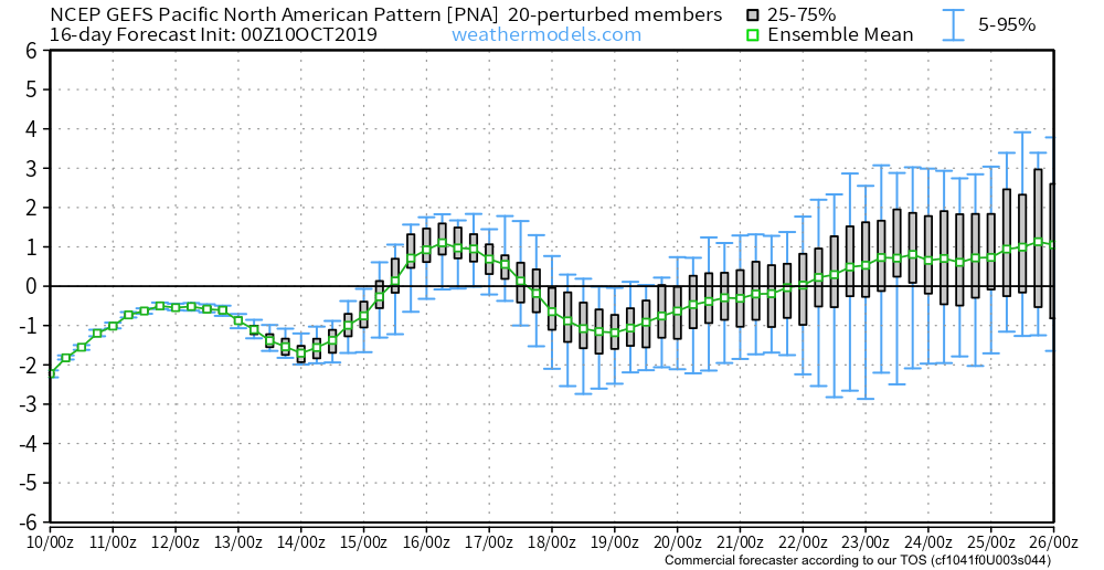
Note the PNA “bobbing” up and down through the medium range period, with more of a negative look around the 20th. This argues for a milder stretch of weather around that time. (Further out, we’ll keep close eyes on the PNA to see if a more consistent positive signal develops as we inch closer to November).
The EPO pops strongly positive mid month which, too, argues for milder times, locally. That said, similar to the PNA above, the EPO is trending towards a scenario that would present colder times as we rumble towards November. We’ll monitor for consistency.

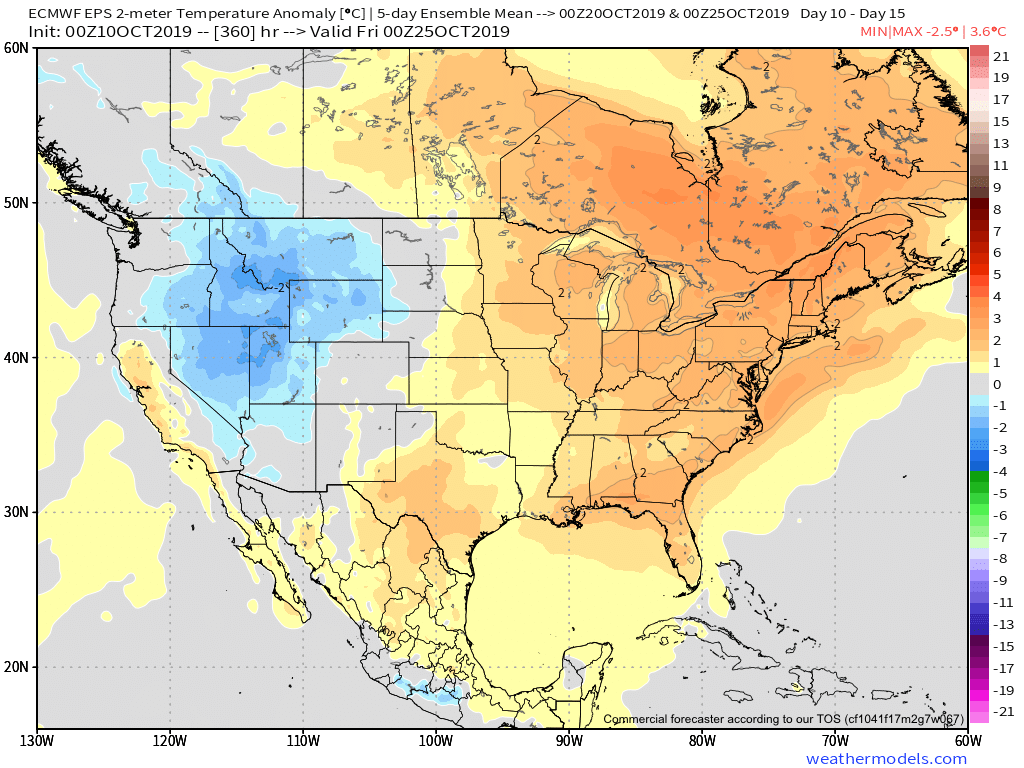
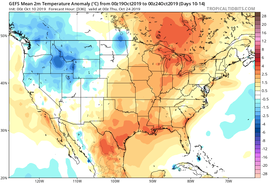
To no surprise, given the two primary teleconnection drivers above (remember these can change as the seasons evolve), we see the pattern set to turn milder just beyond Day 10. Note the strong agreement between the European, Canadian, and GFS ensemble data below.

Permanent link to this article: https://indywx.com/2019/10/10/cool-6-10-day-period-ahead-but-then-what/
Oct 09
VIDEO: Pleasant Weather Continues Through Thursday; Sharp Cold Front Delivers Colder Changes For The Weekend…
You must be logged in to view this content. Click Here to become a member of IndyWX.com for full access. Already a member of IndyWx.com All-Access? Log-in here.
Permanent link to this article: https://indywx.com/2019/10/09/video-pleasant-weather-continues-through-thursday-sharp-cold-front-delivers-colder-changes-for-the-weekend/
Oct 05
Saturday Morning Rambles…
I. Our Saturday will get off to a stunning start. Despite some patchy fog here and there, look for plentiful sunshine and chilly temperatures in the low-mid 40s rising into the low-mid 70s for afternoon highs with increasing clouds.
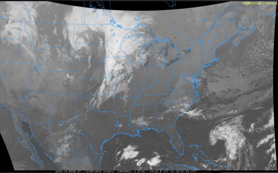
II. Those increasing clouds will deliver showers by tonight across central Indiana and then more concentrated heavier rain downstate Sunday evening into the predawn Monday. Southern Indiana is needing a good soaking in a bad way and this system will at least help things slowly begin to improve…


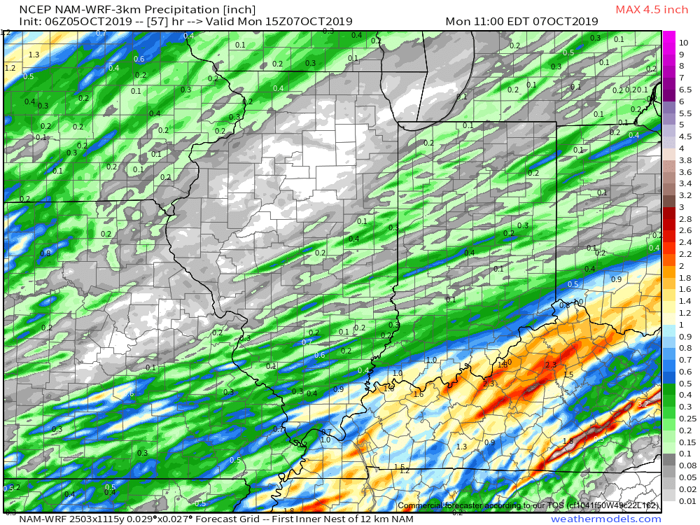
Rainfall totals with this system across central Indiana should accumulate to the tune of 0.20 to 0.40 for most with heavier amounts approaching 1” across the IN-KY border.
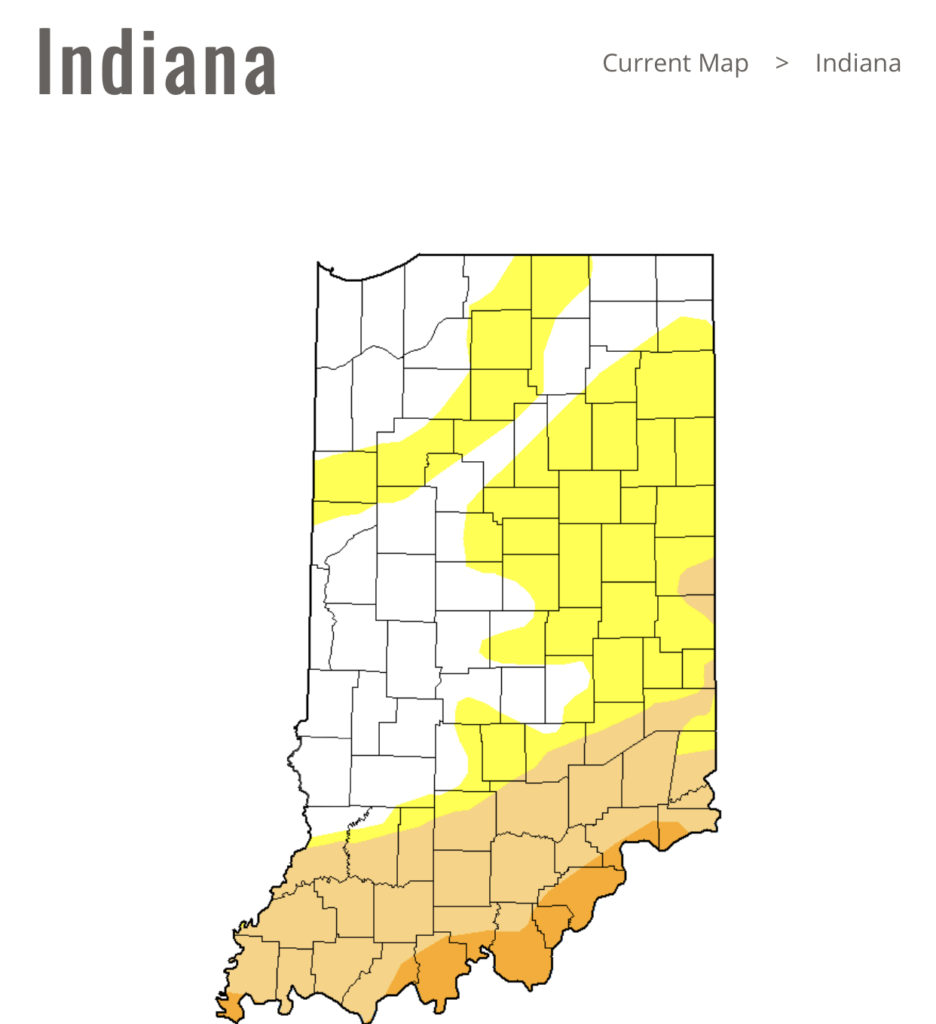
Note this is where things are driest across the state per Thursday’s drought update.
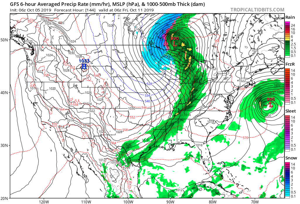
III. Our next storm system will swing through here late in the work week. We’re timing Thursday PM into early Friday for a round of showers and potentially gusty thunderstorms as a cold front pushes through.
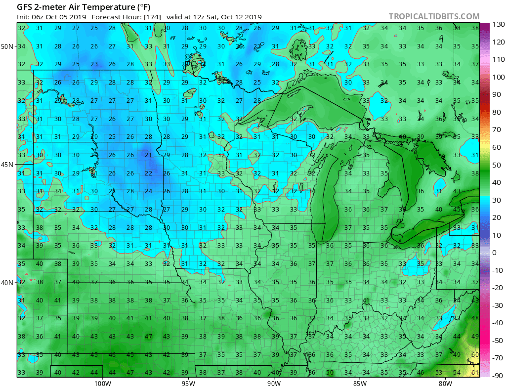
Behind this boundary, the coldest air of the fall so far will blow into town. We’re continuing to think many of the area can expect the first frost of the season next weekend.
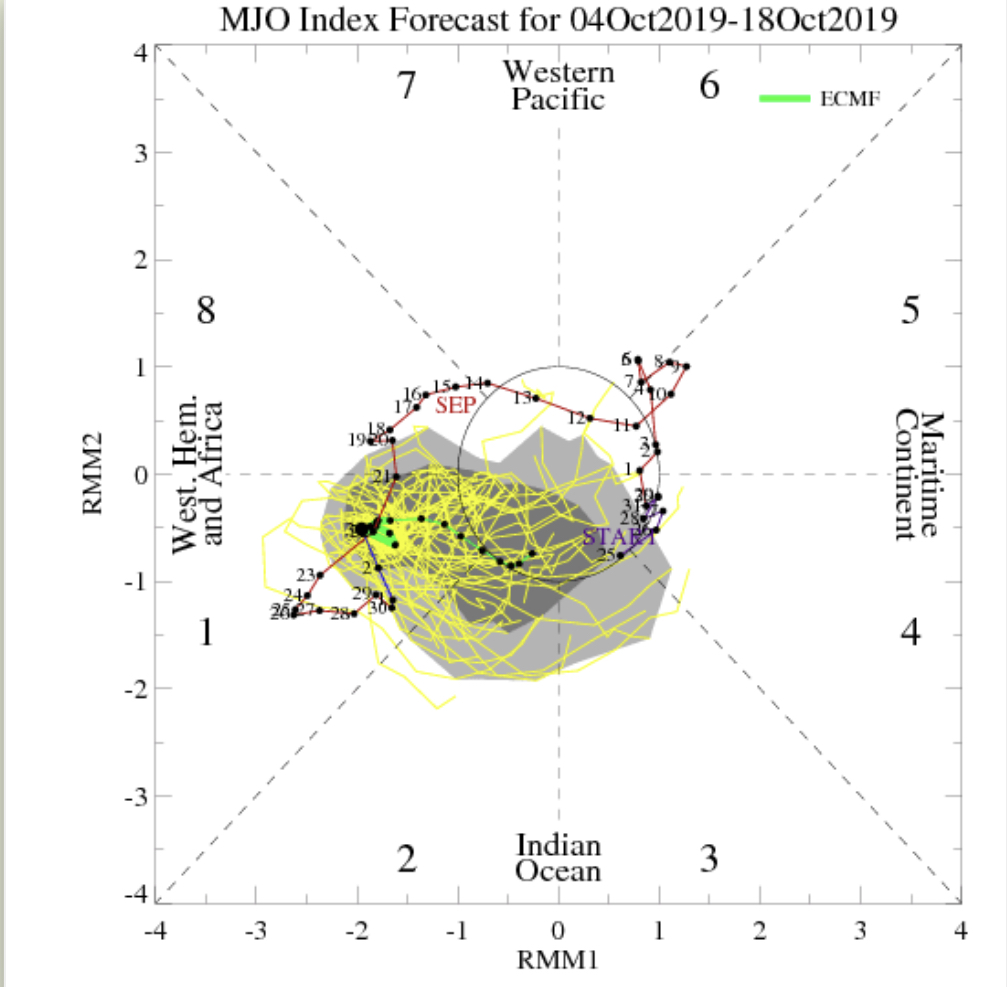
IV. As we look ahead, it’s time to start putting more stock into other tools in the box. Case in point, the MJO is showing signs of less amplitude over the upcoming couple weeks followed by a strongly positive PNA. This supports colder signals in the period. We’ll dig in further in the days ahead.

Permanent link to this article: https://indywx.com/2019/10/05/saturday-morning-rambles-10/
Oct 04
VIDEO: Welcoming An Autumn Like Feel; Fairly Active Pattern In The Week Ahead…
You must be logged in to view this content. Click Here to become a member of IndyWX.com for full access. Already a member of IndyWx.com All-Access? Log-in here.
Permanent link to this article: https://indywx.com/2019/10/04/video-welcoming-an-autumn-like-feel-fairly-active-pattern-in-the-week-ahead/
Oct 03
As #Harvest19 Kicks Off, Timing Out Storms Into Mid-October…
Today is the day of a significant and more permanent transition from our “bonus” summer to a cooler journey ahead.
The ‘mean’ upper air pattern will feature a trough over the eastern portion of the country and associated temperature pattern more like we’d expect for early to mid October.


With the cooler air, we’ll also notice a more active pattern, as well. A model blend paints the potential of 0.50″ to 1.50″ of rain over the upcoming 10-day stretch. More specifically, we’re targeting dates for frontal passages on the following:
I. Thursday, 10.3
II. Sunday, 10.6
III. Friday, 10.11
The Sunday frontal passage and late Week 2 cold front will offer up better chances of more widespread precipitation.

Permanent link to this article: https://indywx.com/2019/10/03/as-harvest19-kicks-off-timing-out-storms-into-mid-october/
Oct 02
VIDEO: Winds Of Change On The Doorstep…
You must be logged in to view this content. Click Here to become a member of IndyWX.com for full access. Already a member of IndyWx.com All-Access? Log-in here.
Permanent link to this article: https://indywx.com/2019/10/02/video-winds-of-change-on-the-doorstep/
Sep 30
Evening VIDEO: Much Cooler Changes On The Horizon; Early Week 2 Storm?
You must be logged in to view this content. Click Here to become a member of IndyWX.com for full access. Already a member of IndyWx.com All-Access? Log-in here.
Permanent link to this article: https://indywx.com/2019/09/30/evening-video-much-cooler-changes-on-the-horizon-early-week-2-storm/
