You must be logged in to view this content. Click Here to become a member of IndyWX.com for full access. Already a member of IndyWx.com All-Access? Log-in here.
Category: Unseasonably Warm
Permanent link to this article: https://indywx.com/2019/12/01/video-rain-mixes-with-snow-later-today/
Nov 30
VIDEO: December Outlook…
You must be logged in to view this content. Click Here to become a member of IndyWX.com for full access. Already a member of IndyWx.com All-Access? Log-in here.
Permanent link to this article: https://indywx.com/2019/11/30/video-december-outlook/
Nov 27
VIDEO: Winds Slowly Diminish Tonight; Unsettled Weather Pattern Continues…
You must be logged in to view this content. Click Here to become a member of IndyWX.com for full access. Already a member of IndyWx.com All-Access? Log-in here.
Permanent link to this article: https://indywx.com/2019/11/27/video-winds-slowly-diminish-tonight-unsettled-weather-pattern-continues/
Nov 19
VIDEO: Updated Short Term And Longer Range Thoughts Into Early December…
You must be logged in to view this content. Click Here to become a member of IndyWX.com for full access. Already a member of IndyWx.com All-Access? Log-in here.
Permanent link to this article: https://indywx.com/2019/11/19/video-updated-short-term-and-longer-range-thoughts-into-early-december/
Nov 18
VIDEO: Gloomy Open To The Work Week…
You must be logged in to view this content. Click Here to become a member of IndyWX.com for full access. Already a member of IndyWx.com All-Access? Log-in here.
Permanent link to this article: https://indywx.com/2019/11/18/video-gloomy-open-to-the-work-week/
Nov 16
Leader – Follower…
Our weekend weather will remain relatively quiet. Sure, we’ll have a weak system pass through the state Sunday afternoon. While this could deal out a light shower (potentially mixed with a little sleet), significant accumulation isn’t anticipated. This will allow us to look ahead to potential “more important” items down the road.
Initially, the flow will back to the southwest midweek, allowing a briefly milder regime to blow into the Ohio Valley for about 24-48 hours. An area of low pressure will track from the lee of the Colorado Rockies Tuesday, across the Plains and into the Great Lakes Thursday into Friday. This will result in a period of rain and gusty winds late Wednesday into Thursday. We’re not expecting particularly hefty rain with this system, with most central Indiana rain gauges around the 0.25″ to 0.50″ range.
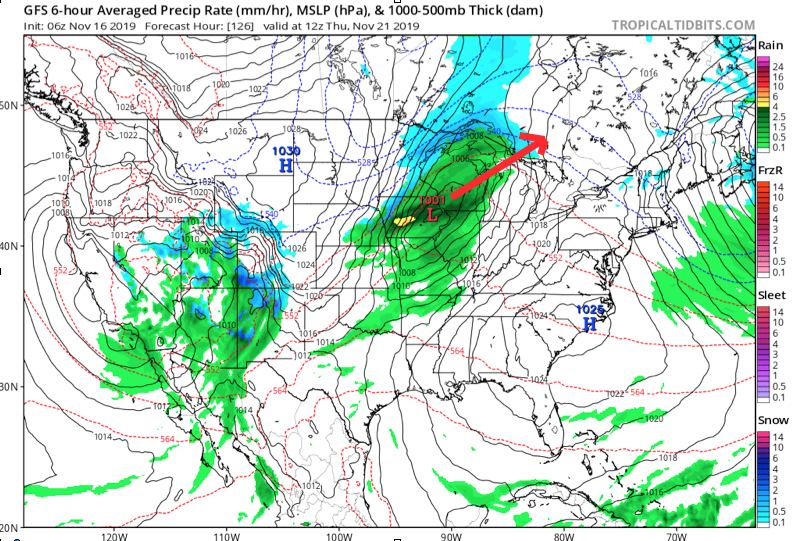
Once the low lifts into the Lakes, it’ll help sling a cold front through the Ohio Valley Thursday night. This will result in a much colder close to the work week.
As colder air is seeping into the region, additional upper level energy will be ejecting out of the Four Corners region Friday evening. Eventually, this will result in a surface wave developing over the mid-South region Friday night into Saturday morning.
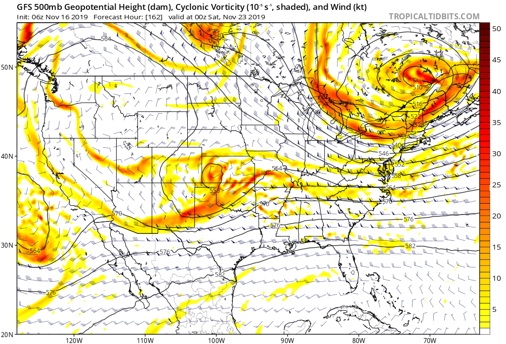
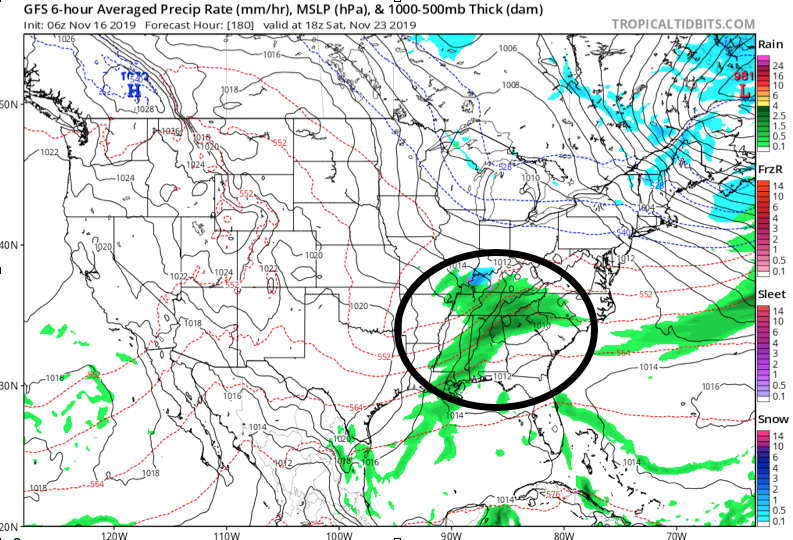
While the majority of operational data currently shows this wave remaining suppressed, history tells us we need to pay special attention to model trends over the next several days. All too often, seemingly “harmless” systems in the medium term that appear to scoot off to our south will trend north. The upper air pattern suggests this may be the case this go around as well.
As it is, some of the individual ensemble members are already jumping on this. Hunch here is that as we go through the upcoming week, a legitimate interior winter threat will be present for next weekend…

Permanent link to this article: https://indywx.com/2019/11/16/leader-follower/
Oct 21
VIDEO: Sifting Through The Noise As We Close October And Open November…
You must be logged in to view this content. Click Here to become a member of IndyWX.com for full access. Already a member of IndyWx.com All-Access? Log-in here.
Permanent link to this article: https://indywx.com/2019/10/21/video-sifting-through-the-noise-as-we-close-october-and-open-november/
Oct 15
Evening Video: A Tale Of Extended Summer That Gives Way To Sudden Winter…
You must be logged in to view this content. Click Here to become a member of IndyWX.com for full access. Already a member of IndyWx.com All-Access? Log-in here.
Permanent link to this article: https://indywx.com/2019/10/15/evening-video-a-tale-of-extended-summer-that-gives-way-to-sudden-winter/
Oct 15
VIDEO: Rain Develops By Evening; Potential Of Pre-Halloween Snow?
You must be logged in to view this content. Click Here to become a member of IndyWX.com for full access. Already a member of IndyWx.com All-Access? Log-in here.
Permanent link to this article: https://indywx.com/2019/10/15/video-rain-develops-by-evening-potential-of-pre-halloween-snow/
Oct 14
Taste Of Winter Before Month’s End?
A cold front will whip through central Indiana Tuesday evening. Showers will accompany the frontal passage, but we still don’t anticipate much in the way of significant moisture across central Indiana. Heavier rainfall totals in excess of 0.50″ will likely fall across drought-stricken areas downstate.
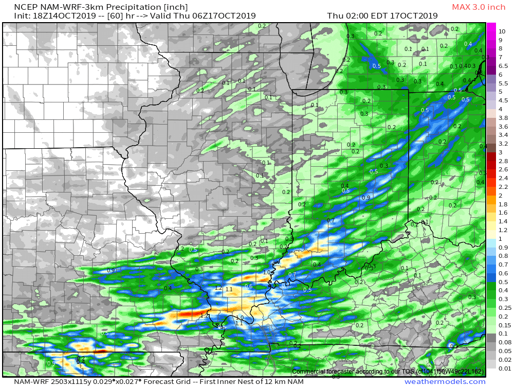
Colder and blustery conditions will be with us Wednesday and Thursday, including wind chills in the upper 20s at times Wednesday morning.
A moderating trend will get underway this weekend as a gusty southwesterly breeze takes hold on the backside of retreating high pressure. This will lead to a couple of days of above normal warmth early next week (not quite done with the 70s just yet).
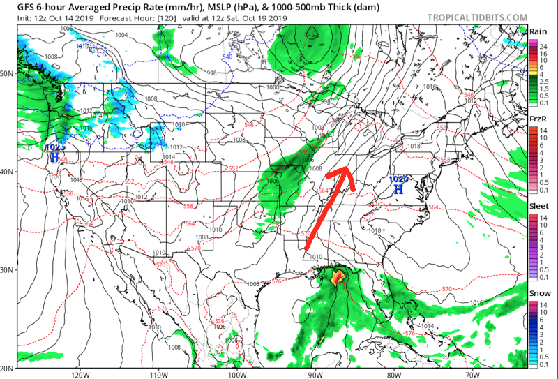
We’ll continue to monitor for a wet and stormy time of things Monday PM into Tuesday. The severe threat is to be determined and will require fine tuning as we push ahead over the next several days.
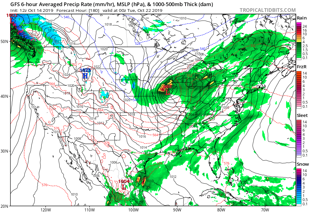
Once this area of low pressure and associated cold front blow through, colder air will arrive on gusty northwest winds by the middle to latter portions of next week.
This will set the tone for a rather significant colder shift as we get set to put a bow on the month of October. A secondary and more significant trough will descend into the region just after Day 10. With a developing negative EPO, positive PNA, and MJO heading for Phase 2, it’s time to start “beating the cold drum” a bit harder. In fact, latest 500mb charts would indicate there’s the potential of at least a little wintry mischief present to go along with the colder shift.

This should at least kick up the lake effect snow guns for the first time this season, and we’ll have to monitor things for the possibility of “backside” energy digging south at the base of the trough that would present the possibility of a little early season snow across parts of the Ohio Valley region as Halloween week nears…
Times, they are, indeed, ‘a changing…
Permanent link to this article: https://indywx.com/2019/10/14/taste-of-winter-before-months-end/
