Busy, Cold Winter Pattern…
 Highlights:
- Embedded Tuesday squalls!
- Fast moving NW flow!
- Bigger winter threat to close the week and again late weekend?
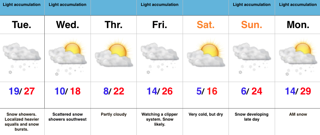
Busy, Cold Winter Pattern…The short term will continue to be dominated by a slow moving upper low over the region. Individual “spokes” (disturbances) of energy will rotate around the upper low and provide enhanced snow showers and embedded heavier squalls through Tuesday night. As promised, there will be “haves” and “have nots” with this system and, in general, we still like the idea of most folks in the 1″-3″ range with a few isolated heavier totals.
This is a challenging northwest flow and can wreck havoc on the timing front. Our best idea right now takes a disturbance southeast Wednesday, but this should remain a touch too far west to prevent much more than our southwest tier counties from seeing much, if any, snow.
A stronger clipper may deliver accumulating snow to wrap up the work week and then we also have our late weekend winter event to fine tune. Get the idea we’re locked into a busy time of things? 🙂


