Category: Unseasonably Cool Weather

Mid West Wintry Event Brewing?

First let me start off by saying we’re not trying to compare specifics with two storms in this post, but instead highlight a pattern in advance that’s similar to one…

You must be logged in to view this content. Click Here to become a member of IndyWX.com for full access.  Already a member of IndyWx.com All-Access?  Log-in here.

Permanent link to this article: https://indywx.com/mid-west-wintry-event-brewing/

Quick Wednesday Evening Video Update

Quick Wednesday evening video update discusses the threats of rain, snow, and arctic cold in our future.

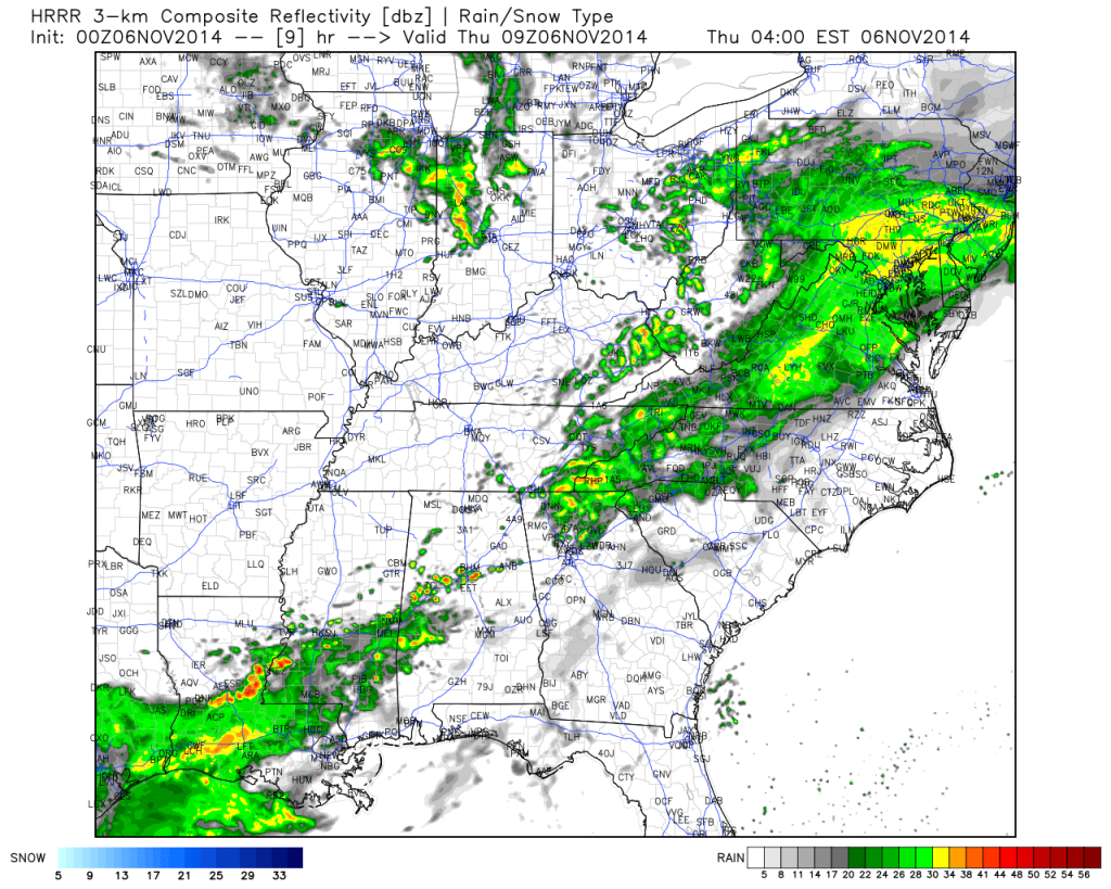
Showers will target the region along with gusty winds and colder air Thursday!

Showers will target the region along with gusty winds and colder air Thursday!

By the way, if you, or your business, can benefit from longer, more detailed video discussions and winter weather updates be sure to e-mail us about our personal and professional weather consulting services at bill@indywx.com.  Have a great evening!

Permanent link to this article: https://indywx.com/quick-wednesday-evening-video-update-2/

Early Season Taste Of Arctic Air…

We continue to become increasingly confident on a push of early season arctic air arriving by the middle part of next week. Our longer range forecast models are in agreement…

You must be logged in to view this content. Click Here to become a member of IndyWX.com for full access.  Already a member of IndyWx.com All-Access?  Log-in here.

Permanent link to this article: https://indywx.com/early-season-taste-of-arctic-air/

Busy; Unseasonably Cold Pattern…

Tue.

Wed.

Thr.

Fri.

Sat.

Sun.

Mon.

 Status-weather-showers-scattered-icon

 Status-weather-clouds-icon

 Status-weather-showers-day-icon

 Status-weather-clouds-icon

 Status-weather-snow-scattered-day-icon

 Status-weather-clouds-icon

 Status-weather-clouds-icon

48/ 56

42/ 54

32/ 48

29/ 43

32/ 47

26/ 39

31/ 54 

Wet Afternoon Shaping Up…Rain will overspread the region from west to east this morning into the afternoon.  We’ve already seen our high for the day and temperatures will settle into the lower 50s for the majority of the afternoon hours as rain falls on the area.

Dry Before Our Next System…Despite a threat of a light shower downstate, most of central Indiana will remain rain-free Wednesday with partly to mostly cloudy skies.  Our next fast moving storm system will deliver light rain Thursday, possibly transitioning to light snow Thursday evening as colder air flows in to close the work week.  An unseasonably cold day can be expected Friday with a strong northwest wind in play.

Weekend Light Snow?  By now do you get the idea that we’re in a cold and active weather pattern?  Yet another weather maker will zip through the state Saturday with possible light rain during the day transitioning to light snow for some Saturday evening.

Major League Early November Cold Looms…While a southwesterly air flow will help boost temperatures at least somewhat closer to seasonal levels Monday, don’t get used to it.  Our mid-range computer models are all focusing in on a very cold pattern developing next week…  We’re talking about highs in the 30s and lows in the teens/ 20s next week.

Upcoming 7-Day Precipitation Forecast:

  • 7-Day Rainfall Forecast: 0.75″ – 1.00″
  • 7-Day Snowfall Forecast: Dusting

Permanent link to this article: https://indywx.com/busy-unseasonably-cold-pattern/

Weekly Outlook: Busy Times In The Weather Office…

October finished colder than average (-0.8°) and slightly wetter than normal (+0.05″). The full October summary can be found here: http://www.crh.noaa.gov/news/display_cmsstory.php?wfo=ind&storyid=104988&source=0 November has gotten off to a rip-roaring start if…

You must be logged in to view this content. Click Here to become a member of IndyWX.com for full access.  Already a member of IndyWx.com All-Access?  Log-in here.

Permanent link to this article: https://indywx.com/weekly-outlook-busy-times-in-the-weather-office/