Thursday Morning Weather Rambles…
1.) All of a sudden what was a warm March has revered big time. Officially, Indianapolis is running close to 1° below normal on the month and will continue to fall further once today’s data is factored in. Always fun to see Mother Nature “balance” things out.
2.) It’s another cold start to the day with many central Indiana neighborhoods in the teens and hard freezes extending south into Florida this morning.

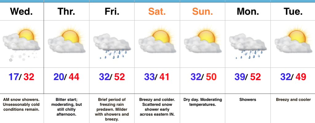
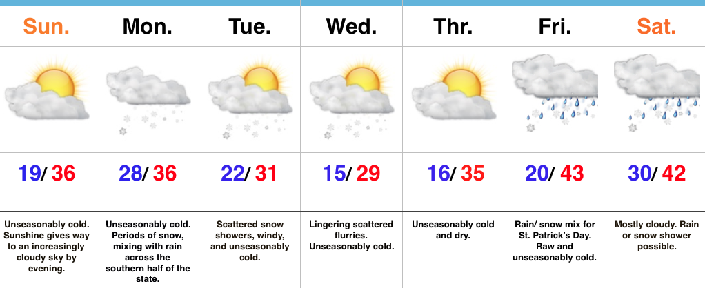
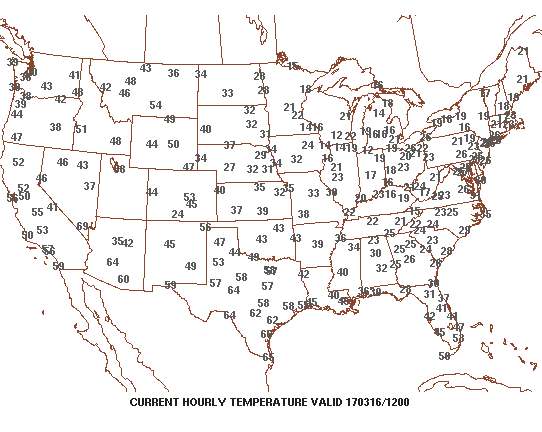 3.) Sunshine can be expected today and after the frigid beginning, a moderating trend will begin this afternoon that will send temperatures into the lower to middle 40s. That’s still close to 10° below average for daytime highs, but will feel much better than what we’ve been dealing with over the past several days. Add in that high March sun angle and it’ll actually be a very pleasant afternoon.
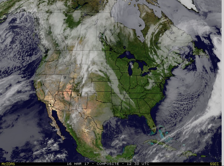 4.) Unfortunately, we won’t hang on to the sunshine for St. Patrick’s Day. A warm front will lift northeast through the region during the overnight and lead to an increase in clouds by evening. A wintry mix of sleet and freezing rain will impact central IN predawn Friday morning before transitioning to showers mid-to-late morning. “Light” is the key word here with models suggesting less than 0.20″ total. By Friday afternoon we’re back to dry times.
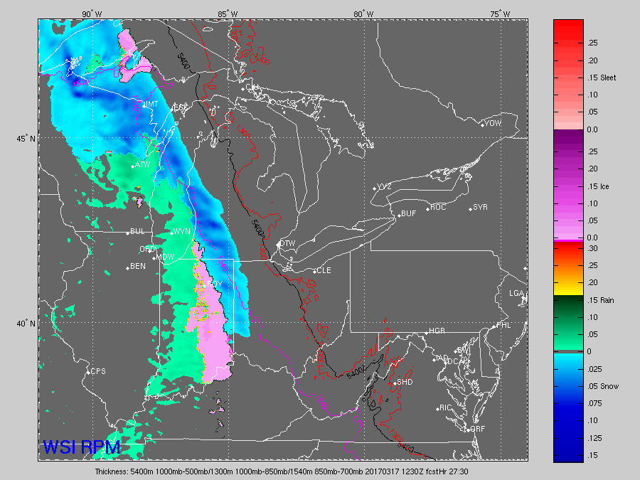
 5.) We’ll turn a touch cooler Saturday and it’ll be a blustery day, as well. A couple of early snow showers are possible across east and northeast portions of the state before afternoon sunshine returns. High pressure settles in overhead Saturday evening and will set up a nice second half of the weekend- lots of sunshine and milder temperatures by Sunday (lower 50s).
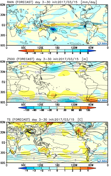
 6.) Looking ahead, the quiet times will be hard to come by as we progress through the latter portions of the month. Both the new JMA Weeklies (shown below) and other ensemble guidance is bullish on a wetter than average close to the month, and also one that features wild temperature swings. Thoughts shift back to severe prospects, especially for our friends to our south and the potential of backlash wet snow showers in the colder air. From a temperature perspective, it’s a pattern that will be very “transient” with no true long-lasting periods of significant warmth, or cold- relative to average.
 Highlights:
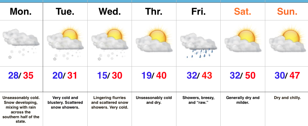
 As we progress through the afternoon hours, clouds will increase and scattered snow showers will develop. Highs will remain below freezing today- generally in the upper 20s to around 30.
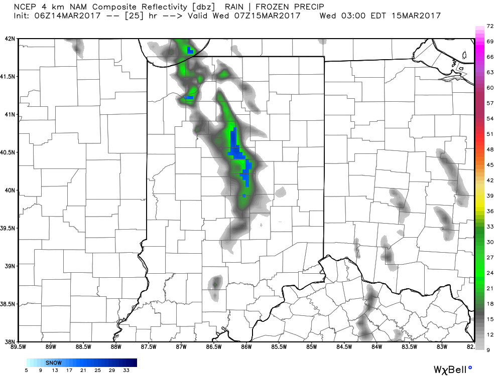
 With very cold air aloft, a lobe of upper level energy, and some lake enhancement, scattered snow showers will develop this afternoon and continue into the evening hours. Additionally, snow squall parameters are high and locally intense bursts of snow can also be expected as we move through the afternoon and evening hours. These won’t impact everyone, but where they do occur, expect rapidly reduced visibility and a quick accumulation. Forecast radar shows this potential as we move into the afternoon hours, with a couple of lake effect streamers continuing Wednesday morning.
 Highlights:
 Highlights: