VIDEO: Looking At The Medium-Longer Term…
You must be logged in to view this content. Click Here to become a member of IndyWX.com for full access. Already a member of IndyWx.com All-Access? Log-in here.
You must be logged in to view this content. Click Here to become a member of IndyWX.com for full access. Already a member of IndyWx.com All-Access? Log-in here.
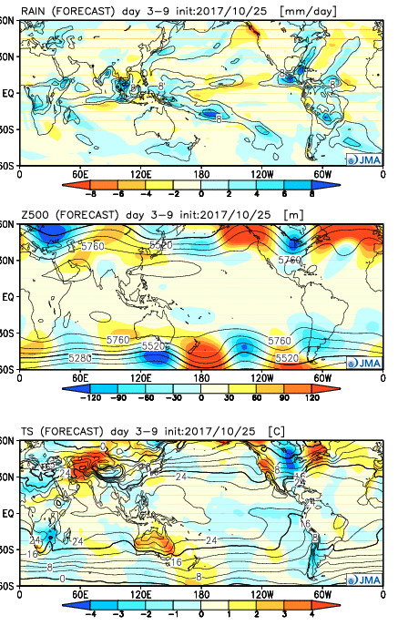
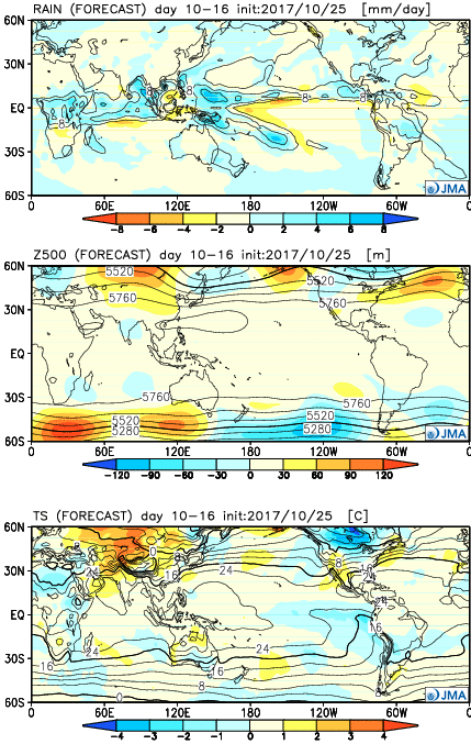
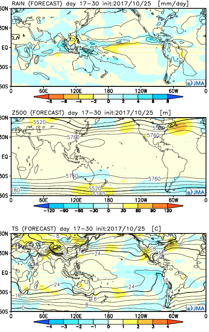
The NEW JMA Weeklies are in and they center the coolest anomalies for November across the central, including our region. Overall, they’re pretty chilly relative to normal, and also wetter than average. Perhaps we get into some November frozen precipitation?
Week 1:
 Week 2:
 Weeks 3-4:
 28 Day Mean:
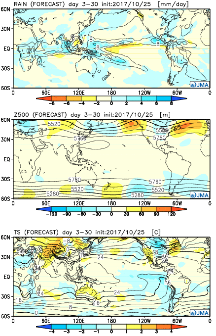 After the cold start to the month, the JMA Weeklies suggest ridges will “bookend” the country as November evolves, especially the Northeast region. This fits our research, as well, and fits the pattern, overall. If you haven’t had an opportunity to read our Winter Outlook, we discussed the potential of early cold centering itself into the “belly” of the country and the Weeklies appear to be seeing this, as well.
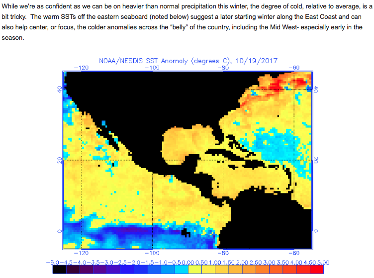
I.) Frost On The Pumpkin: Skies will clear tonight and winds will go calm. Chilly high pressure will briefly build over the eastern Ohio Valley and lead to a calmer period of weather overnight into early Thursday morning. The end result will be the first widespread frost of the season across central Indiana, including many dipping into the lower-to-middle 30s.
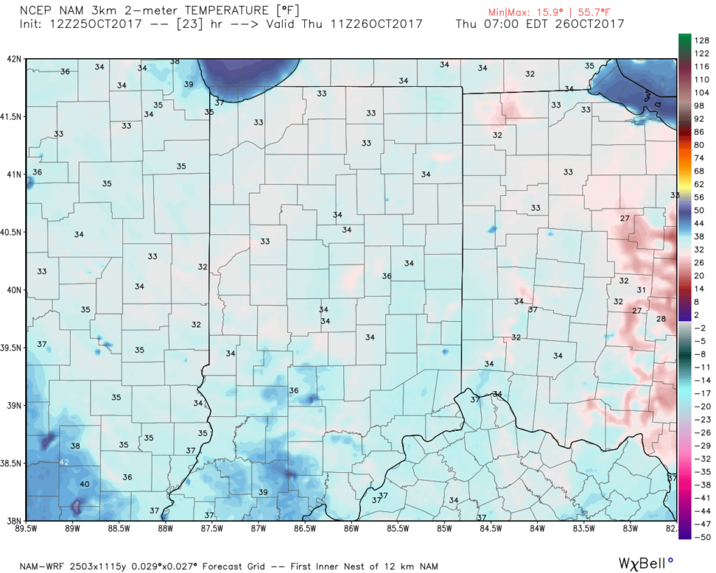 II. Gusty Thursday: After a cold, calm start to our Thursday, southerly winds will become gusty late in the afternoon. This is a result of an approaching cold front that will impact the region Friday.
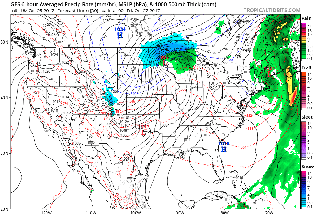 III. Unseasonably Cold Weekend: A cold front will pass Friday afternoon and a band of showers will accompany the frontal passage. Winds will shift to the northwest late in the day and drive in a sharply colder close to the work week. Air will grow cold enough to potentially support snow to mix in with the rain as precipitation comes to an end. Additionally, upper level energy and the colder air mass this weekend (the air will have a bite to it) could support mixed rain and snow showers Sunday. – Novelty stuff only, but those first flakes are always special to see. Nonetheless, temperatures will run well below normal. In fact, highs will be closer to our average low temperature this weekend.
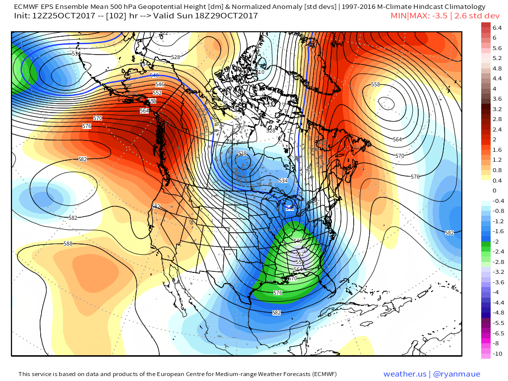
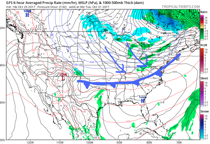
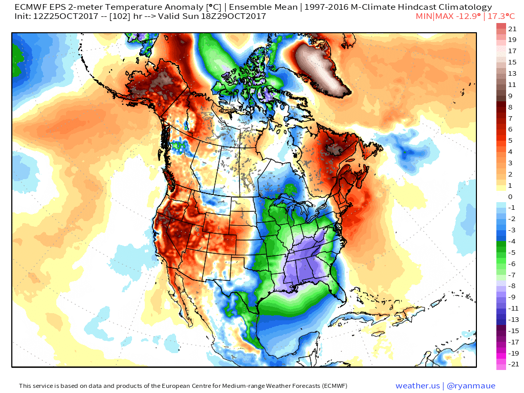 IV: Reinforcing Halloween Chill: We still stand firm on the idea of warm costumes being required this Halloween as chilly reinforcements blow into town Monday night. This will result in Halloween featuring a high in the mid to upper 40s with lows Tuesday night/ Wednesday morning dipping to around freezing (upper 20s in outlying areas away from the metro). Most of Trick-or-treat hours should feature temperatures in the upper 30s and lower 40s.
 Highlights:
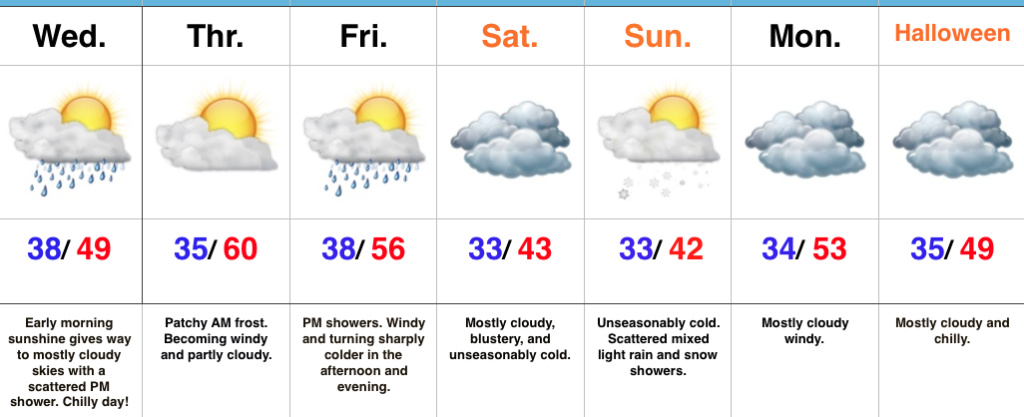
Flannel Weather…Late October averages across central Indiana include highs in the lower 60s and lows in the lower 40s. The balance of this forecast update will include temperatures well below those seasonal norms. Have the coats, jackets, and flannel 🙂 at the ready!
While early parts of our Wednesday could feature a couple looks at the sun, mostly cloudy conditions will dominate our hump day along with scattered afternoon showers. Thursday will be a ‘tweener- morning frost will give way to more in the way of sunshine, with an increasingly gusty southwest breeze by the afternoon!
Our next cold front will approach to close the work week. Showers will spread into the state after a dry start to the day and a cold northwest wind will hit like a wall Friday evening. Look for a sharply colder close to the day.
A deep trough of low pressure will dominate our weekend, supplying the coldest air so far this season, along with considerable cloudiness. Spokes of upper level energy will rotate overhead and help generate a light shower or two, especially Sunday. Yes, temperatures will be cold enough to allow for a little snow to mix in as well.
Looking ahead to Halloween- reinforcing chilly air should be spilling south behind a Monday frontal passage and this will set the tone for chilly conditions as the trick-or-treaters take to the streets. Plan to bundle up!
The 2017-2018 IndyWx.com Winter Outlook is now available!
Upcoming 7-Day Precipitation Forecast:
You must be logged in to view this content. Click Here to become a member of IndyWX.com for full access. Already a member of IndyWx.com All-Access? Log-in here.