
 Highlights:
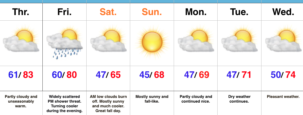
- Unseasonably warm weather continues for now
- Much cooler weekend ahead
- Unimpressed with rain coverage
Feeling More Like It Should By The Weekend…A SW air flow will continue to pump unseasonably warm air into the Mid West as we go through the back half of the work week. Dry conditions will remain before a cold front serves up a widely scattered shower chance Friday afternoon. That cold front will sweep through the state Friday evening and much cooler air will spill into the region. Despite some low clouds and areas of fog Saturday morning, the weekend should feature lots of sunshine along with cool, crisp air. It’ll be a classic fall weekend in central IN. Make plans for a bonfire or to visit one of the many popular corn mazes throughout the region.
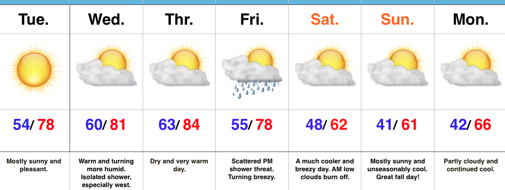
As we rumble into early next week, high pressure and pleasant weather conditions will remain.
In the tropics, Hurricane Matthew continues to be the headline. Our thoughts and prayers are with the Bahamas tonight as Matthew roars through. Tomorrow night and Friday will then feature Matthew coming dangerously close to the east coast of FL. Landfall or not, those living along the east coast of FL should brace for a long duration and damaging erosion event, along with hurricane conditions.
Upcoming 7-Day Precipitation Forecast:
- Snowfall: 0.00″
- Rainfall: 0.10″
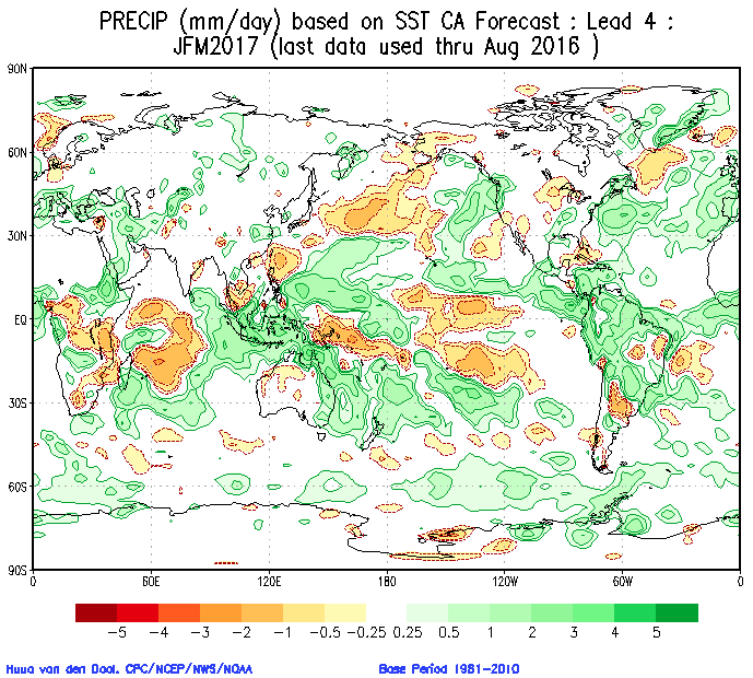
 In addition to the central PAC anomalies, we also are keying in on some other items of interest in the overall SST configuration:
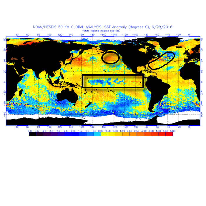 The SST CA model is quickly becoming one of our more trusted seasonal forecast models. We note how it becomes increasingly bullish on a central and eastern trough as winter wears on (by the way, this is likely to go deep into spring this year, too).
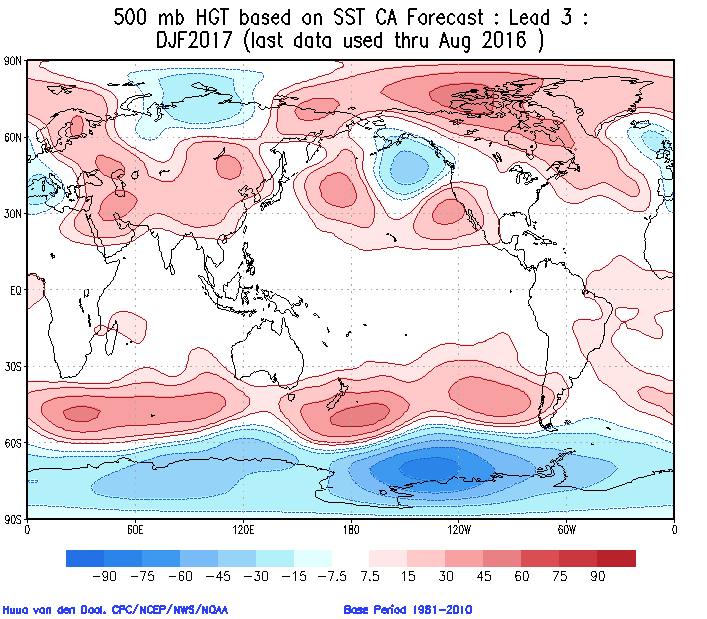
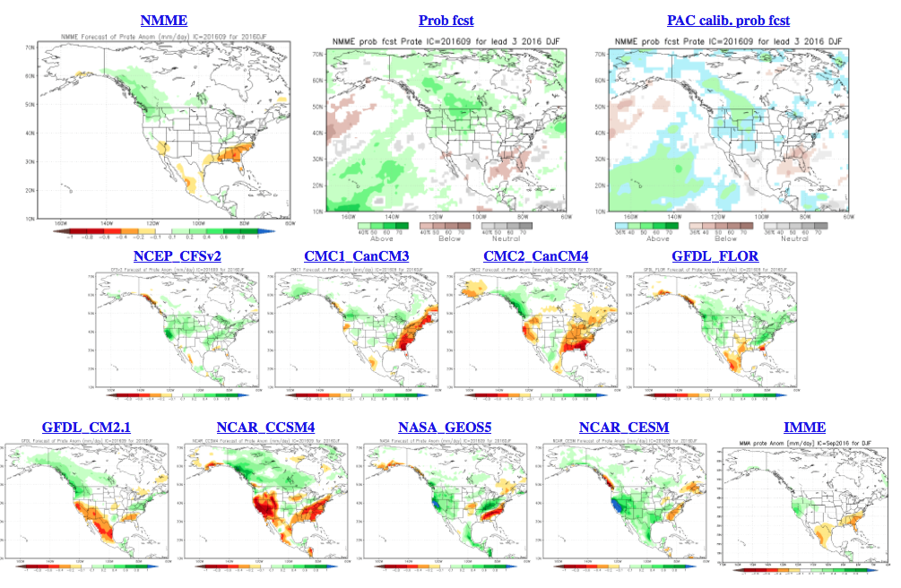
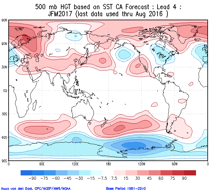 Cold overwhelms the pattern and when you combine it with the active storm track (noted by the green hues, suggesting above normal precipitation through our neck of the woods), confidence is continuing to grow for an above normal snow season.
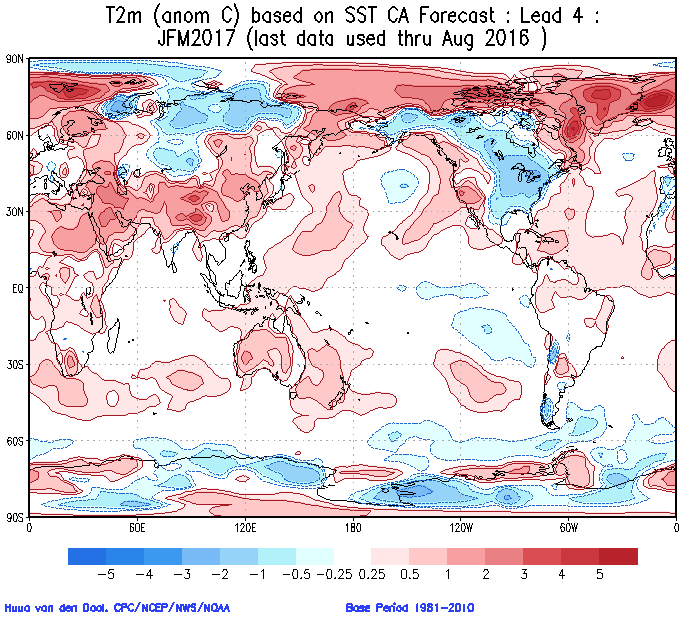
 The SST configuration on the JAMSTEC would suggest a cold, stormy set-up, locally. That said, while it sees the above average precipitation, it’s awfully warm at the surface.
 The NMME (to no surprise…) would suggest a very warm, wet winter.
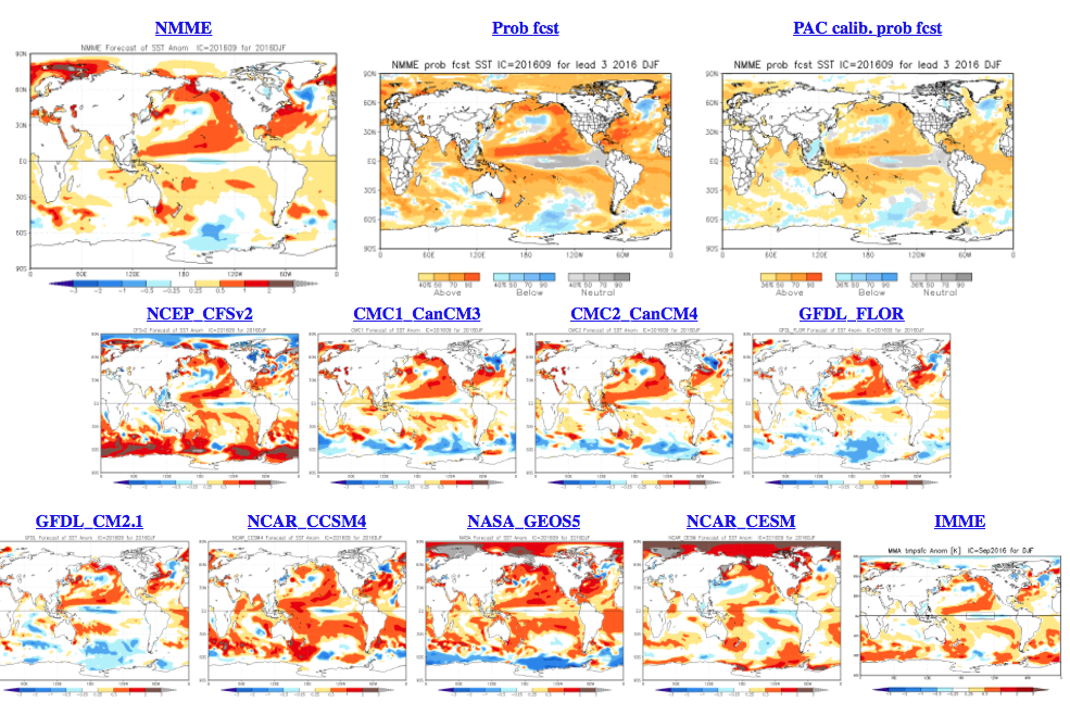
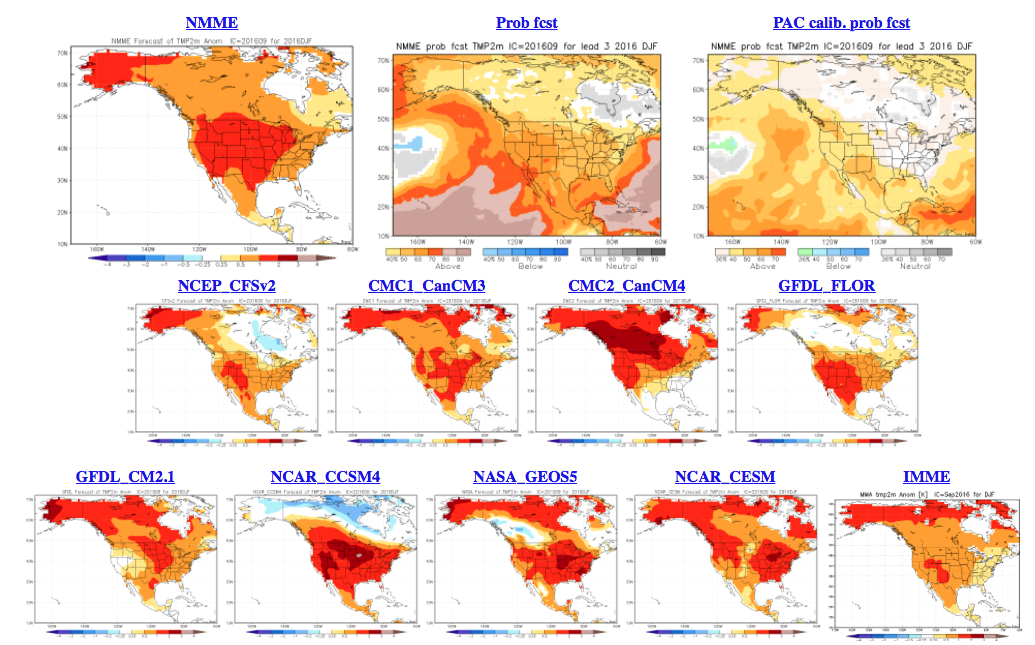
 As a reminder, our complete and final annual winter outlook will be posted here during the second half of October. That will include additional model data, along with several other points behind our reasoning for our winter forecast. As we always do, we’ll put “pen to paper” when it comes to our winter forecast, including our expected temperature and snowfall anomalies. Given the data above, including the warm JAMSTEC and NMME, it’s going to be very, very hard to see a warm winter here. In fact, our idea is for the exact opposite, given the SST configuration, and lines up more closely with the SST CA idea at this point. We’re also in the camp of a very, very active storm track through the Ohio Valley. “Big-hitter” potential is present from a winter storm perspective, especially given that we are likely to see resistance from the SE ridge.
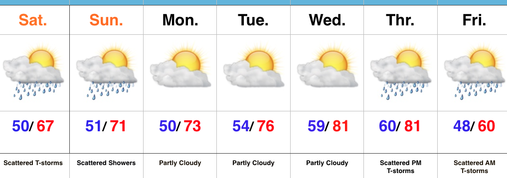
 Slow moving showers and embedded thunder will be most numerous this afternoon before slowly diminishing tonight. While we’ll have to maintain mention of a shower Sunday, most folks will remain dry.
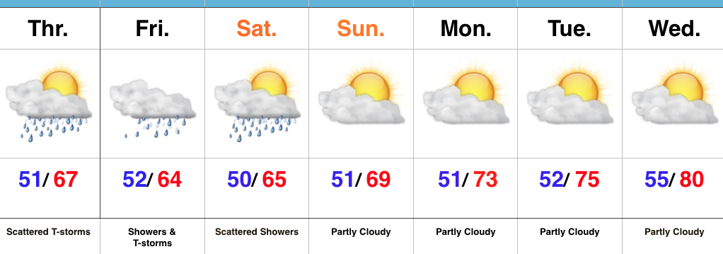 Highlights: