All Eyes On Florence; Generally Quiet Here…
You must be logged in to view this content. Click Here to become a member of IndyWX.com for full access. Already a member of IndyWx.com All-Access? Log-in here.
You must be logged in to view this content. Click Here to become a member of IndyWX.com for full access. Already a member of IndyWx.com All-Access? Log-in here.
You must be logged in to view this content. Click Here to become a member of IndyWX.com for full access. Already a member of IndyWx.com All-Access? Log-in here.
Rainfall of significance is over, and thankfully so. Many area rainfall totals checked in between 4″ and 7″ and while significant, the overall forward motion of Gordon’s remnants moved much quicker than forecast guidance suggested, ultimately limiting flooding issues from being even worse.
Today we’re left will overcast skies, patchy drizzle at times, gusty winds, and MUCH cooler air. In fact, the majority of our Sunday will be spent in the 50s. In case you’re wondering, November 1st is the “average” first day with a high in the 50s- 59° to be exact.


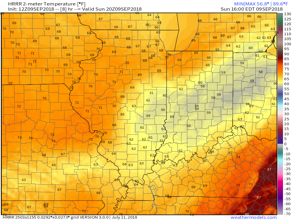
High pressure will return to open the work week. We’ll still likely deal with more clouds than sun on Monday, but as high pressure builds directly overhead Tuesday, more in the way of sunshine will return. Temperatures will be very pleasant through the first half of the work week- lows in the 50s and highs in the 70s.
 All eyes will shift to Florence by midweek. She’ll likely go through a period of significant strengthening on her journey closer to the southeast US coast with a potential landfall along the Carolina coastline Thursday. There’s still time to watch things unfold, but confidence is increasing on a potential major hurricane making landfall later this week.
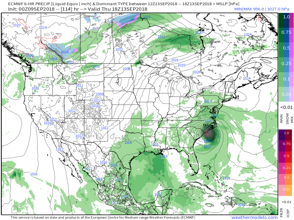 Unfortunately, the upper air pattern and lack of a steering current would lead to Florence either stalling out or “meandering” around the mid-Atlantic region for potentially several days…
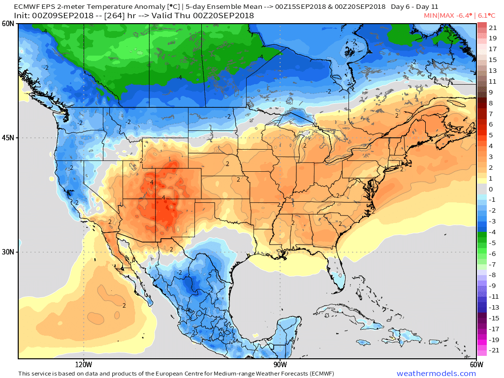
Meanwhile, back here on the home front, our fall-like early week feel will transition to warmer times as we move into late week and next weekend. Highs in the mid 80s will return with lows in the mid to upper 60s.

Steady rain through the majority of the day will turn heavier this evening into the overnight, directly associated with Gordon’s remnants. Excessive rainfall rates (2″ per hour at times along…
You must be logged in to view this content. Click Here to become a member of IndyWX.com for full access. Already a member of IndyWx.com All-Access? Log-in here.
You must be logged in to view this content. Click Here to become a member of IndyWX.com for full access. Already a member of IndyWx.com All-Access? Log-in here.