VIDEO: All Eyes On Friday; Unsettled Weekend Follows…
You must be logged in to view this content. Click Here to become a member of IndyWX.com for full access. Already a member of IndyWx.com All-Access? Log-in here.
You must be logged in to view this content. Click Here to become a member of IndyWX.com for full access. Already a member of IndyWx.com All-Access? Log-in here.
You must be logged in to view this content. Click Here to become a member of IndyWX.com for full access. Already a member of IndyWx.com All-Access? Log-in here.
You must be logged in to view this content. Click Here to become a member of IndyWX.com for full access. Already a member of IndyWx.com All-Access? Log-in here.
As part of some exciting and significant enhancements that we’re looking forward to announcing later this fall, we’re going to be including more content that’s typically only been going out to private clients. Some of that content includes our ‘medium range notes’ that go out each evening, included in the sample below.
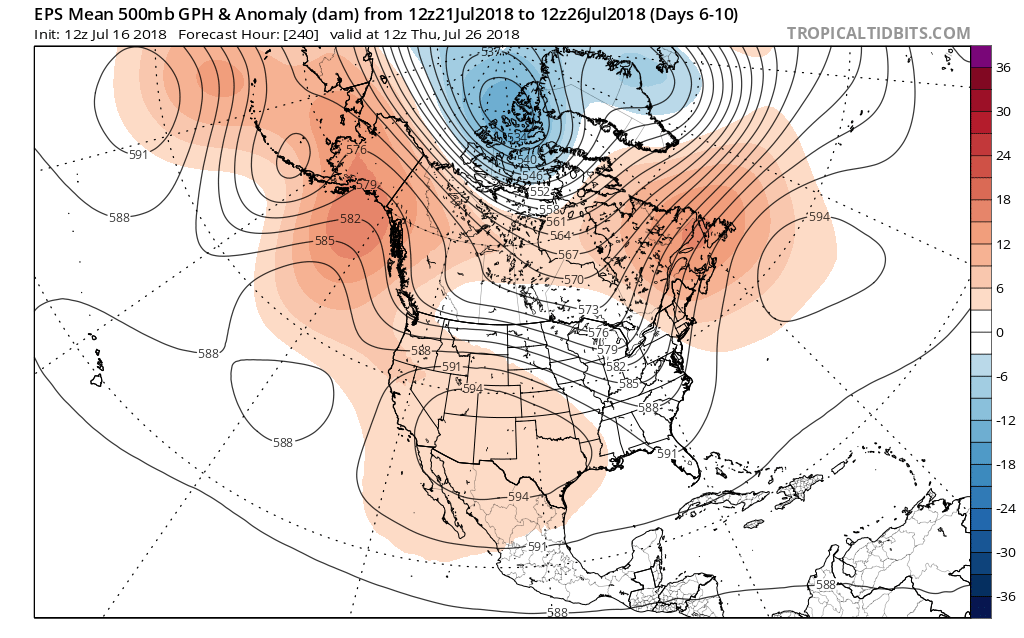
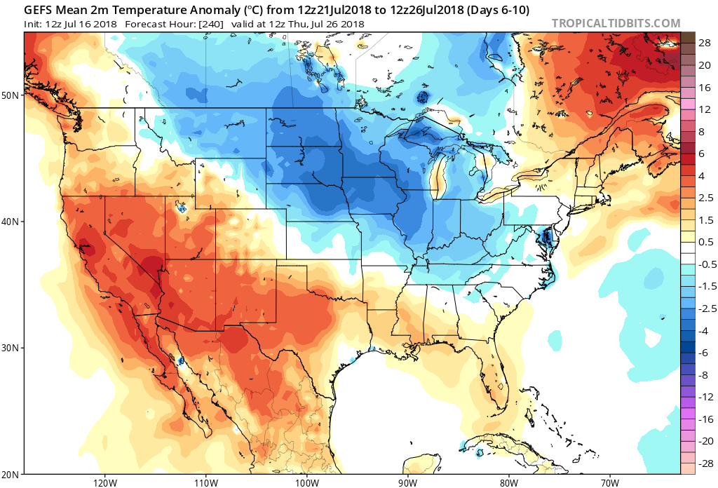
As we look at the medium range period, or the 6-10 day time frame, the pattern flip to a cooler and more active regime is clear. Both the respective GFS and European ensemble members (below) see the significant changes that will be with us as we put a wrap on July and look ahead to welcoming August. Note the upper ridge retrograding west.

Not only will this help drive a significantly cooler pattern, but a wetter one to boot. We note data reflecting wetter than average times returning for the upper Mid West, Great Lakes, and Ohio Valley during the upcoming 6-10 day period. It appears as if much-needed moisture will be returning to central Indiana.

Also note the dramatic flip to cooler times.
Storms Of Significance:
Of note during the period, we’re targeting a storm system that will likely deliver unsettled weather to central Indiana over the upcoming weekend, continuing into the Days 6-7 time period. This is followed by another storm system that will deliver unsettled conditions Days 9-10, including reinforcing cooler than average temperatures.
As always, IndyWx.com features daily blog and video updates that include details around the short-term period.
Forecaster: BM
You must be logged in to view this content. Click Here to become a member of IndyWX.com for full access. Already a member of IndyWx.com All-Access? Log-in here.