Mid-December “Relaxation” Coming, But Winter Set To Roar Back With Authority Around The Holidays And Beyond…
Since this cold pattern took over in mid-October, I thought we’d see a “pull back” of sorts develop at some point. Initially, the thinking was this would come in the middle parts of November, but that never developed. Fast forward to where we are now, and it still appears a relaxation of the cold will develop- albeit much later than originally anticipated. Please understand this doesn’t mean there can’t be cold days or, for that matter, even wintry “mischief.” What it does mean is that the sustained significantly colder than normal air should reverse to seasonable levels and above normal conditions for a time around mid-month.
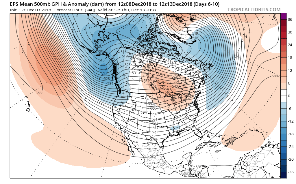
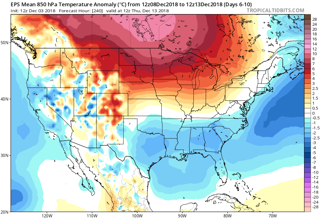
With that said, we’re as fired up as we’ve been for what we continue to think will be a very cold winter and, at times, snowy- as outlined in our winter outlook published last month. In fact, the latest European Weeklies in this evening suggest winter roars back with authority around Christmastime, continuing deep into the New Year period. Analog data and other key components (some of which were outlined in our winter outlook) would back up this idea. Taken verbatim, the new European Weeklies like the idea of “coast-to-coast” cold developing for the holidays this year. While I’m not ready to go that far just yet (still think the mean ridge will set-up shop in a manner to keep the northwest balmy, compared to normal), I do like the idea of a cold and active period returning late December for our part of the country…
Anyone else dreaming of a white Christmas (for the 2nd year in a row)?!

 II. Highs today will come tonight (mid-to-upper 50s) ahead of the cold front. Once the front moves through, colder air will return for the second half of the weekend. As wrap-around moisture combines with the colder air, light snow showers will develop late Sunday night into Monday morning (shown below). This won’t be a huge deal.
 III. The next item of interest will come from a clipper system Thursday. This won’t only serve up another round of light snow, but also help to reinforce the unseasonably cold air. Highs will return to around freezing to close the week with lows in the 20s.
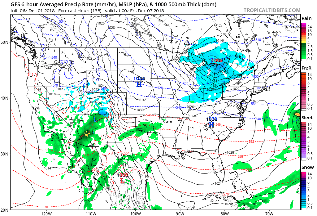 IV. That leads us to what comes next weekend. While it’s still far too early for any sort of specifics, we’ll simply say to keep a mental note in the back of your mind for the potential of a more disruptive winter event coming out from the southern Plains into the Ohio Valley. We’ll certainly have to fine tune things and “hone in” as we progress through the upcoming week. From this distance, prospects range from nothing more than a light snow to a “plowable” storm. Unlike this weekend’s storm, there will be a limit to how far north next weekend’s storm will be able to track…