Updated 07.06.23 @ 7:50a
You must be logged in to view this content. Click Here to become a member of IndyWX.com for full access. Already a member of IndyWx.com All-Access? Log-in here.

Jul 06
Updated 07.06.23 @ 7:50a
You must be logged in to view this content. Click Here to become a member of IndyWX.com for full access. Already a member of IndyWx.com All-Access? Log-in here.
Permanent link to this article: https://indywx.com/2023/07/06/video-pleasant-close-to-the-work-week-recent-wet-pattern-shift-looks-to-hold-through-july/
Jul 04
Updated 07.04.23 @ 6:14a
There’s something about the 4th of July that signals a shift within. It’s been this way for me since back in the high school days. Back then, the following week meant 2-a-days were beginning as a new football season was only a few weeks away. Fast forward to today, and I understand some of the big box retailers are preparing to display their fall and Halloween decor over the next couple weeks. SEC Media Days, the unofficial “official” start of the college football season gets rolling in Nashville on July 17th. Heck, before you know it, we’ll be producing our annual winter outlook.
Okay, back to present.
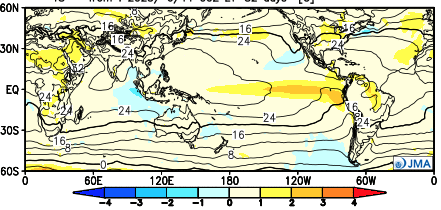
As the Nino continues to mature, we believe the rest of meteorological summer (through end of month August) continues to keep any significant or long lasting heat away from our neck of the woods. In addition, the dry stretch that typically develops at some point each and every summer is also behind us. Simply put, the next 6-7 weeks appear to run near normal from a temperature standpoint and slightly above to above normal from a precipitation perspective. Overall, I prefer to lean on the latest JMA monthly product.
July
Temperatures

Precipitation

August
Temperatures

Precipitation

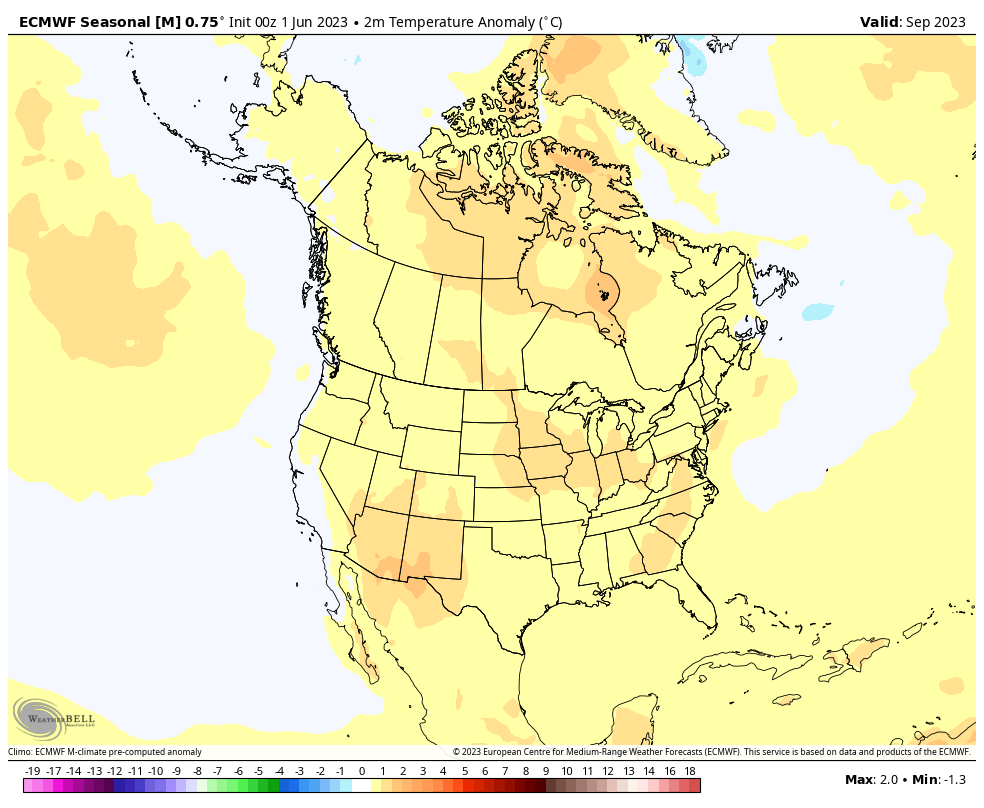
As we look ahead to autumn, the early call is for a warmer than normal open to fall as a whole. Certainly fits the bill with recent autumn trends…
We note both the JMA and latest European Seasonal product going towards this mild look. More on the entire fall seasonal outlook over the next few weeks.
From our family to yours, we’re wishing you a blessed Independence Day! A fresh batch of storms arrive later Wednesday and our short-term update later tonight will handle the latest look there.
Permanent link to this article: https://indywx.com/2023/07/04/brief-break-in-the-pattern-gives-us-time-to-look-ahead-to-the-remainder-of-met-summer-open-to-autumn/
Jun 26
Updated 06.26.23 @ 7:50a
You must be logged in to view this content. Click Here to become a member of IndyWX.com for full access. Already a member of IndyWx.com All-Access? Log-in here.
Permanent link to this article: https://indywx.com/2023/06/26/video-evening-storms-return-wet-pattern-sets-up-late-week/
Jun 24
Updated 06.24.23 @ 9a
You must be logged in to view this content. Click Here to become a member of IndyWX.com for full access. Already a member of IndyWx.com All-Access? Log-in here.
Permanent link to this article: https://indywx.com/2023/06/24/video-sunday-storms-more-active-close-to-june-and-open-to-july/
Jun 22
Updated 06.22.23 @ 4:45a
You must be logged in to view this content. Click Here to become a member of IndyWX.com for full access. Already a member of IndyWx.com All-Access? Log-in here.
Permanent link to this article: https://indywx.com/2023/06/22/digging-our-heels-into-the-pattern-over-the-next-2-weeks/
Jun 21
Updated 06.21.23 @ 7:40a
You must be logged in to view this content. Click Here to become a member of IndyWX.com for full access. Already a member of IndyWx.com All-Access? Log-in here.
Permanent link to this article: https://indywx.com/2023/06/21/video-where-rain-will-be-most-widespread-to-close-the-week-potential-sunday-storms-and-looking-ahead-to-early-july/
Jun 20
Updated 06.20.23 @ 5:30a
I. It’s been a cool June so far compared to normal. Officially, Indianapolis is running close to 3° below normal month to date.
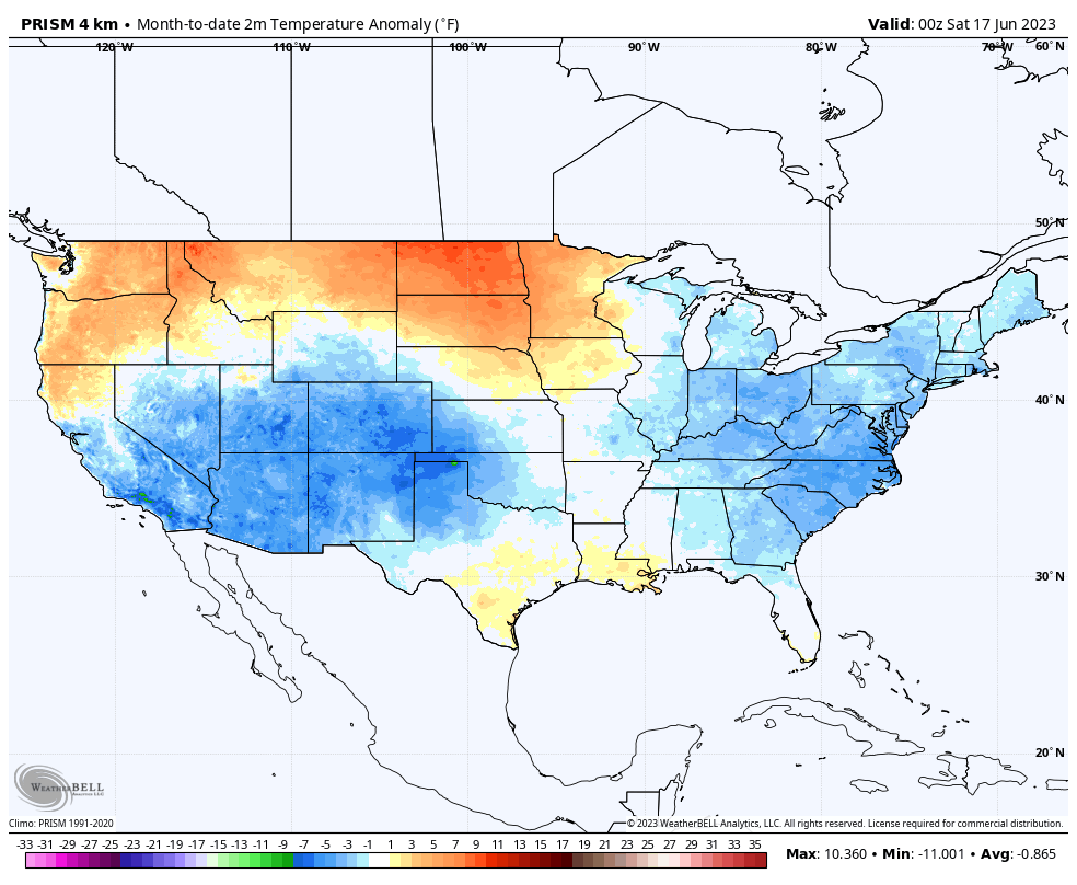
Locally, there’s still no sign of any sort of significant heat on the horizon in this kind of pattern.
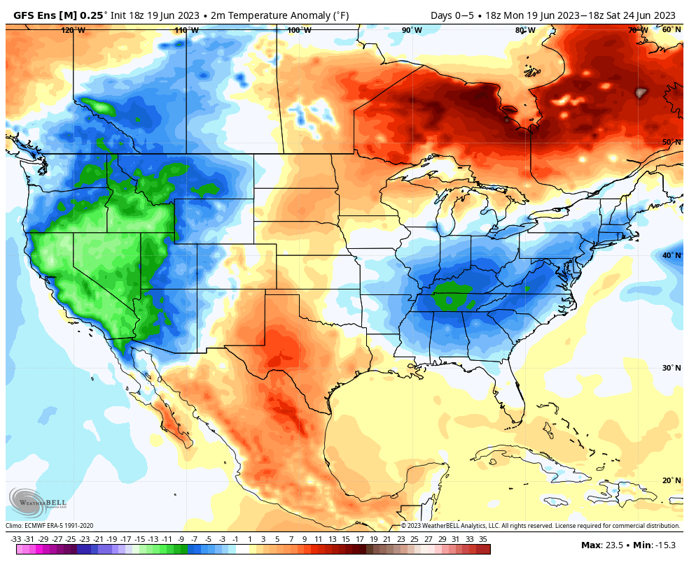

Needless to say, the lack of heat this time of year given how dry it’s been is a true blessing (otherwise the feedback would absolutely be kicking into high gear by now). Thankfully, it continues to look like we’ll avoid any sort of sustained hot wx compared to normal while also seeing the pattern transition towards a more active state.
II. Heaviest rains Monday fell across southern and southeastern Indiana, including amounts in excess of 1”.
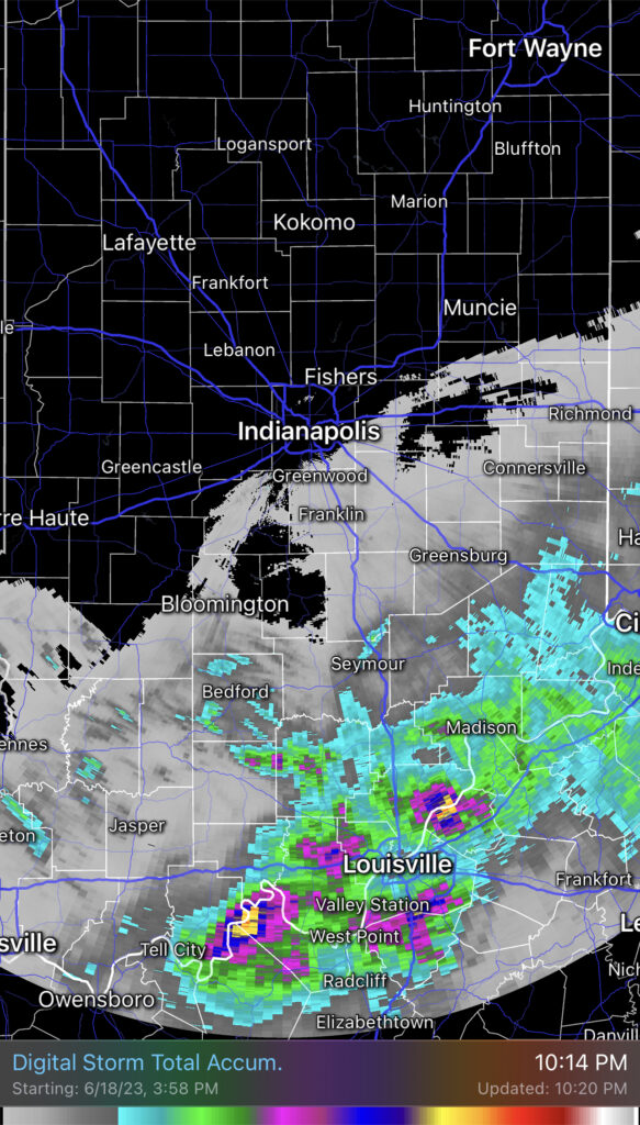
Additional showers will pinwheel into central Indiana this afternoon and evening. Indianapolis and more of immediate central Indiana stand a better shot of getting some beneficial rain today when compared to Monday. Fingers crossed.
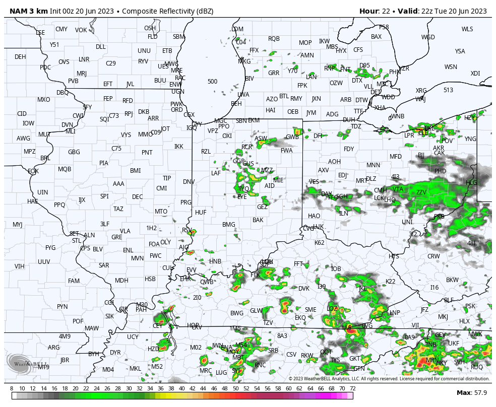
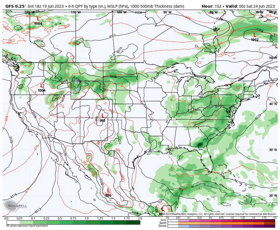
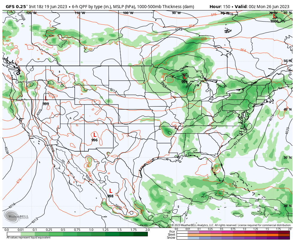
III. Additional opportunities of scattered to numerous showers and storms will occur Friday and Sunday.
Fresh Client video will be posted later this evening!
Permanent link to this article: https://indywx.com/2023/06/20/tuesday-morning-rambles-6/
Jun 19
Updated 06.19.23 @ 7:50a
You must be logged in to view this content. Click Here to become a member of IndyWX.com for full access. Already a member of IndyWx.com All-Access? Log-in here.
Permanent link to this article: https://indywx.com/2023/06/19/video-closed-upper-low-keeps-things-a-bit-unsettled-new-system-approaches-from-the-west-this-weekend/
Jun 17
Updated 06.17.23 @ 9:23a
You must be logged in to view this content. Click Here to become a member of IndyWX.com for full access. Already a member of IndyWx.com All-Access? Log-in here.
Permanent link to this article: https://indywx.com/2023/06/17/video-gorgeous-saturday-tropical-interests-and-rain-chances/
Jun 16
Updated 06.16.23 @ 7:50a
You must be logged in to view this content. Click Here to become a member of IndyWX.com for full access. Already a member of IndyWx.com All-Access? Log-in here.
Permanent link to this article: https://indywx.com/2023/06/16/refreshing-start-to-the-weekend-heating-things-up-for-a-time-next-week/