Updated 08.31.23 @ 7:45a The extended stretch of calm, quiet conditions will allows us to start looking ahead to the upcoming winter in earnest over the upcoming several days. We’ll…
You must be logged in to view this content. Click Here to become a member of IndyWX.com for full access. Already a member of IndyWx.com All-Access? Log-in here.
You must be logged in to view this content. Click Here to become a member of IndyWX.com for full access. Already a member of IndyWx.com All-Access? Log-in here.
A weakening band of showers will push into north-central Indiana later this evening. A quick shower May move through the city but most should remain dry as the associated secondary cold front passes through the area. This frontal passage will serve up dry, cool air reinforcements that will carry us into the start of our Labor Day weekend. Overnight lows into the 40s can be expected.
A quick shower is possible this evening, primarily north of the city
Our “hint” of fall will quickly fade through the holiday weekend and into next week as the upper ridge builds northeast. This won’t only deliver unseasonably hot and humid conditions but will keep us much drier than normal. In fact, after today, I don’t see any meaningful chances of precipitation for at least the upcoming 10-day stretch.
You must be logged in to view this content. Click Here to become a member of IndyWX.com for full access. Already a member of IndyWx.com All-Access? Log-in here.
I. It’s about as oppressive as it gets around these parts out the door early this morning. Temperatures will only fall a couple more degrees between now and sunrise before another dangerously hot day ahead. Check out these temperature and heat indices at 4:45a:
II. We’re tracking (2) frontal boundaries that will put an end to this heat and humidity in the coming days. The first front slips through here Saturday and will break the heat wave with a secondary, more robust, push of dry, cool air early next week. While a shower or storm is possible with both FROPAs, widespread rain isn’t expected with either.
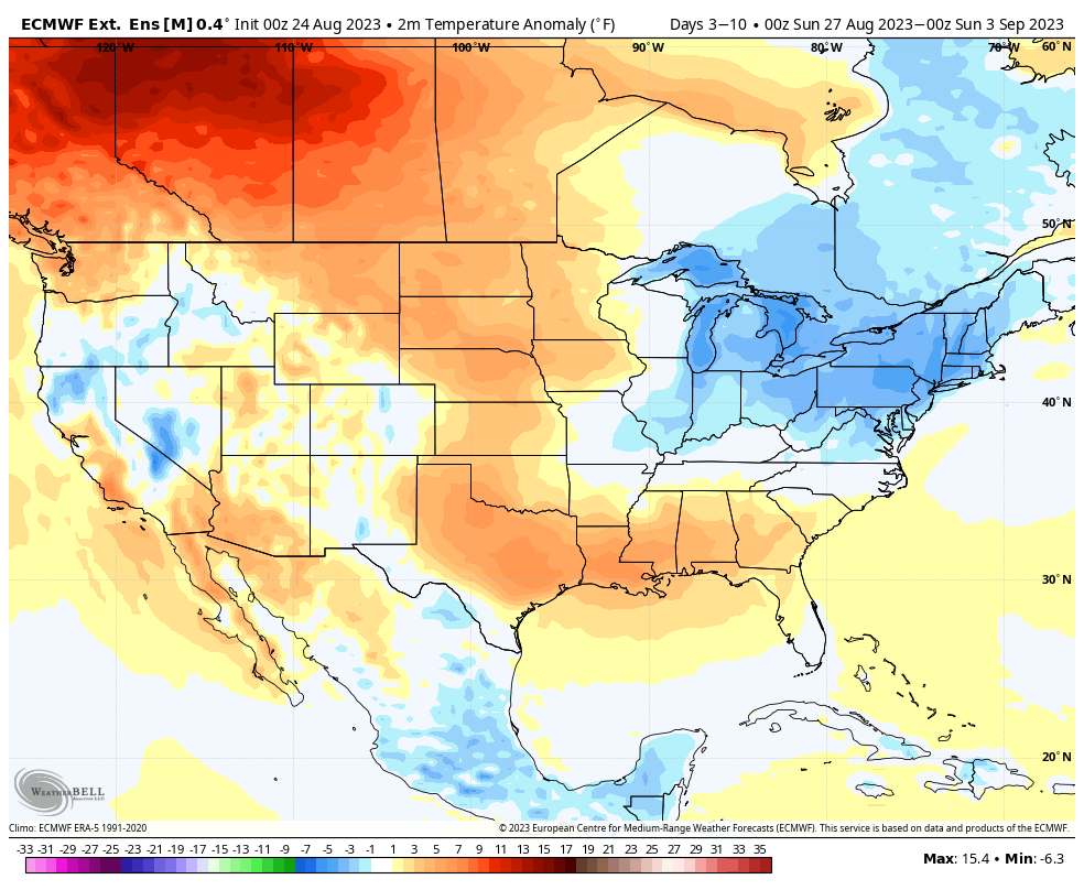
III. A taste of fall is on deck as we move through the middle of next week and get set to kick off the Labor Day weekend. How does overnight lows into the 40s sound with highs in the upper 70s? This breath of fresh air will hold into the early part of the Labor Day weekend along with anticipated dry conditions.
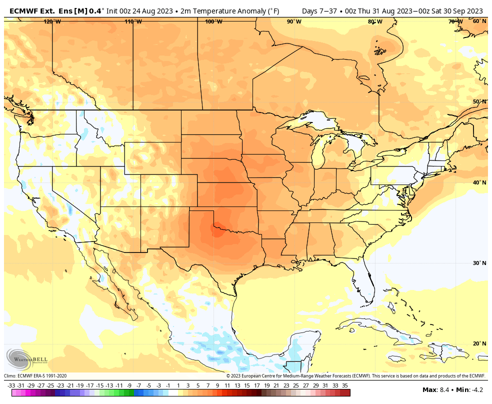
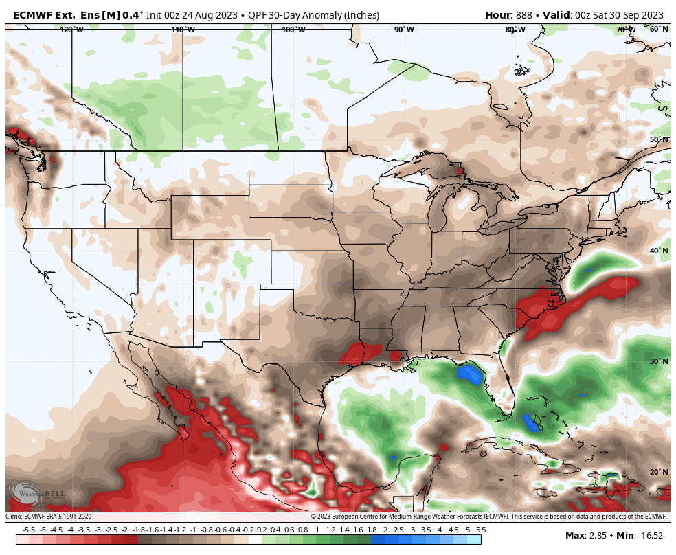
IV. We’re not expecting the cool, refreshing air to last as “endless summer” returns shortly after the open to September. In fact, we continue to believe a warmer than normal and drier than average September awaits as we push through the initial month of meteorological fall. The latest European Weeklies, updated last night, for September say the same: