Updated 03.11.24 @ 7:51a It’s more of the same this week as unseasonably warm temperatures dominate the headlines. We’ll turn unsettled by late week and this will signal a pattern…
You must be logged in to view this content. Click Here to become a member of IndyWX.com for full access. Already a member of IndyWx.com All-Access? Log-in here.
Another unseasonably mild week awaits, but one thing is becoming increasingly clear: we’re not finished with the cold yet. The transition to a colder time of things next week will come with unsettled conditions late this week and the weekend (I know, timing isn’t on our side).
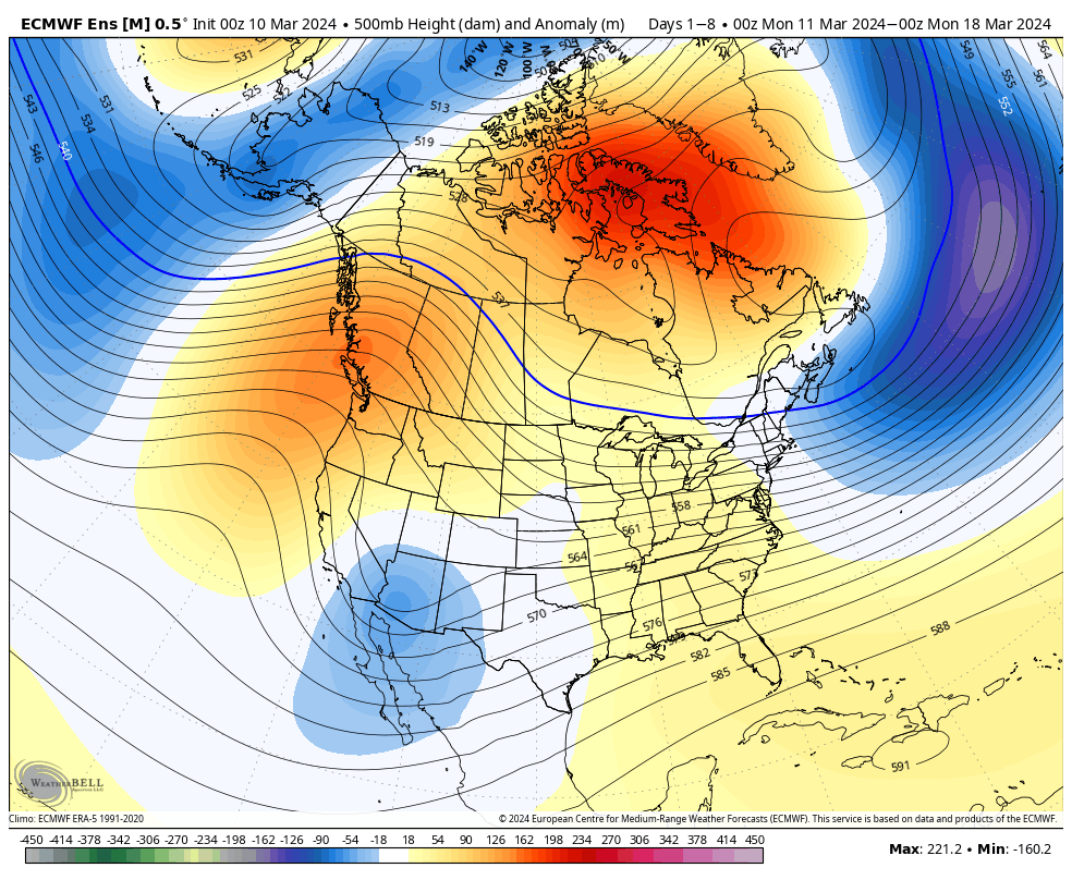
An upper level ridge will dominate in the week ahead, but note the building heights late in the period across western NA. That will help promote a different (colder) airmass here over the wknd into early next week.Warmer than average temperatures can be expected this week from the Plains and points east.Precipitation should check in right around average this week across central IN and the Ohio Valley as a whole.
Forecast Period: 03.10.24 – 03.17.24
The period will open with dry and seasonably chilly conditions before a southwesterly flow takes hold and helps promote yet another quick warm-up in the work week ahead. A weak and fast moving system may deliver some scattered showers midweek but the lions share of our moisture this week will come Thursday and Friday. Colder air then pours in here over the weekend with the potential of snow getting involved by this time next week.
It’s been a very warm March. So far, Indianapolis is running nearly 13° above the average month-to-date.
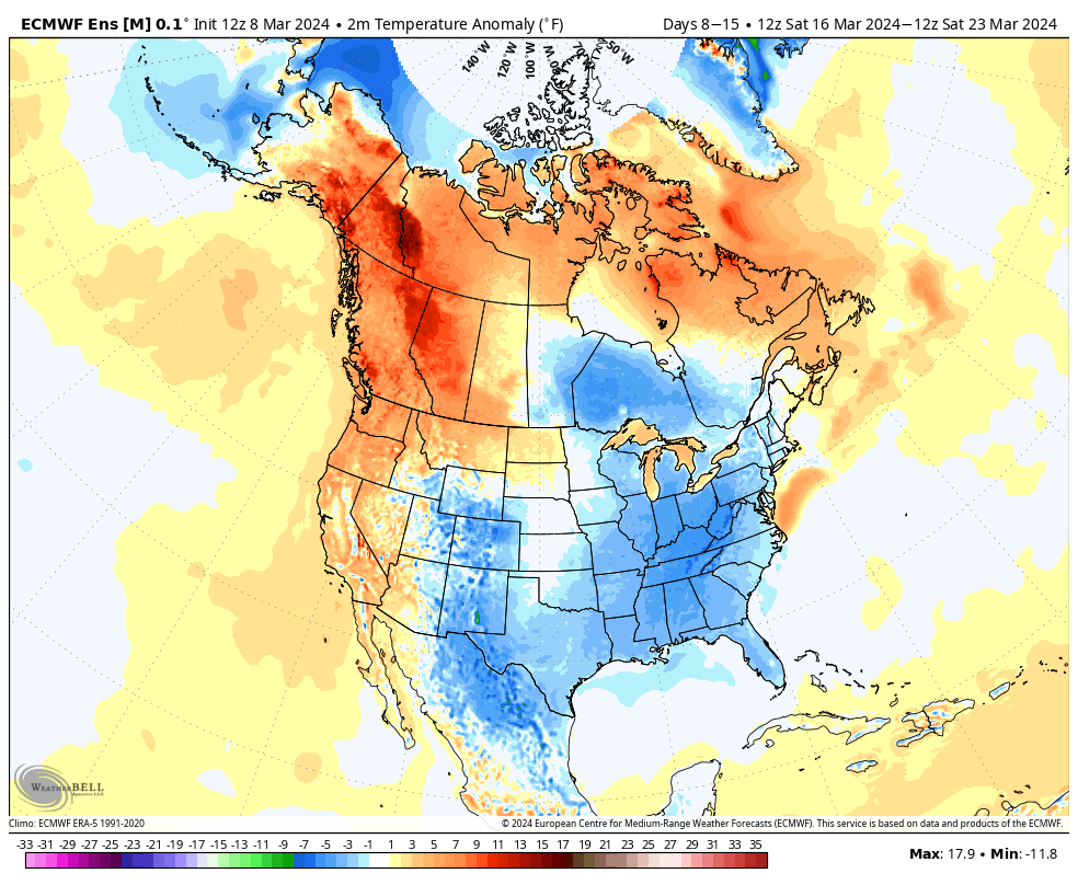
In the short-term (Week 1), the pattern will remain on the milder side of normal.
That all begins to change as we move into Week 2.
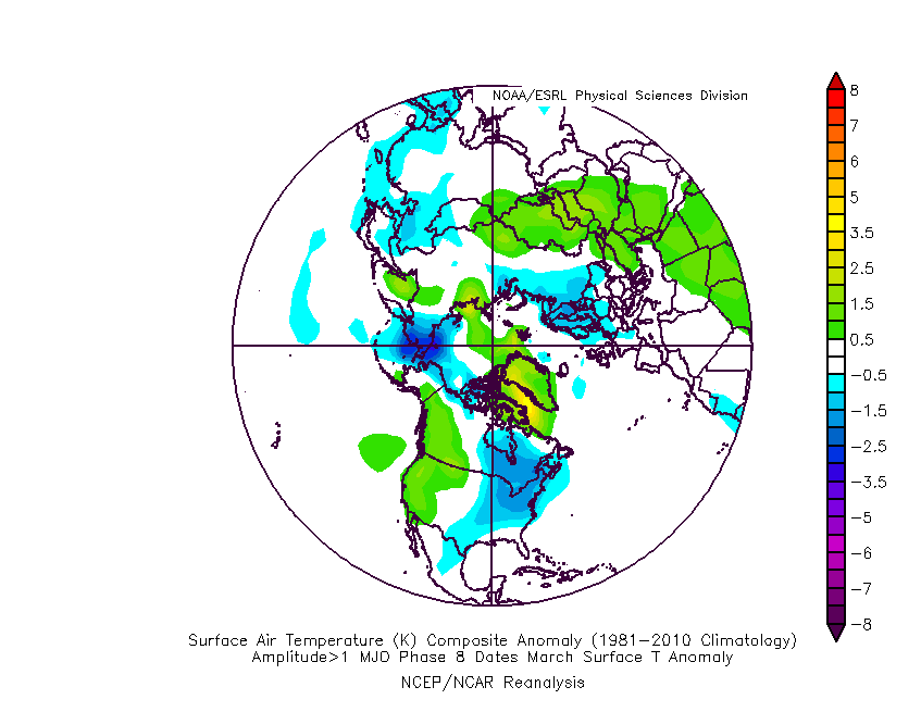
This is largely driven by the MJO sprinting through the traditionally warm phases for this time of year into the colder Phase 8 late month.
The temperature composite analog for MJO Phase 8 in March during an El Nino season:
Strikingly similar to what we see above on the Week 2 charts, huh?
The teleconnection suite aligns towards a cold look by Week 2.
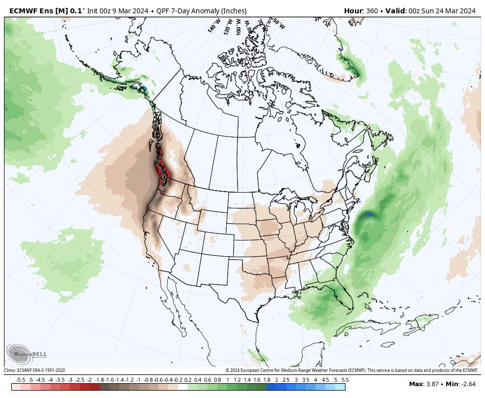
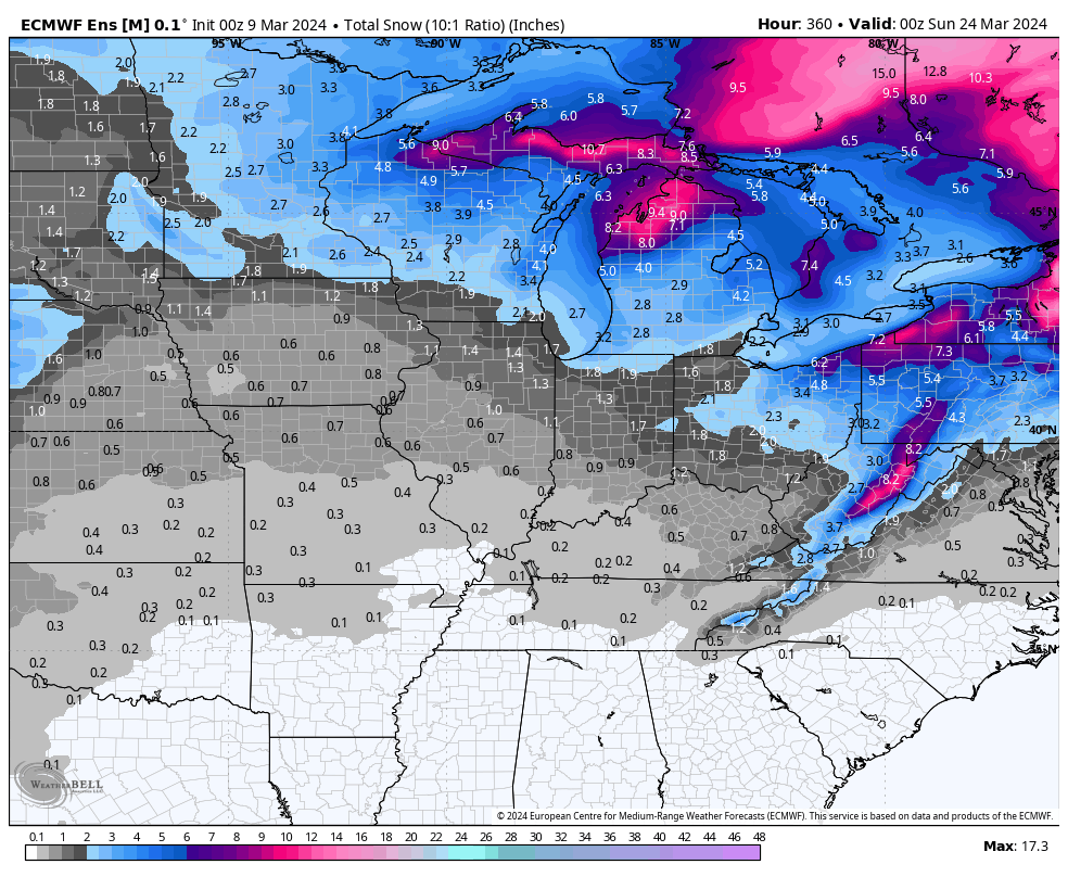
A potentially more significant storm system looms late next week or over St. Patrick’s Day weekend to usher in the pattern change. Otherwise, with a colder pattern than normal settling in Week 2, this will also likely lead to a drier airmass and subsequent opportunity to dry out after a wetter than normal open to March (also of note is that we’re running a little more than 1″ above normal, year-to-date).
No way to be specific with details from this distance, but given the look to the overall pattern, I’d be surprised if we end the month without an opportunity of a little wet snow with the colder transition.
Updated 03.08.24 @ 7:50a “Showery” weather through the early to mid afternoon will give way to an increasingly heavier rain by evening, continuing through the overnight. This is all thanks…
You must be logged in to view this content. Click Here to become a member of IndyWX.com for full access. Already a member of IndyWx.com All-Access? Log-in here.
Today and Wednesday (at least during the daytime) are about as quiet and pleasant as it can get for late-February. After another cold start, we’ll quickly warm into the 50s later this afternoon. We’ll do even better than that come Wednesday as highs flirt with the 60° mark. Patio, anyone?!
Moisture won’t make a return until overnight Wednesday into Thursday morning. We note modeling is honing in on central and southern Indiana for the potential of heaviest rain during the period (most of which falls Thursday morning into the afternoon) and we may also see a couple of thunderstorms thrown into the mix, especially downstate. A solid 0.50″ to 1″ appears most reasonable for area rain gauges.
Wet conditions will return to the area Thursday.
Behind this feature, a brief drop in temperatures can be expected for the weekend, but we won’t really even be able to call this air mass “cold” by late February standards. Nonetheless, trailing upper level energy and just enough cooler air will be enough to ignite a few snow showers Saturday.
Upper level energy will combine with cooler temperatures to provide an opportunity for snow showers Saturday.
We want to reiterate that this upcoming weekend’s snow potential is nothing compared to last weekend and we’ll be right back into the 50s and 60s by Sunday!
That brings us to early next week. While still a bit too far out to get specific, the potential of a more potent storm system is there and we’ll have to keep close tabs on the threat of a more widespread rain and embedded strong storm threat as we get closer. More on this feature in the days ahead.