Updated 04.03.24 @ 7:40a Clouds and showers (even embedded thunder by this afternoon) will transition to wet snow tonight into Thursday morning. The wet snow will fall heavily enough to…
You must be logged in to view this content. Click Here to become a member of IndyWX.com for full access. Already a member of IndyWx.com All-Access? Log-in here.
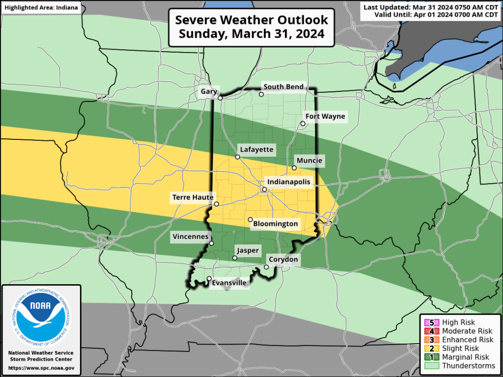
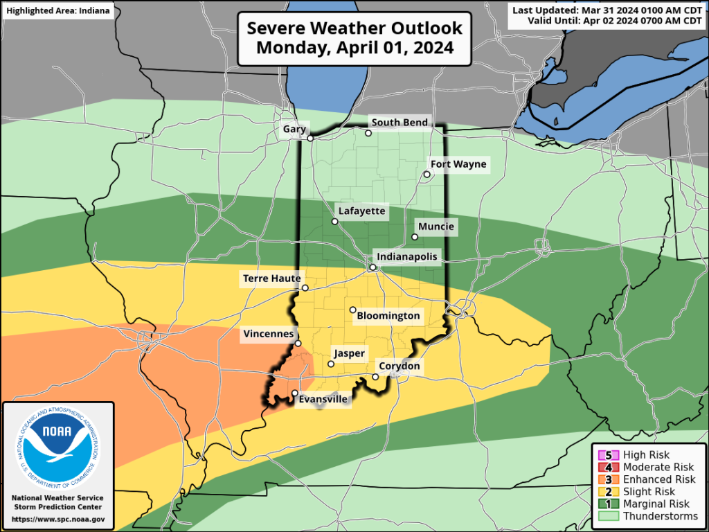
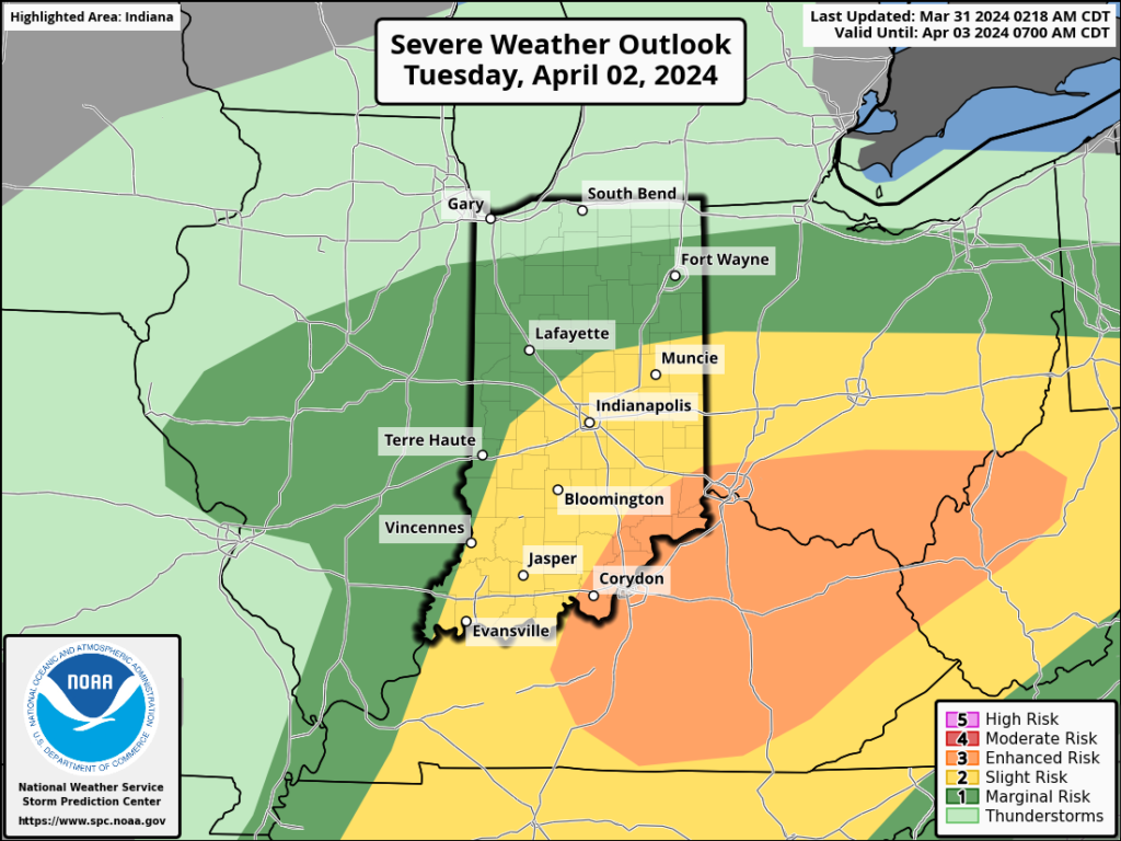
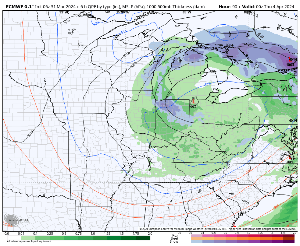
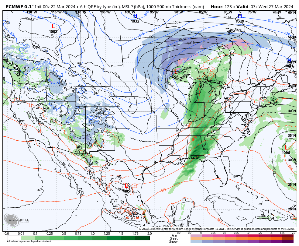
The upcoming immediate term will be headlined by a multi day heavy rain and severe weather episode. A stalled frontal boundary will serve as the pathway for multiple waves of low pressure to ride along through Tuesday. In addition to a heavy rain and flooding threat (primarily targeting immediate central and north-central Indiana), we’ll also likely have to deal with (3) rounds of severe storms. We’ll allow our short-term products to handle those severe threats, but just know all modes of severe are on the table with the greatest emphasis being on large hail with this setup. Should a couple discrete cells develop near or just south of the boundary then an elevated tornado threat would ensue. Again, we’ll have a fresh post hoisted later this afternoon or evening on that.
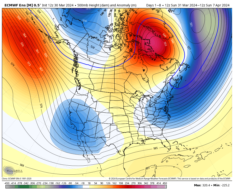
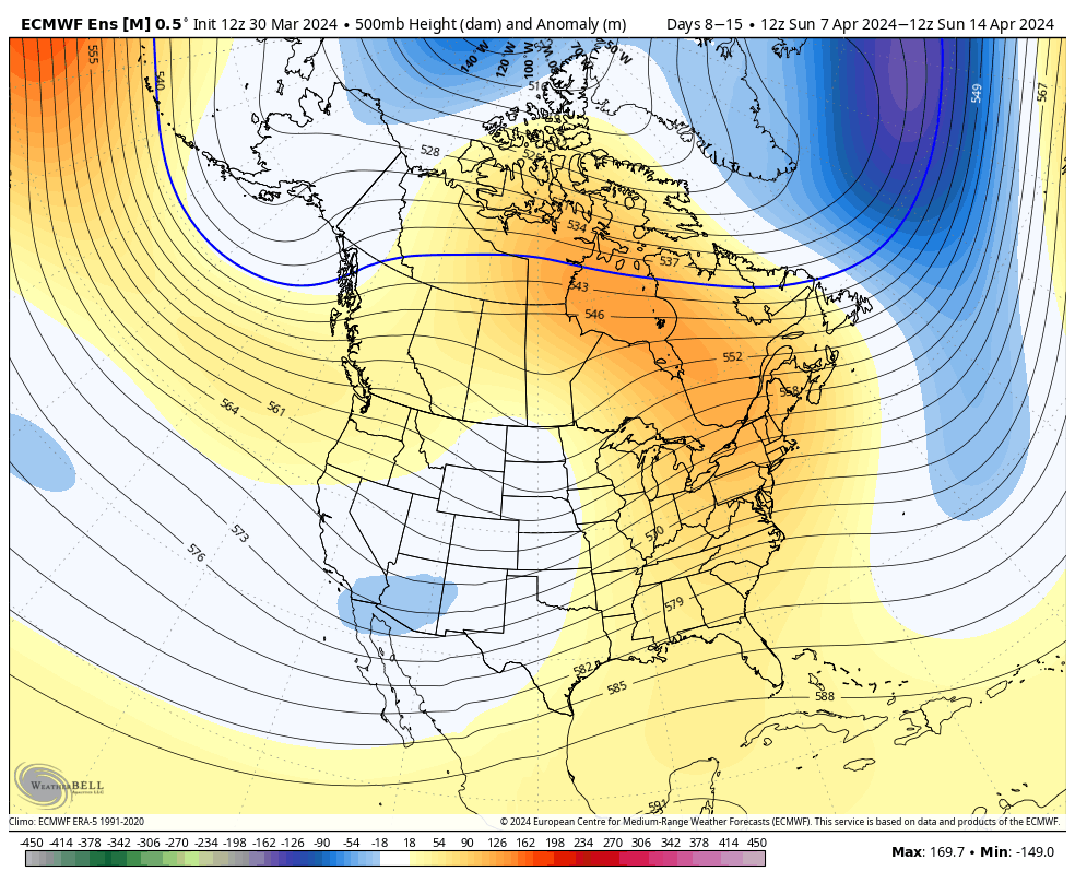
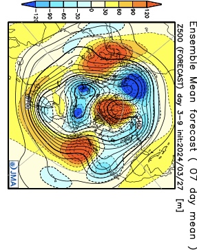
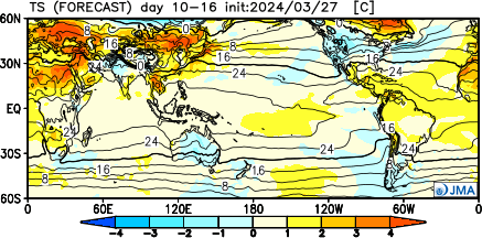
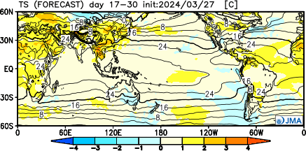
Overall, there’s no change in the idea of an active pattern continuing from Week 1 (image 1 below) into Week 2 (image 2 below).
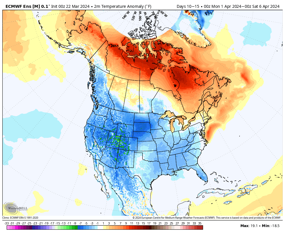
The cooler pattern behind our early week storm system will reverse in significant fashion Week 2. – Transitional regime at its finest.
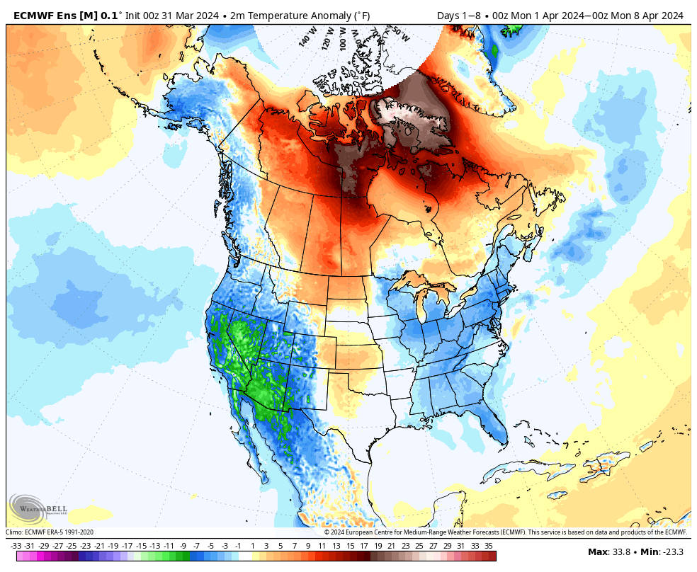
Week 1 temperature anomalies
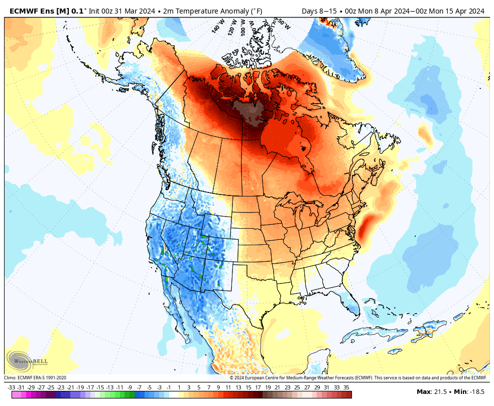
Week 2 temperature anomalies
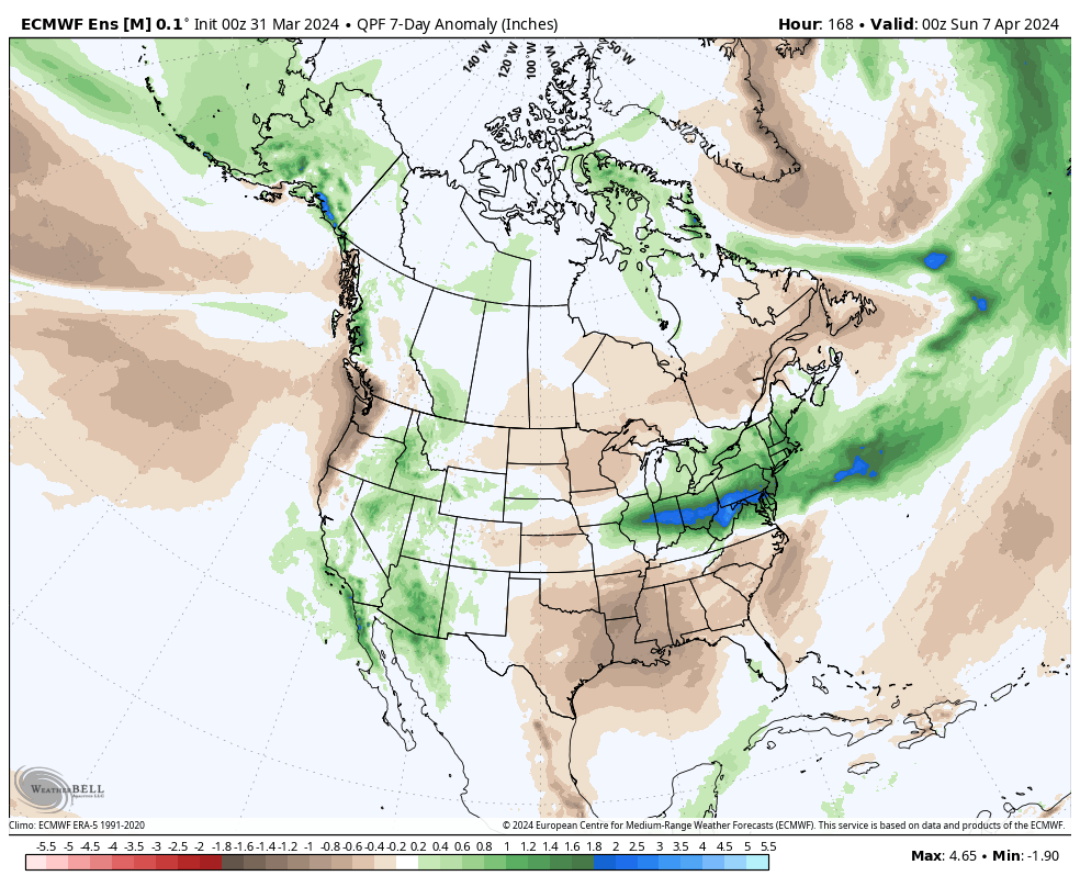
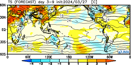
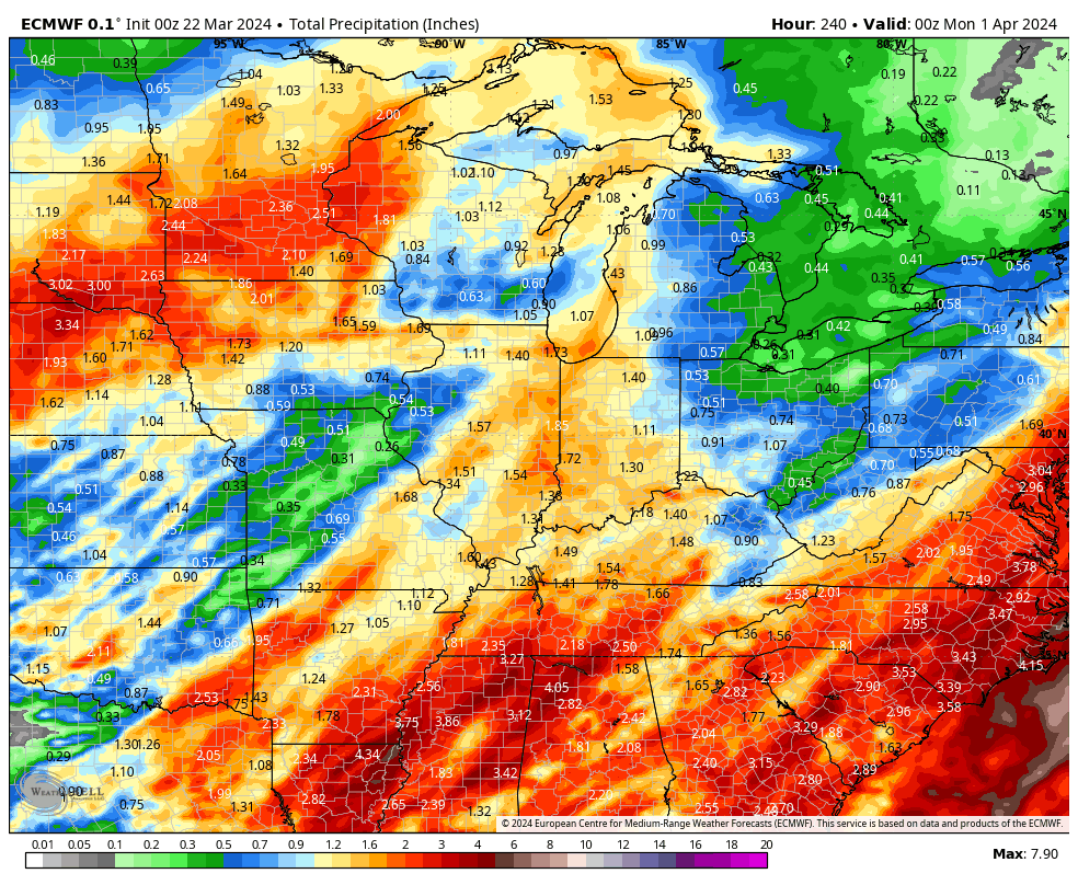
The busy nature of the pattern is reflected in the upcoming 2 week precipitation anomalies.
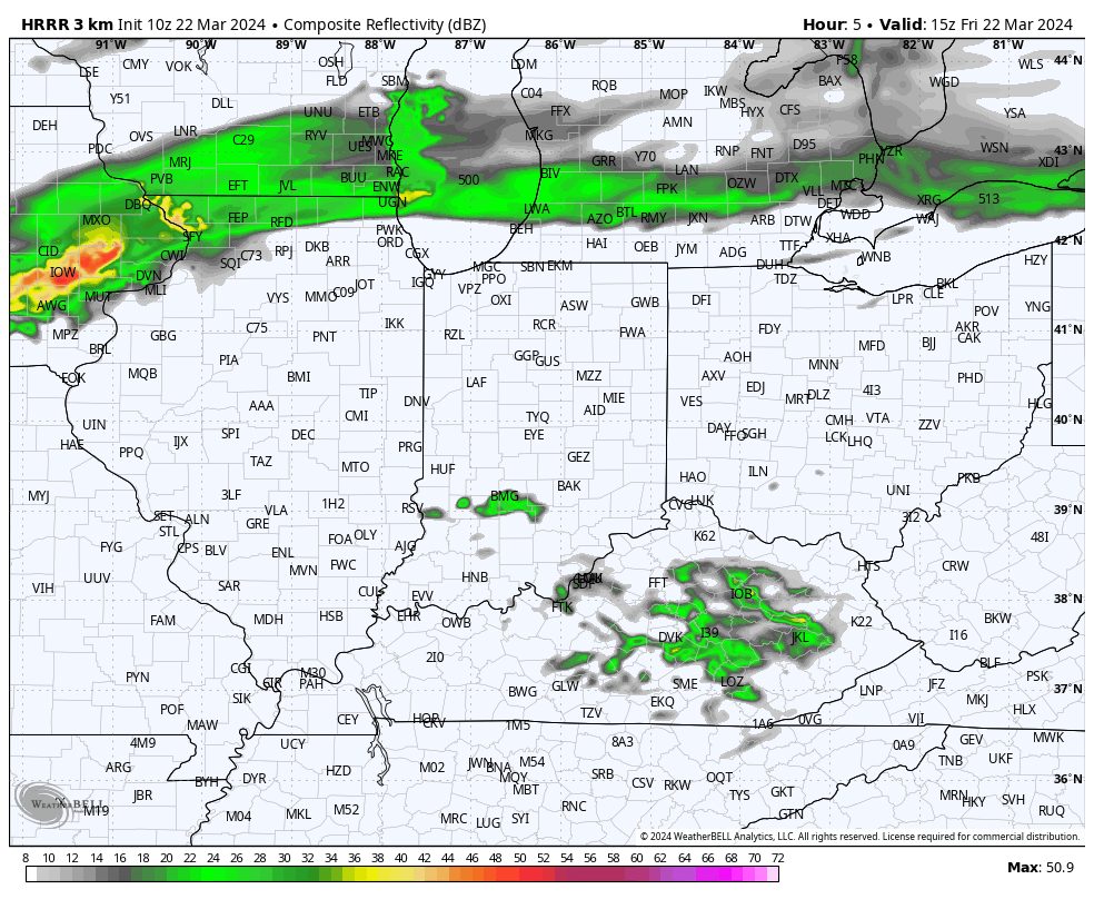
Severe weather will be possible at least across a portion of our immediate viewing area starting this evening and continuing daily through Tuesday.
Colder air will crash in here Wednesday and as an upper low swirls overhead, wet snow will develop. Snow may even fall heavily enough to accumulate on grassy surfaces in spots Wednesday night into Thursday morning.
Don’t get used to any one particular pattern for any length of time over the next few weeks. “Active” will sum things up best in a single word as a transitional regime takes hold.
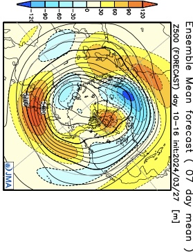
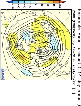
The NEW JMA Weeklies highlight this transitional theme best over the upcoming (4) week period.
Week 1
Week 2
Weeks 3/4
To no surprise, especially given the transitional nature of the pattern, the upcoming few weeks should feature above normal rainfall for a good chunk of the Great Lakes and Ohio Valley.
We’ll also want to keep tabs on the potential of greater than average severe weather episodes, notable considering we’re almost into April. It’s a byproduct of the “topsy-turvy” look to the overall pattern.
Pattern drivers, including the EPO, back up the transitional them over the upcoming couple weeks. Reminder, negative phase favors chilly conditions and positive phases favor milder air (compared to average). This look, too, screams wet and stormy.
Bottom line, buckle up for an active storm track and associated heavier than normal rainfall over the next few weeks. Temperature regimes will feature a bit of it all, including above and below normal periods, likely all balancing out slightly above normal when all is added up.
Updated 03.23.24 @ 10:51a A quiet weekend will turn more active as we open the new work week. We’re tracking this system and another storm late in the week. Both…
You must be logged in to view this content. Click Here to become a member of IndyWX.com for full access. Already a member of IndyWx.com All-Access? Log-in here.
The ‘mean’ trough position will take up shop across the western portion of the country over the upcoming week before shifting into the East in the 10-15 day period. We reiterate while the balance of the upcoming 2 weeks will run cooler than normal, we don’t see anything significantly colder than normal on the horizon and also plenty of transitional warmth ahead of approaching storms.
Note how the trough shifts east late in the period.
Day 1-5Day 5-10Day 10-15
Back to the immediate term, we’ll only see a few light showers later this afternoon (trace to 0.10”). Greatest coverage should arrive after lunch, continuing into mid-afternoon. Again, “light” is the key word.
Colder air arrives for the weekend, itself. We can expect mid to upper 20s both Saturday and Sunday morning.
A new, stronger, storm will blow into town with more in the way of widespread heavier rain and thunder Monday night into the day Tuesday.
Another system will follow late week and next weekend.
1” to 2” is a good bet across the greater region by next Sunday. (The bulk of this falls with our Monday night and Tuesday system).