Wednesday Evening Rambles: Cool, Wet, & Blustery Weekend On Deck…
I. A cold front will approach Indiana Thursday and result in increased cloudiness AND a better chance of scattered showers and thunderstorms- especially during the afternoon and evening hours. Though still warm and humid, temperatures will begin a “step down” process to eventually MUCH cooler readings this weekend.
II. Unsettled weather will continue Friday into Saturday as the surface front settles south. As an increasingly blustery easterly flow takes hold across central Indiana, cooler air will continue to “ooze” into the state. Highs shouldn’t make it out of the 70s Friday with considerable cloudiness and showers around.
III. Unseasonably cool air will be with us Saturday (most of the afternoon will be spent in the 60s for the majority of central IN, especially north of I-70). A stiff easterly flow and showers will continue.
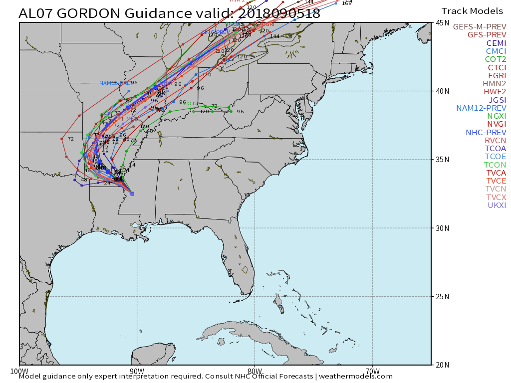
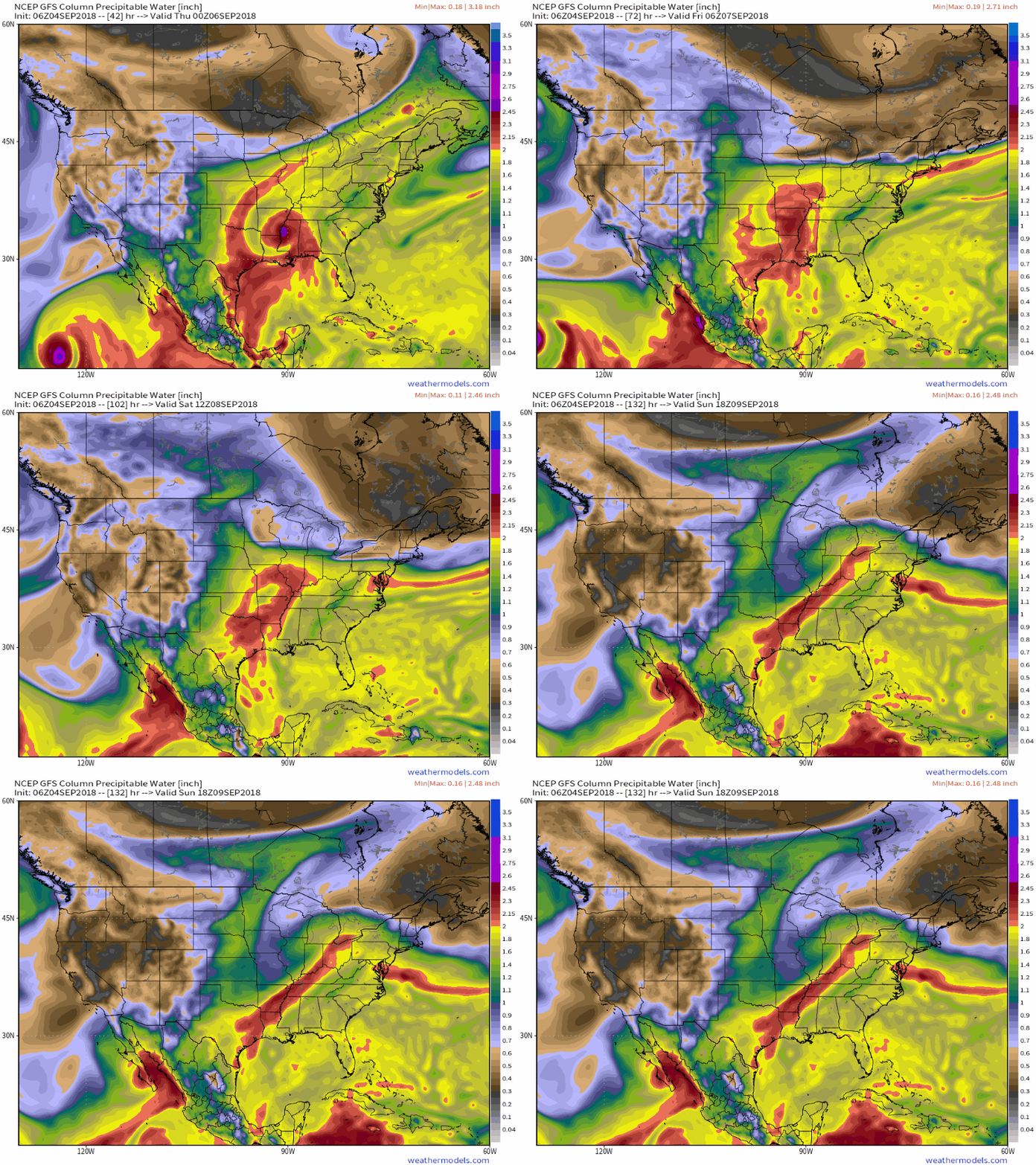
IV. The remnant moisture of Gordon will creep closer to the region Saturday PM before setting up shop Saturday night into Sunday evening. This is the most concerning period for potentially excessive rainfall rates and localized flooding. We still have time to watch things unfold, but the idea here is that widespread 2″ to 4″ totals are likely with locally heavier totals. This is “beefed up” from this morning’s call of 2″ to 3″. Stay tuned, especially if you live near water ways.
V. Finally, the tropical moisture will surge northeast Sunday night and Monday and a cold front will sweep through the region. This will set up a much drier and very pleasant period as we open up the new work week.
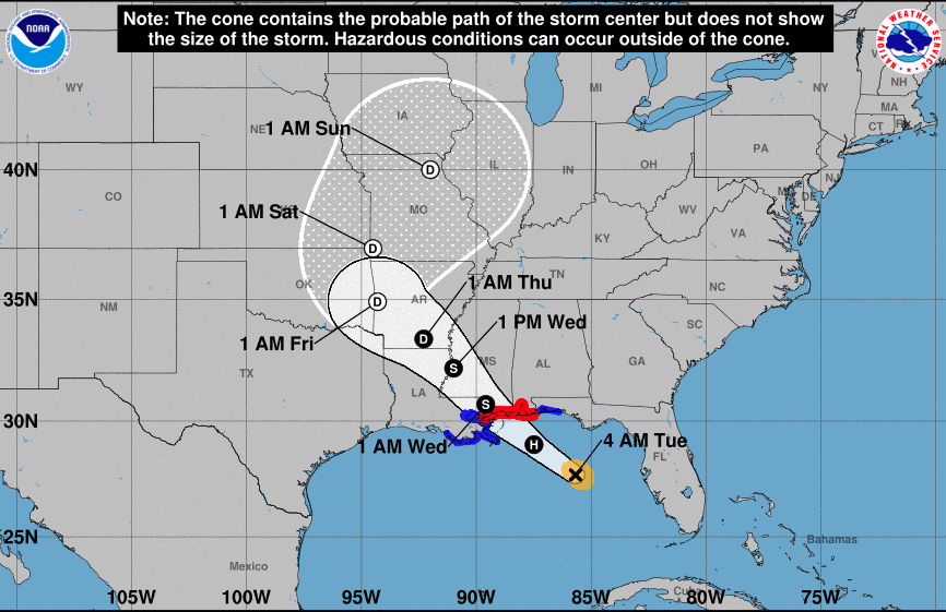 Mostly dry, hot, and humid weather will continue to gain headlines, locally, through midweek. Thereafter, a combination of ingredients spell for unsettled times late week and a rather wet weekend.
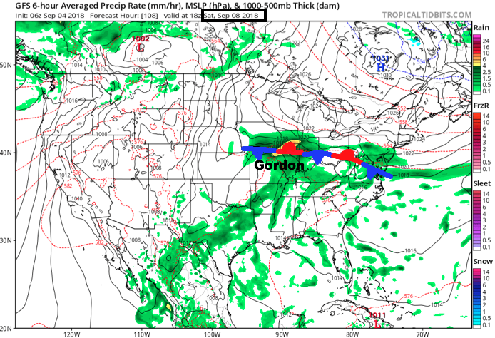
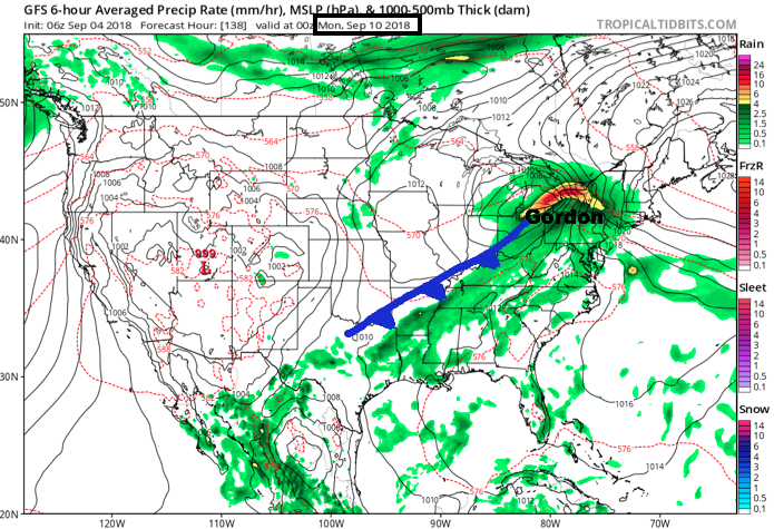 Eventually, Gordon’s remnants will track into the Northeast Sunday night into Monday and will allow the stationary front to sweep through the Ohio Valley. This will provide a drier air mass as we open the new work week.
 Widespread 1″ to 2″ rainfall totals are expected this weekend across central Indiana, including locally heavier amounts.