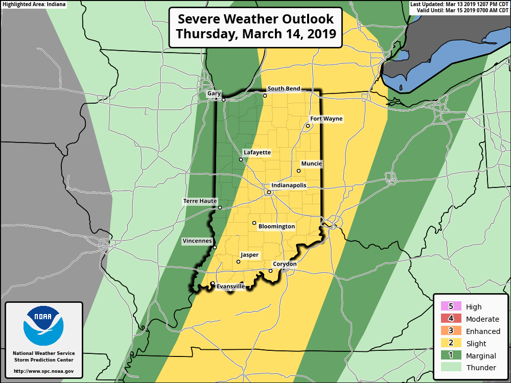
Significant weather alert day across central IN, including damaging wind potential and severe thunderstorms…
You must be logged in to view this content. Click Here to become a member of IndyWX.com for full access. Already a member of IndyWx.com All-Access? Log-in here.
What: All modes of severe weather, including tornadic potential. Damaging wind gusts.
When: Damaging wind gusts develop late tonight into the predawn Thursday. Severe storms are most likely Thursday afternoon into early Thursday evening.
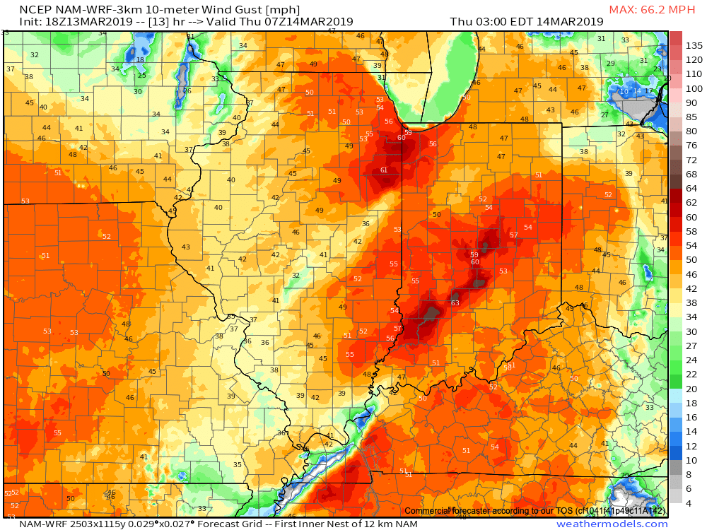
Wind: SW 45-55 MPH with gusts of 60 MPH+
Winds will begin to gust to potentially damaging levels during the overnight tonight.
A couple of rounds of thunderstorms will impact central Indiana during the overnight and again Thursday afternoon and evening. It’s the second round tomorrow afternoon that has us most concerned for the potential of strong to severe thunderstorms. A lot of this hinges on just how much clearing takes place from the morning round of showers and embedded thunder. Should we clear things out in significant fashion, and introduce some sunshine, the threat of severe weather tomorrow afternoon will grow significantly. Conversely, should we hold onto a mostly overcast sky, this will limit the overall severity of afternoon storms. The sun would help destabilize things in rather rapid fashion and given some of the other parameters in place, would lead to all modes of severe weather with storms that develop tomorrow afternoon- including large hail and tornadoes.
Additionally, due to the sheer strength of the storm system, damaging winds are still in play tomorrow (even outside of thunderstorms). In fact, winds will begin to gust upwards of 50 MPH+ during the overnight period tonight. If you haven’t already, please take the time now to tie down or secure loose objects to keep them from being blown about in the wind.
Conditions will begin to improve as early as tomorrow night, although we’ll turn much colder. Air will grow cold enough to promote “wrap around” moisture to fall in the form of snow by Friday afternoon.
Threat of strong to severe storms will be greatest Thursday afternoon into the early evening hours.
Thursday is shaping up to be a significant weather day across the state. Multi-threat severe potential and damaging wind event both on the table…
You must be logged in to view this content. Click Here to become a member of IndyWX.com for full access. Already a member of IndyWx.com All-Access? Log-in here.
Concern is growing for the potential of severe weather Thursday. A strong and potentially damaging wind event is still on the table Wednesday night through Thursday, as well…
You must be logged in to view this content. Click Here to become a member of IndyWX.com for full access. Already a member of IndyWx.com All-Access? Log-in here.
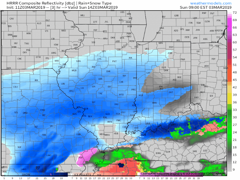
Snow will overspread central Indiana through the late morning hours into the afternoon.
While the overall idea where the accumulating snow would fall was a good one from early week, our initial expected amounts won’t come to fruition. The reason? The storm system is much weaker and faster moving than originally modeled.
Accordingly, this is a 1″ to 2″ type event for most of the area. The majority of the snow will fall from noon to 5p.
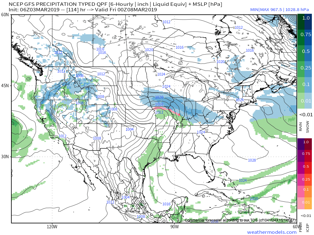
A period of snow will scoot across central Indiana from late morning into the early evening hours.
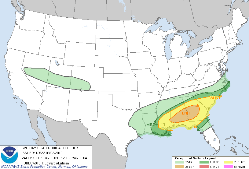
This same storm system will be responsible for a severe weather outbreak, including the possibility of a couple of strong tornadoes, across the Deep South this afternoon.
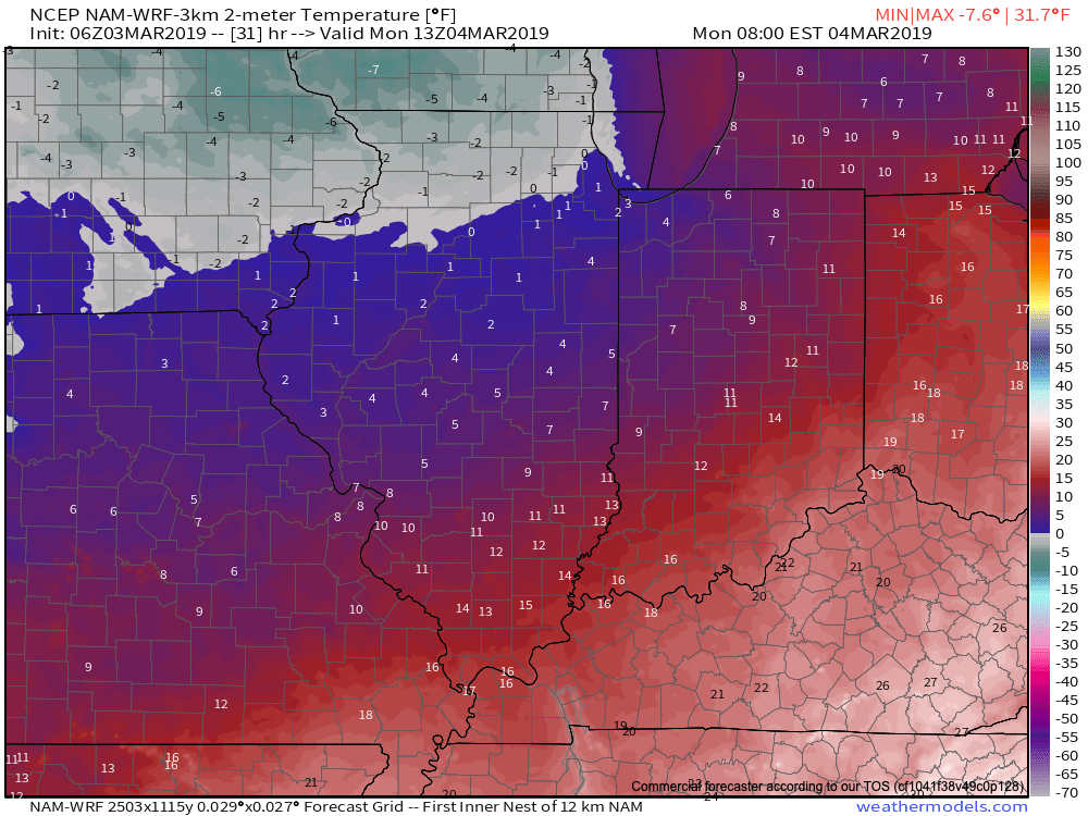
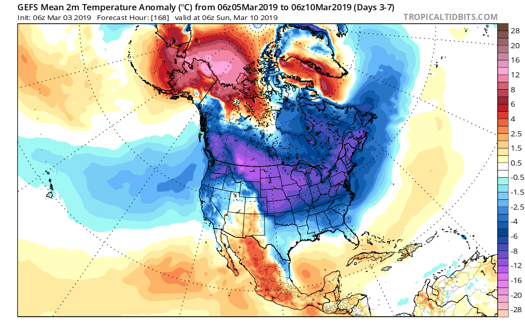
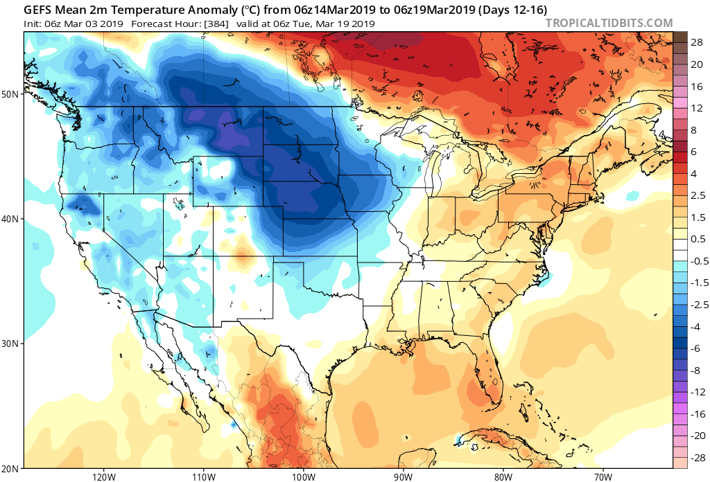
Back here on the home front, MUCH colder air will pour into the region this evening, remaining in place into the new work week. Back-to-back nights with lows in the upper 0s to lower 10s can be expected across central Indiana Monday and Tuesday mornings.
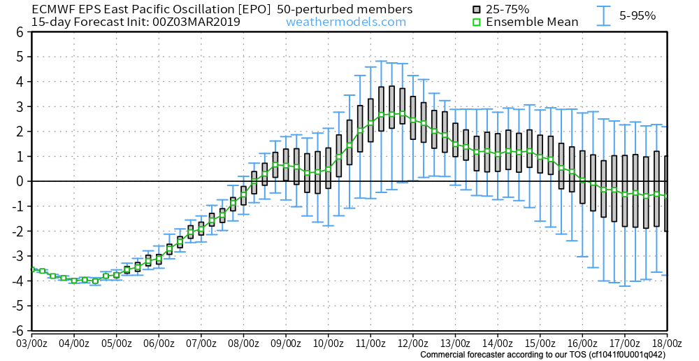
This is all part of the overall colder than normal first half of March, powered by the SOI crash (several week ago), deeply negative EPO, and MJO rumbling through the cold phases.
Additional storm dates to keep note off include Thursday night into Friday (more of a wintry threat with the 3/7-3/8 system) and Saturday into Sunday (potential strong thunderstorms with the system on 3/9-3/10).
Looking ahead, it still appears the mid-March warm-up is on track as the EPO flips to positive.
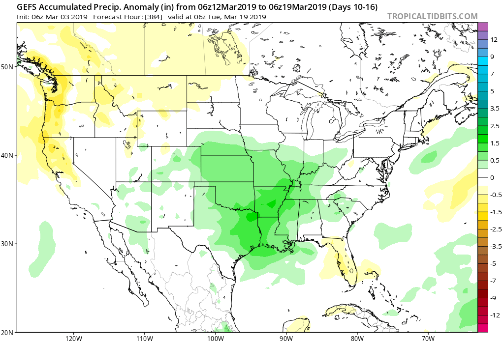
With that warm-up will also come a return of heavier precipitation events and a continued overall active storm track across the region. Precipitation looks to run above average for the mid-month stretch.
We’ll dig deeper early week on what lies ahead as we close the month of March and look ahead towards April…