The combination of passing storms and the setting sun Tuesday evening provided sun incredible rainbows. Thanks to John Feister for sharing this photo taken near Whitestown. John Salewicz snapped this…
You must be logged in to view this content. Click Here to become a member of IndyWX.com for full access. Already a member of IndyWx.com All-Access? Log-in here.
Highlights of tonight’s video: Strong to severe storms Active pattern continues Serious weekend heat Tropics turn active PS: We continue to experience technical issues with a slight lag on audio/…
You must be logged in to view this content. Click Here to become a member of IndyWX.com for full access. Already a member of IndyWx.com All-Access? Log-in here.
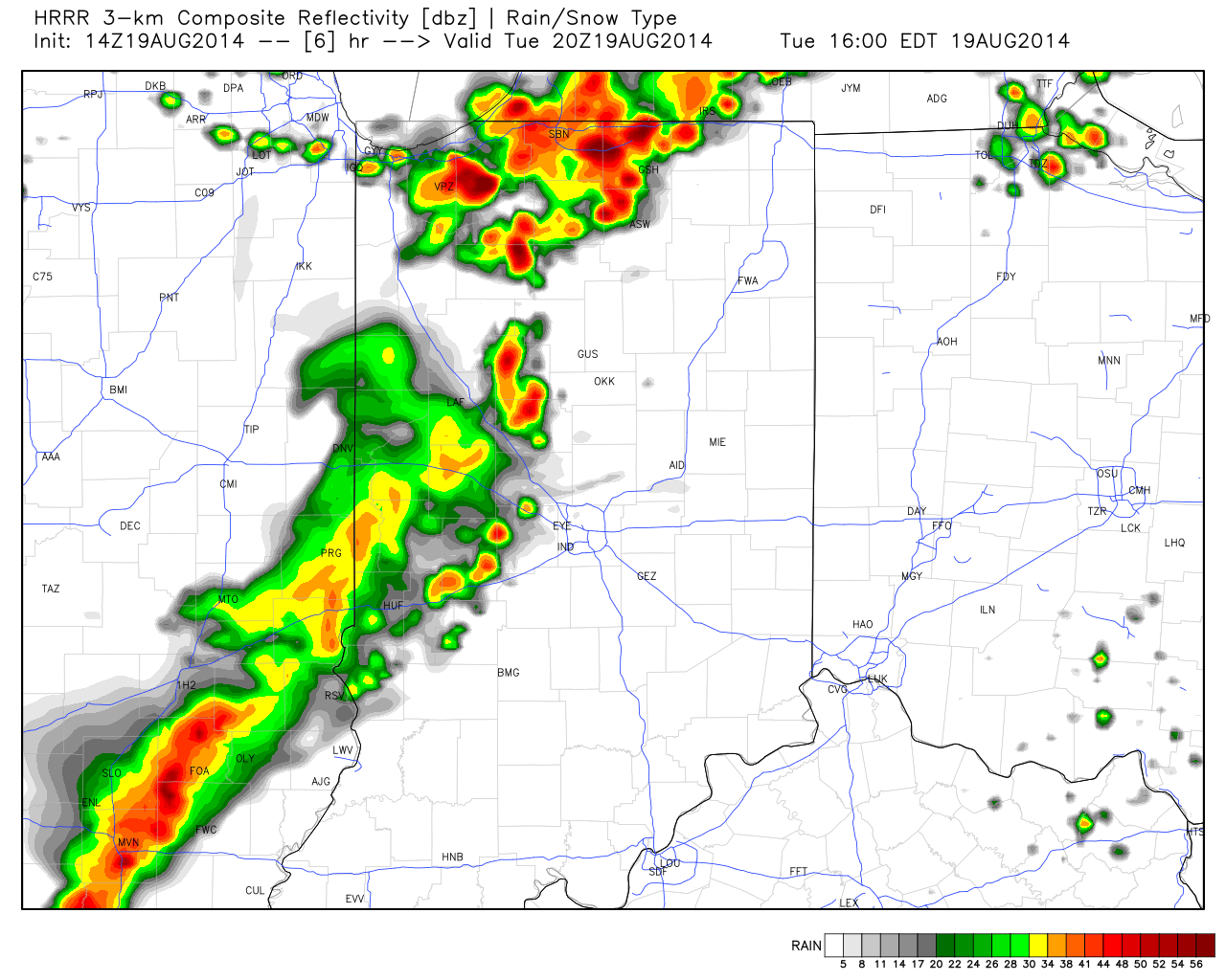
A look at some of the latest data hot off the press suggests we remain under fire for the potential of scattered strong to severe thunderstorms late afternoon into the evening hours. Initial activity could fire as early as 3-4 o’clock across western sections. The latest HRRR forecast radar (valid at 4pm) shows an advancing line of strong, and possibly severe, storms pushing east.
Again, the primary threat is damaging wind, but a couple hail reports will also be possible.
As of the 12 o’clock hour, a complex of thunderstorms sits to our west across western/ central portions of Illinois. We’ll keep a close eye on this complex as it continues pushing east and likely intensifies in a hot, humid, and unstable air mass over the next few hours. Please plan a way to keep abreast of the latest radar and local media this afternoon and evening as storms move in.
Mostly Dry Start To The Work Week…Dense fog is around in spots this morning, particularly northwest of the city. Otherwise, a broad circulation around a departing area of low pressure may help spark an isolated shower or thunderstorm across east-central parts of the state this afternoon. The key word here is “isolated,” however, and most will remain rain-free today.
Better Rain/ Storm Chances…Details on timing are still murky, but we forecast better rain and storm chances Tuesday afternoon on through the mid week period. With all of the moisture in the air, locally heavy downpours can be expected. The nature of the showers and thunderstorms will be what you would expect this time of year- scattered, meaning not everyone will see beneficial rains.
Serious Heat And Humidity…Temperatures will reach the hottest levels of the summer late week into the weekend. Plenty of humidity will be in place as well and conditions may warrant watches, warnings, or advisories for the heat and humidity Friday-Sunday. In a summer that’s spoiled many of us with unseasonably cool conditions, we’ll make up for at least a portion of lost time over the upcoming weekend.
7-Day Precipitation Forecast:
7-Day Rainfall Forecast: 0.50″-1.00″
7-Day Snowfall Forecast: 0.00″
While today will be mostly dry, better chances of scattered thunderstorms lie ahead Tuesday.