 Highlights:
- Another round of strong to severe storms rumble in tonight
- Significant severe weather outbreak Monday
- Storms and flood threat continue Tuesday
- Drying out and turning hot late week
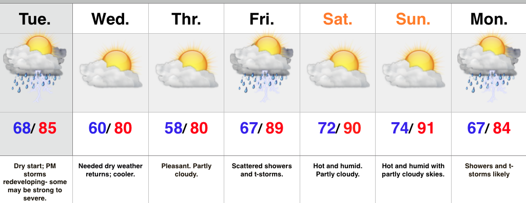
A very active weather pattern will remain through the short-term. Overnight storms have exited to the southeast and we’re now dealing with dry weather and sunshine. A few storms could bubble up this afternoon in the very humid air mass, but the more widespread showers and thunderstorms will hold off until late tonight as another northwest to southeast moving complex rumbles in. Similar to early this morning, flash flooding will be a concern, along with the potential of damaging wind, and hail.
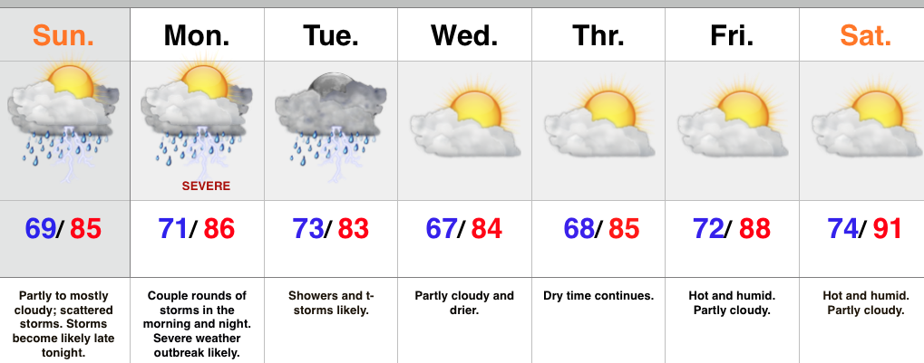
Perhaps more concerning is what we think will be a secondary thunderstorm complex Monday evening into Monday night. Furthermore, conditions appear to favor the threat of a couple super cells developing in advance of the big storm cluster. These individual super cells will have the potential of producing tornadoes and large hail. We’re then concerned of a widespread damaging wind threat with the large storm complex as it moves southeast. Torrential rains and flash flooding will also be a big concern.
Showers and thunderstorms will continue Tuesday, but there’s a light at the end of this wet tunnel by mid week. We forecast a few days of dry weather in the Wednesday through Saturday time period. As ridging expands, heat and humidity will build in a big time way. For those holding out for true summer heat, next weekend may be your time! That said, the long range pattern still supports a wetter/ cooler than normal regime quickly returning so enjoy!
Upcoming 7-Day Rainfall Forecast: 2″-3″ with locally heavier totals