Changes Are Brewing Friends…
You must be logged in to view this content. Click Here to become a member of IndyWX.com for full access. Already a member of IndyWx.com All-Access? Log-in here.
You must be logged in to view this content. Click Here to become a member of IndyWX.com for full access. Already a member of IndyWx.com All-Access? Log-in here.
 Highlights:
Relatively quiet weather remains in the near-term period. A fast moving disturbance will cross the state this morning and could spark a light shower or sprinkle, but we’ll get back to increasingly sunny conditions this afternoon and evening.
Moisture will begin to return as we close the week and head into the weekend, but it’s really not until the second half of the weekend that we begin looking at more widespread rain.
As a SW flow begins to transport Gulf of Mexico (GoM) moisture north, a light passing shower is possible Friday evening and Saturday.
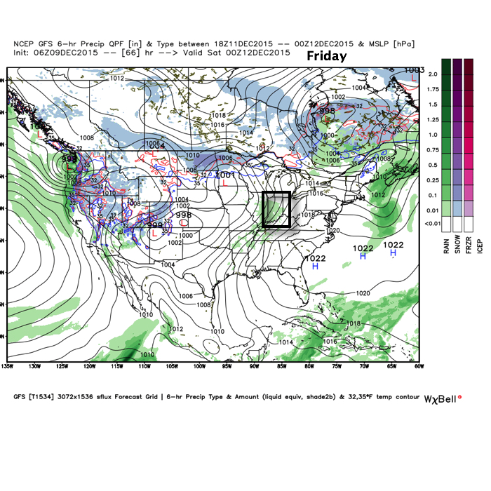
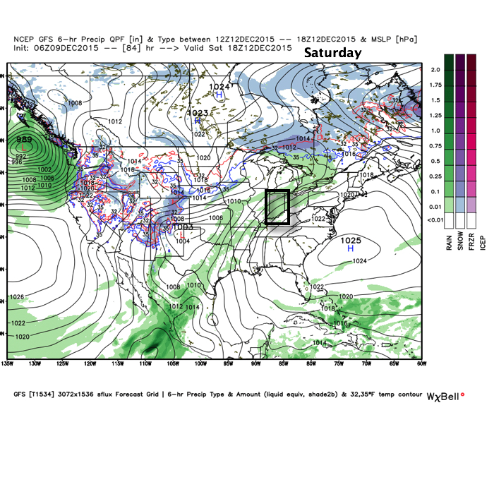
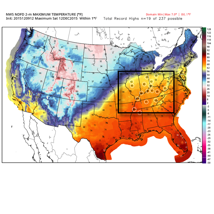
Despite the increase in cloudiness and threat of a passing shower, it won’t keep us away from flirting with records Saturday, and note the widespread portion of the Tennessee and Ohio Valley that will also be in jeopardy of setting new records.
Much better rain and storm chances ramp up Sunday afternoon into Monday.
PWATs (precipitable water values) increase dramatically during the aforementioned time period and could help fuel locally heavy rains during that time period, particularly with embedded thunderstorms.
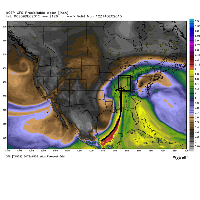
Cooler air will arrive early next week, but remain significantly above normal. We’ll discuss the longer range a bit later…
 Highlights:
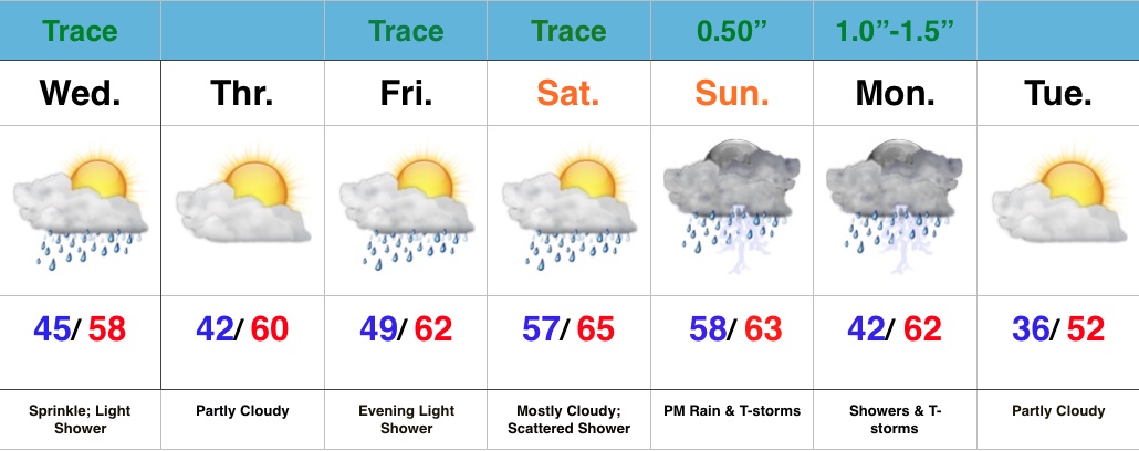
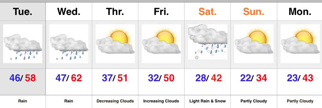
A quick glance at the updated 7-day shows two things, a lack of cold air and a rather active time of things. In the near term, it remains a relatively quiet period. We’ll deal with morning fog in spots this morning (especially north-central IN) and another fast moving disturbance in the Tuesday night-Wednesday time frame.
The big story as we move into the back half of the week is the unseasonably warm regime that will have many asking “What season are we in?” We’ll aim for the upper 50s Thursday, around 60 Friday, and upper 60s Saturday as a strong SW flow develops in advance of our next storm system
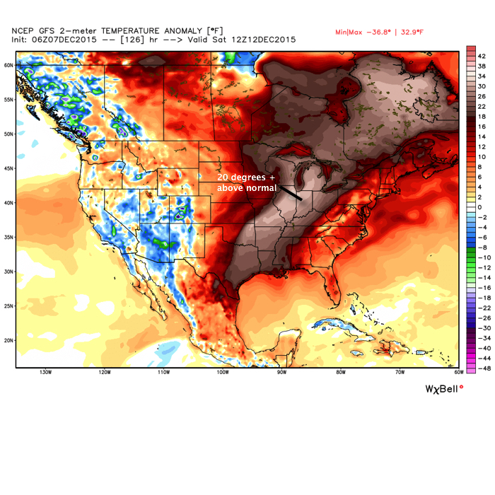
While a scattered, fast moving, shower is possible Saturday, the big story will be the warmth and a gusty SW breeze.
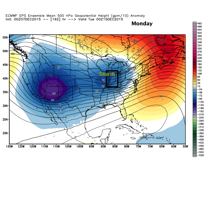
Our storm system will grow closer Sunday and we’ll ramp up rain and storm chances accordingly during that period. Our two most trusted global models handle things differently as we progress into the Sunday-Monday time frame (strength, track, and timing), and we’ll need to continue to fine tune that particular period as we move forward. As it stands now we’ll forecast rain and thunderstorms to become widespread Sunday before colder air arrives on the backside of the storm. Stay tuned.

 Highlights:
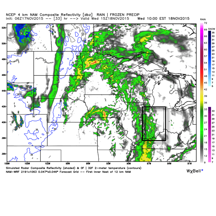
Periods of rain will continue into the mid to late afternoon across central IN as “wave 2” of our current storm system moves through. We’ve added a couple simulated radar images below, courtesy of Weatherbell.com.
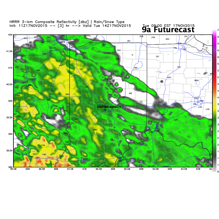
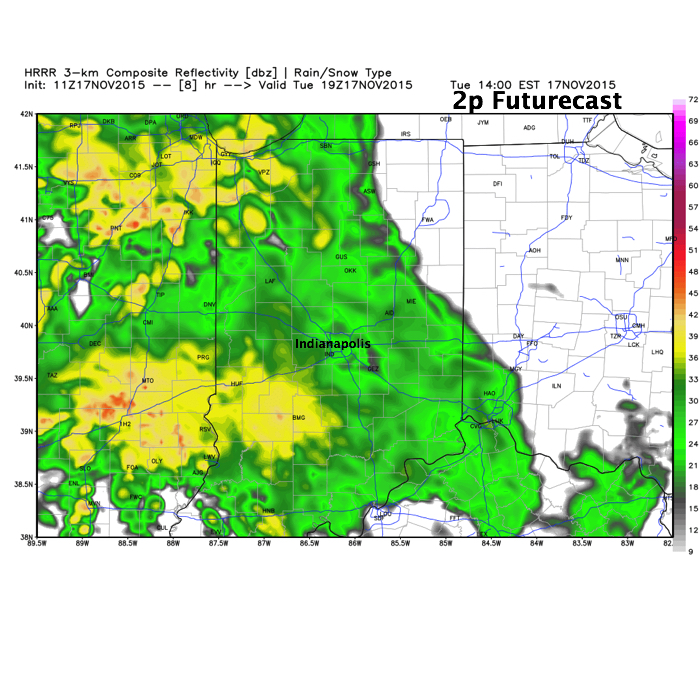 This is all in association with a significant autumn storm system that’s been responsible for delivering hefty snows across the Rockies, blizzard conditions across the High Plains, and severe weather across the central and southern Plains. This storm will lift northeast over the next 24-36 hours.
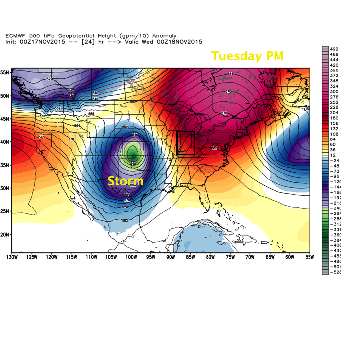
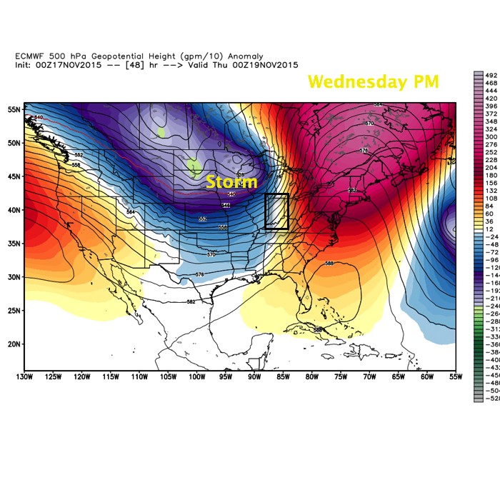 A third, and final, wave of moisture will push through the state Wednesday, in a weakened state from what our friends to the west will experience (where another round of severe is expected today and tonight). This is what the radar may look like mid-morning-ish Wednesday.
 When all is totaled up from rain that began Monday afternoon and ends Wednesday afternoon, many locales will pick up 1.5″-2″ of needed rainfall. While significant, those numbers are lower than what originally model data implied, but we’ll take what we can get to push closer to average for November rainfall.
All eyes will then shift to our second storm system that will arrive over the weekend. There are still more questions than answers in regards to track of this next “wave” of low pressure, but with much colder air in place and pouring in behind the system, snow will fly across northern IN. As of now we forecast the majority of this event to fall in a liquid form across central IN, but even here precipitation may end as light snow showers the way things stand now. Stay tuned as we continue to fine tune the track. Regardless, much colder air will be with us to end the period.
Enjoy the weekend, my friends, as a big and wet storm system awaits on deck to impact early to mid week across the region.
November, so far, has followed suit of the past few months in a much drier than normal regime. Over the past (7) days heaviest rains fell across SE portions of the state. On the month so far, IND sits around 1″ below normal.
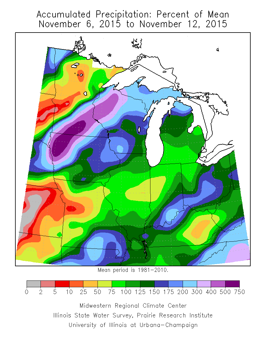
That rainfall deficit may be eaten up over the course of a couple days as our next storm system rolls off the Rockies and into the Plains. (Track sound familiar)?
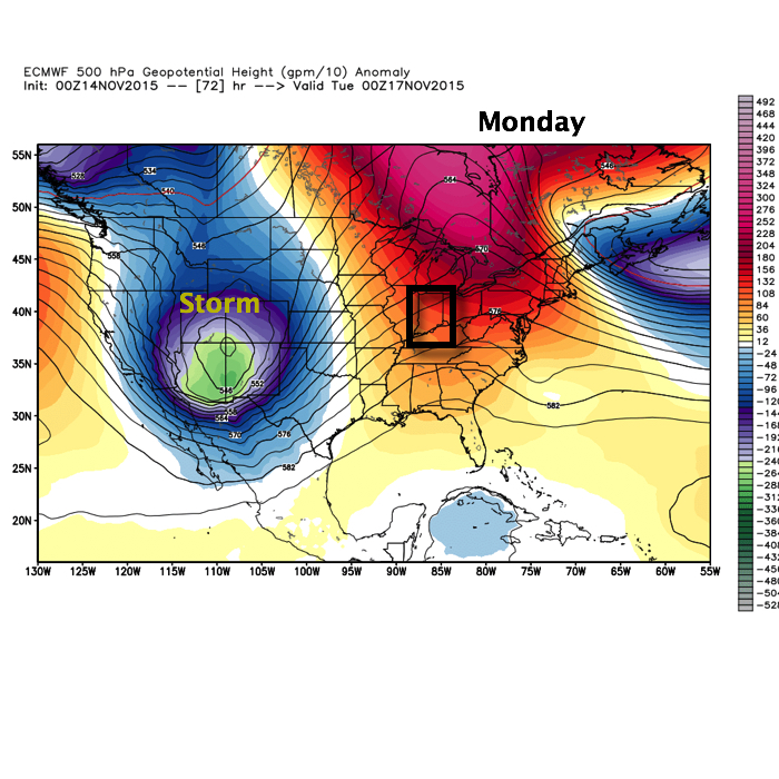
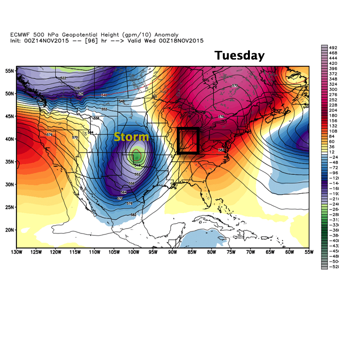
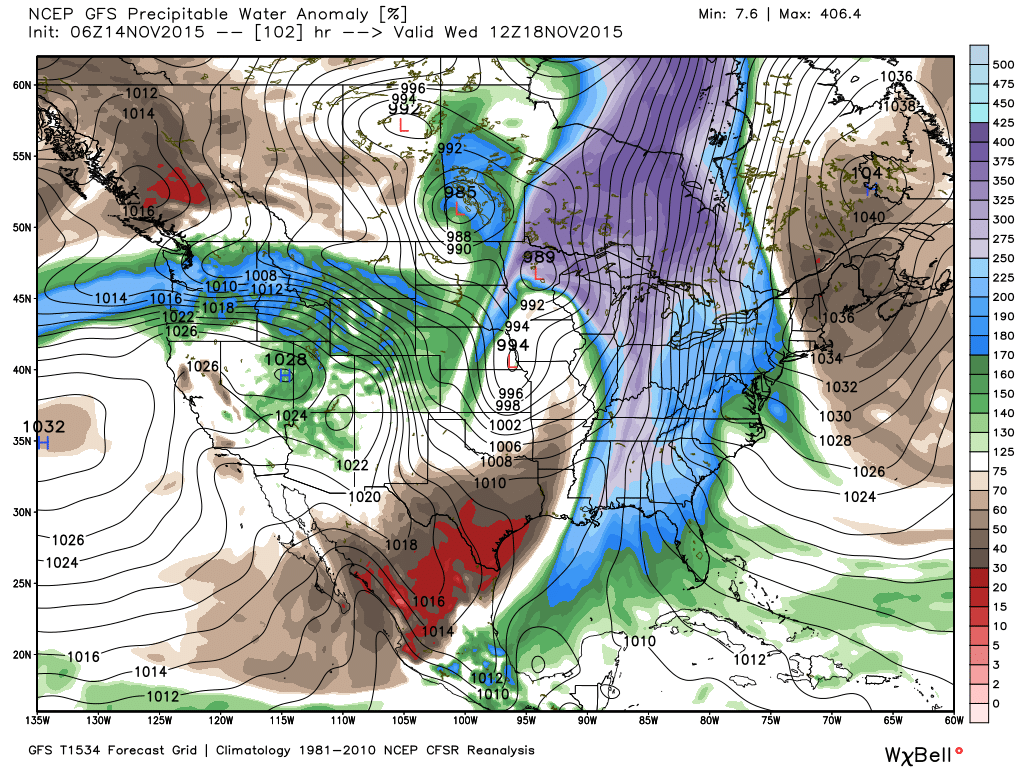
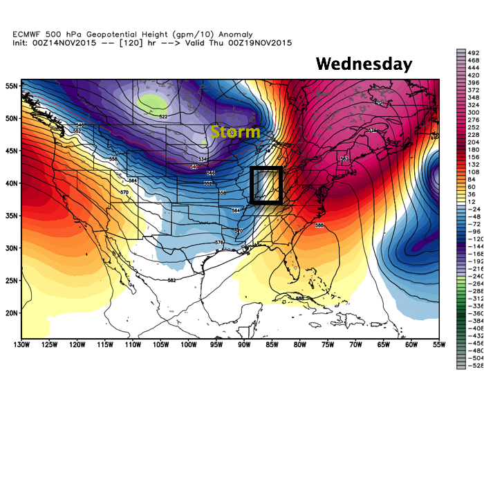 The storm will tap into the Gulf of Mexico and include a deep southerly flow plenty capable of producing a heavy rain event across the region. Note PWATs (precipitable water) nearly 300% of normal.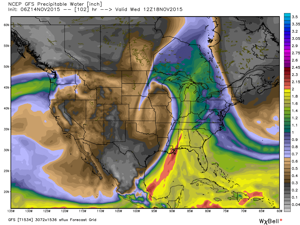
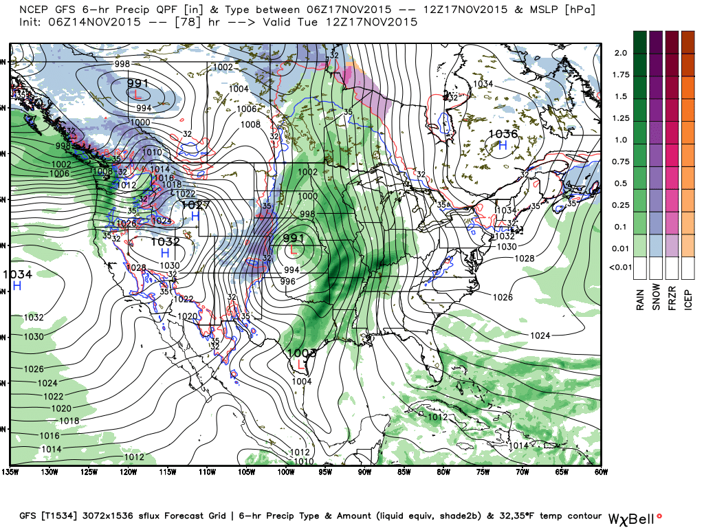
We target Tuesday night-Wednesday as the focal point for heaviest rain potential and model data remains firm on general consensus of 2″-3″ falling with this next storm system, including locally heavier totals.
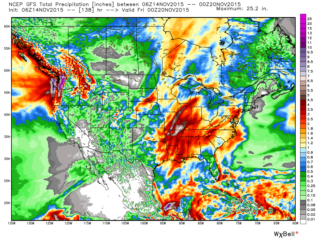 After this next storm, attention will begin to shift towards a colder pattern setting up for late November, including Thanksgiving…