Strong Winds; More Heavy Rain…
Screen Shot 2015-12-28 at 7.38.21 AMHighlights:

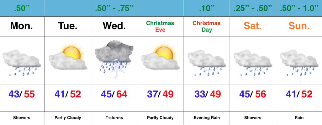
  • Strong winds and flood threat continues
  • Weak mid week system
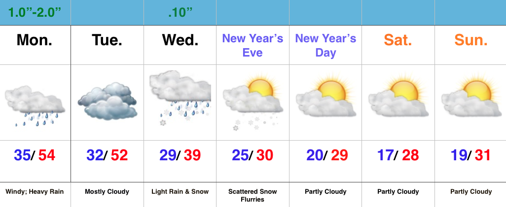
  • Much colder to open the New Year

Strong Winds And Flood Threat Remains…What an active morning across central IN!  Northeast winds are already gusting around 40 MPH with periods of heavy rain this morning.  Across our northern tier of counties (mainly north of a line from LAF to KOK) freezing rain and sleet is the issue this morning with temperatures below freezing.

Periods of heavy rain will continue today, and we also note the threat of embedded thunder (damaging wind risk) this evening, bracketed between the hours of 6p-8p.

Image below is courtesy of Weatherbell.com

StrongWindsTemperatures will remain cold and raw through most of the day before we see a late day rally briefly into the lower to middle 50s.  It’ll be another day with a tight temperature gradient across the state, as northern IN will struggle to make it much above freezing, while southern IN approaches the upper 60s this evening.

Midnight highs Tuesday can be expected before temperatures crash.

We’ll then set our eyes towards a weak wave of low pressure that looks to deliver a light mixed bag of precipitation Wednesday morning.  The freezing line will run through the central part of IN and a mixture of light snow and light rain can be expected.  MUCH colder air flows into the state behind this system and sets the stage for a cold open to 2016.

Image below is courtesy of Weatherbell.com

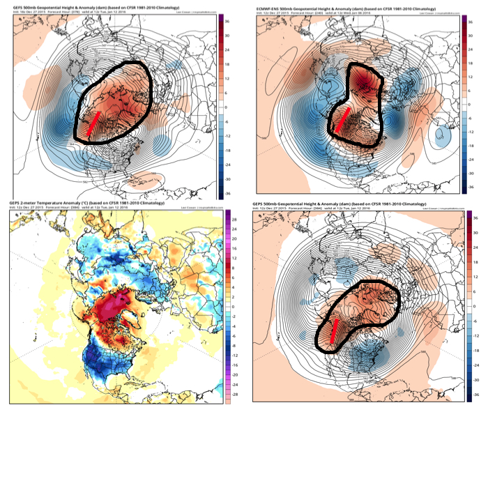
WednesdayForecast models continue to show an expected pattern shift to all-out sustained cold and wintry conditions for mid and late winter.  Note the W NA ridging developing.  Additionally, blocking and a negative AO develop as mid January nears.  Think this is the year without a winter?  Better think again, my friends.

Image below is courtesy of Tropicaltidbits.com
MidJan2016

Severe Weather & Record Warmth…

A very active weather day is in store for central IN.  As we type this (6:30 am), temperatures are hovering around 60 degrees.  Simply put, that’s hard to believe.  We’re on our way to a record warm day, with highs in the middle 60s across central IN.

The main story, however, will be the severe weather our area may have to deal with in (2) waves this afternoon/ evening.

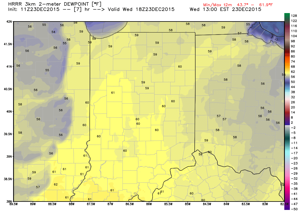
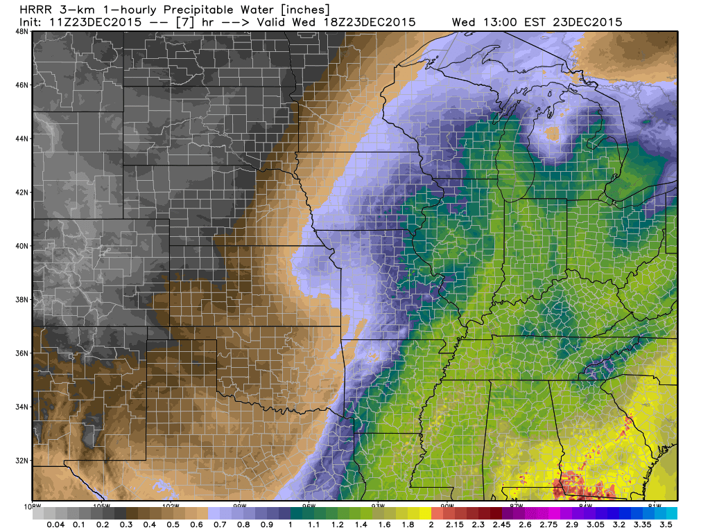
The Set-up:  A short wave trough will eject out of the southern Plains into the Great Lakes region.  A surface low and associated cold front will accompany this trough.  Unseasonably warm and moist air will spread north this afternoon and evening, including surface dew points in the lower 60s.  PWATs (precipitable water values) will exceed 1.25″.

DewPoint

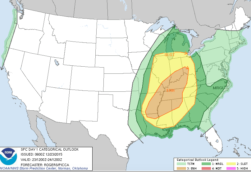
PWATThe Storm Prediction Center has expanded the Slight Risk of severe for all of the state, including an Enhanced Risk across southern IN.

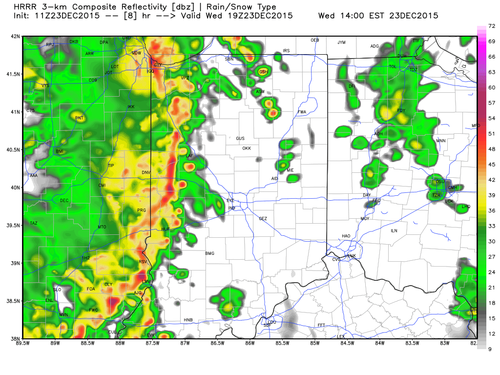
Screen Shot 2015-12-23 at 7.15.53 AMTiming:  We think potentially (2) waves of storms will rumble through the state today.  The first likely comes during the early afternoon with a potential second line of storms blowing through the area in direct association with the cold front later this evening/ tonight.  Admittedly, it’s tough to pin point the second potential wave of activity until we see what/ how the first round of storms impact the local air mass.

*As always, the forecast radar products we show should not be taken verbatim.  These are used for guidance in building our forecast and provide a look at what the radar may look like during a given time frame.

2p forecast radar, courtesy of Weatherbell.com

Impacts:  We remain most concerned for the potential of damaging thunderstorm winds, but stress that we can’t rule out a quick spin-up tornado with this type set-up.

Most importantly, have a means of getting the latest weather information today, especially if you’re traveling.  Set those weather radios to alert you of any watches or warnings that may come later today.

Looking ahead:  We still forecast a significant rain event that will likely lead to flooding early next week.  Model data remains very consistent on the potential of 4″-6″ of rain over the upcoming 7-day period.  Afterwards, a blast of arctic air looks to invade to welcome in 2016.  More on both of these events after we deal with today’s severe.

Active Wednesday Only The Beginning….

Rumbles of thunder woke several folks up (yours truly included) during the overnight. This was just a teaser for what lies ahead Wednesday as we continue to think a very…

You must be logged in to view this content. Click Here to become a member of IndyWX.com for full access.  Already a member of IndyWx.com All-Access?  Log-in here.

Active Stretch Of Weather…

Screen Shot 2015-12-21 at 7.32.21 AMHighlights:

  • Several storms to track
  • Mid week thunder
  • Mild pattern continues through the period

Hard to believe Christmas week is here!  Unfortunately for travelers, we’re looking at a very active stretch of weather through (and beyond) the Christmas holiday.

We’re opening the short work week with rain falling across the state this morning.  Steady rains will taper to showers late morning into the afternoon before drier air invades the region for a quiet Tuesday.

Storm system number 2 blows into town Wednesday and we’re a bit concerned a strong to severe storm may even be possible around these parts Wednesday.  Damaging straight line winds are of greatest concern.  Despite the rain, a strong southerly flow will pull abnormally warm and moist air north, helping add to the ingredients for mid week storms.

Our mid week storm will swing a cold front through here Wednesday night, setting the stage for calmer and cooler (but still above normal) weather Christmas Eve – Christmas Day.  As moisture returns, we’ll forecast a mostly cloudy Christmas with showers/ drizzle possibly developing as early as Christmas evening.

Another complex storm system will be with us for the weekend, but the specifics with this system are still up in the air and will require fine tuning as we draw closer.  Heavy rain appears to be the biggest threat from this distance.  Get the idea that we’re looking at an incredibly busy time of things? 🙂