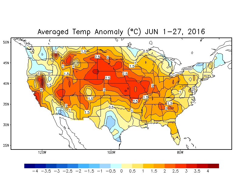
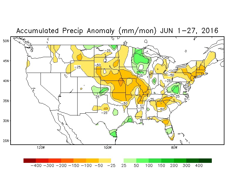
June to date is running warmer (+3.6°) and wetter (+0.71″) than normal in Indianapolis.
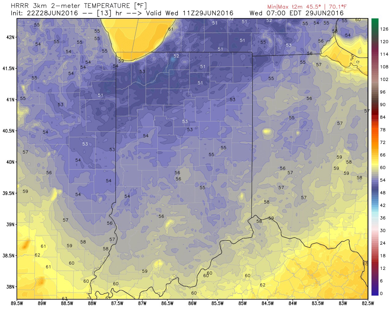
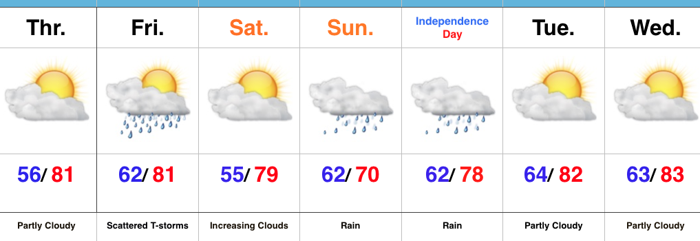
That said, drastic changes have taken place over the past 24 hours for the cooler and drier. In fact, as we write this, many central IN neighborhoods are enjoying temperatures in the lower 60s already at the 10 o’clock hour. An unseasonably cool night is in store with widespread low-mid 50s come Wednesday morning. (Anyone else craving fall)?!🍂
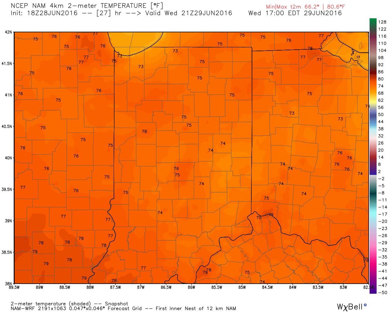
Highs Wednesday afternoon will only reach the upper 70s for most.
Our next chance of rain will arrive on scene to close the work week, however, moisture return still doesn’t look terribly impressive. We’ll continue advertising widely scattered coverage Friday.
The plot thickens as we roll into the crucial Independence Day weekend. Latest data suggests a hefty rain storm will be in our general vicinity, but we caution many details have to be ironed out. Our forecast, locally, Sunday-Monday may differ drastically over a relatively short piece. Fine tuning on track, timing, and amounts will have to be adjusted.

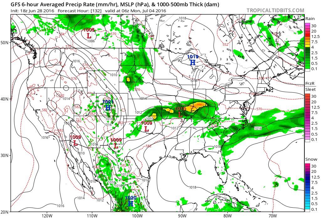
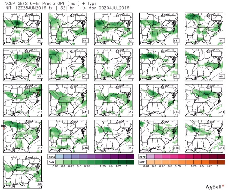
GFS ensemble members also show the challenging times ahead.
Stay tuned! In the meantime, get those window opens and enjoy the weather!
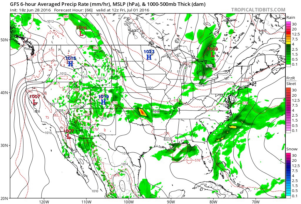
 A line of thunderstorms will develop later this afternoon and a few of these could be strong to severe as they push to the south. Large hail and damaging straight line winds are of greatest concern. We think best chances of thunderstorms across central IN will come during the mid to late afternoon hours into the early evening.
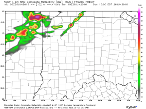
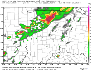
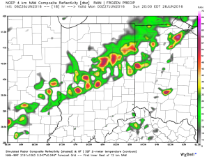
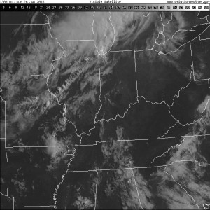
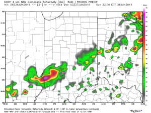 The air mass is loaded with moisture today. In fact, precipitable water values will zoom to 2″+ this afternoon and suggest the threat of torrential rainfall with any storm that develops.
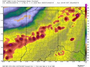 Once to Tuesday, a MUCH cooler, drier air mass will arrive on the scene and help set up an unseasonably cool close to the month.