Drier Weather Arrives For Midweek; Unsettled Easter Weekend…
 Highlights:
- Drier air arrives
- Unsettled Easter weekend
- Drier; cooler early next week
Brighter Days Ahead…Needless to say, our storm system to open the work week has “overachieved.” Severe thunderstorm warnings were hoisted as early as this morning northwest of the city, including Lafayette- where damaging hail was reported. Storms remained northwest of the city through the rush hour before a line of slow-moving “gully washers” arrived just as Hoosiers were heading home from work. Thankfully these remained below severe levels, but heavy rain and vivid lightning was noted and most certainly led to a slow commute home.
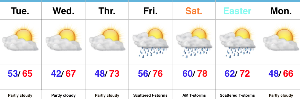
Drier (and brighter) days are ahead this week. High pressure returns as we progress through midweek and should allow for increasing sunshine and beautiful weather.
Unfortunately, we can’t dial up 3 nice weekends in a row, but it will be far from a wash-out. A warm front will lift north Friday into Saturday and result in scattered showers and thunderstorms before a cold front pushes southeast with showers and thunderstorms Easter, especially in the morning. We want to reiterate there will be plenty of dry time this weekend…just have the rain gear handy as needed. Drier air will return Easter afternoon and remain in place early next week.
Upcoming 7-Day Precipitation Forecast:
- Snowfall: 0.00″
- Rainfall: 0.50″ – 1.00″ (locally heavier totals)
 Highs will run close to 15° above average this afternoon.
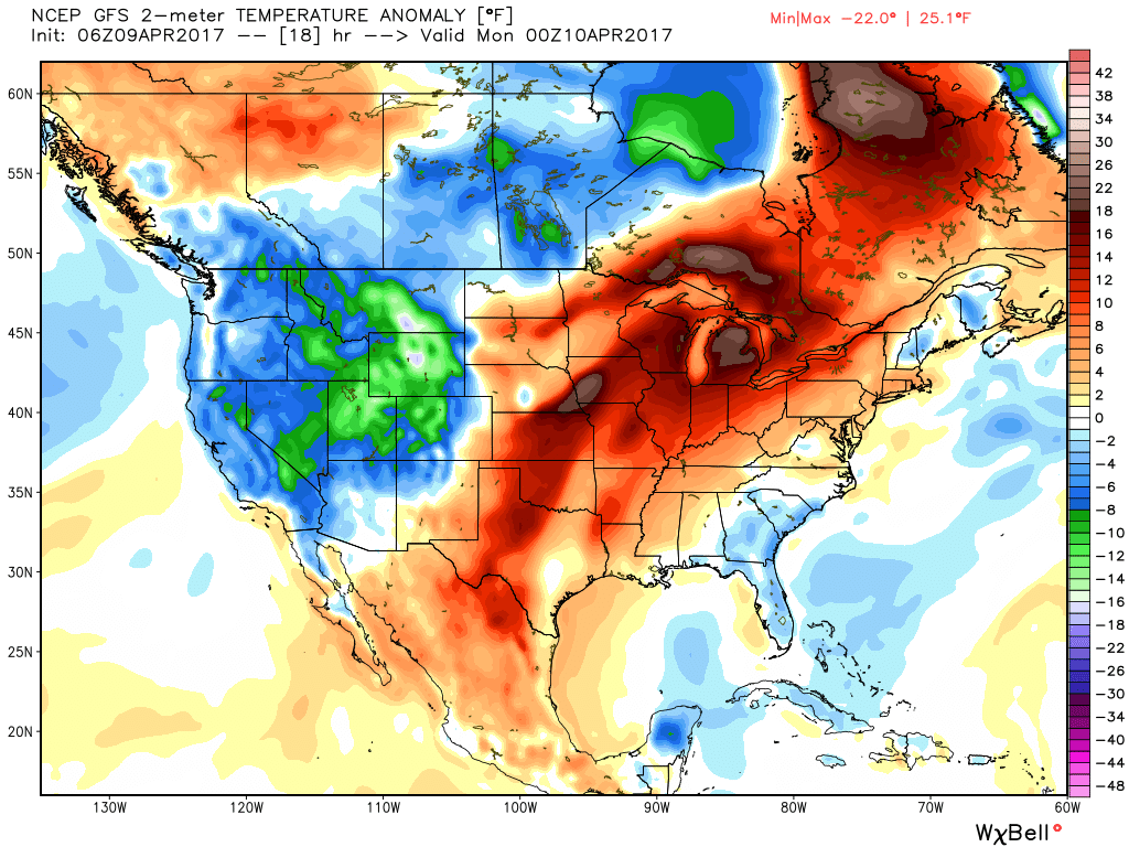 Stormy weather returns Monday as a frontal boundary slips into the state. A couple storms may become strong or severe Monday afternoon and the Storm Prediction Center highlights northwestern portions of the state for a Slight Risk. Damaging straight line winds are of greatest concern with any severe storm that may develop.
 High pressure returns for midweek and supplies a dry regime, along with increasing sunshine and temperatures that will run slightly above average (mid-40s at night and 65°-70° during the day).
 There are questions once to the end of the period as the GFS and European handle the evolution of our late-week storm differently. The GFS brings energy out into the Ohio Valley and results in unsettled weather returning Friday, continuing into Easter weekend, while the European is slower. We’ll keep an eye on things over the next few days and update accordingly. The GFS suggests some localized heavier downpours would be possible in the Friday-Sunday period as the majority of the 7-day precipitation snapshot below falls within the timeframe.
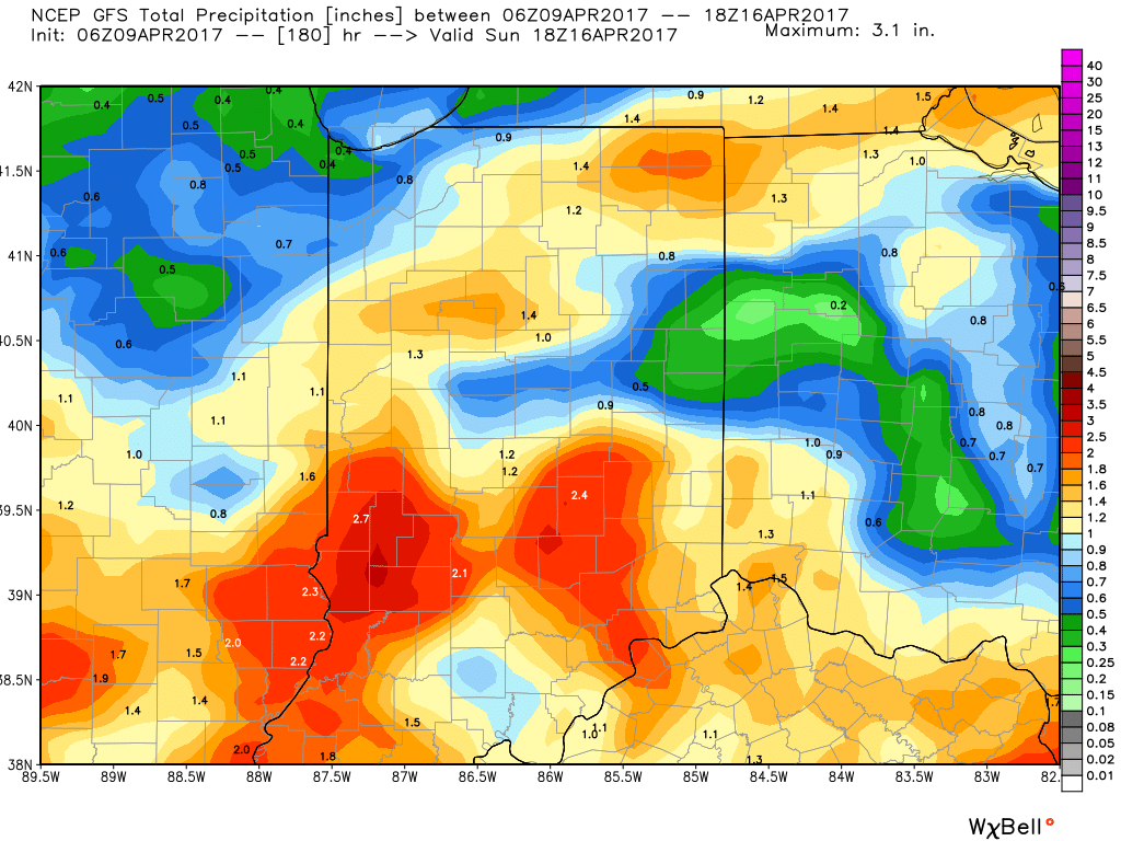
 Highlights:
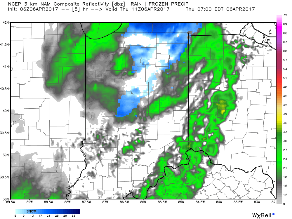 We’ll also add wind into the mix late morning through early evening, including gusts around 50 MPH. Factor in the much colder temperatures with gusty northerly winds and you have the makings for a truly “raw” day across the region. The National Weather Service has issued a Wind Advisory until 8pm.
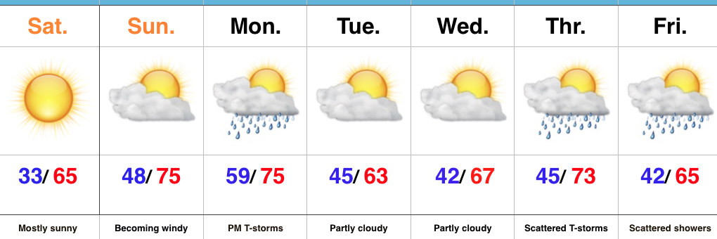
 We should finally get rid of the precipitation later tonight and after a chilly Friday, weekend improvements are coming. Lows both Friday and Saturday morning will be around freezing for most central Indiana neighborhoods. After a cloudy start Friday, sunshine should return Friday afternoon as drier air works into the region. With high pressure arriving this weekend, sunny conditions can be expected and with a southwest wind developing by Saturday afternoon, moderating temperatures are on deck as well.
 In fact, after that cold start Saturday, highs should climb into the lower 60s Saturday afternoon and all the way into the lower to middle 70s Sunday afternoon!
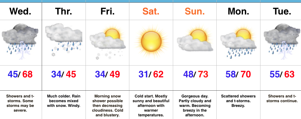 Highlights: