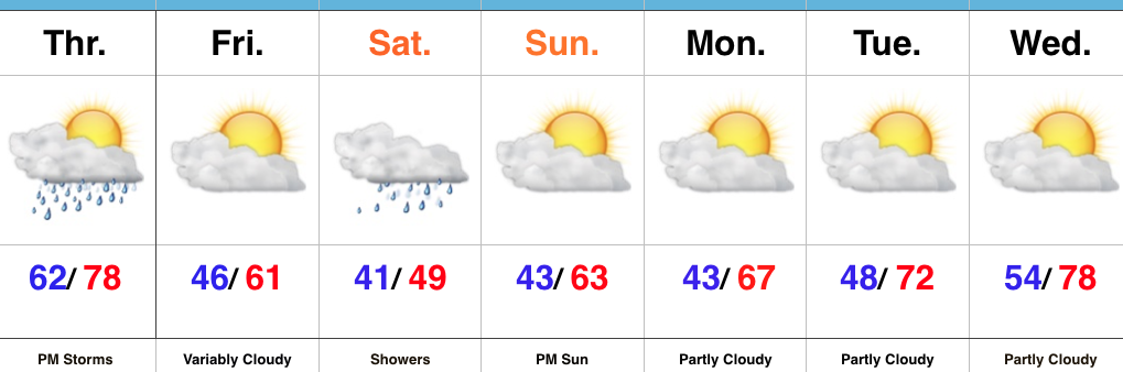
Thursday Storms Before A Cooler Trend…
 Highlights:
- Strong storms possible Thursday afternoon
- Cooler close to the work week
- Raw Saturday
- Delightful open to next week
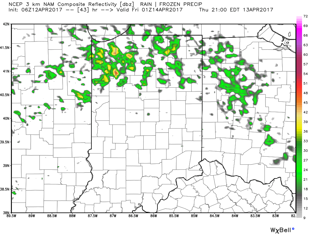
Thursday Rumbles…While storms have pressed through the northern portions of the state today, we’ve enjoyed a couple days of pleasant weather across most of central Indiana. That will come to an end Thursday as scattered to numerous showers and thunderstorms develop, especially during the afternoon into the evening hours. A few of these storms could become strong-to-severe, including damaging wind and large hail potential. The cold front will pass Thursday night and help usher in a briefly drier and much cooler air mass to close out the work week.
Our next storm system will pass south of the region Saturday and result in thickening and lowering clouds Friday evening, and showers Saturday. With a stiff east wind, showers at times, and temperatures well below average, we have the makings for a downright “raw” spring day Saturday. The second half of the weekend will easily be “the pick” as we return to drier air and increasing sunshine Sunday afternoon.
Early next week looks to get off to a pleasant start, including plentiful sunshine and moderating temperatures.
Upcoming 7-Day Precipitation Forecast:
- Snowfall: 0.00″
- Rainfall: 0.75″ – 1.25″
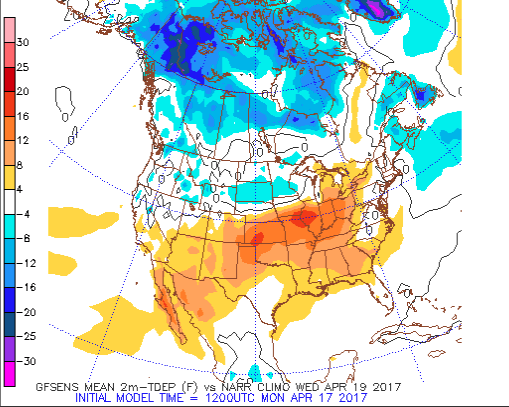 As a cold front slices into the summer-like warmth (highs will approach 80° Wednesday afternoon), scattered showers and thunderstorms will develop late Wednesday into Thursday.
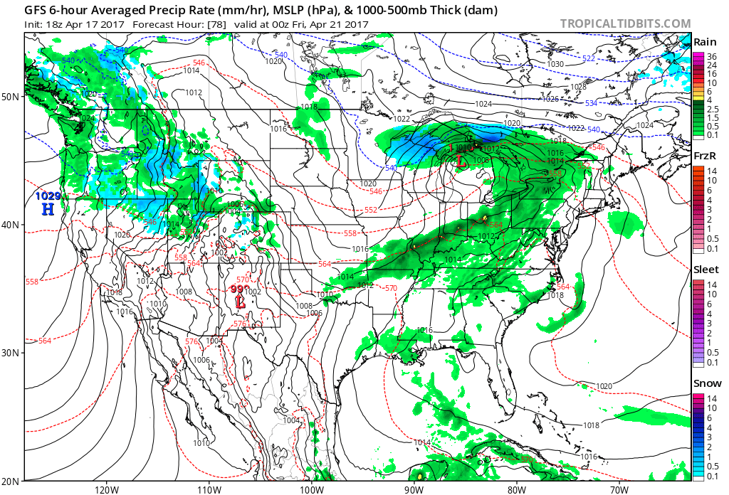 We then will shift gears rather abruptly as we move through the latter portions of the work week and on into the weekend with well below normal chill. In fact, if current data comes to fruition, most of the weekend will be spent in the 40s.
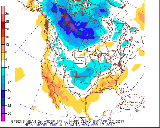 Factor in a stiff northeast wind and periods of rain, we have the makings for a downright “raw” weekend. We suggest having indoor activities planned this weekend as an extended period of damp, blustery, and unseasonably cool weather awaits.
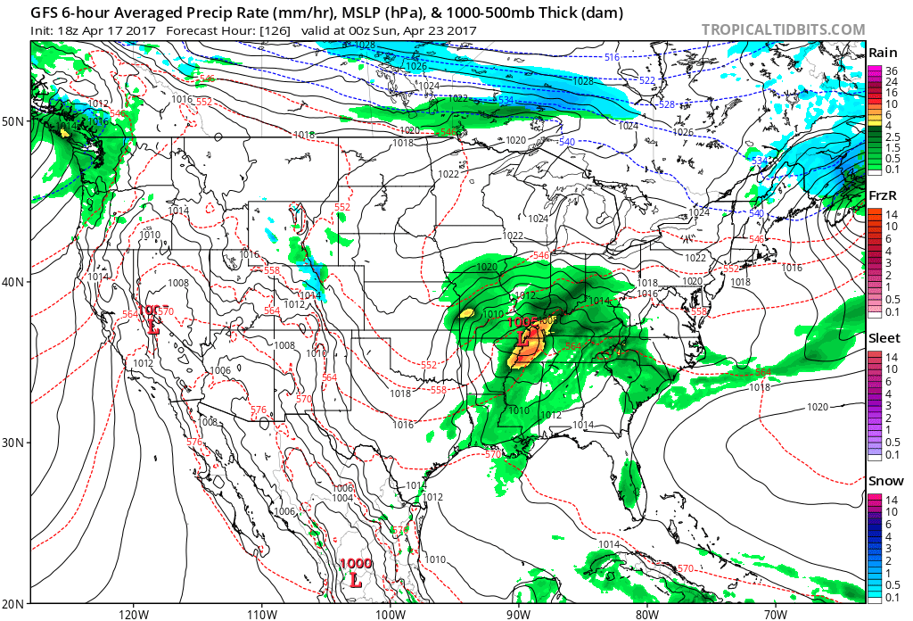 We still have a few days to continue watching the data, but early indications suggest locally heavy rainfall is possible (1″-2″) across the region…
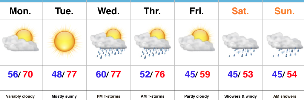 Highlights:
 Highlights:
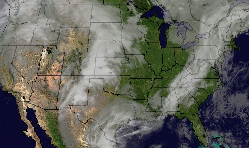 Temperatures will rise from the upper 30s and lower 40s into the middle 60s by evening.
 As we push into Thursday, moisture will return and will lead to an increase in cloud cover, along with scattered showers, especially across northern regions. It won’t rain the entire day by any means, and some neighborhoods likely won’t see a drop of rain Thursday, but we need to be prepared for a passing shower, especially from mid-morning into the evening.
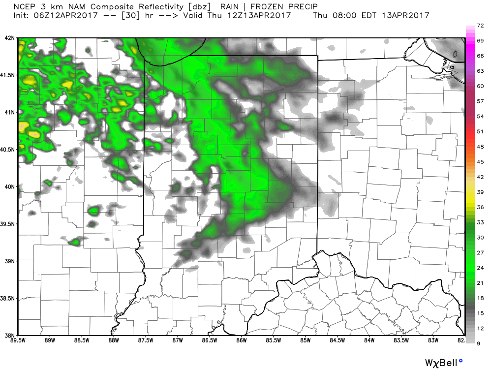
 Looking ahead to Easter weekend, unsettled weather is still expected with scattered showers and thunderstorms associated with a warm front lifting north through the region Friday into Saturday before a cold front sweeps through Easter Sunday with additional thunderstorm chances. That said, there will be plenty of rain-free hours this Easter weekend and warmth will dominate. In fact, highs will flirt with 80° Friday and Saturday. More on the Easter weekend forecast and our full 7-day later today!