More Heavy Rain And Storms Ahead; Cooler Week On Deck…
 Highlights:
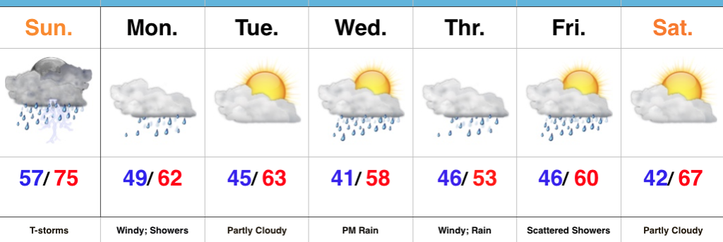
- Widespread rain and strong storms today
- Falling temperatures, windy, and wet Monday
- Midweek storm brewing
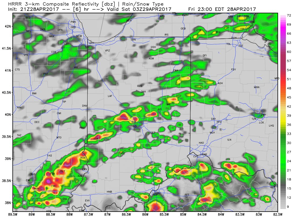
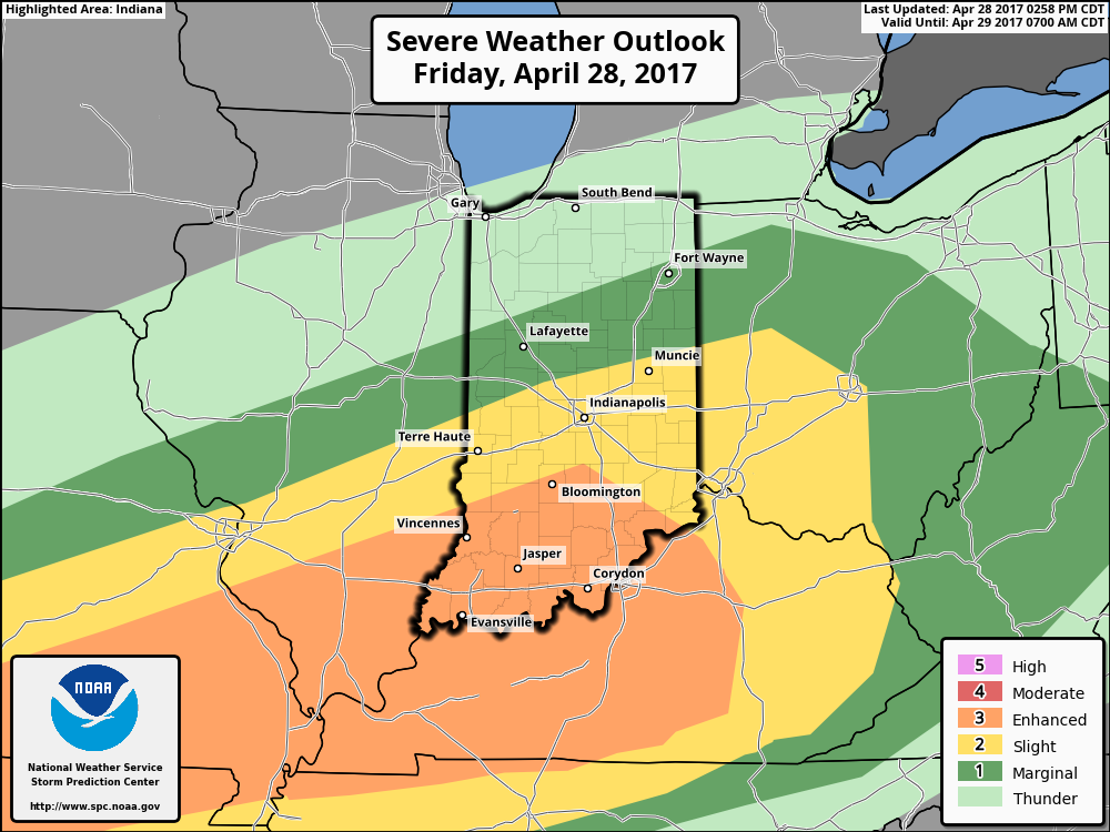
Flooding Concerns Remain High…Another slug of moisture will lift north through central Indiana this afternoon into the nighttime hours. Locally heavy rain will result in big flooding concerns as saturated soils are in place and many creeks and streams are already out of their banks. Throw in an additional 1″-2″ with locally heavier totals and you have the makings of a dangerous flood situation into early week. If that wasn’t enough to be concerned about, we’ll also have to watch how things evolve closely this afternoon for the potential of severe thunderstorms. Damaging straight line winds are of greatest concern.
We’ll transition to a much cooler regime to open the new work week with gusty winds and showers continuing. Temperatures will fall through the 50s during the day. Jackets will be required!
Tuesday will provide a brief break from the wet weather and we should also introduce some sunshine for a while. Unfortunately, we won’t have much time to dry out as a wet, windy, and chilly storm is brewing Wednesday evening into Thursday. Widespread rain (some heavy) will combine with a raw easterly wind and temperatures in the 50s to lead to a rather miserable Thursday.
While shower chances remain early Friday, the theme heading into next weekend is a drier one and we should finally enjoy very pleasant weather by Saturday.
Upcoming 7-Day Precipitation Forecast:
- Snowfall: 0.00″
- Rainfall: 1.50″ – 3.00″
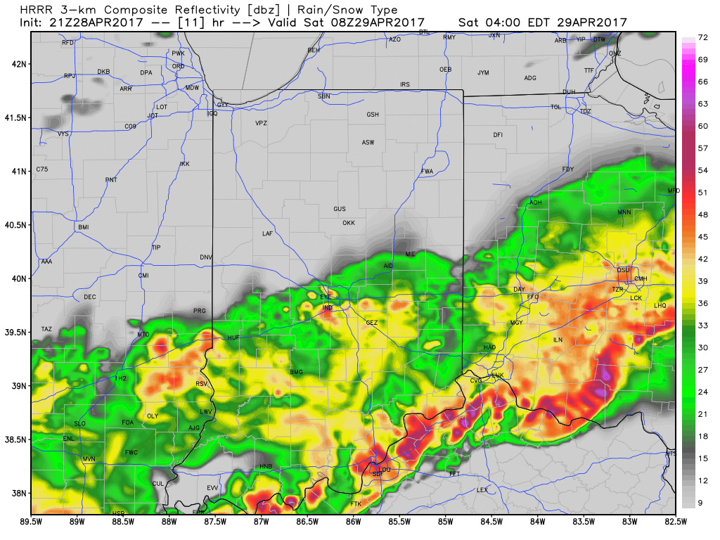
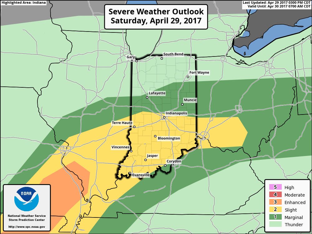 We think an eastward-advancing line of thunderstorms will blow into central Indiana later this evening (between 9p and midnight). Some of these may reach strong to severe levels with damaging straight line winds of greatest concern. Additionally, torrential downpours will occur within this line of storms.
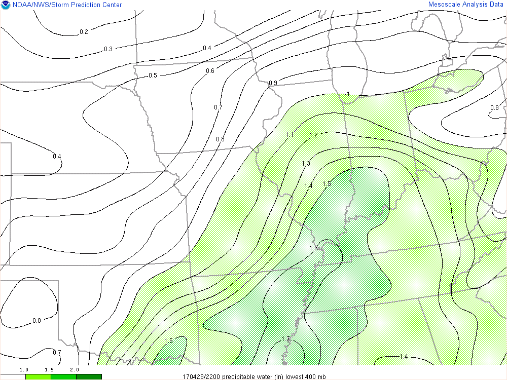
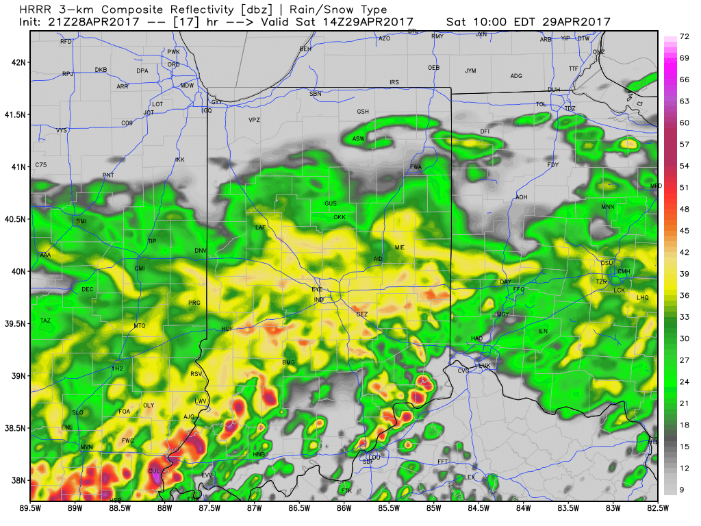
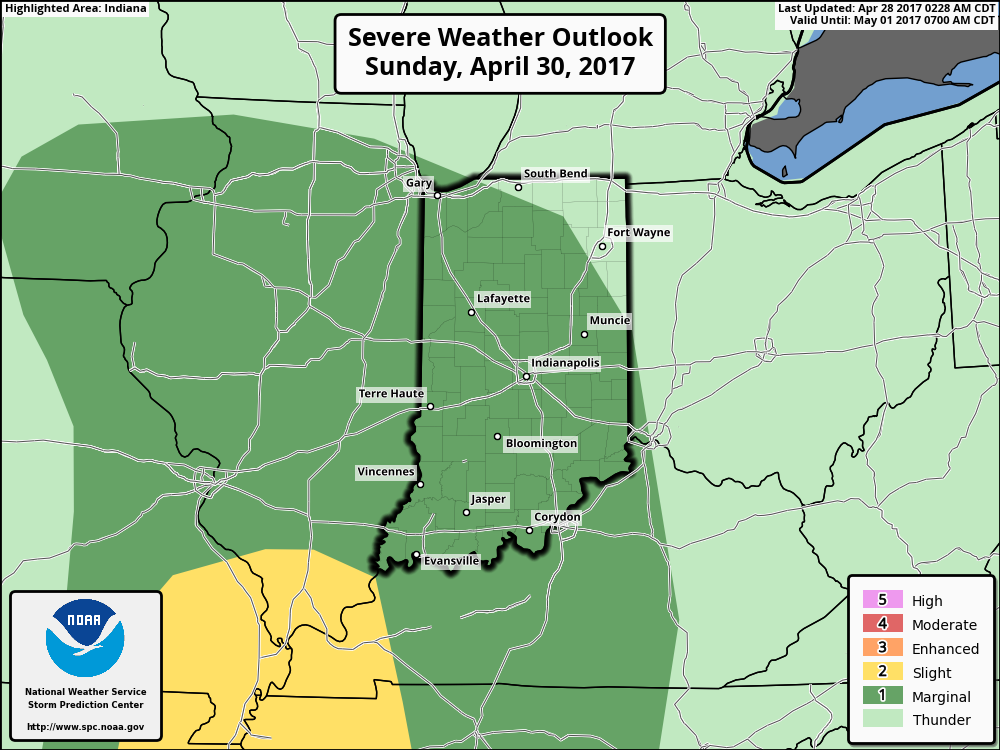 Once all is said and done, we anticipate widespread 2″-3″ rainfall totals through central Indiana, but also note there will be localized heavier amounts. Once to Monday we’ll look at a much cooler, windy, and “showery” regime. Look for falling temperatures through the day Monday and this will set the stage for the week ahead: MUCH cooler, overall…. More on that later this weekend!
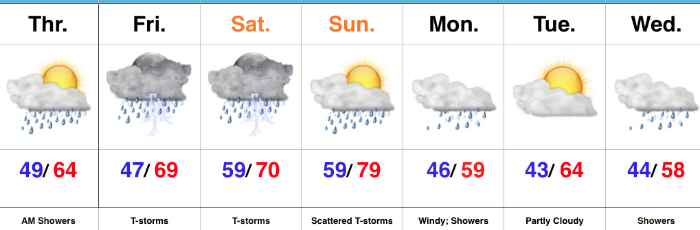 Highlights: